Turn on suggestions
Auto-suggest helps you quickly narrow down your search results by suggesting possible matches as you type.
Cancel
- Home
- :
- All Communities
- :
- Products
- :
- ArcGIS Pro
- :
- ArcGIS Pro Questions
- :
- Point to raster tool > interpolation required
Options
- Subscribe to RSS Feed
- Mark Topic as New
- Mark Topic as Read
- Float this Topic for Current User
- Bookmark
- Subscribe
- Mute
- Printer Friendly Page
Point to raster tool > interpolation required
Subscribe
3172
1
12-10-2022 11:22 PM
12-10-2022
11:22 PM
- Mark as New
- Bookmark
- Subscribe
- Mute
- Subscribe to RSS Feed
- Permalink
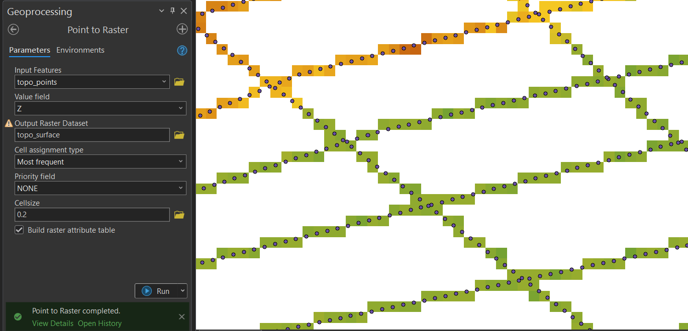
As shown in the attached image, I created a raster from a points dataset. In the point to raster tool I have defined the input feature (points at 0.2 m distance) and the same size for cell size. All other parameters were left as default.
The output raster only has cells where a point was present in the input. What I would like to have instead is a raster where also the cells in between are created by interpolation.
What tool can I use to achieve this?
1 Reply
12-11-2022
01:25 AM
- Mark as New
- Bookmark
- Subscribe
- Mute
- Subscribe to RSS Feed
- Permalink
Use one of the interpolation tools instead of Point to Raster