- Home
- :
- All Communities
- :
- Products
- :
- ArcGIS Pro
- :
- ArcGIS Pro Questions
- :
- Re: OSM basemap and building footprints
- Subscribe to RSS Feed
- Mark Topic as New
- Mark Topic as Read
- Float this Topic for Current User
- Bookmark
- Subscribe
- Mute
- Printer Friendly Page
- Mark as New
- Bookmark
- Subscribe
- Mute
- Subscribe to RSS Feed
- Permalink
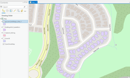
Hi, I use Pro v2.9. The OSM basemap has (visual) polygons for building footprints. However, when you download OSM buildings data either from Geofabrik, Living Atlas, GetOSMData, using QGIS plugins, etc., the basemap has many more building footprints. Does anyone know how to get ALL the building footprints that are shown in the basemap (for a city in Australia)? I can of course get them from LIDAR sources, various deep learning libraries or using one of the Copernicus indices, but those are very slow to use on a large dataset (+-500k properties).
Example given in image attached, showing the basemap and the OSM shapefile
Solved! Go to Solution.
Accepted Solutions
- Mark as New
- Bookmark
- Subscribe
- Mute
- Subscribe to RSS Feed
- Permalink
The "OSM" vector tiles switched over to the Daylight Distribution a while back. While this is primarily OSM-based, the data itself is "amended" by other sources as well, including such things as the Microsoft Building Footprints dataset.
This is actually my primary complaint about the Daylight Distribution, in that it implies a level of OSM coverage that does not exist. As an OSM contributor who is motivated by seeing gaps in the data, I don't like when the gaps are papered over by a secondary source.
If you know how to work with it, you can download each of the Daylight datasets in .osm.pbf format. That page can also link you to information about the original sources of each, from which you can download data in other formats.
Kendall County GIS
- Mark as New
- Bookmark
- Subscribe
- Mute
- Subscribe to RSS Feed
- Permalink
Oh thanks! I have the MS footprints as well as the local council footprints (though the latter have been poorly digitised). The original OSM data I was using was in pbf format, so I will download some more.
I'm not using it for OSM input but for a smaller project calculating areas suitable for adding an extra building, for a project on housing affordability.
Much appreciated.
- Mark as New
- Bookmark
- Subscribe
- Mute
- Subscribe to RSS Feed
- Permalink
If you want only the building footprints in a format that's easy to use, I created this workflow a couple years ago. It's for Clatsop County. Just change it for your area.
https://github.com/bwilsoncc/clatsop_buildings
Source for Australia is here https://github.com/microsoft/AustraliaBuildingFootprints
I evaluated the Microsoft building footprints in my area, decided they were good enough for now in county projects but decided to use more care when putting them into OpenStreetMap, there are lots of errors here. They are not good enough in my opinion for OSM but it depends on what you are doing. In my area they were... so so.
What does Microsoft say?
"Should we import the data into OpenStreetMap?
Maybe. Never overwrite the hard work of other contributors or blindly import data into OSM without first checking the local quality"
But HEY, they are not importing the so-so data into OSM, they are blindly overlaying my hard work with it instead.
- Mark as New
- Bookmark
- Subscribe
- Mute
- Subscribe to RSS Feed
- Permalink
If you're using the OSM vector tiles, you can selectively disable the "daylight" building features, and have an OSM vector basemap that only has OSM data in it.
Kendall County GIS
- Mark as New
- Bookmark
- Subscribe
- Mute
- Subscribe to RSS Feed
- Permalink
Are microsoft building footprints that can be downloaded here: https://github.com/Microsoft/USBuildingFootprints the same as other download options listed on this thread?
How often is Esri's Daylights service updated? As of today it says the last update was May 11, 2022: https://www.arcgis.com/home/item.html?id=fae788aa91e54244b161b59725dcbb2a
- Mark as New
- Bookmark
- Subscribe
- Mute
- Subscribe to RSS Feed
- Permalink
I can't answer your question, sorry but I did want to update my own question. The daylight and MS buildings layer have the information that I wanted BUT...I could not use them due to the size of the dataset (whole earth instead of an extract...if anyone knows where to get an extract with daylight and buildings for a country?) I'm not experienced enough to do an extract via Postgre SQL or PostGIS, so tried with QGIS and Pro Interopability,...these worked...sort of, but after a day of processing, crashed my computer (high end, separate graphics card, SSDs etc), I think due to the system cache size/pagefile settings (warnings that C Drive was full, so I manually crashed the geoprocessing task).
- Mark as New
- Bookmark
- Subscribe
- Mute
- Subscribe to RSS Feed
- Permalink
HeatherShearer55
Scroll to the bottom of page in this link https://github.com/Microsoft/USBuildingFootprints and you can download individual states.
I have used https://extract.bbbike.org/ to extract smaller areas of OSM data with some success, not sure if it only has 'regular' OSM data or the Daylight / MS data.
- Mark as New
- Bookmark
- Subscribe
- Mute
- Subscribe to RSS Feed
- Permalink
I have successfully used the various portals like bbbike or geofabrik for extracts, but I think they don't have the daylight?
- Mark as New
- Bookmark
- Subscribe
- Mute
- Subscribe to RSS Feed
- Permalink
I received a few answers regarding the sources / updates for Daylight on this other thread today:
Also worth a look: https://www.openstreetmap.org/user/migurski/diary/392416
If you have any questions about this data distribution, we have created a #daylightdistro_feedback Slack channel in OSM US. Members of the team will be there periodically to answer questions. You can also email the team at osm@fb.com.