- Home
- :
- All Communities
- :
- Products
- :
- ArcGIS Pro
- :
- ArcGIS Pro Questions
- :
- Re: Mavic 2 Pro Camera Parameters
- Subscribe to RSS Feed
- Mark Topic as New
- Mark Topic as Read
- Float this Topic for Current User
- Bookmark
- Subscribe
- Mute
- Printer Friendly Page
Mavic 2 Pro Camera Parameters
- Mark as New
- Bookmark
- Subscribe
- Mute
- Subscribe to RSS Feed
- Permalink
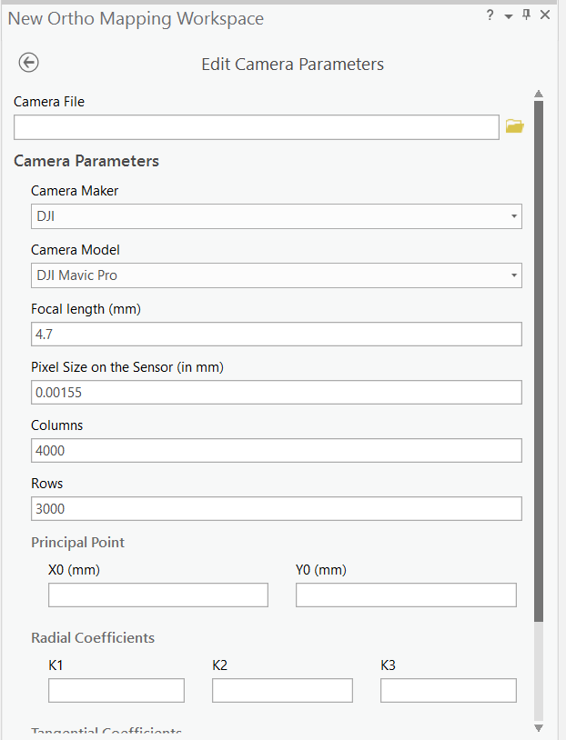
Hello, I am using ArcGIS Pro 2.3.0 to construct an orthomosaic from a mapping mission I flew. The problem is that the Mavic 2 Pro is not one of the "Camera Models" that Esri has made yet. This wouldn't be a problem as you can edit the camera parameters but when I compare the Mavic Pro's automated setting to the online settings I can not draw clear coloration to what Esri has vs what I find as the specs for the Mavic Pro. For instance the Focal Length in (mm) that is auto filed in by ArcGIS Pro is 4.7 when the focal length of the Mavic Pro is actually 28 mm.
This leads me to not trust what I would enter in to the fields and am looking for someone more experienced in this to help me make this workflow accurate. I can not find anyone else posting about this so I hope this helps someone else and we can work on it together after we try a few settings.
Also I would greatly appreciate it if Esri would add the Mavic 2 Pro & Zoom in their next update.
- Mark as New
- Bookmark
- Subscribe
- Mute
- Subscribe to RSS Feed
- Permalink
Did you ever figure out any good settings? Everything I have tried the color is terrible. Hopefully the camera will be added to the next version.
- Mark as New
- Bookmark
- Subscribe
- Mute
- Subscribe to RSS Feed
- Permalink
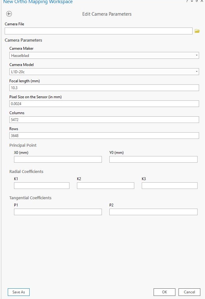
I've been able to successfully process some orthomosaics from aerial images captured with the DJI Mavic 2 Pro in ArcGIS Pro. Below are the settings I used...

- Mark as New
- Bookmark
- Subscribe
- Mute
- Subscribe to RSS Feed
- Permalink
Thanks! That camera model is not in 2.3 or 2.4? How did you get the L1D-20c model as an option?
- Mark as New
- Bookmark
- Subscribe
- Mute
- Subscribe to RSS Feed
- Permalink
Yeah I agree the L1D-20c isn't a preloaded camera option...that would be nice. I manually entered the camera parameters based on some info that I pieced together from other online sources. Not sure if it is exactly right but my orthomasics come out fine. No such luck on generating a DSM or DEM as I always get the below error message.
ERROR 999999: Something unexpected caused the tool to fail. Contact Esri Technical Support (http://esriurl.com/support) to Report a Bug, and refer to the error help for potential solutions or workarounds.
Unable to instantiate class for xml schema type:
Failed to execute (GeneratePointCloud).
Not sure if this is due to wrong camera parameters or something else?
- Mark as New
- Bookmark
- Subscribe
- Mute
- Subscribe to RSS Feed
- Permalink
Hello,
I am having the same problem with the DJI Mavic Pro 2. I used your settings above with Focal Length equal to 10.3 and Pixel size equal to 0.0024 but it still did not work when I run block adjustment. I get the following error:
ERROR 999999: Something unexpected caused the tool to fail. Contact Esri Technical Support (http://esriurl.com/support) to Report a Bug, and refer to the error help for potential solutions or workarounds.
Failed to compute block adjustment.
Failed to compute adjustment using engine 'Frame'.
All geometries involved in this operation must have the same spatial reference.
Failed to execute (ComputeCameraModel).
Did you get this same error as well? What was your work around?
I am using ArcGIS Pro 2.4
- Mark as New
- Bookmark
- Subscribe
- Mute
- Subscribe to RSS Feed
- Permalink
Hi All,
I'm on 2.4.1 and the Camera db does not have this L1D-20c yet. The model has been their for awhile and will ESRI is updating the db. People buy new drones all the time ![]() .
.
The focal length = 10.3 and pixel size 0.00155 did not work for me.
Thanks!
Alan
- Mark as New
- Bookmark
- Subscribe
- Mute
- Subscribe to RSS Feed
- Permalink
Hi all,
I am going to post this here for future reference. I did the calculation per ESRI's instruction posted here, and block adjustment worked for me. Let me know if you come up with different results...
Equations for Pixel Size:
Pixel Size = CCD Diagonal / Image Diagonal(in pixels)
WHERE
CCD Diagonal = 2 * (Focal Length * Tan(FOV/2))
Mavic Pro 2 Camera Spec
Camera: Hasselblad l1d-20c
If,
Focal Length = 10.3 mm
Field of View (FOV) = 77°
Image Diagonal = 3678 (in pixels)
CCD Diagonal = 2 * (10.3 * Tan(77/2)) = 16.386
Therefore,
Pixel Size = 16.386 / 3678 = .00446
**PS: I agree ESRI should update the database for the Hasselblad l1d-20c camera specs since it is a popular drone and great camera, but I hope this is helpful for now.