- Home
- :
- All Communities
- :
- Products
- :
- ArcGIS Pro
- :
- ArcGIS Pro Questions
- :
- I am attempting to
- Subscribe to RSS Feed
- Mark Topic as New
- Mark Topic as Read
- Float this Topic for Current User
- Bookmark
- Subscribe
- Mute
- Printer Friendly Page
I am attempting to
- Mark as New
- Bookmark
- Subscribe
- Mute
- Subscribe to RSS Feed
- Permalink
I work as part of a drainage department that at the end of the day, assesses landowners for the runoff they contribute to a particular drainage project. What i would like to do is to create a variable band width "bulls eye" raster from the start of the drainage infrastructure (a single point that is not quite in the center of the watershed) and would like to create a raster (or contours) to create bands of relative distance from that single starting point outward to the watershed boundary. Ultimately, I use this to calculate remoteness of a particular piece of land to the drainage improvement project. The single starting point would be assigned a 100% use while the watershed boundary would be assigned a 0% use. Is there a way to generate these multiple relative distance bands such that each band would uniformly break down the distance from the point to the watershed boundary in 10% increments? As a result, the width of each band of the bulls eye would be variable depending on the watershed boundary's distance from the single starting point. I have included a very rough sketch of what i am trying to accomplish.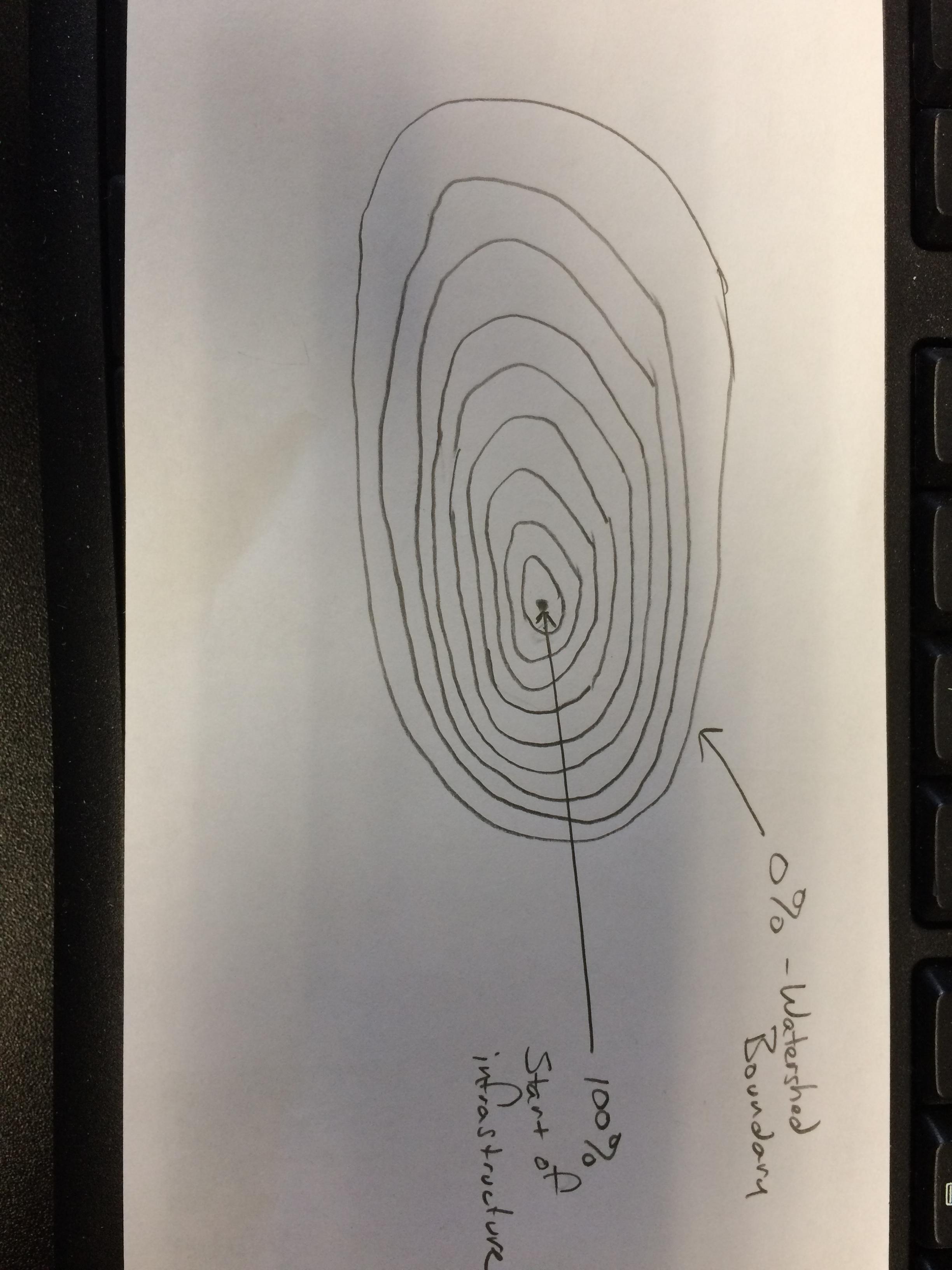 Any help would be greatly appreciated!
Thank you,
Jason