- Home
- :
- All Communities
- :
- Products
- :
- ArcGIS Pro
- :
- ArcGIS Pro Questions
- :
- Re: Georeferencing bugs in ArcGIS Pro
- Subscribe to RSS Feed
- Mark Topic as New
- Mark Topic as Read
- Float this Topic for Current User
- Bookmark
- Subscribe
- Mute
- Printer Friendly Page
Georeferencing bugs in ArcGIS Pro
- Mark as New
- Bookmark
- Subscribe
- Mute
- Subscribe to RSS Feed
- Permalink
Hello Geonet!
Has anyone else had issues with georeferencing images in ArcGIS Pro? It's something I do on an almost daily basis in ArcMap, and I keep attempting to switch my workflow to ArcGIS Pro to practice using the software since I know Esri is planning on transitioning completely to Pro.
However, I find the experience to be so buggy that I can't even complete this simple task. After fitting an image to display, I try to pan around and my cursor is stuck on the rotate function, no matter which button on my mouse I click. If I change the transparency of the layer with the ribbon and then use the L keyboard shortcut to turn the layer off/on, the transparency doesn't save and it always goes back to 0%. However, if I turn the layer off/on in the TOC it seems to stick.
The biggest offender is that when I try to set a control point, once again my cursor is stuck on the rotate function. This has happened so often that I frequently can't georeference the image at all. On my most recent attempt, after several minutes somehow it seemed to change (though I have no idea what caused that to happen) and I was able to set a few control points, but then I opened the control point table and once again the pan function didn't seem to work using either my mouse or the C keyboard shortcut.
After enough frustration I went back to ArcMap for a completely smooth process and had several images georeferenced in less than five minutes.
Just want to know if I'm alone in this experience or if there are others who share my frustration? I am eager to embrace ArcGIS Pro and the changes that Esri is promoting, but I can't do this if I can't even complete simple workflows such as this.
Thanks for any thoughts or input!
Best,
Katherine
Katie
If this post helped you, please consider giving a kudos and/or marking as the accepted solution. Thanks!
- Mark as New
- Bookmark
- Subscribe
- Mute
- Subscribe to RSS Feed
- Permalink
Im having an issue with the Georeferencing where I can get it to fit, but when I hit "save" and then "Close Georeference", the image disappears. I literally have to remove the image and re import it for it to honor my Georeferencing... I don't think its just you.
- Mark as New
- Bookmark
- Subscribe
- Mute
- Subscribe to RSS Feed
- Permalink
I'm having that same problem.
- Mark as New
- Bookmark
- Subscribe
- Mute
- Subscribe to RSS Feed
- Permalink
Yes, I've had that exact same experience many times. The only fix is to remove the image from the Project, close the Project, delete all of the auxiliary files that were created from the original georeferencing, then reopen the Project, readd the image, and georeference it again. Sometimes, I find that closing and reopening my Project after every successful georeference makes the next georeferencing operation successful. That's not always the case, but sometimes that works.
EDITED TO ADD: I started experimenting with raster formats this morning. Previously, I had been georeferencing TIFFs. I converted them to PNG to see what would happen, and I've successfully done three in a row with no issues. Perhaps it's an issue with file formats in Pro?
- Mark as New
- Bookmark
- Subscribe
- Mute
- Subscribe to RSS Feed
- Permalink
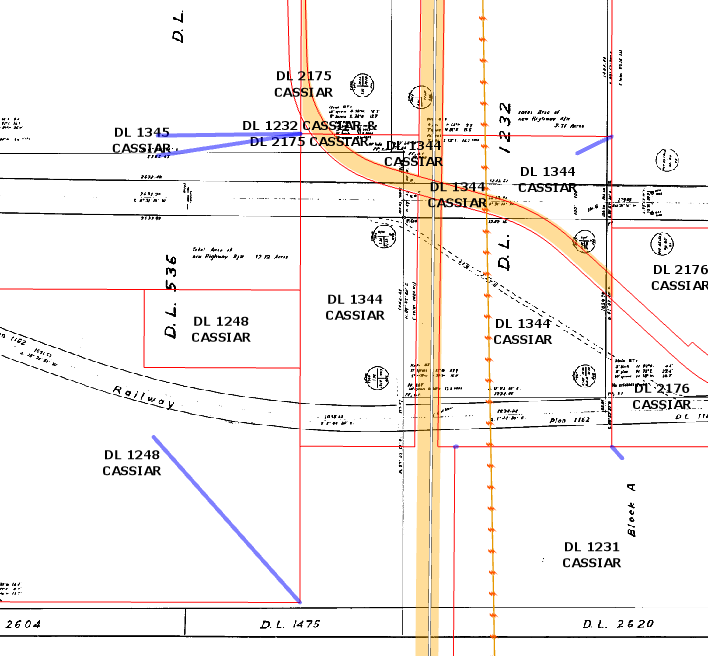
I am in the same situation Katherine. I am trying my best to transition to ArcGIS Pro, but am so frustrated at trying to do basic georeferencing tasks. I have over 100 scanned drawings that need to be georeferenced and am creating a Task to get a Junior to help me out. The task option is great, but not working well with Georeferencing.
The issues I'm having are:
1. No obvious way to indicate which image file I am georeferencing. In my ArcMap workflow I would complete one, turn off the layer in TOC, add the next image, then choose the latest image in the Georeference Drop Down. Now, I find that I have to Close Georeference, Remove the current drawing from TOC, then add the next one and start over. (I don't want to remove the previous drawing as I use it as reference when putting in the next drawing along the road network.) Not conducive to georeferencing 100s of drawings!
2. The control points leave blue lines all over my view. I can't find an options button anywhere to remove the blue connection lines once I've completed my georeferencing. They get in the way when I'm trying to do the next drawing.
- Mark as New
- Bookmark
- Subscribe
- Mute
- Subscribe to RSS Feed
- Permalink
In regards to the bugs that are seen, please contact Technical Support with the details so that they can get addressed: https://support.esri.com/en/contact-tech-support.
In regards to the image that you are georeferencing, it is displayed in the heads-up-display (top right corner).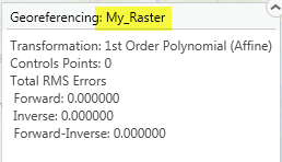
ArcGIS Pro is context driven. No Need to remove the previous layer. After you close the georeferencing session, highlight\select the next raster you want to georeference and then Click the Georeferencing button again. The heads-up-display will update with the raster that you have highlighted when you started the session.
As for the blue lines, we have had reports of this on GeoNet and forums, but have have failed to replicate this. Please log a support incident so we have the exact steps and data so we can try and address this and all issues.
Thanks!
Simon W.
- Mark as New
- Bookmark
- Subscribe
- Mute
- Subscribe to RSS Feed
- Permalink
Thanks Simon. I've noticed the Georeferencing Heads-Up display in the corner, however it would be helpful if this had the ability to change the current raster being georeferenced as ArcMap did without having to close a session, and reopen. On that note, this process did not work for me every time (closing and reopening Georeference) and I ended up having to close the entire project and reopen as well as ensure I only had one raster in my TOC at a time for it to work consistently.
I'll make sure to follow up with ESRI Support on the blue lines. Pardon my ignorance, but what is the best way to "log a support incident"? I've called ESRI support before, but is there a way to log my actions? (unless I'm misunderstanding you).
- Mark as New
- Bookmark
- Subscribe
- Mute
- Subscribe to RSS Feed
- Permalink
Hello Samantha,
You can log or create an incident however you would like (there are a few options on the Support website link that I posted). You can definitely call, to create a support incident.
I understand that changes in workflow are annoying at first. The drop-down to specify the layer was not allowed in the Pro implementation, so we had to use the contextual implementation. Furthermore, we had to have a concept of start and stop, otherwise a new raster would be georeferenced every time the Contents pane was edited\touched.
Once we fix any issues you have, hopefully the new workflow makes sense and can accomplish your project goals.
Thanks!
Simon W
- Mark as New
- Bookmark
- Subscribe
- Mute
- Subscribe to RSS Feed
- Permalink
Is there something else you have to do besides clicking the save button in the ribbon to keep the image's reference?
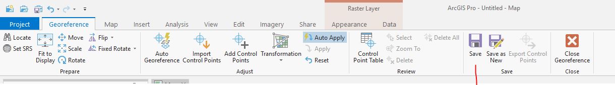
I understand the heads-up-display lets you know which one your working on so I did 7 of them but when I close it and try opening it back up it loses all the work i did. i followed these instructions here about saving https://pro.arcgis.com/en/pro-app/help/data/imagery/georeferencing-tools.htm
- Mark as New
- Bookmark
- Subscribe
- Mute
- Subscribe to RSS Feed
- Permalink
Kassandra,
After you Save the raster and Close the session, your image should be georeferenced. After you Close the session, is the image in the correct location? Or did all your hard work already go away? (Out of curiosity, where did your raster originate from?)
Are you using a raster dataset or a raster product? We save raster datasets. We do not update the raster product at its source, since we do not want to edit\corrupt your satellite data that the provider has specific specifications for. For raster products, you can only save the layer within the project.
If it is still your standard raster dataset (e.g. tiff file) that is not updating properly, please call and log an issue with Technical Support.
Thanks!
Simon W.