- Home
- :
- All Communities
- :
- Products
- :
- ArcGIS Pro
- :
- ArcGIS Pro Questions
- :
- Re: Export raster contour dataset always results i...
- Subscribe to RSS Feed
- Mark Topic as New
- Mark Topic as Read
- Float this Topic for Current User
- Bookmark
- Subscribe
- Mute
- Printer Friendly Page
Export raster contour dataset always results in blacked out image
- Mark as New
- Bookmark
- Subscribe
- Mute
- Subscribe to RSS Feed
- Permalink
- Report Inappropriate Content
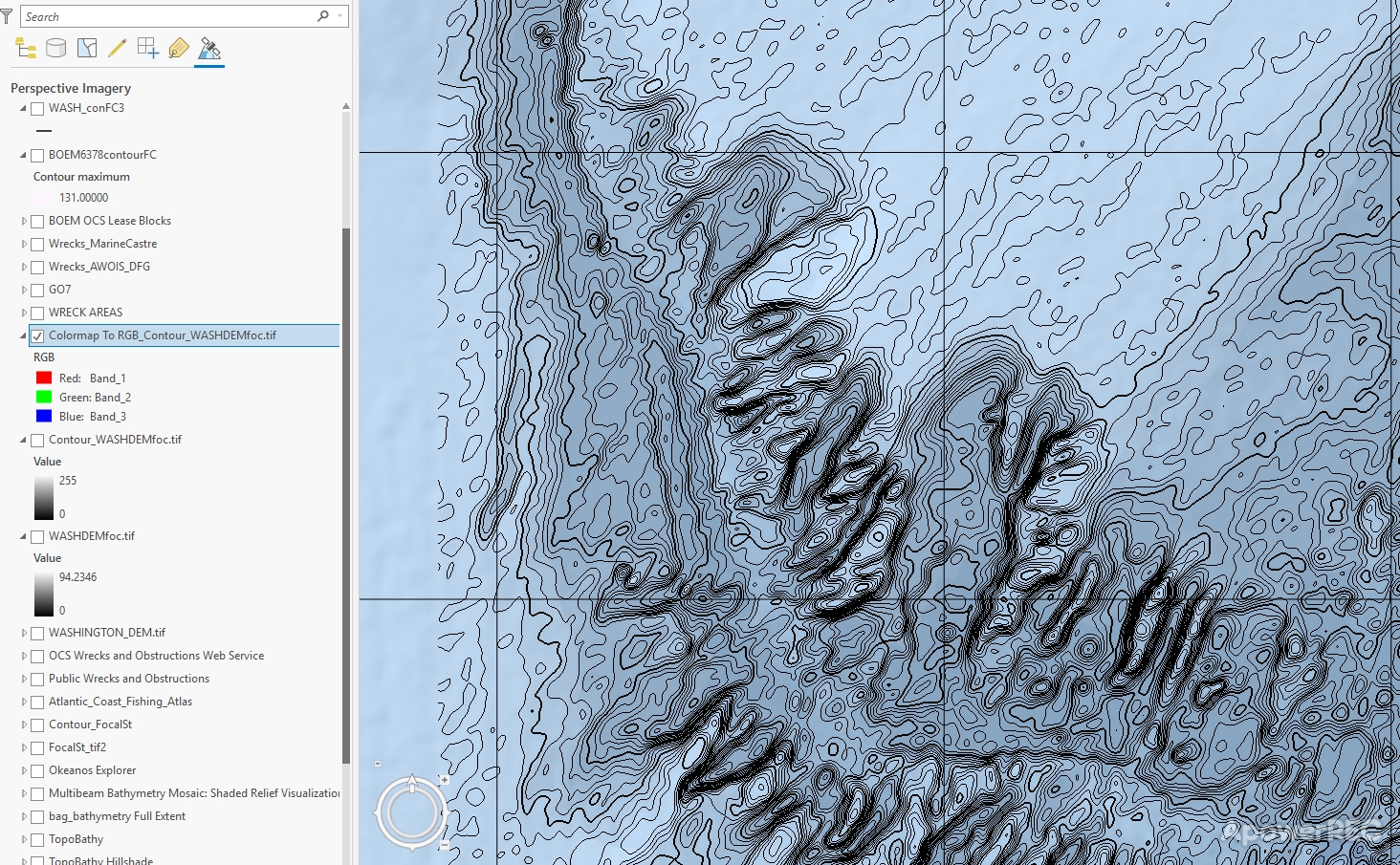
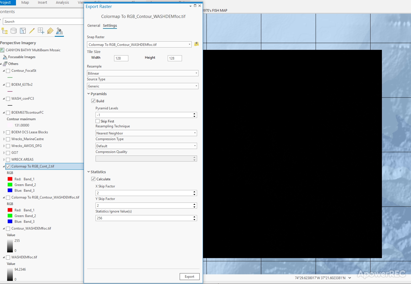
I'm creating seafloor maps and started using the contour tools in ArcGIS Pro. Despite being new to designing contour maps, I'm pleased with the appearance of contours created with the raster toolset (rather than the feature toolset...more on that later). I need to export the contour imagery, however I cannot export the individual raster with only contours (transparent background w/ no data) without the image being blacked out after the export process completes. The contour lines are there, but very faint and the image is pretty much ruined because I can't figure out how to reverse this persistence black color scheme. Alternatively, I've tried to combine the contour raster with the underlying raster, using the following methods:
1. Combine images in raster dataset (ArcGIS Pro crashes every time I hit the run button on the tool)
2. Mosaic (Contour raster turns black and covers the underlying imagery)
3. Weighted Overlay (Contour line raster and underlying raster merge, but contours come out fried and cracked looking and have completely lost their smooth flowing appearance)
4. Composite (the two rasters merge but the contour lines disappear)
I've investigated every possible place that NoData could be pulling from and set them all to a value outside the color scheme (as transparent), but still get a black image after export.
I've tried and tried to get the contours to display correctly building them as feature lines but all settings result in boxy polygon looking shapes with no linear pattern despite my feature class being designated as lines. I have run the Focal Analysis tool on the underlying raster prior to building contours but doesn't seem to matter.
Any guidance to get me on track with contours would be greatly appreciated.
Thanks!
- Mark as New
- Bookmark
- Subscribe
- Mute
- Subscribe to RSS Feed
- Permalink
- Report Inappropriate Content
color scheme is it stretched? (don't)
statistics recalculated?
cell sizes all the same?
- Mark as New
- Bookmark
- Subscribe
- Mute
- Subscribe to RSS Feed
- Permalink
- Report Inappropriate Content
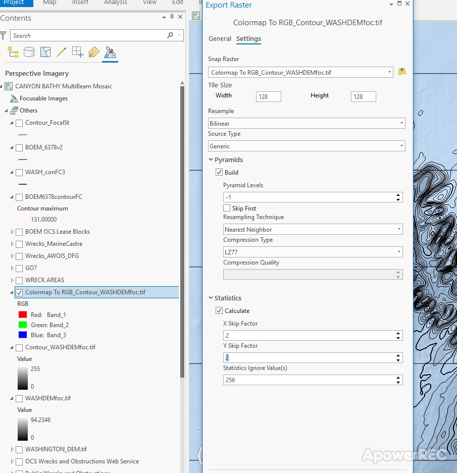
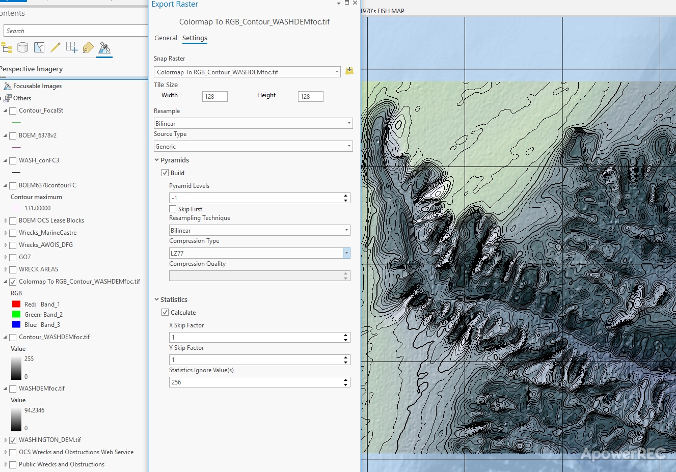
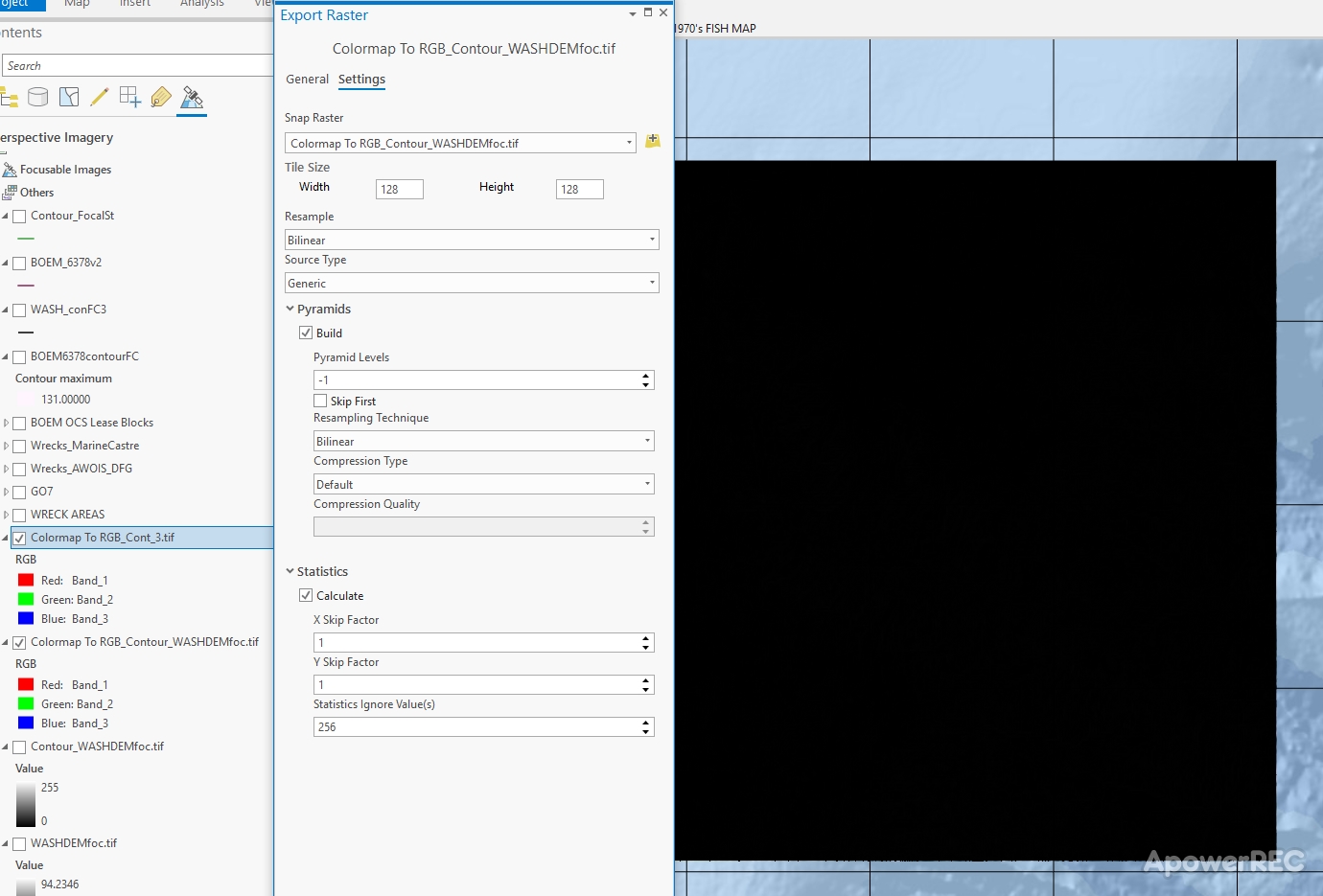
Ran a few export scenarios with contour raster set to RGB, statistics recalculated and cell sizes matching. Still get blacked out raster after export. Tried exporting image of just contour lines and contour raster over DEM. Same result, any ideas?
Thanks. 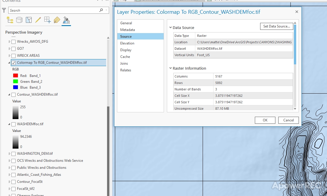

- Mark as New
- Bookmark
- Subscribe
- Mute
- Subscribe to RSS Feed
- Permalink
- Report Inappropriate Content
The only thing that I see offhand is your compression type for the black square images (with the horrid name with spaces in it) is that it is Default and the others seem to be LZW.
but, you could be poking around for days to find a solution
- Mark as New
- Bookmark
- Subscribe
- Mute
- Subscribe to RSS Feed
- Permalink
- Report Inappropriate Content
I was trying different resampling techniques and compression types to see if that made a difference on the export results. Usually I have those fields set to Biliniar and LSW when exporting a raster
Thanks.