- Home
- :
- All Communities
- :
- Products
- :
- ArcGIS Pro
- :
- ArcGIS Pro Questions
- :
- Re: Custom Reference Grid
- Subscribe to RSS Feed
- Mark Topic as New
- Mark Topic as Read
- Float this Topic for Current User
- Bookmark
- Subscribe
- Mute
- Printer Friendly Page
- Mark as New
- Bookmark
- Subscribe
- Mute
- Subscribe to RSS Feed
- Permalink
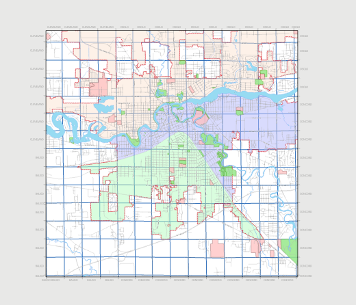
I have created a custom reference grid that is based on county quarter sections.
This issue I am having is when I expand the map frame to the desired extent the labels for the reference grid disappear, is this a bug or is there a parameter that I am missing?
I have attempted to activate and adjust the map frame without expanding the layout but the grid labels still disappear.
Scale when activated and adjusting map frame, all labels are visible, but when I expand to the desired scale they are not visible?

Solved! Go to Solution.
Accepted Solutions
- Mark as New
- Bookmark
- Subscribe
- Mute
- Subscribe to RSS Feed
- Permalink
Hi Brian,
As to your comment:
Still cannot get the grid to be visible for the full extent of the quarter section grid, but this work for using the map series option in layout view.
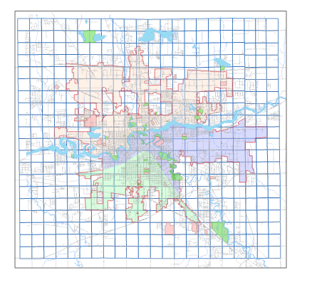
Custom grids work off the intersection of polygon or line features with the edges of a map frame. If a feature falls entirely within the map frame there will be no label. I believe this is what is occurring in the screenshot below.
The grid needs an intersection point with the map frame to know where to place one label in relation to the next label.
Hope this helps,
Tom
- Mark as New
- Bookmark
- Subscribe
- Mute
- Subscribe to RSS Feed
- Permalink
Was able to gain desired output.
Work around:
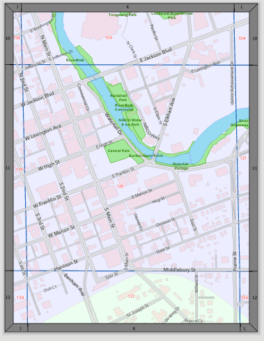
1.) Create two grids


(see the numeric boxes on the snip above)
2.) Set formatting for grid.
Labels 1 & 3 are visible for the X-Axis Grid.

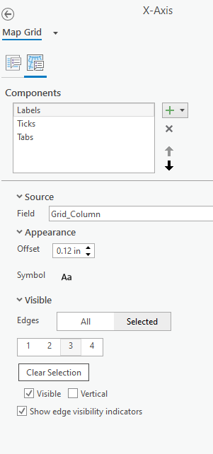
Labels 2 & 4 are visible for the Y-Axis Grid.

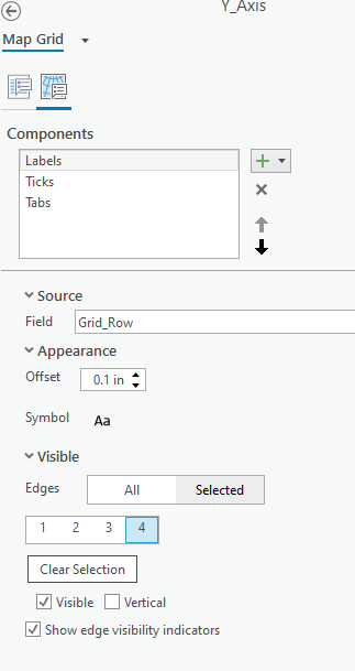
(Make sure to turn off the edges that would cause overlap by unchecking the visible box)
Still cannot get the grid to be visible for the full extent of the quarter section grid, but this work for using the map series option in layout view. So this does not fully compensate as work around solution, based on my experience thus far.
- Mark as New
- Bookmark
- Subscribe
- Mute
- Subscribe to RSS Feed
- Permalink
Hi Brian,
As to your comment:
Still cannot get the grid to be visible for the full extent of the quarter section grid, but this work for using the map series option in layout view.
Custom grids work off the intersection of polygon or line features with the edges of a map frame. If a feature falls entirely within the map frame there will be no label. I believe this is what is occurring in the screenshot below.
The grid needs an intersection point with the map frame to know where to place one label in relation to the next label.
Hope this helps,
Tom
- Mark as New
- Bookmark
- Subscribe
- Mute
- Subscribe to RSS Feed
- Permalink
Thank you Tom, worked like a charm!!!
The issue lies within edges of the grid I am using, they are not symmetrical. It looks like I have figure out how to clean up the edges of grid.

- Mark as New
- Bookmark
- Subscribe
- Mute
- Subscribe to RSS Feed
- Permalink
When I try to create a custom grid to display PLSS data (township and range) on the layout view for my x- and y-axis, ArcPro crashes. It seems like the function to select edges for which data I would like to appear (1,2,3 or 4) is not working for me despite many attempts, and this causes the entire program to crash.
Zooming out to include intersections helped for sure, but the options for display (circled) remain greyed out.
Any ideas?


I would like Range to show up top and bottom, Township L-R.
When I try to change to 'Selected' it does not respond or crashes.
- Mark as New
- Bookmark
- Subscribe
- Mute
- Subscribe to RSS Feed
- Permalink
I have a similar problem. Every time I select the PLSS Township layer in Properties on a custom grid, ArcGIS Pro crashes. It doesn't matter how zoomed in/out I am.
- Mark as New
- Bookmark
- Subscribe
- Mute
- Subscribe to RSS Feed
- Permalink
I have this problem, every time I try to add a custom grid and get it configured ArcGIS Pro crashes. Have you found a solution for this issue yet?
- Mark as New
- Bookmark
- Subscribe
- Mute
- Subscribe to RSS Feed
- Permalink
I am having this same issue. Has anyone found a solution for it yet?
- Mark as New
- Bookmark
- Subscribe
- Mute
- Subscribe to RSS Feed
- Permalink
Replying to myself because sometimes the 'edges visible' is glitchy (as in, the range grid shows up on all of the edges) and then I wonder how I fixed it before.
First, zoom out in layout so there are intersections. Grids are located under 'Map Frame' in Contents. Double-click the grid to format.
I found that I can delete the problem grid (usually Range Grid in this case), then add it back. You need to update the source in 'options' and then choose the edges in 'components.' 

- Mark as New
- Bookmark
- Subscribe
- Mute
- Subscribe to RSS Feed
- Permalink
I have managed to get a custom township and range grid (well, two separate grids) working using Arcade to power the labels. When I save it to a style, I can add it to a new layout, but I need to redo the source every time. Is there a way to export a custom grid with the source, expressions, etc.?
On the plus side, no more crashes!