- Home
- :
- All Communities
- :
- Products
- :
- ArcGIS Pro
- :
- ArcGIS Pro Questions
- :
- Create lines at specific bearing
- Subscribe to RSS Feed
- Mark Topic as New
- Mark Topic as Read
- Float this Topic for Current User
- Bookmark
- Subscribe
- Mute
- Printer Friendly Page
Create lines at specific bearing
- Mark as New
- Bookmark
- Subscribe
- Mute
- Subscribe to RSS Feed
- Permalink
I am wondering if there is a script that will create multiple lines based on the bearing and coordinates of a point feature held in a XLS.
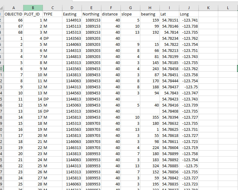
What I am trying to do is create slope arrows for a cruise plan map. I have a slope table (xls), with ID, Length, Bearing, Slope%, Easting, Northing. Currently I create each line using the create line => Direction, length using the xls which is fine if I have only a few. But when I have 50+ to create it is time consuming. It would be nice to run a script/tool to create my lines automatically.. is there such a thing out there? I searched online did not see anything helpful.
Any help much appreciated.
Tina
- Mark as New
- Bookmark
- Subscribe
- Mute
- Subscribe to RSS Feed
- Permalink
perhaps Bearing Distance To Line (Data Management)—ArcGIS Pro | Documentation
if the data are in, or can be derived, in your table
... sort of retired...
- Mark as New
- Bookmark
- Subscribe
- Mute
- Subscribe to RSS Feed
- Permalink
I will try that one thanks..
- Mark as New
- Bookmark
- Subscribe
- Mute
- Subscribe to RSS Feed
- Permalink
Did you try converting the csv to a file geodatabase table?
... sort of retired...
- Mark as New
- Bookmark
- Subscribe
- Mute
- Subscribe to RSS Feed
- Permalink
Can you please provide an example table (snippet) and the result you want to create?
Have a great day!
Johannes
- Mark as New
- Bookmark
- Subscribe
- Mute
- Subscribe to RSS Feed
- Permalink
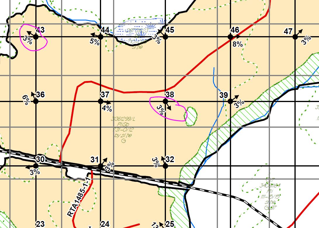
Johannes, I have attached a snip of the final product. Essentially I need to produce lines (in this case 40m long) starting at the plot drawn in the direction of the bearing given to me, then that line is displayed with a arrow symbol and labelled with the slope of the land in the direction of the line.
Currently the only way I know how is to create each line using the draw line tool => direction/distance.
Tina
- Mark as New
- Bookmark
- Subscribe
- Mute
- Subscribe to RSS Feed
- Permalink
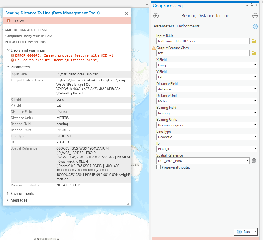
Hi Tina,
The csv screenshot seems fine, but the error message complains about OID -1. Would you be able to share the file so I can take a look? Thanks! - Dan
- Mark as New
- Bookmark
- Subscribe
- Mute
- Subscribe to RSS Feed
- Permalink
Hi Tina, which version of Pro are you using?