- Home
- :
- All Communities
- :
- Products
- :
- ArcGIS Parcel Fabric
- :
- ArcGIS Parcel Fabric Questions
- :
- Re: ArcGIS Pro 2.5: How does the fabric feature cl...
- Subscribe to RSS Feed
- Mark Topic as New
- Mark Topic as Read
- Float this Topic for Current User
- Bookmark
- Subscribe
- Mute
- Printer Friendly Page
ArcGIS Pro 2.5: How does the fabric feature classes and their ID fields work in case of parcel merging and dividing?
- Mark as New
- Bookmark
- Subscribe
- Mute
- Subscribe to RSS Feed
- Permalink
ArcGIS Pro 2.5: How does the fabric feature classes and their ID fields work in case of parcel merging and dividing?
I couldn’t figure out how fabric feature classes (parcels, records, and historic parcels) and their ID fields (global ID, created by record, retired by record) are generated in case of parcel merging and dividing.

Jamal Numan
Geomolg Geoportal for Spatial Information
Ramallah, West Bank, Palestine
- Mark as New
- Bookmark
- Subscribe
- Mute
- Subscribe to RSS Feed
- Permalink
To get a better understanding of the 'parcel aware' editing tools make sure you first understand the behavior that is described in the meetup: Video Link : 6073
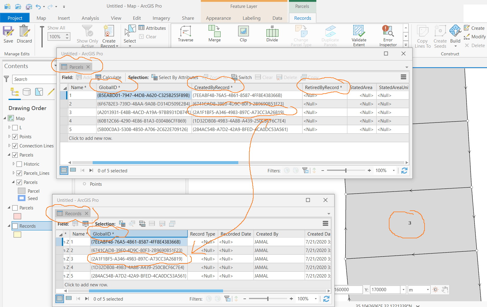
The GlobalIDs are the primary key (PK) of any feature: parcel, line, point, connection line, and records.
They are determined by the system and are unique across systems (unlike object IDs).
When they are used as a Foreign key (FK) - for example in the CreateByRecord field, they should match the Record that was the active record during the creation of the feature, regardless if a relationship class is in place or not.
When merging a new parcel '555' from parcels '222' and '333' with an active record 'AAA' - you will see that the GlobalIS of record 'AAA' will be written to the 'RetiredByRecord' field of parcels '222' and '333' as well as to the ;CreatedByRecord' field of the new child parcel '555'.
I hope this answers your question
Amir
- Mark as New
- Bookmark
- Subscribe
- Mute
- Subscribe to RSS Feed
- Permalink
Thank you Amir for the elaboration.
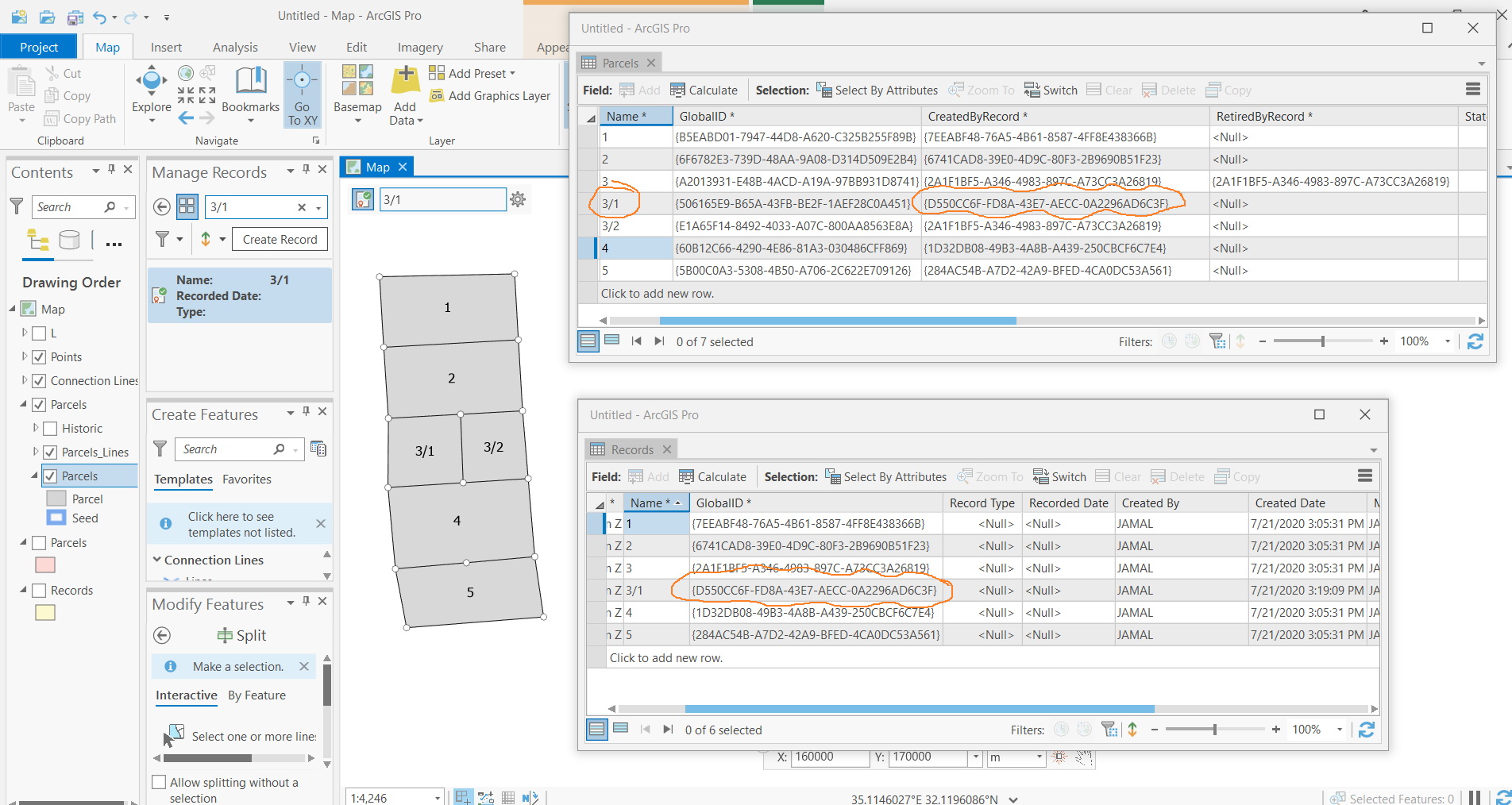
Now, it’s much clearer. However, I couldn’t figure out why this structure is not able to return the history as parcels are kept divided
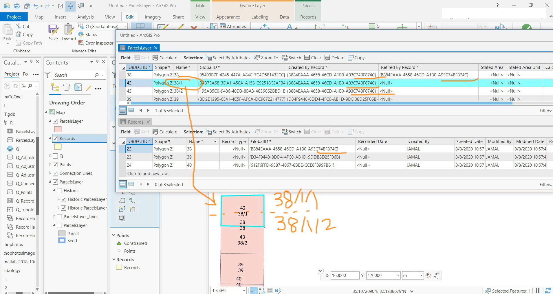
For example, in the screenshot below, parcel#3 is divided into 3/1 & 3/2. Then parcel#3/1 is divided into 3/1/1 & 3/1/2. Identifying 3/1/1 doesn’t return all its history which is parcel#3/1 and parcel#3

Jamal Numan
Geomolg Geoportal for Spatial Information
Ramallah, West Bank, Palestine
- Mark as New
- Bookmark
- Subscribe
- Mute
- Subscribe to RSS Feed
- Permalink
Hi Jamal,
I assume you use the editing Divide tool with an active record.
If you do it SHOULD create historic parcels and populate the RetiredByRecord with the Global ID of the Active Record. If you are using an old version of ArcGIS Pro (2.4) - you might not get this 'parcel behavior'.
Amir
- Mark as New
- Bookmark
- Subscribe
- Mute
- Subscribe to RSS Feed
- Permalink
Thanks Amir
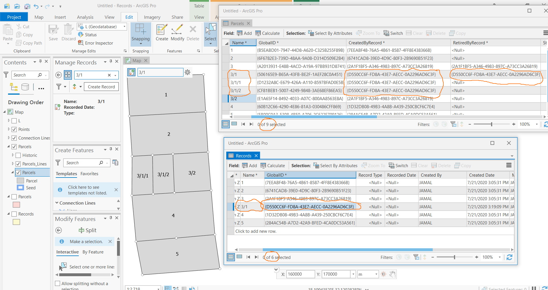
Let me re-describe the scenario as follows:
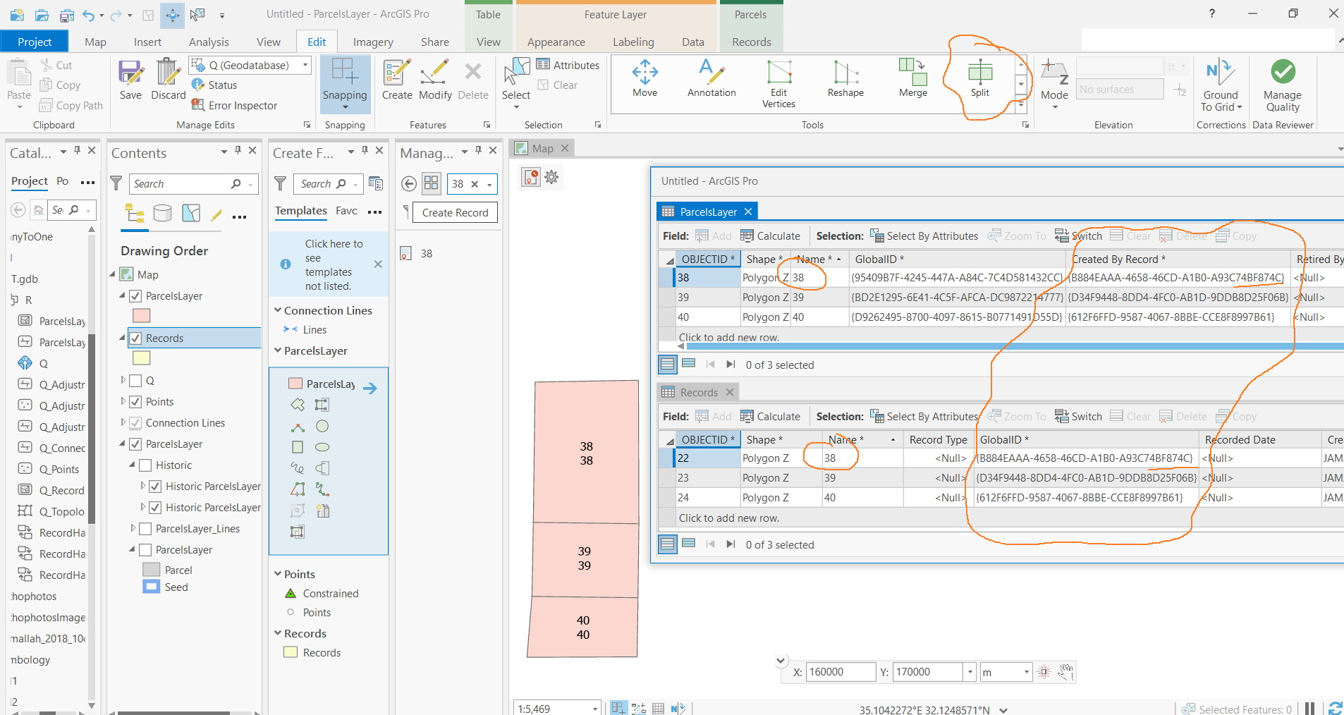
- In the 1st screenshot, I got identical parcel layer and record layer.
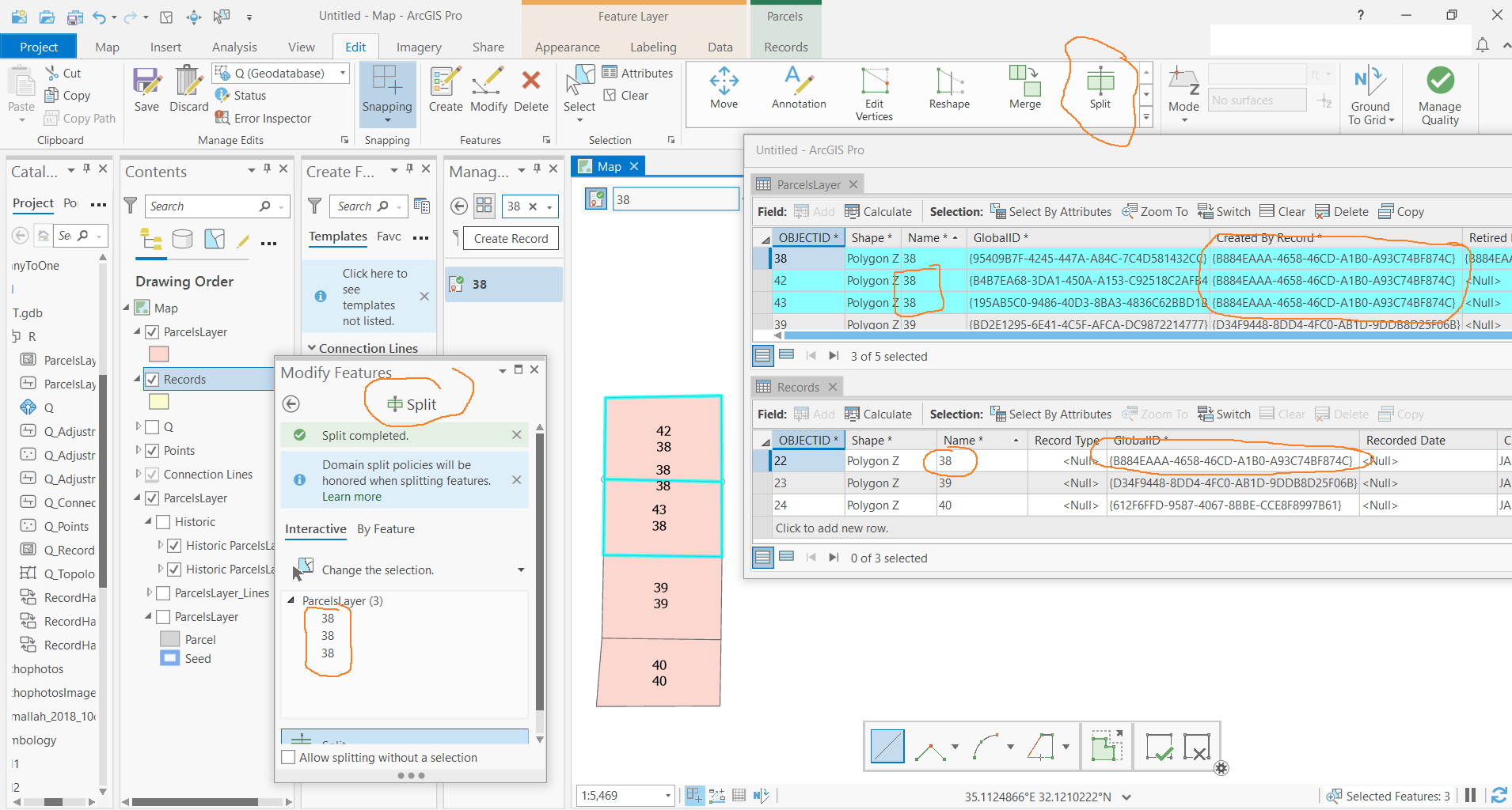
- Now, Parcel#38 is split into two parcels: 38/1 and 38/2.
- Then how these two created parcels are recorded in the record layer so that parcel#38/1 can be newly split into 38/1/1 and 38/1/2?
Jamal Numan
Geomolg Geoportal for Spatial Information
Ramallah, West Bank, Palestine
- Mark as New
- Bookmark
- Subscribe
- Mute
- Subscribe to RSS Feed
- Permalink
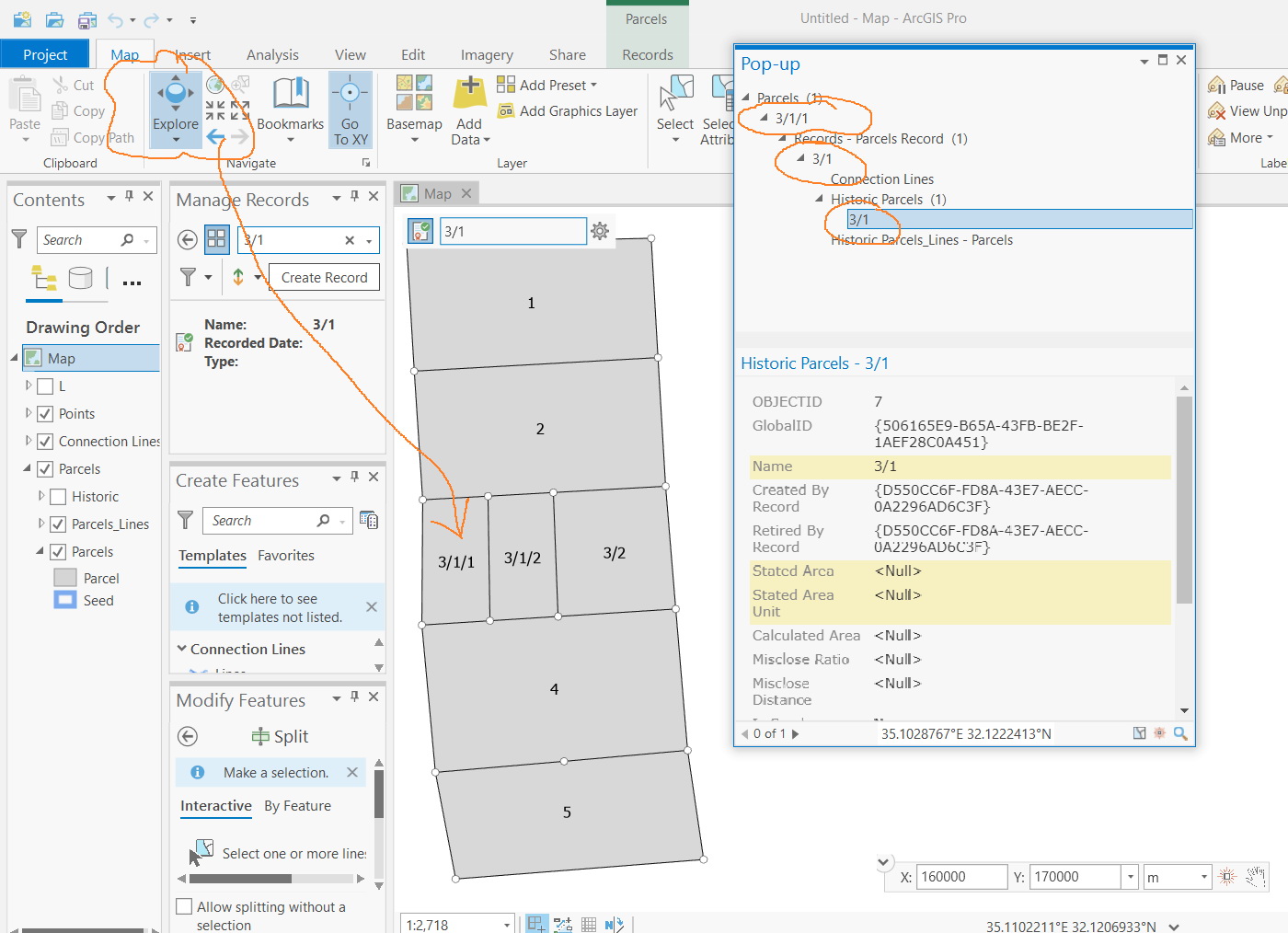
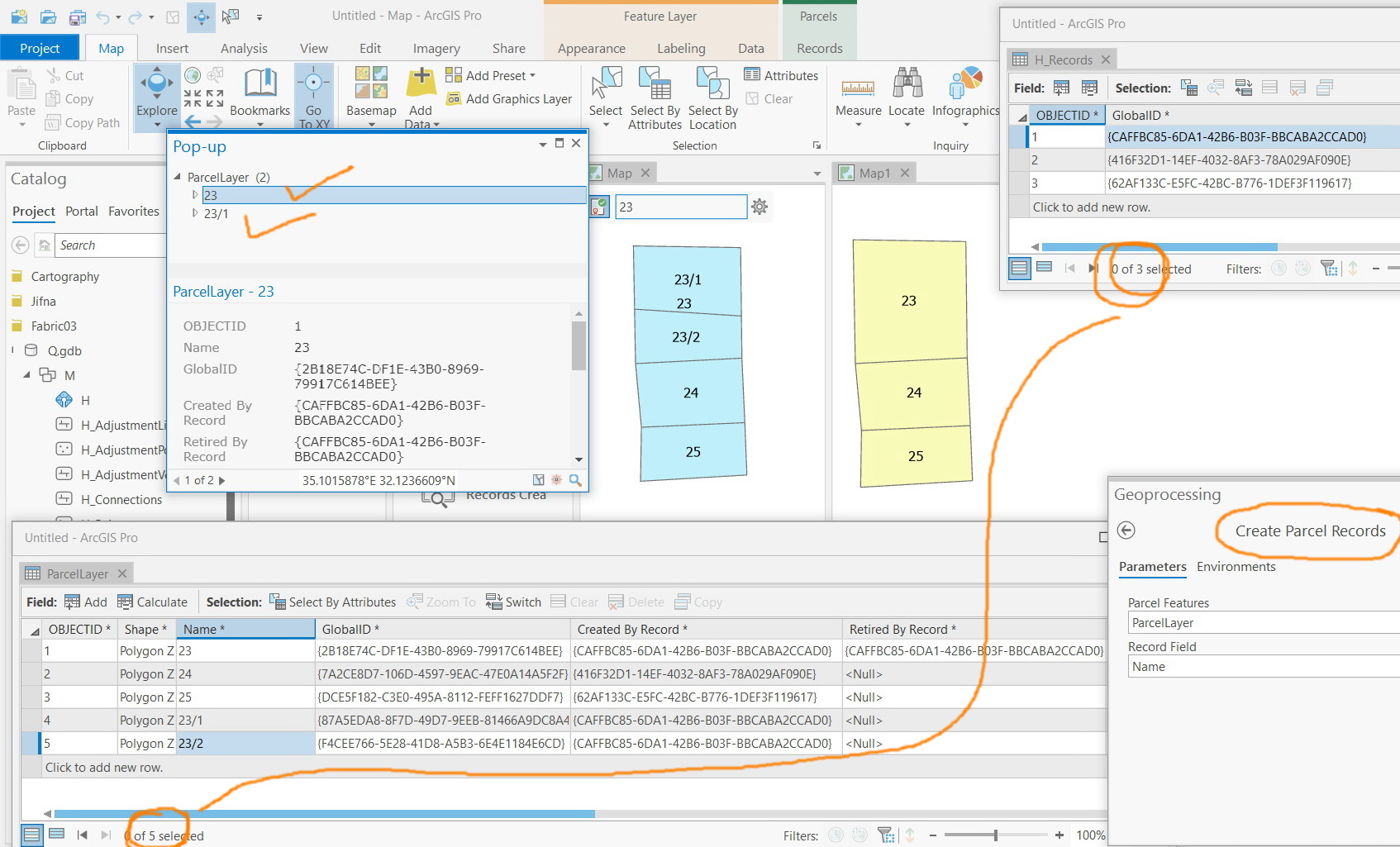
I got that all can be managed if we just consider two layers: parcel and records. No need for the default symbology. After each parcel edit, you need to apply “create parcel records”
and “build extent” tools
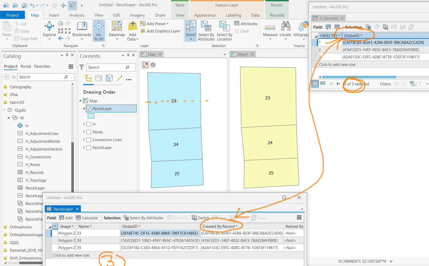
In the screenshot below:
Parcel#23 is set as an active record
Parcel#23 is split into 23/1 & 23/2
The “create parcel records” tool is performed
The “build extent” is run
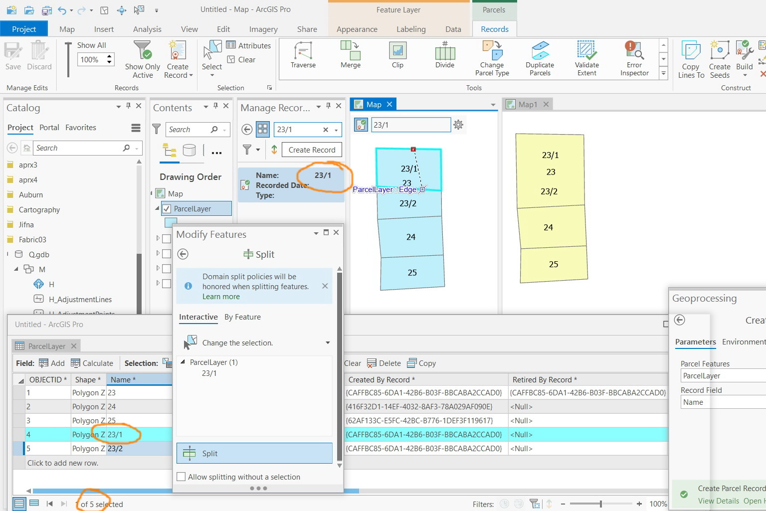
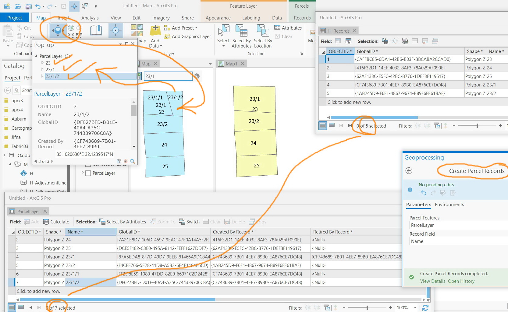
Parcel#23/1 is set as an active record
Parcel#23/1 is split into 23/1/1 & 23/1/2
The “create parcel records” tool is performed
The “build extent” is run
And so on!
This way, the identify tool brings the history correctly if we work only with these two layers (parcel and records)

Jamal Numan
Geomolg Geoportal for Spatial Information
Ramallah, West Bank, Palestine