- Home
- :
- All Communities
- :
- Products
- :
- ArcGIS Online
- :
- ArcGIS Online Questions
- :
- Shapefile Coordinate System
- Subscribe to RSS Feed
- Mark Topic as New
- Mark Topic as Read
- Float this Topic for Current User
- Bookmark
- Subscribe
- Mute
- Printer Friendly Page
Shapefile Coordinate System
- Mark as New
- Bookmark
- Subscribe
- Mute
- Subscribe to RSS Feed
- Permalink
Hi Arc GIS Online community,
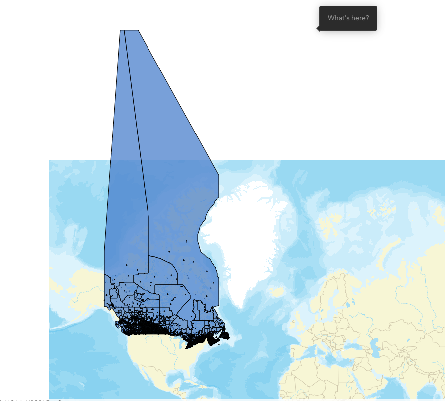
I am trying to map Canadian dissemination areas below, but I think the shape file coordinate system is NAD83/Statistics Canada Lambert Coordinate reference system and gives me the attached image.
I appreciate any help how to read it with Arc GIS online default WGS 1984 Web Mercator system. I only have GIS online and QGIS. Thanks
Solved! Go to Solution.
Accepted Solutions
- Mark as New
- Bookmark
- Subscribe
- Mute
- Subscribe to RSS Feed
- Permalink
Thank you Russal. I downloaded the update file and it worked.
- Mark as New
- Bookmark
- Subscribe
- Mute
- Subscribe to RSS Feed
- Permalink
Looks like you are using the Digital Boundary version instead of the carto one. If you wanted to use that in the coordinate system. You could use this Gov Canada tile layer to have it in the same coordinate system
https://jsapi.maps.arcgis.com/home/item.html?id=3d0be59ed0fa4604b1b9384f9b9a8a36

- Mark as New
- Bookmark
- Subscribe
- Mute
- Subscribe to RSS Feed
- Permalink
Thank you Russal. I downloaded the update file and it worked.