- Home
- :
- All Communities
- :
- Products
- :
- ArcGIS Online
- :
- ArcGIS Online Questions
- :
- Geoshape in Survey 123 Connect is creating points
- Subscribe to RSS Feed
- Mark Topic as New
- Mark Topic as Read
- Float this Topic for Current User
- Bookmark
- Subscribe
- Mute
- Printer Friendly Page
Geoshape in Survey 123 Connect is creating points
- Mark as New
- Bookmark
- Subscribe
- Mute
- Subscribe to RSS Feed
- Permalink
- Report Inappropriate Content
Hi all!
Im experiencing some strange behaviour with Survey 123 Connect (3.0.127).
Essentially i have enabled it to collect polygons via the geoshape type. The web survey allows me to capture polygons (after i have enabled viewing at 3.8) however when i go to AGOL or Arcpro to view the feature service it is capturing points not polygons.
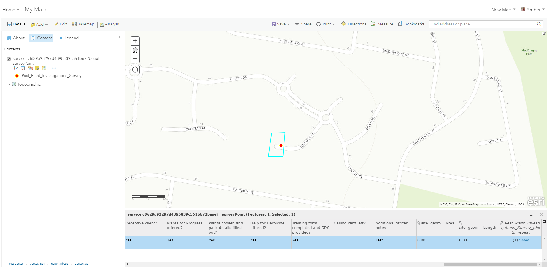
In AGOL when i select the attribute record for the entry however it will highlight a 'polygon' around it. See screenshot attached.
Is this expected behaviour? I had envisaged collecting actual polygons when i read about the geoshape functionality.
Any help would be great!
Cheers
Amber
- Mark as New
- Bookmark
- Subscribe
- Mute
- Subscribe to RSS Feed
- Permalink
- Report Inappropriate Content
Hi Amber,
Firstly, I suggest you download the latest Connect version. Your version is quite old - the polygon and line functionalities are relatively new so it might be worthwhile testing it with the latest versions.
Check in your AGOL folders to see if you have a polygon and a point layer.
Check the polygon symbology in the webmap. Try to open it in a separate webmap to see how it behaves.
Try to delete the existing survey/layers from AGOL and republish from Connect.
If the issue still persists, can you please upload a photo of your web map layers (where both the polygon and point show up), and also the Connect file.
Cheers,
Uri
- Mark as New
- Bookmark
- Subscribe
- Mute
- Subscribe to RSS Feed
- Permalink
- Report Inappropriate Content
Hi Uri,
Thank you for your reply!
Unfortunately my organisation has a fully Managed Operating Environment which is forcing us to stick to 3.0.127 until we can get the upgrade though the IT department. I do wonder if version 'compatibility' might be causing this issue.
In regards to your advice:
1. There is only one feature service, which is displaying as a point
2. I've opened it in an AGOL webmap and Arcgis pro and only get symbology options that apply to a point
3. I reloaded the form to create a fresh Survey in Connect and came up with the same issue
4. Below is a screenshot of the layer in webmap with the point displaying in the TOC but the selection from the attribute table showing as a polygon spatially
Ill attach the form as well

Thanks for the help!
- Mark as New
- Bookmark
- Subscribe
- Mute
- Subscribe to RSS Feed
- Permalink
- Report Inappropriate Content
Form is attached to the original question
- Mark as New
- Bookmark
- Subscribe
- Mute
- Subscribe to RSS Feed
- Permalink
- Report Inappropriate Content
Hi Amber,
I've published your survey as is, and it worked fine (see below). It only produced a polygon.
I'm using the latest Connect version so that might be the difference.
Does this happen with every survey you publish (with polygon geometry)?
A possible workaround: create a polygon layer with the same schema and force the survey to send the results there (by putting the URL of the polygon layer in the 'submission_url' in the Settings tab in Connect).
Use Survey123 with existing feature services—Survey123 for ArcGIS | Documentation
Cheers,
Uri
- Mark as New
- Bookmark
- Subscribe
- Mute
- Subscribe to RSS Feed
- Permalink
- Report Inappropriate Content
Hi Uri,
I managed to find a non-MOE pc and installed the most up to date survey 123 connect and as you said it all works perfectly.
So I think I’m going to publish my survey up on AGOL using the newer version and pressure my IT team to get cracking on the upgrade!
Thanks so much for your assistance Uri!
Cheers
Amber