- Home
- :
- All Communities
- :
- Products
- :
- ArcGIS Online
- :
- ArcGIS Online Questions
- :
- Edit Point Locations in New Map Viewer and Connect...
- Subscribe to RSS Feed
- Mark Topic as New
- Mark Topic as Read
- Float this Topic for Current User
- Bookmark
- Subscribe
- Mute
- Printer Friendly Page
Edit Point Locations in New Map Viewer and Connect Points to Polygon
- Mark as New
- Bookmark
- Subscribe
- Mute
- Subscribe to RSS Feed
- Permalink
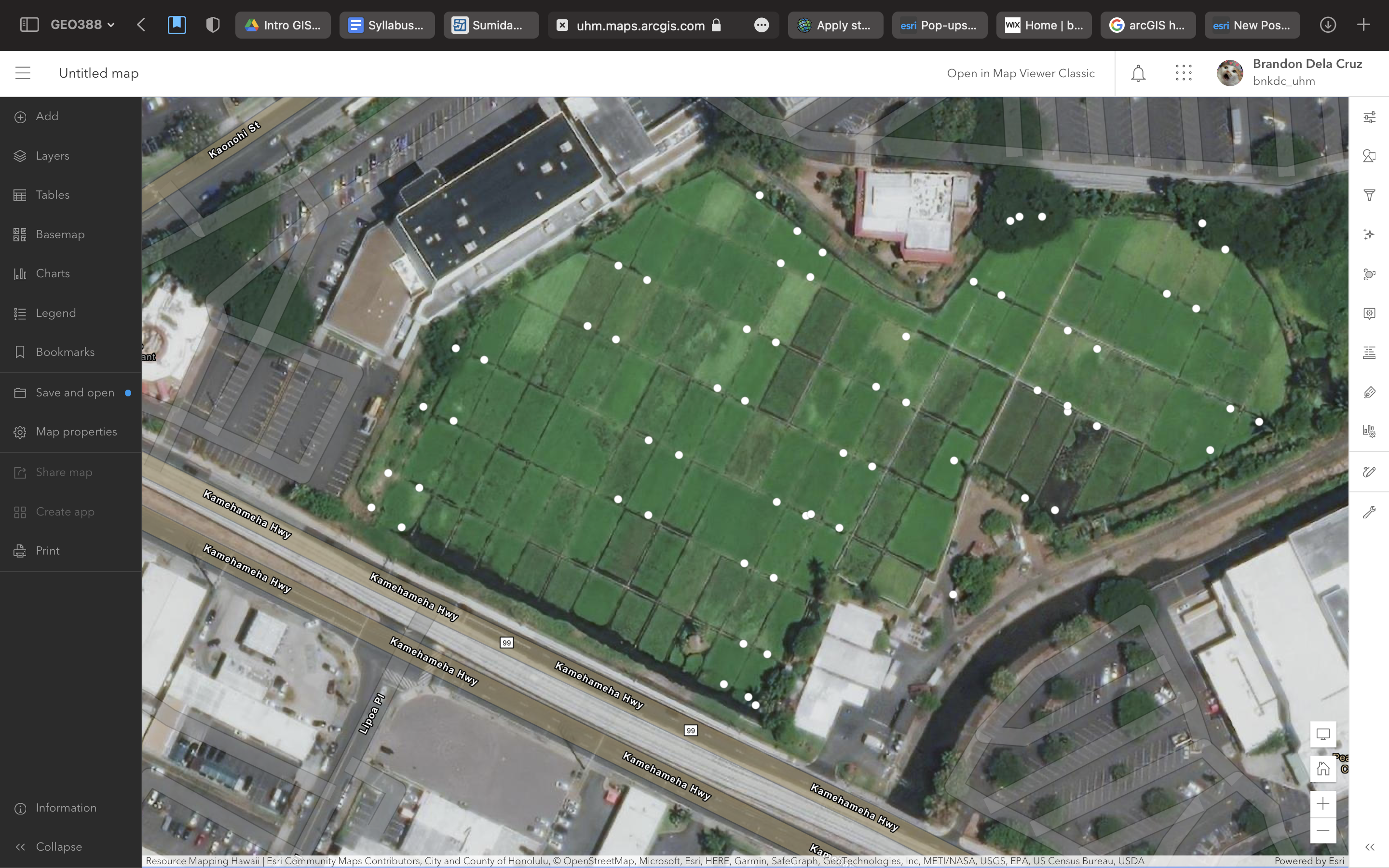
I uploaded a CSV file containing exact GPS locations of about 64 points but it seems that my points got shifted to the left when uploading on to AGOL. Is there a way to drag the points to the right so they align with the ArcGIS Imagery basemap?
Also is there a way to connect up to 4 of the points to form a polygon?
- Mark as New
- Bookmark
- Subscribe
- Mute
- Subscribe to RSS Feed
- Permalink
I figured out how to move the points!!
Contents (locate Feature Layer) > Settings(...) > Open in Map Viewer Classic with full editing controls
Click point > Edit > Click and Drag
BOOM!
but I still don't know if its even possible to connect points to form a polygon 😞
any suggestions?
- Mark as New
- Bookmark
- Subscribe
- Mute
- Subscribe to RSS Feed
- Permalink
I wouldn't move the points manually unless this is a one time situation and that level of accuracy is acceptable. Manually moving the the points is a time consuming workflow, especially if you have to repeat it often, and it adds error to the points. The points are probably shifted because their spatial reference differs from that of the base map. If you find out what coordinate system your points are in you can set your basemap to match it.
As for connecting the points all four of the points you would want to connect to make a polygon would all need a common IDentifier to let the system know that they form a unique polygon. Each point that shares a common ID would also need a sequence number so the system would know that for this polygon it's going to connecting 1 to 2 and 2 to 3 and 3 to 4, and 4 to 1 again. without this you can get some unexpected results. If you are going to just be doing this once, and you know which points are in a polygon group, it might just be easier to define a polygon layer, turn on snapping, and draw them manually.