- Home
- :
- All Communities
- :
- Products
- :
- ArcGIS Online
- :
- ArcGIS Online Questions
- :
- Re: Does Manage Tile Cache tool work with tif imag...
- Subscribe to RSS Feed
- Mark Topic as New
- Mark Topic as Read
- Float this Topic for Current User
- Bookmark
- Subscribe
- Mute
- Printer Friendly Page
Does Manage Tile Cache tool work with tif images
- Mark as New
- Bookmark
- Subscribe
- Mute
- Subscribe to RSS Feed
- Permalink
I have a process I use frequently to generate tile packages for use online and in mobile applications such as survey123. Generally I am only using simple base map layers (points/lines/polys). Now I need one that incorporates both shape files and imagery. I've been using a series of ArcToolbox tile cache tools in ArcMap 10.6.1 along with the ArcGIS_Online_Bing_Maps_Google_Maps.xml. Area of interest is approximately 4 miles by 3 miles. I started the Manage Tile Cache tool Monday afternoon. Its now Wednesday and its still running.
Generate Tile Cache Tiling Scheme
Manage Tile Cache: Pics Below
Export Tile Cache
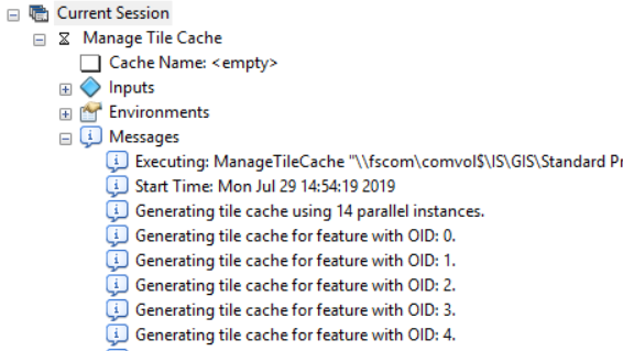
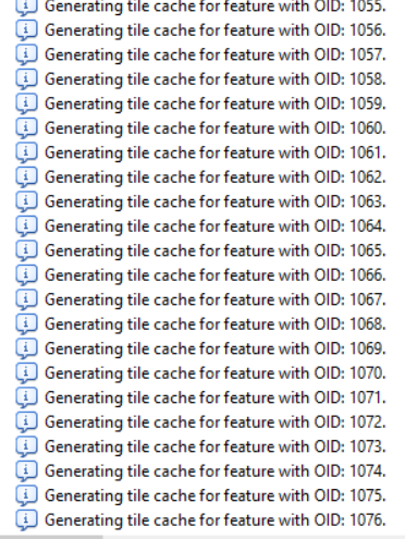
These tools worked fine until added imagery. I know this does not support image services, but does that include georeferenced tiff images as well? I've never seen it do this before and I don't really understand what it is doing. Why are there so many tile caches and why is it taking days to process? Usually this takes under 30 minutes. Can anyone direct me to documentation on what this means, a different process to use, or let me know if its just not possible to create these tpk files using tif images.
- Mark as New
- Bookmark
- Subscribe
- Mute
- Subscribe to RSS Feed
- Permalink
Hi Adam Daily,
The tool should work with georeferenced tiffs: Manage Tile Cache—Help | ArcGIS Desktop. I would recommend cross-posting this to Geoprocessing or creating a case with Esri Support to look into it further.
Thanks,
Peter