- Home
- :
- All Communities
- :
- Products
- :
- ArcGIS Online
- :
- ArcGIS Online Questions
- :
- Re: ArcGIS Online trouble with 3D extrusion in Arc...
- Subscribe to RSS Feed
- Mark Topic as New
- Mark Topic as Read
- Float this Topic for Current User
- Bookmark
- Subscribe
- Mute
- Printer Friendly Page
ArcGIS Online trouble with 3D extrusion in ArcScene
- Mark as New
- Bookmark
- Subscribe
- Mute
- Subscribe to RSS Feed
- Permalink
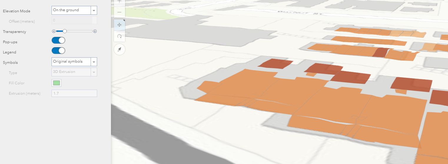
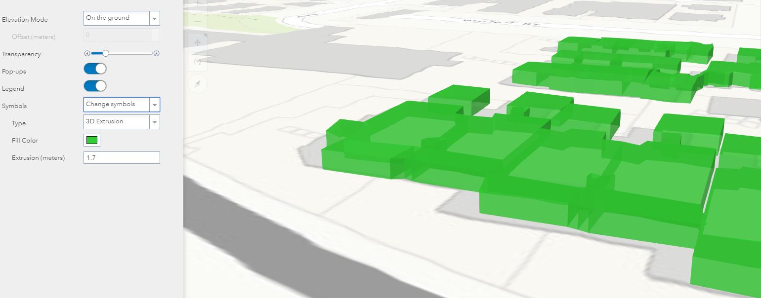
I'm having difficulty viewing my Feature Class in Scene Viewer where my saved symbology is not appearing as 3D Extruded, but rather as 2D. I have a Feature Class uploaded to my ArcGIS Online account and opened it in Map Viewer. Here, I was able to apply my desired symbology and save. When I view this Feature Class in Scene Viewer, by symbology is correct, but I cannot view it as 3D Extruded. If I change the Symbols option from "Original Symbols" to "Change Symbols", I'm able to view my data in 3D, however I lose my symbology.
How can I keep my symbology and view it as 3D in Scene Viewer?
Here are a couple screen captures to help illustrate my issue:
Correct symbology, but not in 3D
In 3D, but cannot change symbology
Solved! Go to Solution.
- Mark as New
- Bookmark
- Subscribe
- Mute
- Subscribe to RSS Feed
- Permalink
Yup I can see the scene layers and feature layers and see the issue you are seeing. We are looking into it. Could you share one more thing to the group - the source data you published the feature layer from. This could be a zipped GDB or Service Definition depending on how you published it.
Thanks!
Russ
- Mark as New
- Bookmark
- Subscribe
- Mute
- Subscribe to RSS Feed
- Permalink
Here’s the Source Data from my “Trouble_with_symbology_layer”. This layer was uploaded from a network drive
Data Type: Shapefile Feature Class
Shapefile: G:\OM\ArcThemes\3D_Condo\CONDO_1st_Level_3D_20170721.shp
Geometry Type: MultiPatch
Coordinates have Z values: Yes
Coordinates have measures: Yes
Projected Coordinate System: NAD_1983_HARN_StatePlane_Colorado_North_FIPS_0501_Feet
Projection: Lambert_Conformal_Conic
False_Easting: 3000000.00031608
False_Northing: 999999.99999600
Central_Meridian: -105.50000000
Standard_Parallel_1: 39.71666667
Standard_Parallel_2: 40.78333333
Latitude_Of_Origin: 39.33333333
Linear Unit: Foot_US
Geographic Coordinate System: GCS_North_American_1983_HARN
Datum: D_North_American_1983_HARN
Prime Meridian: Greenwich
Angular Unit: Degree
Here’s the Source Data from my “missing_root_node_layer”. This layer was uploaded from my local drive
Data Type: Shapefile Feature Class
Shapefile: C:\2018_GIS_work\_Boulder\AirSpace\Shapefile\3597573_3d_COGO.shp
Geometry Type: MultiPatch
Coordinates have Z values: Yes
Coordinates have measures: Yes
Projected Coordinate System: NAD_1983_HARN_StatePlane_Colorado_North_FIPS_0501_Feet
Projection: Lambert_Conformal_Conic
False_Easting: 3000000.00031608
False_Northing: 999999.99999600
Central_Meridian: -105.50000000
Standard_Parallel_1: 39.71666667
Standard_Parallel_2: 40.78333333
Latitude_Of_Origin: 39.33333333
Linear Unit: Foot_US
Geographic Coordinate System: GCS_North_American_1983_HARN
Datum: D_North_American_1983_HARN
Prime Meridian: Greenwich
Angular Unit: Degree
- Mark as New
- Bookmark
- Subscribe
- Mute
- Subscribe to RSS Feed
- Permalink
Judging by what you posted they are from 3D Shapefiles? If you can share the zipped 3D Shapefiles as well that would be great.
Thanks!
Russ
- Mark as New
- Bookmark
- Subscribe
- Mute
- Subscribe to RSS Feed
- Permalink
Okay, I’ve added the zipped shapefiles to the group. Again, I greatly appreciate all your help!
Pete
- Mark as New
- Bookmark
- Subscribe
- Mute
- Subscribe to RSS Feed
- Permalink
looks like they are feature layers still .. do you see on the right hand side of the feature layer item Created From which will have a link to the source data(zipped shp, gdb or .sd) and share that to the group 
Thanks!
Russ
- Mark as New
- Bookmark
- Subscribe
- Mute
- Subscribe to RSS Feed
- Permalink
Okay, I think I’ve got it now!
- Mark as New
- Bookmark
- Subscribe
- Mute
- Subscribe to RSS Feed
- Permalink
Thanks! So with 3D shapefiles we do have an issue we are investigating with attributes being not stored in the cache of the scene layer which ends up reflecting the issue we see here with the symbols not updating. If you convert your 3D Shapefile into a feature class and zip that gdb or share it from ArcMap/Pro you will get a feature layer and scene layer that works as you expect. I did a simple export features on the shapefile in ArcMap to create the feature class and uploaded that which worked out. I can share the zipped gdb with you if you want.
- Mark as New
- Bookmark
- Subscribe
- Mute
- Subscribe to RSS Feed
- Permalink
Okay, thanks for looking into this! Sure, if you wouldn’t mind sharing that file I’d appreciate it!
- Mark as New
- Bookmark
- Subscribe
- Mute
- Subscribe to RSS Feed
- Permalink
Shared to the group.
- Mark as New
- Bookmark
- Subscribe
- Mute
- Subscribe to RSS Feed
- Permalink
So if I’m understanding you correctly, I shouldn’t convert my Feature Class to 3D in ArcScene? Sorry, this is all new to me!
1. Add feature class to ArcScene (I don’t have Pro)
2. Extrude polygon
3. Export Feature Class and zip
4. Upload to AGOL
5. Publish hosted scene layer
6. View in Scene