- Home
- :
- All Communities
- :
- Products
- :
- ArcGIS Network Analyst
- :
- ArcGIS Network Analyst Questions
- :
- creating pipeline network
- Subscribe to RSS Feed
- Mark Topic as New
- Mark Topic as Read
- Float this Topic for Current User
- Bookmark
- Subscribe
- Mute
- Printer Friendly Page
creating pipeline network
- Mark as New
- Bookmark
- Subscribe
- Mute
- Subscribe to RSS Feed
- Permalink
I am working on a project where I should connect street segments along public streets (for example for a pipeline for gas or oil). I have an example geodatabase with a feature dataset. The feature dataset includes the streets from open street map (osmstreets) around the street segments and the street segments that should be connected itself. I converted the street segments to points to be able to add them later as locations in the network analyst toolbox.
Then I created a network dataset, a route layer and added my points from the street segments as stops to the layer.
Now I want to connect the points/stops with each other along the public streets from open street map
There I have several problems and questions.
1. When I want to calculate a route with the "solve" tool I always get errors like this although I chose the option "ignore invalid locations":
"Warning: No route from first location "Location 1" to last location "Location 15".
Error: No solution found."
The problem is that the route does not connect if there are junctions between
2. Can I choose a start and end point?
3. Is it possible to calculate routes as a kind of network. As I said I need it for gas or oil networks ans only need the shortest connection between the segments and not a route that connects one point after another like a car would drive? lready tried to build a geometric network but there some points are not included.
Thanks for your help.
- Mark as New
- Bookmark
- Subscribe
- Mute
- Subscribe to RSS Feed
- Permalink
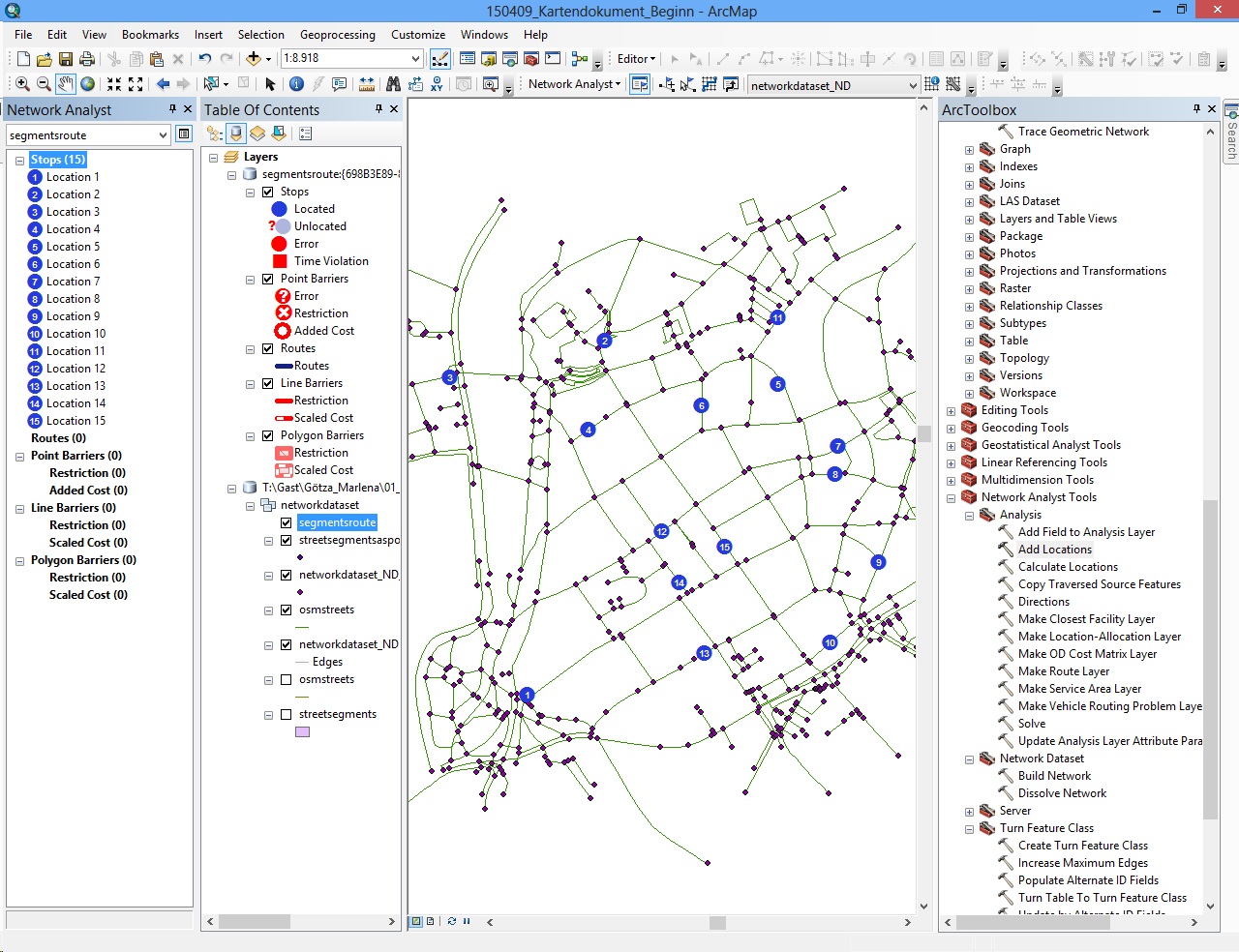
Picture to Point 1: The 15 Locations and the network
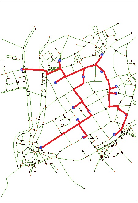
To point 3: I want this as result
The files are in my former post "ESRI.rar"
- Mark as New
- Bookmark
- Subscribe
- Mute
- Subscribe to RSS Feed
- Permalink
Network Analyst may not be the optimal tool to use for this solution; You might want to take a look at Geometric Networks: ArcGIS Help 10.1