- Home
- :
- All Communities
- :
- Products
- :
- ArcGIS Maps for Adobe CC
- :
- ArcGIS Maps for Adobe CC Questions
- :
- Re: AGO data error?
- Subscribe to RSS Feed
- Mark Topic as New
- Mark Topic as Read
- Float this Topic for Current User
- Bookmark
- Subscribe
- Mute
- Printer Friendly Page
AGO data error?
- Mark as New
- Bookmark
- Subscribe
- Mute
- Subscribe to RSS Feed
- Permalink
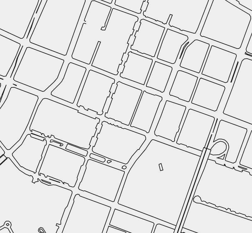
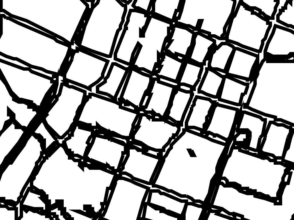
When I add content from our AGO site, the data displays with severe jagged edges. Is this a size restriction? Something in Illustrator? It's not really usable if this is the output from AGO-->Illustrator.
Scott
- Mark as New
- Bookmark
- Subscribe
- Mute
- Subscribe to RSS Feed
- Permalink
Hi Scott,
Looks like the geometries of your data got simplified during the export. If you can share us with the data/webmap, we can investigate the problem on our end and provides a solution for it.
Thanks,
Xingdong
- Mark as New
- Bookmark
- Subscribe
- Mute
- Subscribe to RSS Feed
- Permalink
Sure, but it has happened with every layer I try. Does the map scale make a difference? I don't see why it would but I can't think of anything else.
Data layer: http://grvlsc.maps.arcgis.com/home/item.html?id=e2b2d444b98b402988e0a034e5963e27
- Mark as New
- Bookmark
- Subscribe
- Mute
- Subscribe to RSS Feed
- Permalink
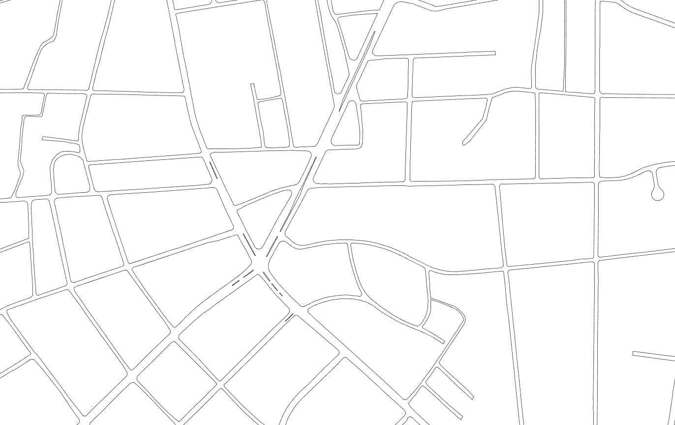
If when creating the Mapboard I define a very small map scale, then the geometry looks much better. Is this the intended workflow? Since it's vector data, I'm not understanding why that would matter but it appears it does. Is it converted from raster at some point?
- Mark as New
- Bookmark
- Subscribe
- Mute
- Subscribe to RSS Feed
- Permalink
Hi Scott,
Thank you for preparing the data. We are able to reproduce the issue and will be looking for a solution for it. To answer your question, the vector data is not scale dependent and there is no raster to vector conversion during the process.
Thanks,
Xingdong
- Mark as New
- Bookmark
- Subscribe
- Mute
- Subscribe to RSS Feed
- Permalink
Xingdong,
Thanks for taking a look.
Why does setting map a small scale seem to resolve it?
Scott
- Mark as New
- Bookmark
- Subscribe
- Mute
- Subscribe to RSS Feed
- Permalink
Any progress on this? Is it registered as a bug? This is holding up production for us.
Scott
- Mark as New
- Bookmark
- Subscribe
- Mute
- Subscribe to RSS Feed
- Permalink
Hi Scott,
The issue was logged as a high priority bug in our system. We are working on it and will get back to you as soon as possible.
Thanks,
Xingdong
- Mark as New
- Bookmark
- Subscribe
- Mute
- Subscribe to RSS Feed
- Permalink
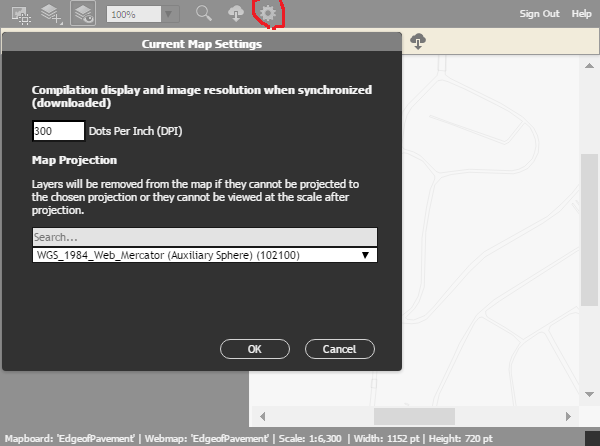
Hi Scott,
Vector data snaps to display pixel grid during export. So the issue is related to map export dpi setting. Try to bump up your setting to 300 dpi and see if the results meet your production requirements. You can also export the map in a large scale (increased level of detail) to have better results as you already know. If it is still an issue, we can increase the up limit in the incoming release.
- Mark as New
- Bookmark
- Subscribe
- Mute
- Subscribe to RSS Feed
- Permalink
I also have this issue and notice in AGOL - depending on the scale, the polygon will be simplified to a degree. When we pull in the data to illustrator it pulls the simplified polygon at the scale it will fit within the artboard.
It doesn't matter if you up the DPI because it is still pulling the simplified polygon. Only when you zoom way into a feature does it draw without simplification... though this doesn't allow you to download all of the features in the project area.