- Home
- :
- All Communities
- :
- Products
- :
- ArcGIS Maps for Adobe CC
- :
- ArcGIS Maps for Adobe CC Questions
- :
- AGO data error?
- Subscribe to RSS Feed
- Mark Topic as New
- Mark Topic as Read
- Float this Topic for Current User
- Bookmark
- Subscribe
- Mute
- Printer Friendly Page
AGO data error?
- Mark as New
- Bookmark
- Subscribe
- Mute
- Subscribe to RSS Feed
- Permalink
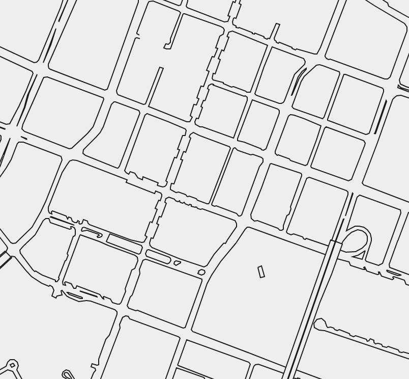
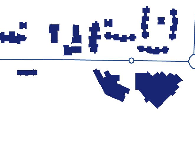
When I add content from our AGO site, the data displays with severe jagged edges. Is this a size restriction? Something in Illustrator? It's not really usable if this is the output from AGO-->Illustrator.
Scott
- Mark as New
- Bookmark
- Subscribe
- Mute
- Subscribe to RSS Feed
- Permalink
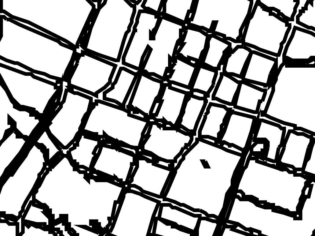
Bogg2050 can you share a screenshot of the downloaded artwork in Ai of the polygon with the default dpi (96) and another of the polygon at 300 dpi?
- Mark as New
- Bookmark
- Subscribe
- Mute
- Subscribe to RSS Feed
- Permalink
scale: 1:8,656 -
DPI 96
 300 DPI
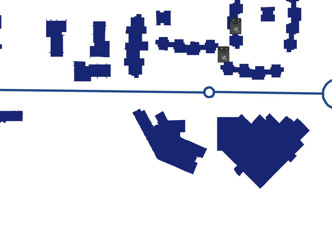
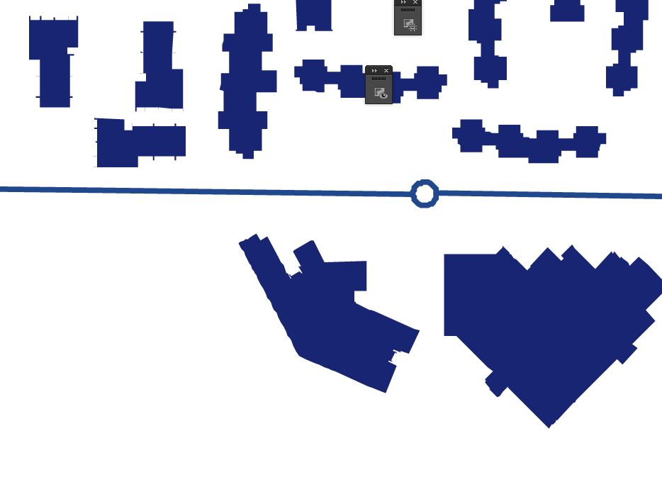 600 DPI
- Mark as New
- Bookmark
- Subscribe
- Mute
- Subscribe to RSS Feed
- Permalink
Thanks, where/how did you set the DPI to 600? This was outside of Maps for Adobe, correct? This indeed does look like the same issue as Scott Aulen 's above. We've tracked this to a lower level limitation of ArcGIS Online Printing and Export, and we are looking to resolve this in a future release. Sorry for the inconvenience.
- Mark as New
- Bookmark
- Subscribe
- Mute
- Subscribe to RSS Feed
- Permalink
Hey Clint,
hmm, looks like I didn't realize it reverted to 300 DPI if you try to set it above 300.
Glad you were able to track the issue down.
- « Previous
-
- 1
- 2
- Next »
- « Previous
-
- 1
- 2
- Next »