This happens on the Map control of my JS API application. JS API V 3.15
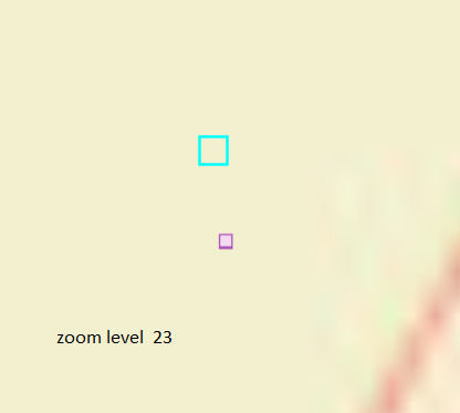
When I zoom in, the graphics layer draws points with offset. This only happens if I go higher than zoom level 19.
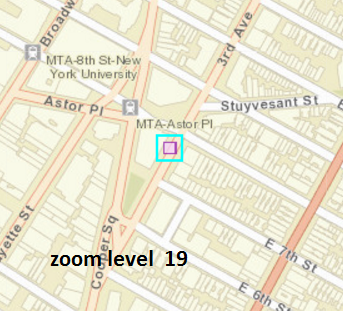
My Map service uses the Spatial Reference: 102100 (3857) and the layers use the same.
There are no offset set in the Marker Symbol!
here are the coordinates
Graphics in the selection layer : {"x":-8236542.608046744,"y":4972503.374560848,"spatialReference":{"wkid":102100,"latestWkid":3857}}
Same point in ArcMap Layer : "x":-8236542.608046744,"y":4972503.374560848
Graphics in the selection layer drawing location at zoom level 23 : "x":-8236542.689359816,"y":4972503.365381212
The Point as drawn by Map service at zoom level 23 is at : "x":-8236542.502745978,"y":4972502.171052645