- Home
- :
- All Communities
- :
- Developers
- :
- JavaScript Maps SDK
- :
- JavaScript Maps SDK Questions
- :
- Re: Rss Checkbox / Table of Contents map.on issu...
- Subscribe to RSS Feed
- Mark Topic as New
- Mark Topic as Read
- Float this Topic for Current User
- Bookmark
- Subscribe
- Mute
- Printer Friendly Page
Rss Checkbox / Table of Contents map.on issue???
- Mark as New
- Bookmark
- Subscribe
- Mute
- Subscribe to RSS Feed
- Permalink
<!DOCTYPE html>
<html>
<head>
    <title>Map</title>
    <meta http-equiv="Content-Type" content="text/html; charset=utf-8">
    <meta name="viewport" content="initial-scale=1, maximum-scale=1,user-scalable=no">
    <link rel="stylesheet" href="http://js.arcgis.com/3.8/js/dojo/dijit/themes/tundra/tundra.css">
    <link rel="stylesheet" href="http://js.arcgis.com/3.8/js/esri/css/esri.css">
    <link rel="stylesheet" type="text/css" href="http://gmaps-utility-gis.googlecode.com/svn/tags/agsjs/latest/build/agsjs/css/agsjs.css" />
    <style>
        html, body {
            height: 100%;
            width: 100;
            margin: 0;
            padding: 0;
            font-family: helvetica, arial, sans-serif;
            font-size: 90%;
   color: #00151;
        }
       #map {
            padding: 0;
   overflow: hidden;
   background-color:#0072AF; color:#0072AF;
        }
   #header {
      margin:0px;
      padding: 0px;
   text-align:right;
    background: -webkit-gradient(linear, left top, left bottom, from(#005b8c), to(#1980b7));
       background-color:#0072AF; color:#0072AF;
      border: solid 1px #000000;
      height: 56px;
    }
 #bookmarks-wrapper {
        position: absolute;
        z-index: 40;
        top: 15px;
        right: 30px;
        background: transparent;
        font-size: 12pt;
        color: #444;
      }

   #Search-wrapper {
        position: absolute;
        z-index: 40;
        top: 15px;
        right: 140px;
        background: transparent;
        font-size: 12pt;
        color: #444;
      }

     #RssLayers-wrapper {
        position: absolute;
        z-index: 40;
        top: 15px;
        right: 265px;
        background: transparent;
        font-size: 12pt;
        color: #444;
      }
 #title {
      font-size:150%;
      color: #ffffff;
      text-align:center;
   margin: 2px;
    }
    #subfooter {
      font-size:small;
      color: #ffffff;
   font-size:13px;
      text-align:center;
   margin: 2px;
    }
    .esriControlsBR {
   display: none;
 }


        /* this line hides layers when out of scale for the inline TOC
        .agsjsTOCOutOfScale {
            display: none
        }*/
    </style>
    <script type="text/javascript">
        var djConfig = {parseOnLoad: true, packages: [{"name": "agsjs","location": "http://gmaps-utility-gis.googlecode.com/svn/tags/agsjs/latest/build/agsjs" }] };
    </script>

    <script src="http://js.arcgis.com/3.8/"></script>
    <script type="text/javascript">
        var map, toc, dynaLayer1;

        require(["dojo/_base/connect",
                 "dojo/parser",
      "esri/urlUtils",
      "dojo/on",
      "agsjs/dijit/TOC",
                 "esri/map",
     "esri/layers/ArcGISDynamicMapServiceLayer",
      "esri/dijit/Geocoder",
       "esri/layers/GeoRSSLayer",
       "esri/InfoTemplate",
       "dojo/_base/array",
       "esri/symbols/PictureMarkerSymbol",
       "esri/renderers/SimpleRenderer",
                 "dijit/form/CheckBox",
       "dojo/dom",
       "dojo/dom-construct",
      "dijit/form/DropDownButton",
      "dijit/form/Button",
      "dijit/layout/BorderContainer",
      "dijit/layout/ContentPane",

                 "dojo/fx",
                 "dojo/domReady!"],
                 function (connect, parser,urlUtils, on, TOC, Map, ArcGISDynamicMapServiceLayer, Geocoder,GeoRSSLayer,InfoTemplate,array, PictureMarkerSymbol, SimpleRenderer, CheckBox, dom, domConstruct) {

                     //call the parser to create the layout dijits
                     parser.parse();


                     map = new Map("map", {
                         center: [-93.00, 35.768],
                         zoom: 4,
                         basemap: "streets"
                     });
///Proxy

// Dyanmic layer For Table of Contents
                     dynaLayer1 = new ArcGISDynamicMapServiceLayer("http://maps5.gisworkshop.com/ArcGIS/rest/services/McKenzieTaxDirector/MapServer");

                     map.on('layer-add-result', function (e) {
                         dynaLayer1.setVisibleLayers([0]);
                         toc = new TOC({
                             map: map,
                             layerInfos: [{
                                 layer: dynaLayer1,
                                 title: "McKenzie Parcels",
                                 collapsed: true,
                                 slider: false
                             }]
                         }, 'tocDiv');
                         toc.startup();
                     });
                     map.addLayer(dynaLayer1);
///Geocoding Service
  var geocoder = new Geocoder({
   placeholder: "",
   url: "",
   map: map,
   autoComplete: true,
   },"search");
   geocoder.startup();


    // var georssUrl = "http://geocommons.com/overlays/116926.atom"; // S.F. and East Bay Breweries http://geocommons.com/overlays/116926
           var rssBeer = new GeoRSSLayer("http://geocommons.com/overlays/116926.atom", {id: "Beer"});
            rssBeer.on("load", function () {
                //domStyle.set("loading", "display", "none");
                // create an info template
                  var template = new InfoTemplate("${title}", "<tr><td></td><td>${description}</td></tr><br/><br/><tr><td>  <a href=${link} target=_blank> BeerLine </a></td></tr></br>");
    // set the info template for the feature layers that make up the GeoRSS layer
                // the GeoRSS layer contains one feature layer for each geometry type
                var layers = rssBeer.getFeatureLayers();
                var picRenderer = new PictureMarkerSymbol("http://static.arcgis.com/images/Symbols/Basic/RedShinyPin.png", 21, 21);
                var georssRenderer = new SimpleRenderer(picRenderer);
                array.forEach(layers, function (l) {
                    l.setInfoTemplate(template);
                    l.setRenderer(georssRenderer)
                });

            });
///////////////////////////////////////////////////////////////////////////


            //add the legend
            map.on("layers-add-result", function (evt) {
                var layerInfo = array.map(evt.layers, function (layer,
                index) {
                    return {
                        layer: layer.layer,
                        title: layer.layer.name
                    };

                });

                //add check boxes
                array.forEach(layerInfo,

                function (layer) {
                    var layerName = layer.title;
                    if (layer.layer.id === "Beer") { layerName = "My Beer";}

                    var checkBox = new CheckBox({
                        name: "checkBox" + layer.layer.id,
                        value: layer.layer.id,
                        checked: layer.layer.visible,
                        onChange: function (evt) {
                            var clayer = map.getLayer(this.value);
                            clayer.setVisibility(!clayer.visible);
                            this.checked = clayer.visible;
                        }
                    });
                    //add the check box and label to the TOC
                    domConstruct.place(checkBox.domNode, "toggle",
                        "after");
                    var checkLabel = domConstruct.create('label', {
                        'for': checkBox.name,
                        innerHTML: layerName
                    }, checkBox.domNode, "after");
                    domConstruct.place("<br />", checkLabel,
                        "after");
                });
            });


          map.addLayers([rssBeer]);


     }); // End Main Function ///////
    </script>
</head>
<body class="tundra">
    <div id="content" data-dojo-type="dijit/layout/BorderContainer" design="headline" gutters="true" style="width: 100%; height: 100%; margin: 0;">
<div id="header" class="shadow roundedCorners" data-dojo-type="dijit/layout/ContentPane" data-dojo-props="region:'top'">

   <div id="title">Title Main
       <div id="subfooter">SubTitle</div>

    </div>
 <!-- Bookmarks widget inside a Drop Down Button -->
        <div id="bookmarks-wrapper">
   <div data-dojo-type="dijit/form/DropDownButton" region="top"> <span>Layers</span>
    <div data-dojo-type="dijit/TooltipDialog">
    <div id="tocDiv"></div>
    </div>
    </div>
  </div>

 <!-- Search widget inside a Drop Down Button -->
        <div id="Search-wrapper">
   <div data-dojo-type="dijit/form/DropDownButton" region="top"> <span>Address</span>
    <div data-dojo-type="dijit/TooltipDialog">
    <div id="search"></div>
    </div>
    </div>
  </div>
 <!-- Search widget inside a Drop Down Button -->
        <div id="RssLayers-wrapper">
   <div data-dojo-type="dijit/form/DropDownButton" region="top"> <span>Rss Layers</span>
    <div data-dojo-type="dijit/TooltipDialog">

     <h3>Layers</h3>
                <br>
    <div id="toggle" style="padding: 2px 2px;"></div>
    </div>
    </div>
  </div>
 </div><!-- End Header -->

   <div id="map" data-dojo-type="dijit/layout/ContentPane" region="center">


        </div> <!-- End Map-->
    </div>

</div>
</body>
</html>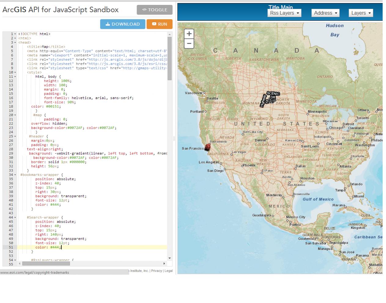
- Mark as New
- Bookmark
- Subscribe
- Mute
- Subscribe to RSS Feed
- Permalink
Hi Jamie,
A few quick notes:
1) You have an extra div closing tag.
2) You are calling parser twice. Remove parseOnLoad: true from the following line:
var djConfig = {parseOnLoad: true, packages: [{"name": "agsjs","location": "http://gmaps-utility-gis.googlecode.com/svn/tags/agsjs/latest/build/agsjs" }] };
3) You are using the map's layers-add-result event incorrectly. It will not fire when adding one layer directly to the map using: map.addLayer(rssBeer); or map.addLayers([rssBeer]); You have two options:
- Add each layer individually (map.addLayer(rssBeer); ) and handle each unique case in a single layer-add-result event callback.
- Add both layers at the same time (map.addLayers([rssBeer, dynaLayer1]); ) and handle each case using a loop in your layers-add-result event callback.
There are pros and cons to both and deciding between the two really depends on the rest of your application.
Pseudo-Code:
1)
map.on("layer-add-result", function (evt) {
if("beer layer pseudo code"){
toc = new TOC({
map: map,
layerInfos: [{
layer: evt.layer,
title: "Beer",
collapsed: true,
slider: false
}]
}, "tocDiv1");
toc.startup();
}else if("dyna layer psuedo code"){
toc2 = new TOC({
map: map,
layerInfos: [{
layer: evt.layer,
title: "Dyna",
collapsed: true,
slider: false
}]
}, "tocDiv2");
toc2.startup();
}
});
2)
map.addLayers([dynaLayer1, rssBeer]);
map.on("layers-add-result", function (evt) {
// Loop through the Layers
array.forEach(evt.layers, function(layer, index){
var toc = new TOC({
map: map,
layerInfos: [{
layer: layer.layer,
title: layer.layer.id,
collapsed: true,
slider: false
}]
}, layer.layer.id);
toc.startup();
});
});
- Mark as New
- Bookmark
- Subscribe
- Mute
- Subscribe to RSS Feed
- Permalink
Thank you for your response I decided to move in a slightly different direction. Where I scrapped the TOC widget and just went with the generate check-boxes. ![]()
<!DOCTYPE HTML>
<html>
<head>
<meta charset="utf-8">
<meta name="viewport" content="initial-scale=1, maximum-scale=1,user-scalable=no">
<title>HurricaneTracker</title>
<link rel="stylesheet" href="http://js.arcgis.com/3.8/js/dojo/dijit/themes/tundra/tundra.css">
<link rel="stylesheet" href="http://js.arcgis.com/3.8/js/esri/css/esri.css">
<style>
html, body {
height: 100%;
width: 100%;
margin: 0;
padding: 0;
background-color: #000000;
}
#map {
height: 100%;
width:100%;
margin: 0;
padding: 0;
overflow: none;
}
legendDiv {
display: none;
}
.esriControlsBR {display:none;}
#header {
margin:0px;
padding: 0px;
text-align:right;
background: -webkit-gradient(linear, left top, left bottom, from(#005b8c), to(#1980b7));
background-color:#0072AF; color:#0072AF;
border: solid 1px #000000;
height: 56px;
}
#title {
font-size:150%;
color: #ffffff;
text-align:center;
margin: 2px;
}
#subfooter {
font-size:small;
color: #ffffff;
font-size:13px;
text-align:center;
margin: 2px;
}
#LayerDrop {
position: absolute;
top: 20px;
right: 20px;
z-index: 50;
}
#appToolbarButtons{
float: right;
vertical-align: middle;
}
#layerBTN {
vertical-align: right;
bottom: 15px;
cursor: pointer ;
margin-right: 5px;
z-index: 50;
cursor: pointer;
right: 10px;
width: 65px!important;
padding: 5px;
position: absolute;
-moz-box-shadow:inset 0px 0px 35px 0px #ccd8e0;
-webkit-box-shadow:inset 0px 0px 35px 0px #ccd8e0;
box-shadow: 1px 6px 12px #0093CA inset, -1px -10px 5px #00ACEC inset, 1px 2px 1px rgba(0, 0, 0, 0);
background-color: #00ACEC;
background:-moz-linear-gradient( center top, #145bb3 5%, #468ccf 100% );
filter:progid:DXImageTransform.Microsoft.gradient(startColorstr='#145bb3', endColorstr='#468ccf');
-webkit-border-top-left-radius:37px;
-moz-border-radius-topleft:37px;
border-top-left-radius:37px;
-webkit-border-top-right-radius:37px;
-moz-border-radius-topright:37px;
border-top-right-radius:37px;
-webkit-border-bottom-right-radius:37px;
-moz-border-radius-bottomright:37px;
border-bottom-right-radius:37px;
-webkit-border-bottom-left-radius:37px;
-moz-border-radius-bottomleft:37px;
border-bottom-left-radius:37px;
text-indent:0;
display:inline-block;
color:#FFFFFF;
font-family:Arial;
font-weight:bold;
font-style:normal;
text-decoration:none;
text-align:center;
text-shadow:0px 0px 0px #072038;
}
#LocateButton {
position: absolute;
top: 95px;
left: 20px;
z-index: 50;
}
#BasemapToggle {
position: absolute;
bottom: 30px;
left: 30px;
z-index: 50;
width:59px;
height:50px;
}
.BasemapToggle .basemapImage {
width:55px;
height:30px;
overflow:hidden;
}
</style>
<script src="http://js.arcgis.com/3.8/"></script>
<script>
var map;
require([
"dojo/parser",
"esri/map",
"esri/dijit/LocateButton",
"esri/dijit/BasemapToggle",
"esri/layers/KMLLayer",
"esri/InfoTemplate",
"esri/layers/FeatureLayer",
"dojo/_base/array",
"esri/symbols/PictureMarkerSymbol",
"esri/renderers/SimpleRenderer",
"esri/dijit/Legend",
"dijit/form/CheckBox", "dojo/dom", "dojo/dom-construct",
"dijit/layout/BorderContainer",
"dijit/layout/ContentPane",
"dijit/Dialog",
"dojo/domReady!"
], function (parser,
Map, LocateButton, BasemapToggle, KMLLayer, InfoTemplate,
FeatureLayer, array, PictureMarkerSymbol, SimpleRenderer, Legend, CheckBox, dom, domConstruct
) {
map = new Map("map", {
basemap: "national-geographic",
fadeOnZoom: true,
center: [-80.013, 32.622],
zoom: 4
});
// create layout dijits
parser.parse();
geoLocate = new LocateButton({
map: map
}, "LocateButton");
geoLocate.startup();
var toggle = new BasemapToggle({
map: map,
basemap: "satellite"
}, "BasemapToggle");
toggle.startup();
var legendLayers = [];
var kmlUrl = "";
var kml = new KMLLayer(kmlUrl, {
id: "KML"
});
kml.setRefreshInterval(5);
var kmlHurricane = "";
var kmlH = new KMLLayer(kmlHurricane, {
id: "Hurricane"
});
kmlH.setRefreshInterval(10);
kmlH.setVisibility(false);
var kmlGaleURL = "";
var kmlGale = new KMLLayer(kmlGaleURL, {
id: "Gale"
});
kmlGale.setRefreshInterval(10);
kmlGale.setVisibility(false);
var kmlTropicalURL = "";
var kmlTropical = new KMLLayer(kmlTropicalURL, {
id: "Tropical"
});
kmlTropical.setRefreshInterval(3);
kmlTropical.setVisibility(false);
//////
var kmlRadarURL = "";
var kmlRadar = new KMLLayer(kmlRadarURL, {
id: "Radar"
});
kmlRadar.setRefreshInterval(7);
kmlRadar.setVisibility(false);
//////
var cities = new FeatureLayer(
mode: FeatureLayer.MODE_ONDEMAND,
id: "City",
outFields: ["*"]
});
cities.setVisibility(false);
///////////////////////////////////////////////////////////////////////////
////Add layers to Legend ////This Also Sets Order of Layers ////
legendLayers.push({ layer: cities, title: 'Cities' });
legendLayers.push({ layer: kmlH, title: 'Hurricane (64kt/73mph)' });
legendLayers.push({ layer: kmlGale, title: 'Gale (50kt/57mph)' });
legendLayers.push({ layer: kmlTropical, title: 'Tropical (34kt/ 39mph)' });
legendLayers.push({ layer: kmlRadar, title: 'Radar' });
legendLayers.push({ layer: kml, title: 'Path' });
//////////////////////////////////////////////////////////
///////////// Check-Box Created////////////////////////////////////
map.on('layers-add-result', function () {
//add check boxes
array.forEach(legendLayers, function (layer) {
var layerName = layer.title;
var checkBox = new CheckBox({
name: "checkBox" + layer.layer.id,
value: layer.layer.id,
checked: layer.layer.visible
});
checkBox.on("change", function () {
var targetLayer = map.getLayer(this.value);
targetLayer.setVisibility(!targetLayer.visible);
this.checked = targetLayer.visible;
});
//add the check box and label to the TOC
domConstruct.place(checkBox.domNode, "toggle",
"after");
var checkLabel = domConstruct.create('label', {
'for': checkBox.name,
innerHTML: layerName
}, checkBox.domNode, "after");
domConstruct.place("<br /><hr/>", checkLabel,
"after");
});
});
map.addLayers([cities, kml, kmlH, kmlGale, kmlTropical, kmlRadar]);
});
</script>
</head>
<body class="tundra">
<div id="content" data-dojo-type="dijit/layout/BorderContainer" design="headline" gutters="true" style="width: 100%; height: 100%; margin: 0;">
<div id="header" class="shadow roundedCorners" data-dojo-type="dijit/layout/ContentPane" data-dojo-props="region:'top'">
<div id="title">Tropical Tracker
<div id="subfooter"> </div>
</div>
</div>
<div id="map" data-dojo-type="dijit/layout/ContentPane" region="center">
<div id="appToolbarButtons">
<button id="layerBTN" type="button" onClick="myLayersDialog.show();"> Layers</button>
</div>
<div id="LocateButton"></div>
<div id="BasemapToggle"></div>
</div>
</div>
</div>
<!--Start Layers Dialog Btn -->
<div data-dojo-type="dijit/Dialog" data-dojo-id="myLayersDialog" style="width: 260px; height: 25em; overflow: auto;" title="Layers">
<div id="toggle" style="padding: 2px 2px;"></div>
<div class="dijitDialogPaneActionBar">
<button data-dojo-type="dijit/form/Button" type="button" onClick="myLayersDialog.hide()">OK</button>
</div>
</div>
<!--Start Legend Dialog BTN -->
</body>
</html>