- Home
- :
- All Communities
- :
- Developers
- :
- JavaScript Maps SDK
- :
- JavaScript Maps SDK Questions
- :
- Re: Questions on Search Widget
- Subscribe to RSS Feed
- Mark Topic as New
- Mark Topic as Read
- Float this Topic for Current User
- Bookmark
- Subscribe
- Mute
- Printer Friendly Page
- Mark as New
- Bookmark
- Subscribe
- Mute
- Subscribe to RSS Feed
- Permalink
Hello All,
I try to use search widget to find street intersection and here are my two jsfiddle files but I am not sure why the first code with define locator is not showing up the correct intersection point.
Please try this streets:
e state st & n 5th st, redlands ca
1. jsfiddle
http://jsfiddle.net/sky12/L8c035rg/1/
2. jsfiddle - Esri default
http://jsfiddle.net/sky12/0pod8chb/
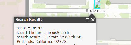
Besides that, can you tell me how to show the "score" information on poup infowindow as well.
Thanks.
Solved! Go to Solution.
Accepted Solutions
- Mark as New
- Bookmark
- Subscribe
- Mute
- Subscribe to RSS Feed
- Permalink
I think its because your marker symbol has an offset set.
esri.symbol.PictureMarkerSymbol("images/mylocation5.png", 17, 32).setOffset(18, 27)
remove the setOffset and it should hit the same location.
Drew
- Mark as New
- Bookmark
- Subscribe
- Mute
- Subscribe to RSS Feed
- Permalink
The symbol has some kind of offset on it so it is showing at that offset distance.
esri.symbol.PictureMarkerSymbol("images/mylocation5.png", 17, 32).setOffset(18, 27)
- Mark as New
- Bookmark
- Subscribe
- Mute
- Subscribe to RSS Feed
- Permalink
I think its because your marker symbol has an offset set.
esri.symbol.PictureMarkerSymbol("images/mylocation5.png", 17, 32).setOffset(18, 27)
remove the setOffset and it should hit the same location.
Drew
- Mark as New
- Bookmark
- Subscribe
- Mute
- Subscribe to RSS Feed
- Permalink
Thanks. It works! How about show "Score" on popup infowindow?
- Mark as New
- Bookmark
- Subscribe
- Mute
- Subscribe to RSS Feed
- Permalink
James,
Here, I added an infoTemplate with Score :
<!DOCTYPE html>
<html dir="ltr">


<head>
   <meta http-equiv="Content-Type" content="text/html; charset=utf-8">
   <meta name="viewport" content="initial-scale=1, maximum-scale=1,user-scalable=no" />
   <title>ArcGIS API for JavaScript | Basic Search</title>
   <link rel="stylesheet" href="http://js.arcgis.com/3.14/dijit/themes/claro/claro.css">
   <link rel="stylesheet" href="http://js.arcgis.com/3.14/esri/css/esri.css">
   <style>
      html,
      body,
      #map {
         height: 100%;
         width: 100%;
         margin: 0;
         padding: 0;
      }
      #search {
         display: block;
         position: absolute;
         z-index: 2;
         top: 20px;
         left: 74px;
      }
   </style>
   <script src="http://js.arcgis.com/3.14/"></script>
   <script>
      require([


        "esri/map",
        "esri/dijit/Search",
        "esri/InfoTemplate",
  "esri/geometry/Extent",
  "esri/tasks/locator",
  "dojo/dom",
        "dojo/domReady!"


      ], function (Map, Search,InfoTemplate, Extent, Locator, dom) {


  var map = new Map("map", {
          basemap: "topo",
          center: [-117.19, 34.055],
          zoom: 18
        });

  //Create extent to limit search
         var extent = new Extent({
            "spatialReference": {
               "wkid": 102100
            },
            "xmin": -13063280,
            "xmax": -13033928,
            "ymin": 4028345,
            "ymax": 4042715
         });

  var search = new Search({
   enableButtonMode: false,
   enableLabel: false,
   enableInfoWindow: true,
   autoComplete: true,
   autoNavigate: true,
   map: map,
   sources:
   [
    {
  locator: new Locator("http://geocode.arcgis.com/arcgis/rest/services/World/GeocodeServer"),
  singleLineFieldName: "SingleLine",
  outFields: ["score"],
  name: "world_geocoder",
  localSearchOptions: {
   minScale: 300000,
   distance: 50000
  },
  placeholder: "Search Place or Address",
  searchExtent: extent,
  highlightSymbol: new esri.symbol.PictureMarkerSymbol("images/mylocation5.png", 17, 32).setOffset(18, 27),
             infoTemplate: new InfoTemplate("Search Result: ${Score}")
    }
   ]
  }, "search");
  search.startup();


      });
   </script>
</head>


<body>
   <div id="search"></div>
   <div id="map"></div>
</body>


</html>
See this example;
Search using a suggestion template | ArcGIS API for JavaScript