- Home
- :
- All Communities
- :
- Developers
- :
- JavaScript Maps SDK
- :
- JavaScript Maps SDK Questions
- :
- Re: Print - What I see is not what I get
- Subscribe to RSS Feed
- Mark Topic as New
- Mark Topic as Read
- Float this Topic for Current User
- Bookmark
- Subscribe
- Mute
- Printer Friendly Page
Print - What I see is not what I get
- Mark as New
- Bookmark
- Subscribe
- Mute
- Subscribe to RSS Feed
- Permalink
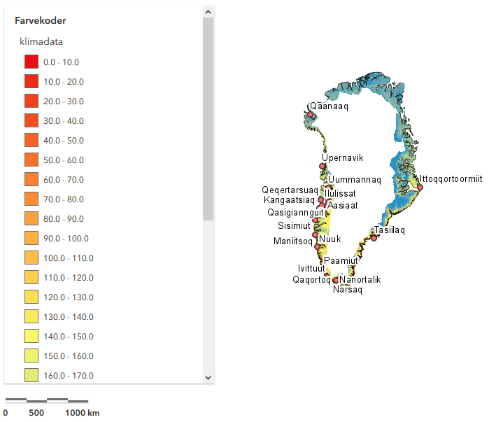
I have an web application created using Esri Javascript API 4.7. There I am using a Print widget, and I am point to the view of the map. But, the result look completely different from what I see on the screen.
The code is as follows:
What I see on the view:
What I see in the result of the print:
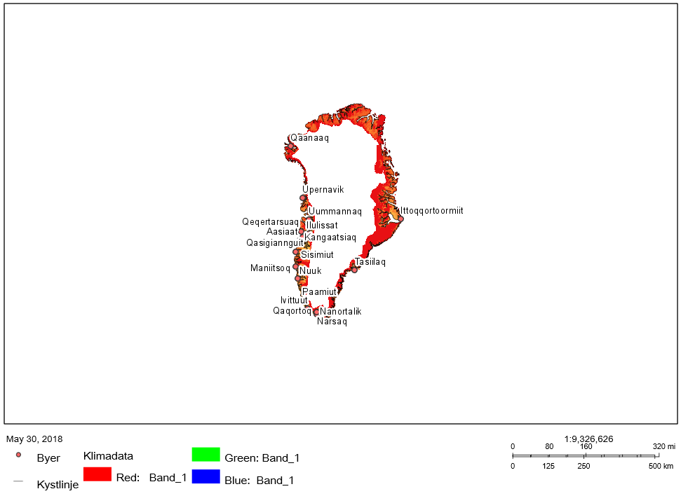
I am not sure which other properties I can set when I instanciate the Print widget. Neither the colors on the map, nor the legend or the scale bar looks anything like what I see on the view. What am I missing?
Any help is greatly appreciated.
Regards
Carsten
- Mark as New
- Bookmark
- Subscribe
- Mute
- Subscribe to RSS Feed
- Permalink
Carsten,
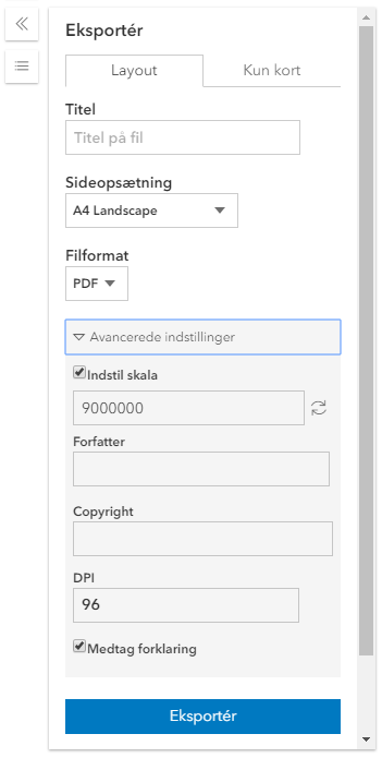
What happen when you go to the advanced options in the print widget and check set scale?
- Mark as New
- Bookmark
- Subscribe
- Mute
- Subscribe to RSS Feed
- Permalink
Hi Robert.
The Set scale check box is called "Indstil skala" in Danish. It is already checked like this:
- Mark as New
- Bookmark
- Subscribe
- Mute
- Subscribe to RSS Feed
- Permalink
Hi Carsten,
In addition to Robert's question, what type of layer are you adding to the map? If you could share your code, that would help to test as well.
- Mark as New
- Bookmark
- Subscribe
- Mute
- Subscribe to RSS Feed
- Permalink
Hi Noah.
It's an ImageryLayer. I can send source code to you 🙂