- Home
- :
- All Communities
- :
- Developers
- :
- JavaScript Maps SDK
- :
- JavaScript Maps SDK Questions
- :
- Mosaic Rule Where Clause Not Honored In Print Task...
- Subscribe to RSS Feed
- Mark Topic as New
- Mark Topic as Read
- Float this Topic for Current User
- Bookmark
- Subscribe
- Mute
- Printer Friendly Page
Mosaic Rule Where Clause Not Honored In Print Task in 4.5
- Mark as New
- Bookmark
- Subscribe
- Mute
- Subscribe to RSS Feed
- Permalink
tldr: Web_Map_as_JSON for print request includes correct mosaic rule where clause for image service layer, but resulting pdf does not honor the mosaic rule and draws the entire image service layer
I'm having a problem with the execute print task method when exporting an image service layer. I use the mosaic rule where clause to toggle the visibility of individual raster items in the image service, but when I go to print, the entire image service is shown in the resulting pdf. I'm using unique names from a field published in the service to effectively filter raster items out of the entire layer, and am building the mosaic rule client side as rasters items are toggle on/off.
I checked the network traffic for the request and the Web Map as JSON data passes the correct mosaic rule where clause in the execute print task request, but still shows the entire image service. There is no definition expression parameter listed in the spec to pass along with this request, either (spec here. I'm looking at the "syntax for an image service layer" option).
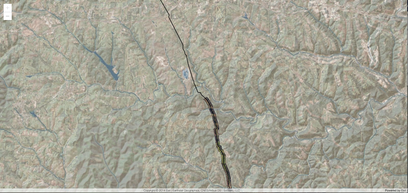
Here is an example of what the 2D map looks like (only one raster item from the service is turned on):

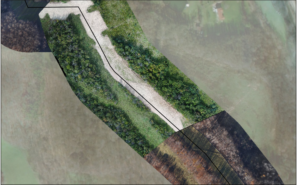
This is what I get in the print result (don't mind the different zoom level, it's the same map):
if the image does not appear below, please refresh

- We would expect the above image to only be showing the imagery that begins in the bottom right corner, up until it meets the imagery with more green vegetation in the center. The imagery in the top left corner is not the same raster item as the bottom right, and shouldn't be showing either.
Has anyone else been able to successfully execute a print in the 4.x API that honors an image service layer's mosaic rule?
As always, any insight is much appreciated.
- Mark as New
- Bookmark
- Subscribe
- Mute
- Subscribe to RSS Feed
- Permalink
Did you ever figure this out or get a solution from esri? I'm running into the same issue 😞
@George_Thompson do you have any ideas or could point me to someone who can assist?
We have a web map showing a few mosaic dataset image services coming from our federated 1071 Image Server. The mosaic datasets are being filtered client side by the 'Name' attribute. When we print, the output PDF shows the entire mosaic dataset rather than the filtered one visible in the map view. Any ideas?
Thanks!
- Mark as New
- Bookmark
- Subscribe
- Mute
- Subscribe to RSS Feed
- Permalink
I am not sure and would recommend contacting technical support to have them take a look.