- Home
- :
- All Communities
- :
- Developers
- :
- JavaScript Maps SDK
- :
- JavaScript Maps SDK Questions
- :
- Issue with showing WMSLayer on the SceneView
- Subscribe to RSS Feed
- Mark Topic as New
- Mark Topic as Read
- Float this Topic for Current User
- Bookmark
- Subscribe
- Mute
- Printer Friendly Page
Issue with showing WMSLayer on the SceneView
- Mark as New
- Bookmark
- Subscribe
- Mute
- Subscribe to RSS Feed
- Permalink
Hello!
I created a simple code with example WMS Layer on the Scene View with the ground elevation.
Codepen: https://codepen.io/tomaszbarczyk/pen/VwYQRVN?editors=1000
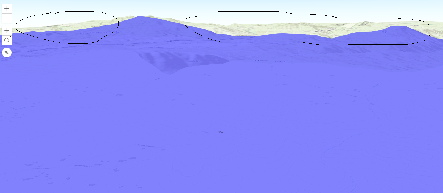
I observed that at certain map tilt WMS Layer is not covering the whole visible area whereas it should. Actually WMS layer should cover terrain selected on this screenshot:
Is there any option to fix that behaviour? Any changes in layer configuration are needed?
Regards,
Tomek
- Mark as New
- Bookmark
- Subscribe
- Mute
- Subscribe to RSS Feed
- Permalink
Dear Esri Staff and ArcGis Developers! ArcGIS API for JavaScript
Anyone notices this problem on your side?
Sorry for pressing but that issue is quite important for me.
Regards,
Tomek
- Mark as New
- Bookmark
- Subscribe
- Mute
- Subscribe to RSS Feed
- Permalink
Hello Tomasz,
This is a know limitation for WMS and MapImageLayer. This visual limitations just happens if user tilt that the far away hills/mountains get seen.
Workaround: Set the tilt constraints to avoid that the user can tilt to this point where you can see this effect
SceneView | constraints
Example:
var view = new SceneView({
container: "viewDiv",
map: map,
constraints: {
tilt: {
max: 60
}
},
});This technical limitation would be solved in the future.
Regards,
Sascha
- Mark as New
- Bookmark
- Subscribe
- Mute
- Subscribe to RSS Feed
- Permalink
Thank you Sascha!
Do you have estimated timeframe when this will be fixed and released?
Regards,
Tomek