- Home
- :
- All Communities
- :
- Developers
- :
- JavaScript Maps SDK
- :
- JavaScript Maps SDK Questions
- :
- Re: Creating multiple graphics
- Subscribe to RSS Feed
- Mark Topic as New
- Mark Topic as Read
- Float this Topic for Current User
- Bookmark
- Subscribe
- Mute
- Printer Friendly Page
- Mark as New
- Bookmark
- Subscribe
- Mute
- Subscribe to RSS Feed
- Permalink
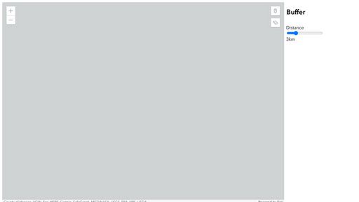
So, I'm only able to create one graphic at a time. I was wondering if there is a way to allow the user to add multiple graphics on the map. I basically want the user to be able to add multiple graphics throughout the map using one point-button. Also, if the user decides to change the value for the buffer via slider, this should be applied to all the graphics
<html>

<head>
  <meta charset="utf-8" />
  <meta name="viewport" content="initial-scale=1,maximum-scale=1,user-scalable=no" />

  <link rel="stylesheet" href="https://js.arcgis.com/4.24/esri/themes/light/main.css" />
  <script src="https://js.arcgis.com/4.24/"></script>

  <style>
    html,
    body,
    #viewDiv {
      height: 100%;
      width: 100%;
      margin: 20;
      padding: 20;
    }

    .ext-box {
      display: table;
      width: 350px;
      height: 100%;
    }

    .int-box {
      display: table-cell;
      vertical-align: top;
      width: 340px;
      height: 260px;
    }

    .FixedHeightContainer {
      float: left;
      height: 380px;
      width: 230px;
      padding: 3px;
      background: rgb(112, 128, 144, 0.5);
    }

    .header {
      height: 30px;
      padding-top: 5px;
    }

    .geometryResultsdiv {
      height: 345px;
      overflow: auto;
      background: #fff;
      font-size: 8px;
    }

    .menu {
      display: table;
      width: 65%;
      border: 1px solid black;
      border-right: none;
      box-sizing: border-box;
    }

    .menu>div {
      display: table-row;
      background-color: white;
    }

    .menu>div>div {
      border-right: 1px solid black;
      display: table-cell;
      text-align: center;
      vertical-align: middle;
    }

    @media screen and (max-width: 240px) {
      .menu {
        display: block;
        float: left;
        width: auto;
        border: none;
      }

      .menu>div {
        display: block;
      }

      .menu>div>div {
        border: none;
        padding-right: 10px;
        display: block;
        text-align: left;
      }
    }

    .boxpadding {
      padding: 0px 0px 5px 8px;
    }

    .float-container {
      border: 3px solid #fff;
      padding: 2px;
    }

    .float-child1 {
      width: 40%;
      float: left;
      padding: 2px;
    }

    .float-child2 {
      width: 25%;
      float: left;
      padding: 2px;
    }
  </style>

  <script>
    require([
      "esri/Map", "esri/views/MapView", "esri/views/draw/Draw", "esri/Graphic", "esri/geometry/geometryEngine",
      "esri/geometry/support/webMercatorUtils",
      "esri/layers/GraphicsLayer",
      "dojo/dom",
      "dojo/domReady!"
    ], (Map, MapView, Draw, Graphic, geometryEngine, webMercatorUtils, GraphicsLayer, dom) => {

      let blayer = new GraphicsLayer({
        id: "layer",
      });
      blayer.opacity = 0.5;
      const map = new Map({
        basemap: "gray-vector",
        layers: [blayer]
      });
      const view = new MapView({
        container: "viewDiv",
        map: map,
        zoom: 10,
        center: [-77.367, 37.55]
      });
      const draw = new Draw({
        view: view
      });
      document.getElementById("clear-button").onclick = () => {
        view.graphics.removeAll();
        blayer.removeAll();
      };
      document.getElementById("point-button").onclick = () => {
        const action = draw.create("point");
        view.focus();
        action.on("cursor-update", function(evt) {
          GraphicPoint(evt.coordinates);
        });
        action.on("draw-complete", function(evt) {
          GraphicPoint(evt.coordinates);
        });
      };

      function GraphicPoint(coordinates) {
        view.graphics.removeAll();
        let point = {
          type: "point", // autocasts as /Point
          x: coordinates[0],
          y: coordinates[1],
          spatialReference: view.spatialReference
        };
        const graphic = new Graphic({
          geometry: point,
          symbol: {
            type: "simple-marker",
            style: "circle",
            color: [0, 0, 0, 0.5],
            size: "9px",
          },
        });
        view.graphics.add(graphic);
        BufferGeom(graphic.geometry);
      }

      function BufferGeom(geom) {
              var d = document.getElementById("distance");
              const buffGeom = geometryEngine.geodesicBuffer(
                  geom,
                  d.value,
                  "kilometers"
                );
                const buffgra = new Graphic({
                  geometry: buffGeom,
                  symbol: {
                    type: "simple-fill",
                    color: [112, 128, 144, 0],
                  },
                })
                blayer.removeAll();
                blayer.add(buffgra);
              d.addEventListener('change', function (){
                const buffGeom = geometryEngine.geodesicBuffer(
                  geom,
                  d.value,
                  "kilometers"
                );
                const buffgra = new Graphic({
                  geometry: buffGeom,
                  symbol: {
                    type: "simple-fill",
                    color: [112, 128, 144, 0],
                  },
                })
                blayer.removeAll();
                blayer.add(buffgra);
              })

            }
      view.ui.add('point-button', 'top-right')
      view.ui.add('clear-button', 'top-right')

    });
  </script>
</head>

<body>
  <div id="viewDiv">

    <div class="ext-box">
      <div class="int-box">
        <h2 class="boxpadding">Buffer</h2>
        <div class="float-container">
          <div class="float-child2">
            <div class="slider">
                    <label for="fader"> Distance</label>
                    <input
                      id="distance"
                      type="range"
                      value="3"
                      min="1"
                      max="10"
                      step="0.5"
                      oninput="this.nextElementSibling.value = this.value+'km'"
                    />
                    <output>3km</output>
                  </div>
          </div>
        </div>
        </br>
        </br></br>
          <div>
            <div id="clear-button" class="esri-widget esri-widget--button esri-interactive" title="Clear Grpahics">
              <span class="esri-icon-erase"></span>
            </div>
            <div id="point-button" class="esri-widget esri-widget--button esri-interactive" title="Draw point">
              <span class="esri-icon-map-pin"></span>
            </div>
          </div>
        </br>
      </div> <!-- End of int box -->
    </div> <!-- End of ent box -->

  </div>
</body>

</html>
@Sage_Wall @UndralBatsukh @Gurunara @GreteSoosalu
Solved! Go to Solution.
Accepted Solutions
- Mark as New
- Bookmark
- Subscribe
- Mute
- Subscribe to RSS Feed
- Permalink
The problem is you are removing all graphics from your graphicslayer whenever user either creates a point or changes the distance. You need to check that logic. In any case hope you can use one of the following codepens
Something like this? https://codepen.io/U_B_U/pen/rNqwYQW?editors=1000
Or something like this? https://codepen.io/U_B_U/pen/MWPoOLe?editors=1000
Or like this? https://codepen.io/U_B_U/pen/MWPoOMj?editors=1000
- Mark as New
- Bookmark
- Subscribe
- Mute
- Subscribe to RSS Feed
- Permalink
Yes! You can use GraphicsLayer.addMany method to add array of graphics.
- Mark as New
- Bookmark
- Subscribe
- Mute
- Subscribe to RSS Feed
- Permalink
Hi @UndralBatsukh , so how do I create an array of graphics? And after that, I would just do blayer.addMany(array)?
- Mark as New
- Bookmark
- Subscribe
- Mute
- Subscribe to RSS Feed
- Permalink
Yep.
const graphics = [graphic1, graphic2, graphic3];
bLayer.addMany(graphics);
//or
bLayer.addMany([graphic1, graphic2, graphic3]);
- Mark as New
- Bookmark
- Subscribe
- Mute
- Subscribe to RSS Feed
- Permalink
Hi @UndralBatsukh , I tried doing that but im still only able to produce one graph at a time. Please see the code here: https://codepen.io/Charanb98/pen/wvYdQYV?editors=1000
- Mark as New
- Bookmark
- Subscribe
- Mute
- Subscribe to RSS Feed
- Permalink
What is it you are trying to do? Looks like you are adding point and polygon graphics using GraphicsLayer.addMany. If you can tell me what you are expecting in your codepen then that would help.
- Mark as New
- Bookmark
- Subscribe
- Mute
- Subscribe to RSS Feed
- Permalink
Hi, So I am currently able to add a ring around a point using the buffer method and change the ring size using addEventListener(). But, I can't find a way to display more than 1 ring basically I want the user to be able to add as many rings as they want to by using the point-button
- Mark as New
- Bookmark
- Subscribe
- Mute
- Subscribe to RSS Feed
- Permalink
The problem is you are removing all graphics from your graphicslayer whenever user either creates a point or changes the distance. You need to check that logic. In any case hope you can use one of the following codepens
Something like this? https://codepen.io/U_B_U/pen/rNqwYQW?editors=1000
Or something like this? https://codepen.io/U_B_U/pen/MWPoOLe?editors=1000
Or like this? https://codepen.io/U_B_U/pen/MWPoOMj?editors=1000


