- Home
- :
- All Communities
- :
- Products
- :
- ArcGIS Hub
- :
- ArcGIS Hub Questions
- :
- Why do number field datatypes change to text/strin...
- Subscribe to RSS Feed
- Mark Topic as New
- Mark Topic as Read
- Float this Topic for Current User
- Bookmark
- Subscribe
- Mute
- Printer Friendly Page
Why do number field datatypes change to text/string in downloads from Open Data Portal?
- Mark as New
- Bookmark
- Subscribe
- Mute
- Subscribe to RSS Feed
- Permalink
I've noticed that all number field datatypes (except for ObjectID) are converted to string datatypes in the Shapefile downloads from Open Data Portal.
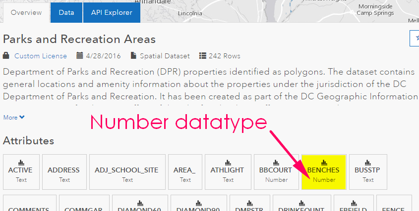
For example, in the Open Data Portal for Washinton DC Parks, you can see there is a field named "Benches" with a Number datatype:
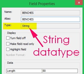
However, once you download the Shapefile, the datatype is converted to String:
This creates a hassle for people consuming this data if they want to symbolize based on numeric fields, because they have to convert the data in their GIS before they can symbolize using numeric data.
Is this by design (if so, why?) or a oversite/bug?
- Mark as New
- Bookmark
- Subscribe
- Mute
- Subscribe to RSS Feed
- Permalink
I also noticed dates become text fields and all text fields are 80 characters. Is there a way to preserve the field types (and length) from the source, as export to shapefile would do?