- Home
- :
- All Communities
- :
- Products
- :
- ArcGIS Hub
- :
- ArcGIS Hub Blog
- :
- ArcGIS Open Data - New Beta Sites!
ArcGIS Open Data - New Beta Sites!
- Subscribe to RSS Feed
- Mark as New
- Mark as Read
- Bookmark
- Subscribe
- Printer Friendly Page
Since launching at the User Conference two years ago, ArcGIS Open Data has enabled over 3,000 organizations worldwide to make nearly 50,000 datasets discoverable and accessible to their communities near and far. Working closely with governments of all sizes, community advocacy groups, and other organizations we've learned a lot of things.
The team is excited to preview where we're going next: a simpler way to launch a modern site for data administrators, greater data analysis tools for citizens, open API explorer for developers, and new ways to build and showcase data stories that grow collaboration between everyone.
This first beta release now provides recent features seen on the global opendata.arcgis.com to local sites. It's important to note that although we will use these sites to release new features going forward, we are not removing support for the sites currently available, and are not going to stop the incredible work that has already been done by the ArcGIS Open Data community.
That being said, read on to learn more details!
New site editor
The new site editor is a result of thorough pattern analysis and a review of administrator's current pain points when creating an Open Data site. We've applied what we've learned to give administrators of all technical levels the ability to create a site that follows the organization's brand and highlights the data housed within.
Log into the administrative app and you'll see a new button, "Try Beta Site." When you launch a new beta site, you'll see a pre-filled template in the site editor. You can use and modify this template as you wish, or delete all the components and start from scratch.
Highlights
Theme Builder
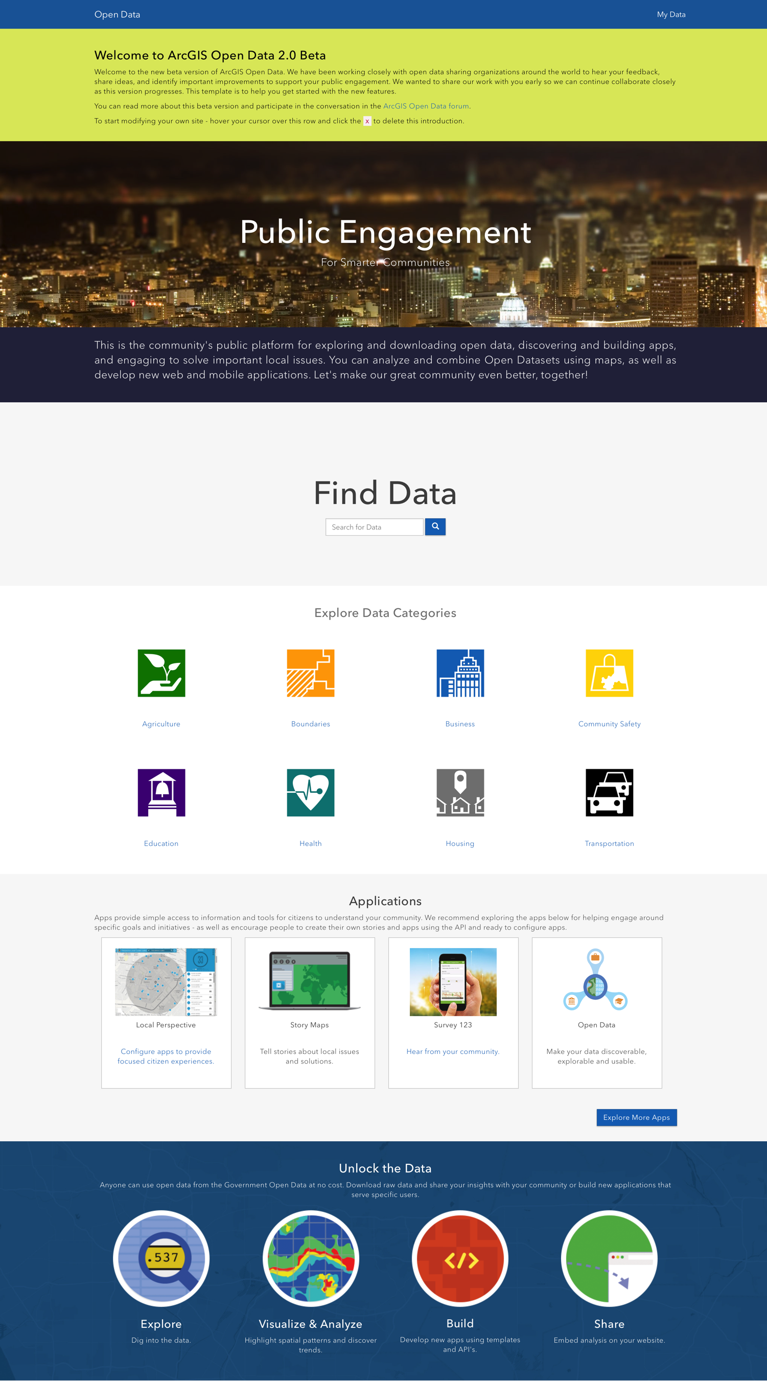
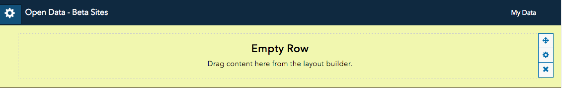
The initial phase of the new sites allow administrators to select four colors which will comprise their site's theme. These colors will be applied throughout the site to give users a consistent, recognizable and trusted experience while discovering and exploring the data. Furthermore, this theme can be used in configured applications so you can ensure that your branding is consistent and easy to maintain across multiple your entire suite of public engagement apps
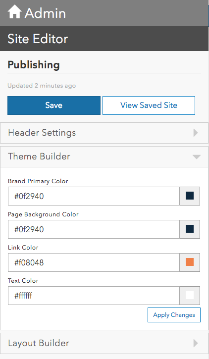
Administrators set the site theme in the Site Editor (above) and see the effects applied throughout the site (below)
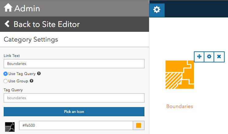
Layout Builder
There are common patterns seen in the thousands of ArcGIS Open Data sites on the web today, and we have created a number of cards for administrators to easily replicate them without requiring a developer or designer on hand. The bones of the layout are rows - these are the width-long blocks of the homepage which can be customized to have a background image or a background color. Admins can change the text color for individual rows if they wish to override the greater theme text color.
Within the rows come cards. Administrators can drag cards onto the rows and organize their layout in a WYSIWYG (what you see is what you get) interface. These cards follow general site patterns and include banners, images, text, and category widgets to organize your data. We have more widgets in the making and would love to hear what you'd like to see.
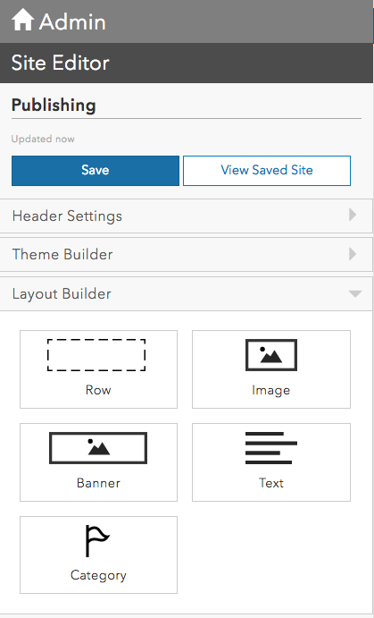
The current card options for site customization (above), and a category card in edit mode (below)
Supported Customization
We also heard from organizations that want to build more custom designs but ensure that their sites continue to work as we add new features and capabilities to ArcGIS Open Data. The new sites are now built with Calcite-Bootstrap, which means developers and designers can use custom HTML and the widely popular Bootstrap design elements to build experiences using tools they are already familiar with.
What's upcoming
We understand that headers and footers are crucial to match branding guidelines and create a consistent experience across all organizational pages. In the near future we'll add the ability to create custom headers and footers using either iframes or custom HTML. We're also adding more ways to feature your data, applications, and information products on the homepage. Down the line we'll have more granularity when picking a site theme to allow even greater site customization.
New features
Over the past few months we have been rolling out new features to opendata.arcgis.com, and have been fielding questions about how administrators can access them for their own site. This is your chance! We go into greater detail about some of these features in our April blog post, but check out some highlights below.
Highlights
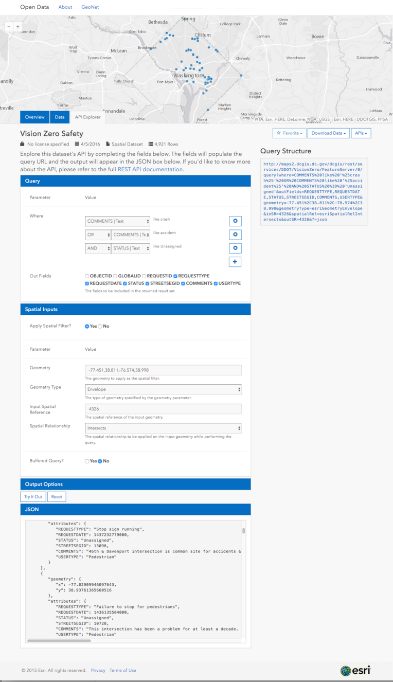
API Explorer
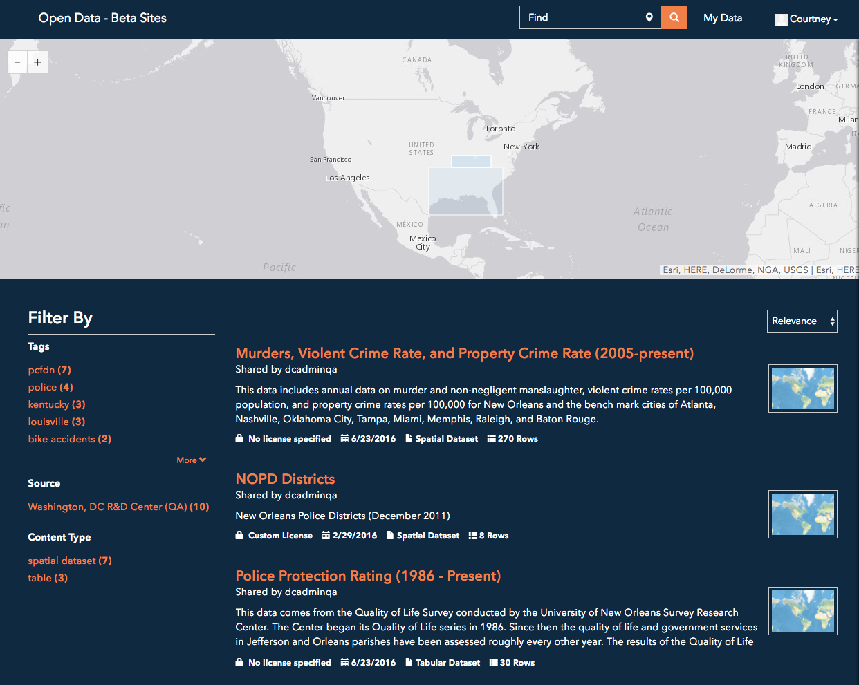
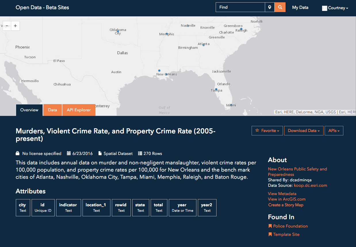
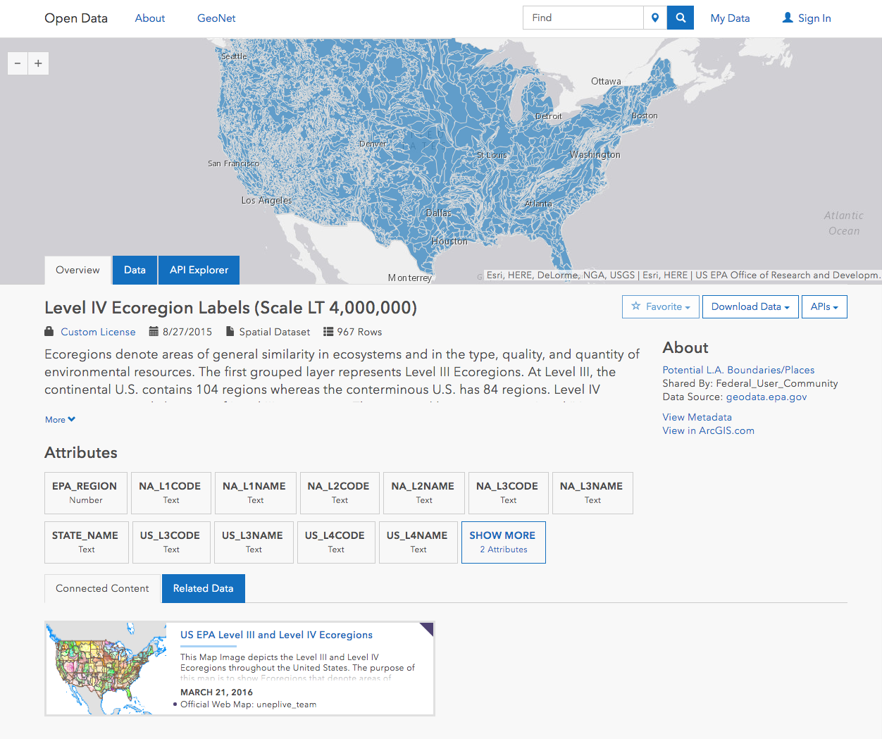
The API Explorer is a new way for citizens to access detailed subsets of datasets. Each dataset shared with ArcGIS Open Data is backed by the Geoservices REST API and has a unique explorer on the dataset page. This is a capability that can be turned off in the administrative settings, but we feel strongly that this programatic gateway to the data will expand the reach of your data and allow citizens to access it in new ways.
Connected Content
Many ArcGIS Open Data sites feature web maps in addition to the raw data. These web maps are excellent ways to highlight trends and analyses performed with the data, and they can now be found on the dataset pages themselves instead of only in the search results. When a citizen lands on a dataset that has been used in a web map, they will see the web map under a new section called "Connected Content." Some of these are found in the wild already!
Logins and Citizen Capabilities
Custom sites now support social logins, giving your community super easy access to a host of additional capabilities on your site, which currently include favoriting datasets and creating Story Maps (see below) and with so much more on the way.
Story Maps
Open Data and Story Maps make a great pair -- the 50k open datasets are incredible story telling fodder. Citizens can now take their dataset of interest from an Open Data site and launch it directly into a Story Map. Here, they can go through the Story Map workflow of editing their web map, adding text and other multimedia components, and sharing it with the web. We're working on ways for these resulting Story Maps to become Connected Content so that other citizens can access these insights and leverage the knowledge of their neighbors.
______________________________
We hope you take a peek at the beta sites and explore the new capabilities offered for custom sites. We absolutely welcome and encourage your feedback on anything and everything - we'll be monitoring and participating in our ArcGIS Open Data space on GeoNet. In the next few months you'll see a new administrative experience and some surprises for the public users! Follow along with us on the ArcGIS Blog.
You must be a registered user to add a comment. If you've already registered, sign in. Otherwise, register and sign in.
-
Accessibility
1 -
Catalog
5 -
community
5 -
data management
5 -
discussions
4 -
downloads
1 -
enterprise sites
2 -
gallery card
1 -
Initiatives
1 -
learning resource
3 -
pages
2 -
premium
8 -
projects
1 -
Search
1 -
sites
11 -
workspaces
8