Turn on suggestions
Auto-suggest helps you quickly narrow down your search results by suggesting possible matches as you type.
Cancel
- Home
- :
- All Communities
- :
- Products
- :
- ArcGIS for Microsoft
- :
- ArcGIS for Microsoft Fabric
- :
- ArcGIS for Power BI
- :
- ArcGIS for Power BI Questions
- :
- Re: ArcGIS varius issues with map highlighting pol...
Options
- Subscribe to RSS Feed
- Mark Topic as New
- Mark Topic as Read
- Float this Topic for Current User
- Bookmark
- Subscribe
- Mute
- Printer Friendly Page
ArcGIS varius issues with map highlighting polygon information
Subscribe
891
1
11-03-2021 10:00 PM
11-03-2021
10:00 PM
- Mark as New
- Bookmark
- Subscribe
- Mute
- Subscribe to RSS Feed
- Permalink
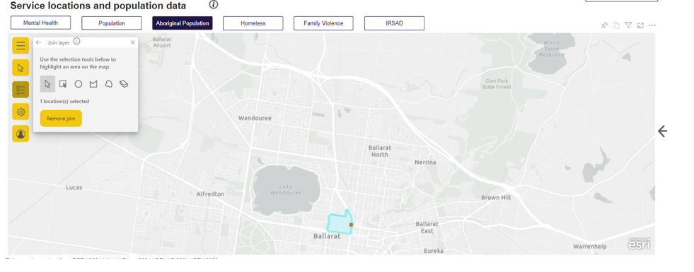
Hi , Below are the issues we have been experiencing for the past 4-6 weeks. Attached is a document with images an examples.
- ArcGIS visual with Polygon data.
- Sometimes on mouse hover, it highlights the wrong polygon area, and also the tooltip has the incorrect information for that area where the mouse is.
- Join layer option only works if the JOIN layer screen is open, allowing the powerBI filters to interact with the map polygon data.
- ArcGIS visual with Polygon data and Lat/Long point location data combined.
- Join layer option only works if the JOIN layer screen is open, allowing the powerBI filters to interact with the map polygon data.
- When polygon data is filtered , based on the PowerBI location filters, the polygon tooltips are not displaying.
- Point location data resets to default circle and colours
1 Reply
11-23-2021
02:18 PM
- Mark as New
- Bookmark
- Subscribe
- Mute
- Subscribe to RSS Feed
- Permalink
Has anyone experience similar behavior? Has this been fixed in the next release ?