Turn on suggestions
Auto-suggest helps you quickly narrow down your search results by suggesting possible matches as you type.
Cancel
- Home
- :
- All Communities
- :
- Products
- :
- ArcGIS Field Maps
- :
- ArcGIS Field Maps Questions
- :
- Field Maps - Sentinel infrared satellite imagery
Options
- Subscribe to RSS Feed
- Mark Topic as New
- Mark Topic as Read
- Float this Topic for Current User
- Bookmark
- Subscribe
- Mute
- Printer Friendly Page
Field Maps - Sentinel infrared satellite imagery
Subscribe
1375
1
05-04-2022 01:49 PM
05-04-2022
01:49 PM
- Mark as New
- Bookmark
- Subscribe
- Mute
- Subscribe to RSS Feed
- Permalink
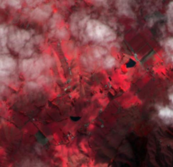
I have created a web map that includes publicly available Sentinel-2 infrared satellite imagery. In my web map the imagery displays as expected, though when I open it in field maps on both my iPhone and iPad, the infrared imagery is black and white. I'm yet to work out the reason why this is happening - any advice would be appreciated!
1 Reply
08-23-2022
08:34 AM
- Mark as New
- Bookmark
- Subscribe
- Mute
- Subscribe to RSS Feed
- Permalink
Sentinel 2 views use a template to display correctly in arcgis. My guess is that the field map app lacks the capability to recognize and display an image service layer the way it does in arcgis Pro or web maps. Try downloading and using the actual source imagery using the bands you want.