- Home
- :
- All Communities
- :
- Products
- :
- ArcGIS Enterprise
- :
- ArcGIS Enterprise Questions
- :
- Re: “Shift” tool has performance issue,
- Subscribe to RSS Feed
- Mark Topic as New
- Mark Topic as Read
- Float this Topic for Current User
- Bookmark
- Subscribe
- Mute
- Printer Friendly Page
- Mark as New
- Bookmark
- Subscribe
- Mute
- Subscribe to RSS Feed
- Permalink
“Shift” tool has performance issue,
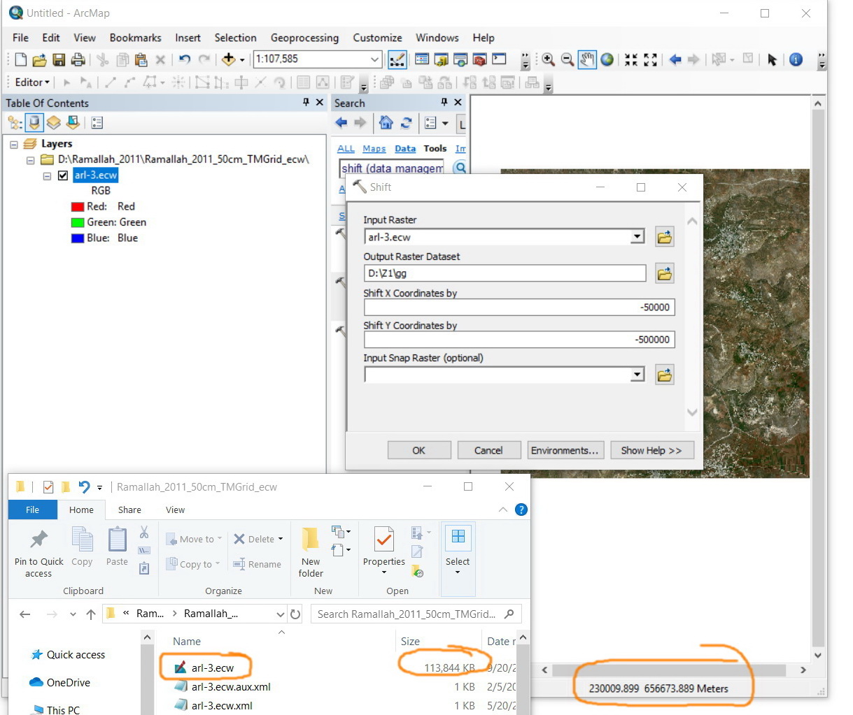
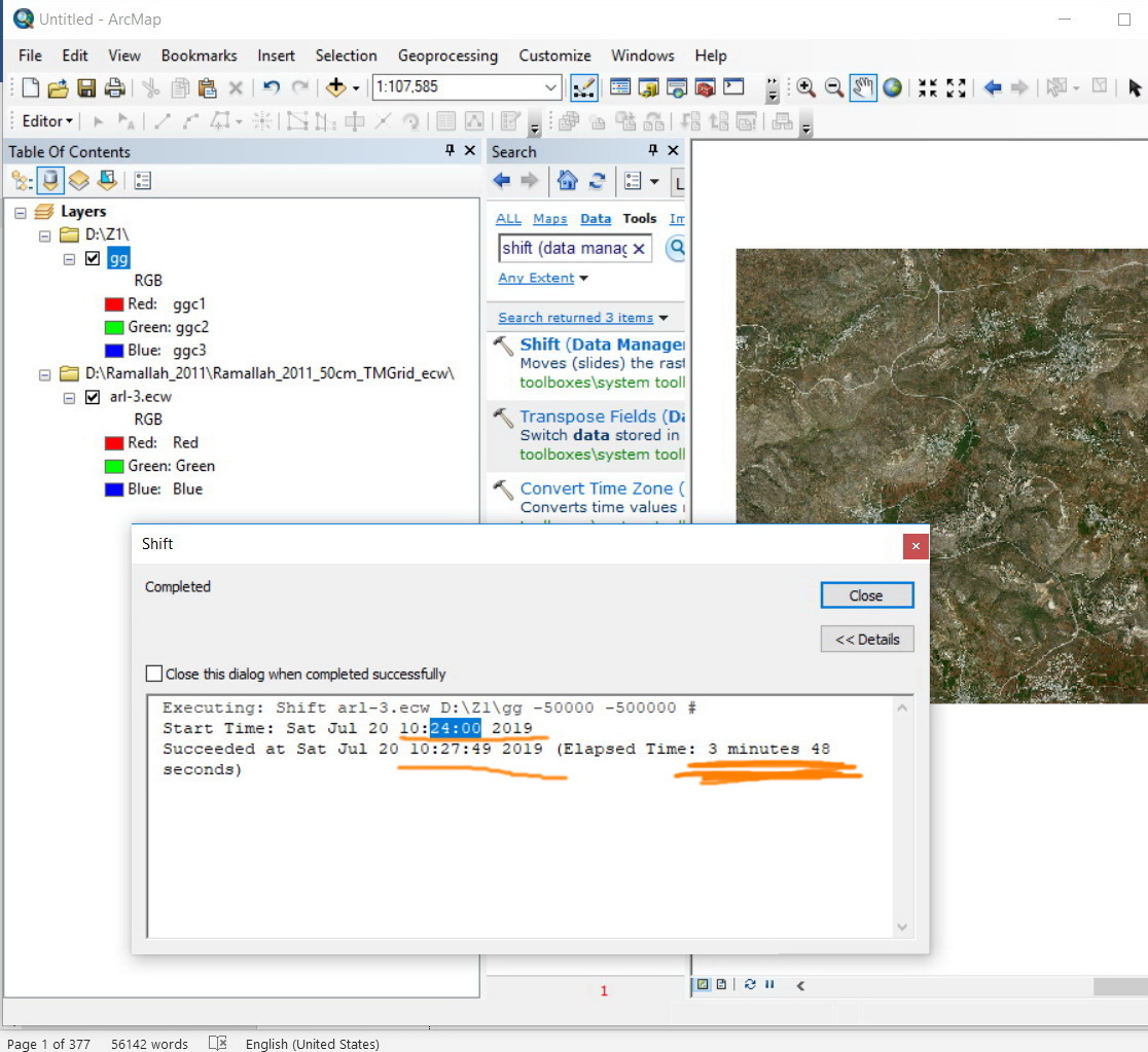
I observed that the “Shift” tool has performance issue. Is it normal that a raster of 113 MB takes around 4 minutes in order to be shifted (-50000, -500000)? My machine is with 4 Cores X 64GB RAM
Is there any recommendation to increase the performance of this tool?
Jamal Numan
Geomolg Geoportal for Spatial Information
Ramallah, West Bank, Palestine
Solved! Go to Solution.
- Mark as New
- Bookmark
- Subscribe
- Mute
- Subscribe to RSS Feed
- Permalink
Precisely Dan.
The issue here is to convert from “Israel_TM_Grid” to “Palestine_1923_Palestine_Grid”.
Unfortunately, none of the built-in algorithms available in ArcGIS can perform the job properly. We found out that the best way to do it is to move the rasters with -50000 in X and -500000 in Y. This way, the “Israel_TM_Grid” is converted precisely to “Palestine_1923_Palestine_Grid”.
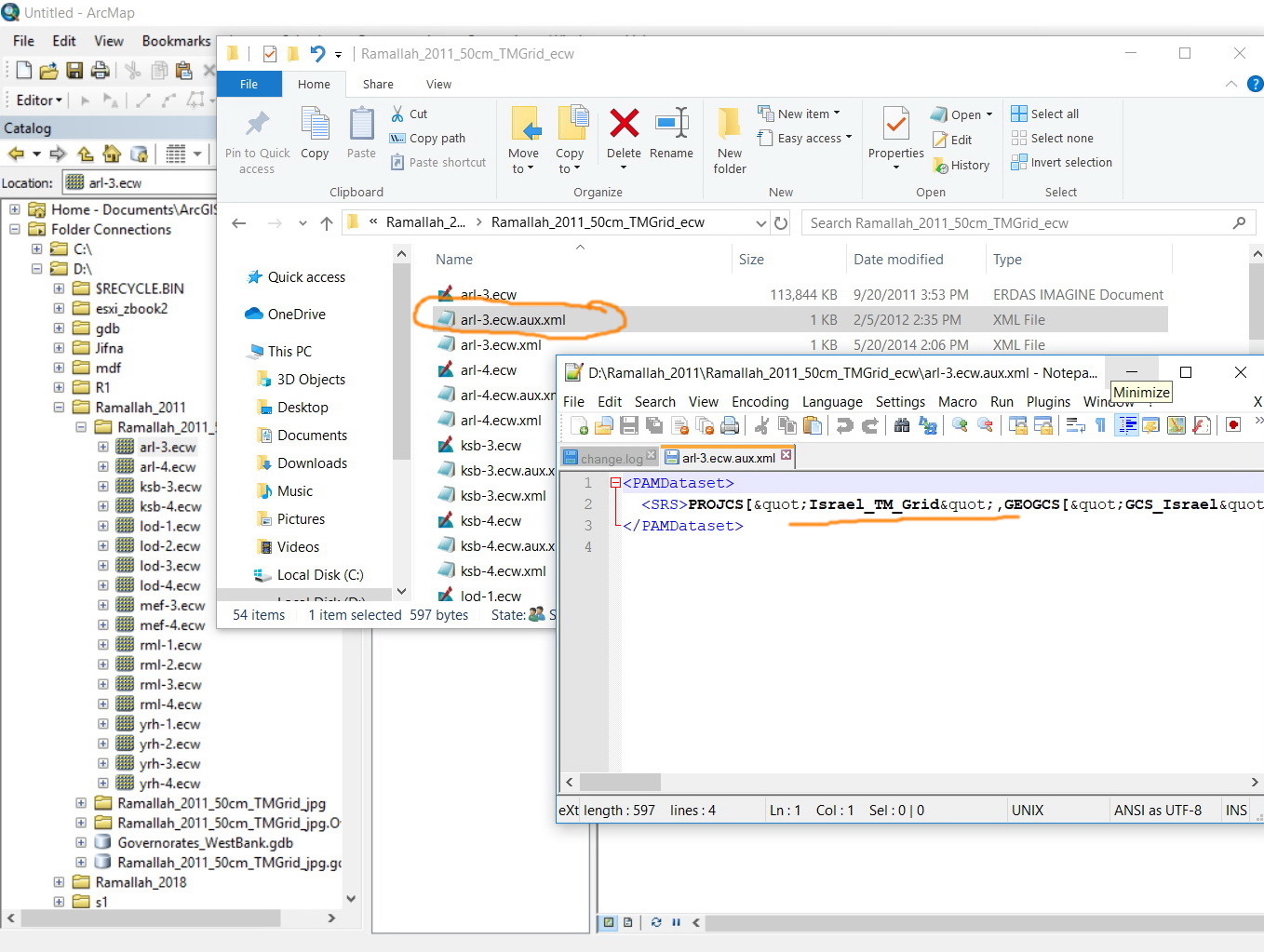
Correct. Each raster has its aux:
<PAMDataset>
<SRS>PROJCS["Israel_TM_Grid",GEOGCS["GCS_Israel",DATUM["Israel",SPHEROID["GRS_1980",6378137.0,298.257222101]],PRIMEM["Greenwich",0.0],UNIT["Degree",0.0174532925199433]],PROJECTION["Transverse_Mercator"],PARAMETER["False_Easting",219529.584],PARAMETER["False_Northing",626907.39],PARAMETER["Central_Meridian",35.20451694444445],PARAMETER["Scale_Factor",1.0000067],PARAMETER["Latitude_Of_Origin",31.73439361111111],UNIT["Meter",1.0]]</SRS>
</PAMDataset>
What might be the best practice to move the raster with the value (-50000, -500000) other than applying the shift tool?
However, we are forced to convert them from ecw to jpg due to the fact that the ArcGIS Server doesn’t support ecw when it comes to publishing.
Jamal Numan
Geomolg Geoportal for Spatial Information
Ramallah, West Bank, Palestine
- Mark as New
- Bookmark
- Subscribe
- Mute
- Subscribe to RSS Feed
- Permalink
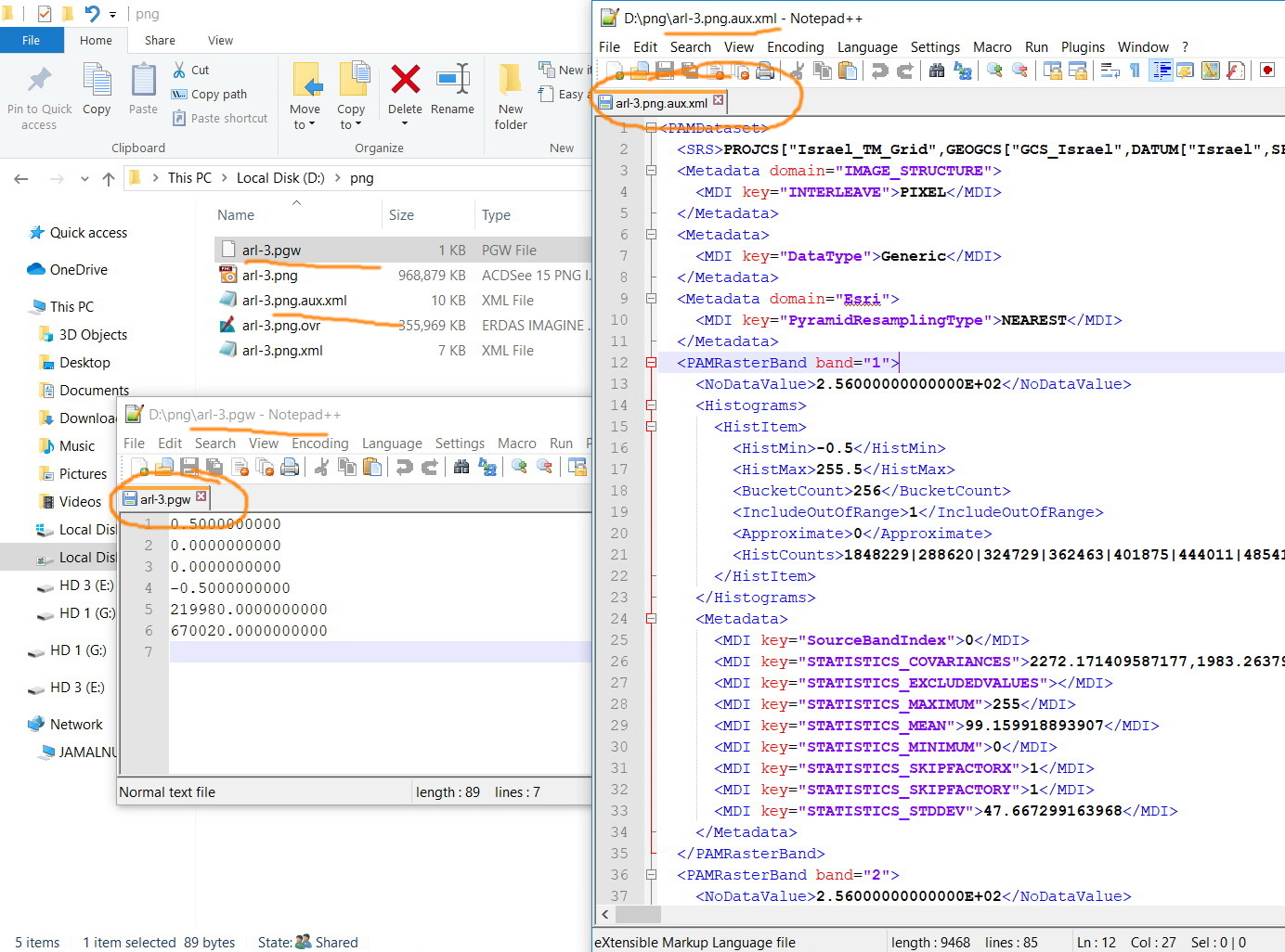
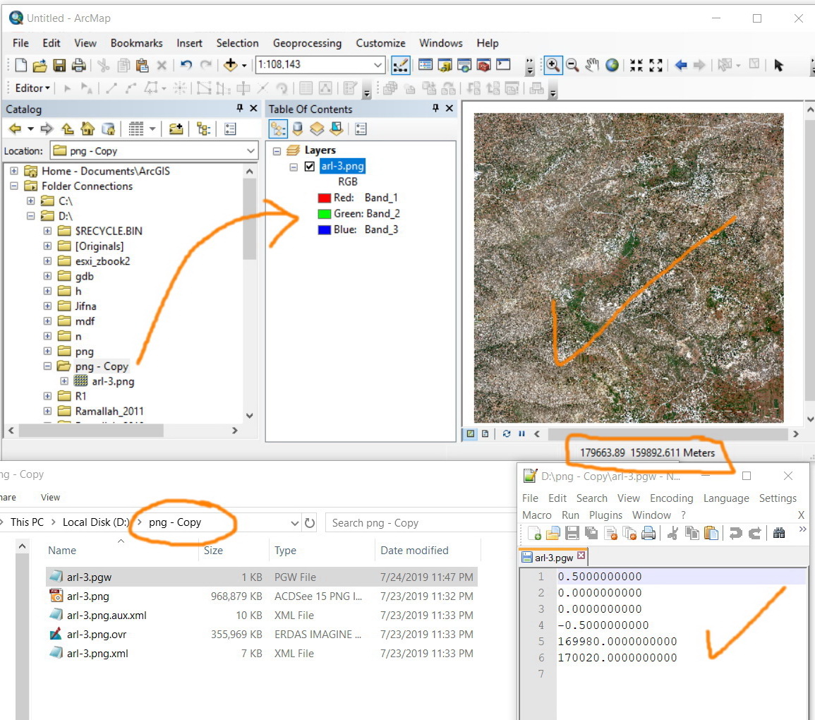
It is the png's world file *.pnw that I would be interested in seeing. In theory, subtracting those values prior to shifting that would save you the shifting slowness
- Mark as New
- Bookmark
- Subscribe
- Mute
- Subscribe to RSS Feed
- Permalink
As a test, and if I read you right, I just subtracted 50,000 from X and 500,000 from y in your arl-3.pgw yielding.
Rename arl-3.pgw to arl-3.old
copy and paste the below into a text editor (ie Notepad) and name it arl-3.pgw. and save it in the same folder.
Add the image
Does it line up properly?
0.5000000000
0.0000000000
0.0000000000
-0.5000000000
169980.0000000000
170020.0000000000- Mark as New
- Bookmark
- Subscribe
- Mute
- Subscribe to RSS Feed
- Permalink
Replacing the values of the pgw with the ones you have provides does stick the raster in the right place.
Does this mean that need to subtract the (-50000, -500000) from each pgw files in order to stick the 1600 raster in their correct position?
Jamal Numan
Geomolg Geoportal for Spatial Information
Ramallah, West Bank, Palestine
- Mark as New
- Bookmark
- Subscribe
- Mute
- Subscribe to RSS Feed
- Permalink
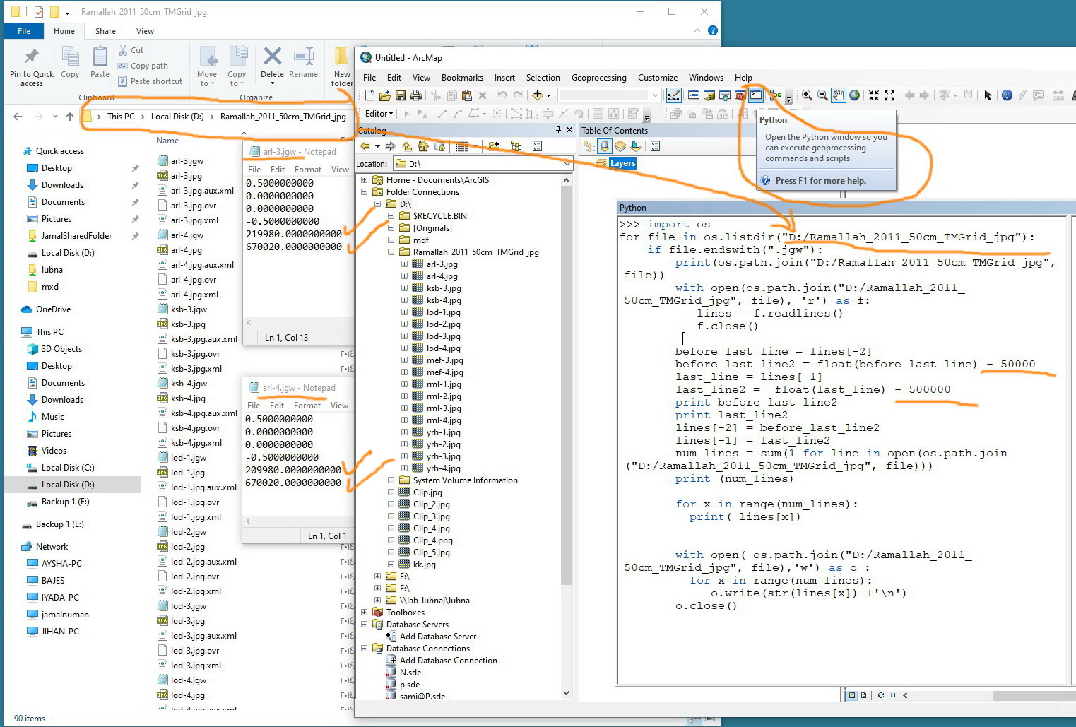
yes... time for some scripting to
- read the *.pnw, rename them *.pnw_old,
- get the appropriate lines containing the X, Y values,
- do the math and
- save the file out to a new copy so as to retain the old.
You wouldn't want to do this manually... even though it would be quicker than shifting.

- Mark as New
- Bookmark
- Subscribe
- Mute
- Subscribe to RSS Feed
- Permalink
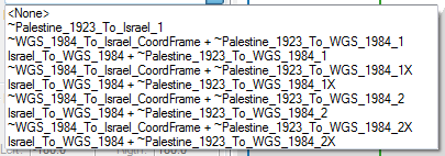
Hello Jamal NUMAN! I just want to verify if I understand your comment correctly. Were you not able to line-up your data using any of the transformation paths below in map properties or by projecting it with project tool and available transformation paths below? Thanks!
- Mark as New
- Bookmark
- Subscribe
- Mute
- Subscribe to RSS Feed
- Permalink
Correct. None of the transformations paths make the data line-up precisely.
Despite the fact that the “Israel_TM_Grid” coordinate system is based on “GRS_1980” Spheroid and “Transverse_Mercator” projection while the “Palestine_1923_Palestine_Grid” is built from“Clarke_1880_Benoit” and Spheroid “Cassini” projection:, they can be converted from one another by subtracting\adding (50000, 500000) to their x and y respectively.

Jamal Numan
Geomolg Geoportal for Spatial Information
Ramallah, West Bank, Palestine
- Mark as New
- Bookmark
- Subscribe
- Mute
- Subscribe to RSS Feed
- Permalink
Hi All,
I managed to develop a python script that performs the required action as shown in the screenshots below. However, I’m struggling at the moment in how to create a tbx tool that can be used to run the script. The script is attached.

Best,
Arwa
- Mark as New
- Bookmark
- Subscribe
- Mute
- Subscribe to RSS Feed
- Permalink
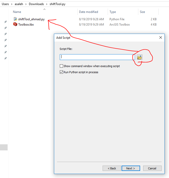
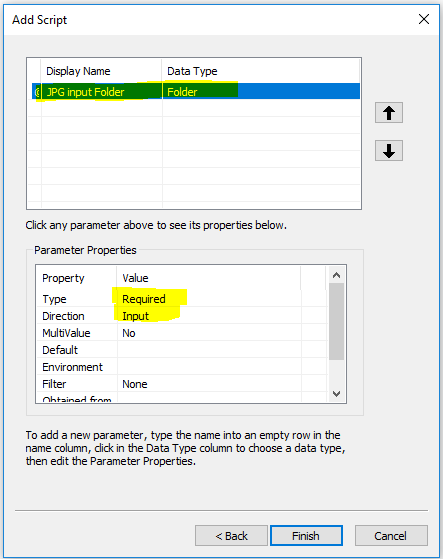
Arwa,
There are two approaches to get this job done, the most simple and easy one is by creating a script tool .
But first, you have to edit your script to access the parameters via GetParameterAsText() "see the attached file".
then go to arcmap > create a new toolbox
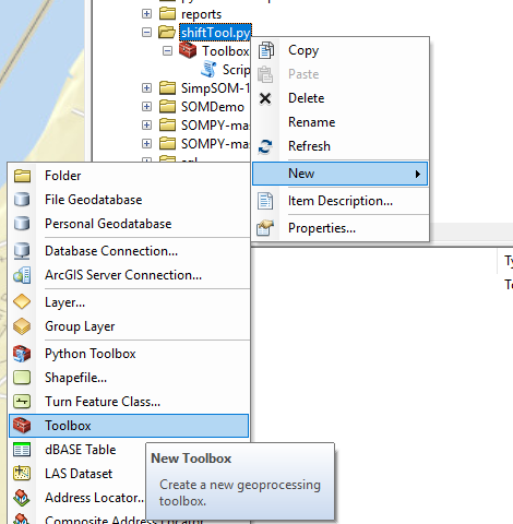
right click on the toolbox>add>script and follow the snapshots below

let me know if you have any questions,
Thanks,