- Home
- :
- All Communities
- :
- Products
- :
- ArcGIS Enterprise
- :
- ArcGIS Enterprise Questions
- :
- Re: “Shift” tool has performance issue,
- Subscribe to RSS Feed
- Mark Topic as New
- Mark Topic as Read
- Float this Topic for Current User
- Bookmark
- Subscribe
- Mute
- Printer Friendly Page
- Mark as New
- Bookmark
- Subscribe
- Mute
- Subscribe to RSS Feed
- Permalink
“Shift” tool has performance issue,
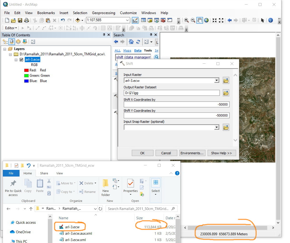
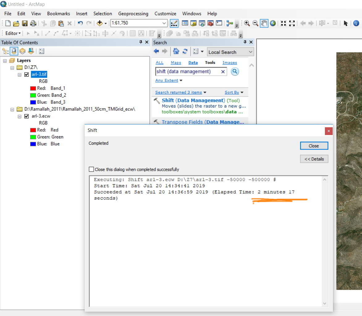
I observed that the “Shift” tool has performance issue. Is it normal that a raster of 113 MB takes around 4 minutes in order to be shifted (-50000, -500000)? My machine is with 4 Cores X 64GB RAM
Is there any recommendation to increase the performance of this tool?
Jamal Numan
Geomolg Geoportal for Spatial Information
Ramallah, West Bank, Palestine
Solved! Go to Solution.
Accepted Solutions
- Mark as New
- Bookmark
- Subscribe
- Mute
- Subscribe to RSS Feed
- Permalink
yes... time for some scripting to
- read the *.pnw, rename them *.pnw_old,
- get the appropriate lines containing the X, Y values,
- do the math and
- save the file out to a new copy so as to retain the old.
You wouldn't want to do this manually... even though it would be quicker than shifting.

- Mark as New
- Bookmark
- Subscribe
- Mute
- Subscribe to RSS Feed
- Permalink
Shift—Data Management toolbox | ArcGIS Desktop probably the same in arcmap
but anyway....
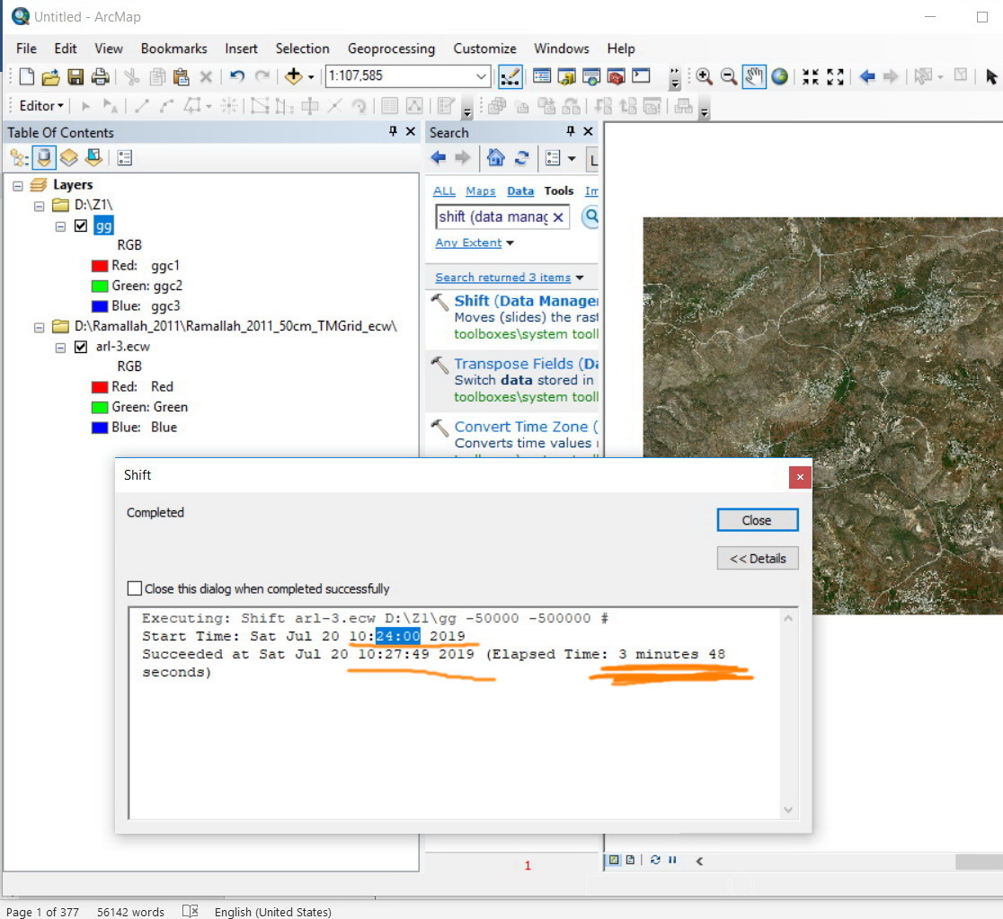
you didn't specify a file extension, so it isn't the shift that is taking a long time, but it is the conversion to an esri grid in the ZZ folder.
If you want to shift specify and output type by giving the raster an extension like *.tif... (ecw isn't on ArcGIS Pro's list of output types)
- Mark as New
- Bookmark
- Subscribe
- Mute
- Subscribe to RSS Feed
- Permalink
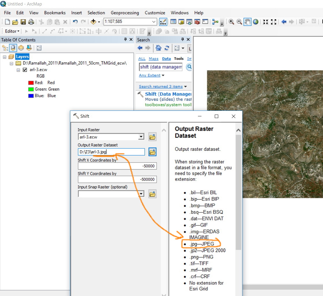
Many thanks for the input Dan.
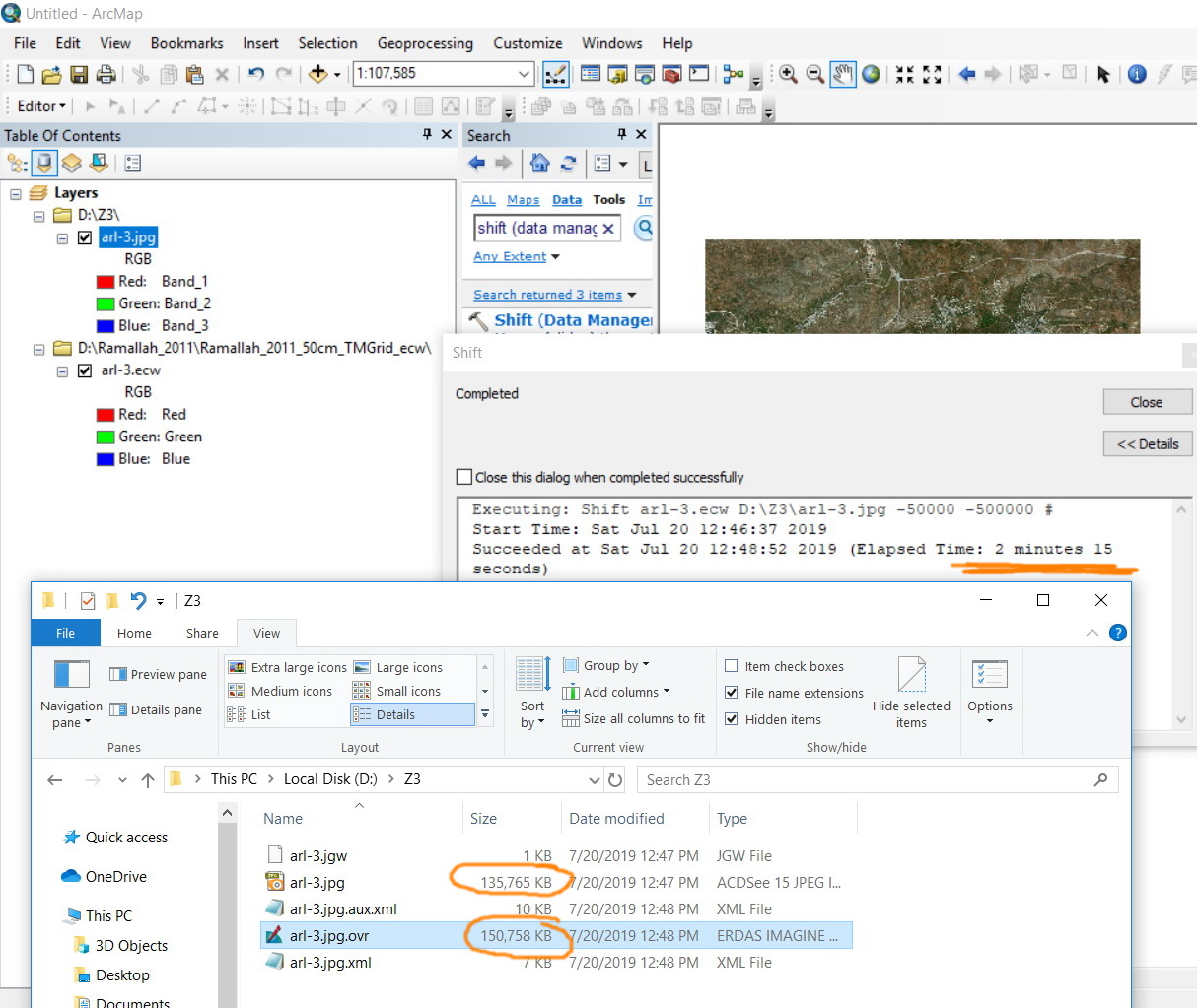
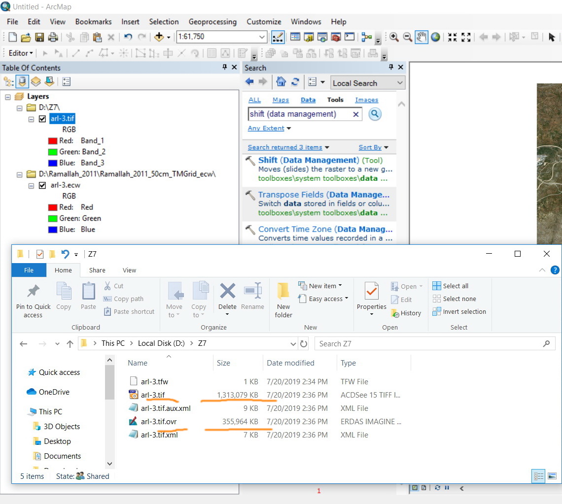
I tried it with jpg extension. it took around 2 min and 15 sec.
I observed that as the ecw file (113 MB) is shifted with jpg extension, then ovr file is created with a size of 150 MB. This means that the 113 ecw file is ending up with 135 MB for jpg in addition to 150 MB for the ovr. This means that the size is tripled just to shift the raster!
Jamal Numan
Geomolg Geoportal for Spatial Information
Ramallah, West Bank, Palestine
- Mark as New
- Bookmark
- Subscribe
- Mute
- Subscribe to RSS Feed
- Permalink
try another format... esri usually recommends *.tif
- Mark as New
- Bookmark
- Subscribe
- Mute
- Subscribe to RSS Feed
- Permalink
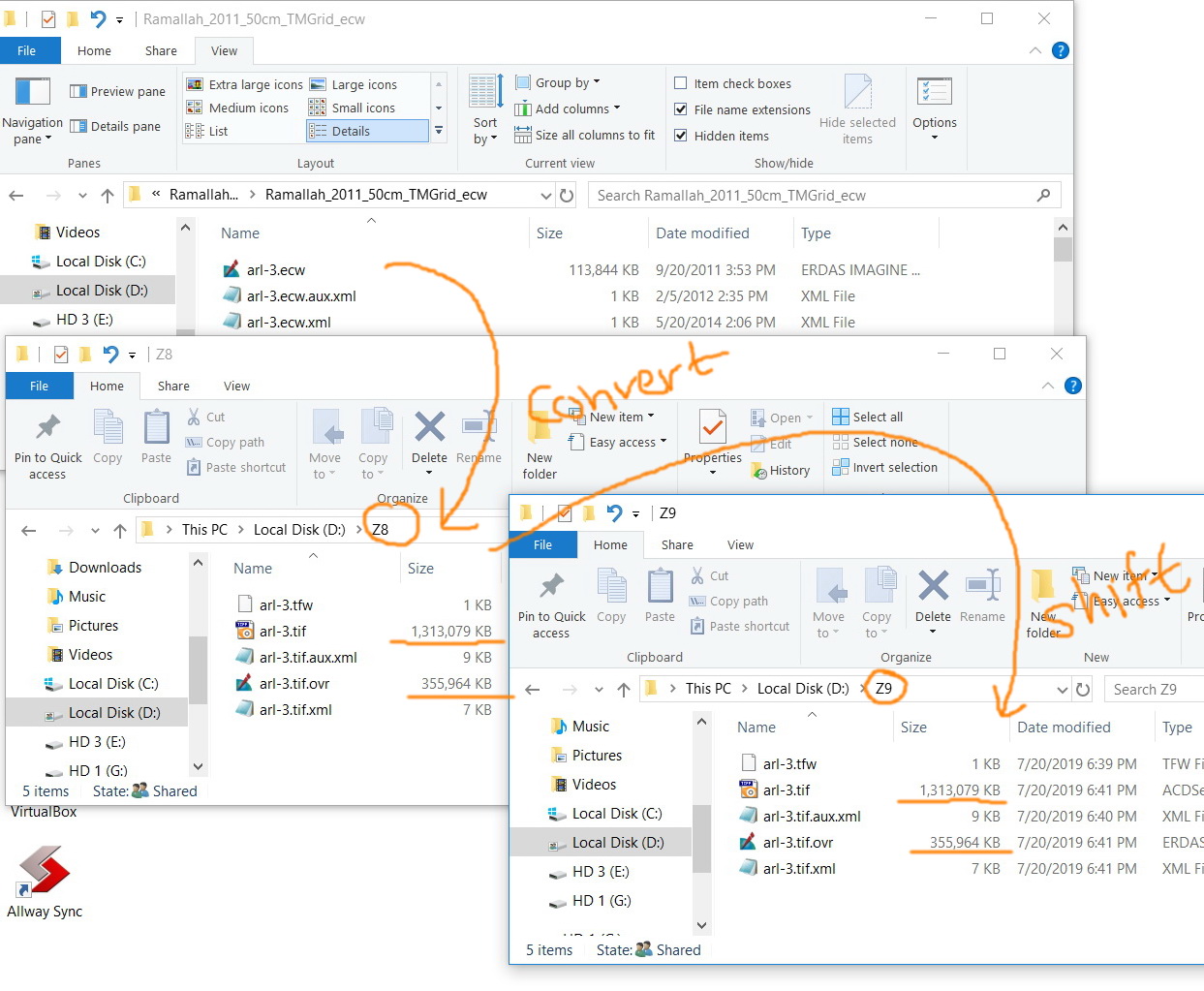
Now the size of the tif and ovr are much bigger: 1.5 GB for the tif and 350 MB for the ovr
Jamal Numan
Geomolg Geoportal for Spatial Information
Ramallah, West Bank, Palestine
- Mark as New
- Bookmark
- Subscribe
- Mute
- Subscribe to RSS Feed
- Permalink
did you try convert first, then shift? when you convert, you can specify the compression etc
- Mark as New
- Bookmark
- Subscribe
- Mute
- Subscribe to RSS Feed
- Permalink
I have converted ecw to tif and then the tif is shifted:
-The size of tif file is much bigger than ecw
-When shifting tif, the size stays the same (as expected)


Jamal Numan
Geomolg Geoportal for Spatial Information
Ramallah, West Bank, Palestine
- Mark as New
- Bookmark
- Subscribe
- Mute
- Subscribe to RSS Feed
- Permalink
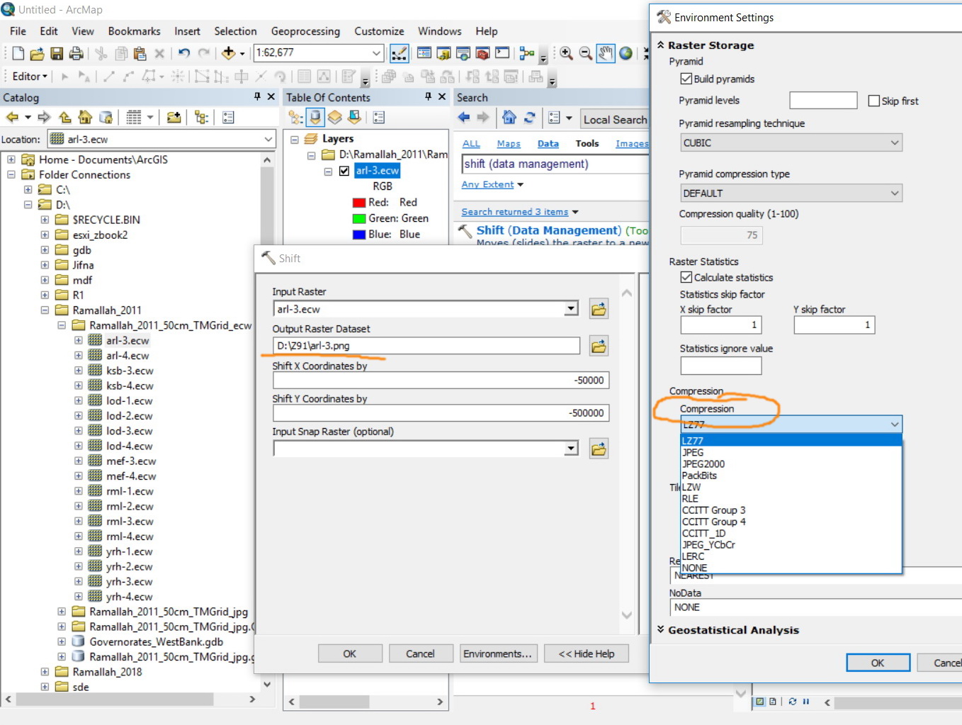
In the raster to other format tool... did you go to the environments tab and check the compression being used?
Compression (Environment setting)—Geoprocessing | ArcGIS Desktop
You can experiment with compression types and bit settings. You haven't indicated what bit type the input data are but I can assume 8-bit unsigned from this
Raster file formats—ArcGIS Pro | ArcGIS Desktop
But since ecw is proprietary, then you will have to go to something else. tif will be larger, *.png is smaller and lossless (I used it for all imagery/graphics regardless whether for gis or not).
So if raster size is the issue, you are fighting a lost cause... SID and ecw are the squished choices, tif, png are widely used and jpeg has had its day
- Mark as New
- Bookmark
- Subscribe
- Mute
- Subscribe to RSS Feed
- Permalink
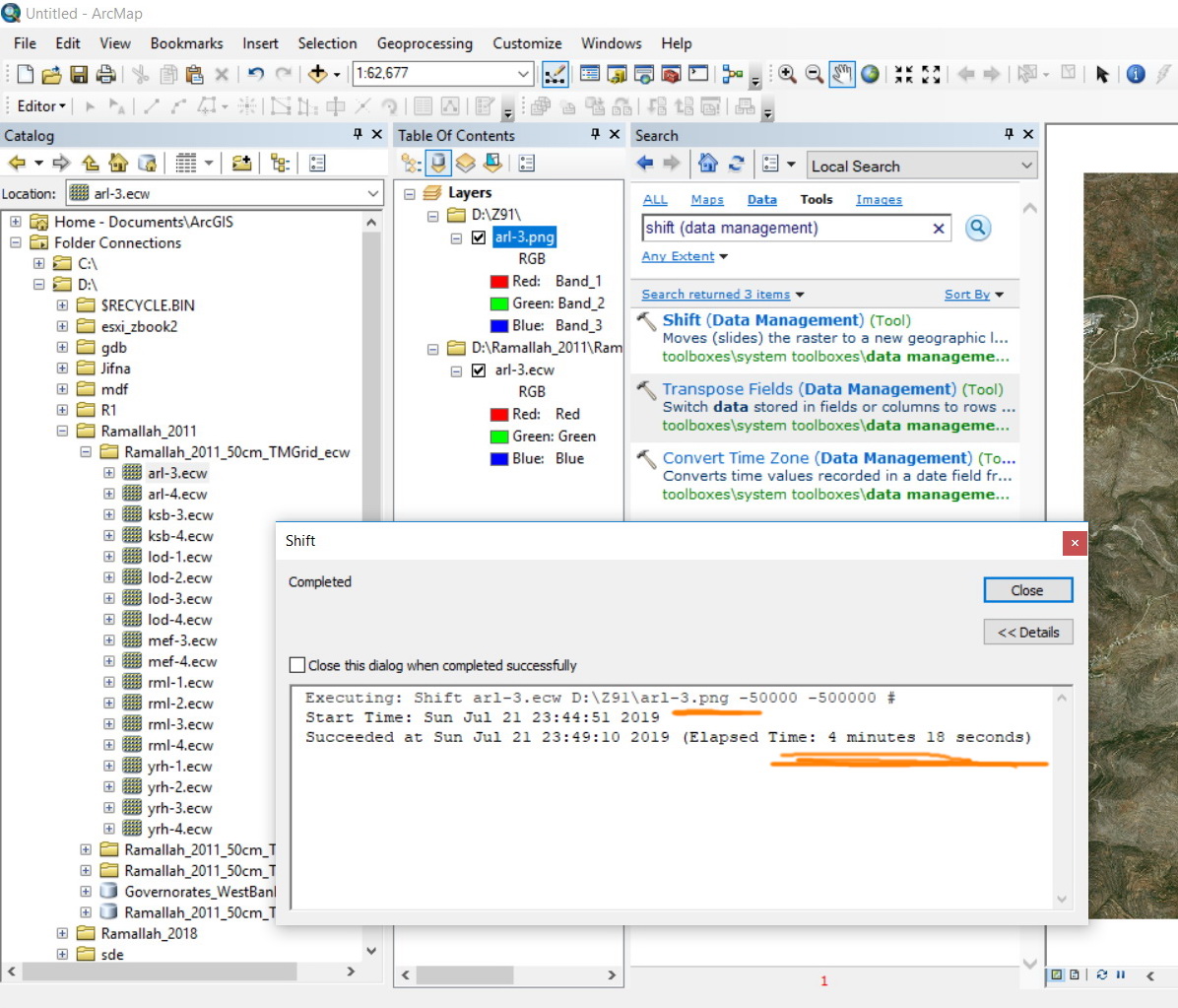
I’ll be trying to go for the png option as it is better than other formats in terms of size. However, the performance stays low as one raster needs around 4 minutes to be converted and shifted.
This means that the 1,600 rasters need around 4.5 days to be converted and shifted

Jamal Numan
Geomolg Geoportal for Spatial Information
Ramallah, West Bank, Palestine
- Mark as New
- Bookmark
- Subscribe
- Mute
- Subscribe to RSS Feed
- Permalink
Was it a projection issue Jamal?
If it was, I am wondering if a batch reprojection wouldn't be better.
Also, the png format produces a world file. it might be faster to just go and edit it in a text editor (or via a script) to just adjust (aka, shift) the coordinates there. If the coordinates are embedded in the file then you can't do this, but if there is a world file, it can be done.
why don't you zip and post all the bits of the *.png file except the png… it the *.aux, *.pnw, *.ovr etc etc