- Home
- :
- All Communities
- :
- Products
- :
- ArcGIS Enterprise
- :
- ArcGIS Enterprise Questions
- :
- Re: How to count the number of users of a particul...
- Subscribe to RSS Feed
- Mark Topic as New
- Mark Topic as Read
- Float this Topic for Current User
- Bookmark
- Subscribe
- Mute
- Printer Friendly Page
How to count the number of users of a particular service?
- Mark as New
- Bookmark
- Subscribe
- Mute
- Subscribe to RSS Feed
- Permalink
How to count the number of users of a particular service?
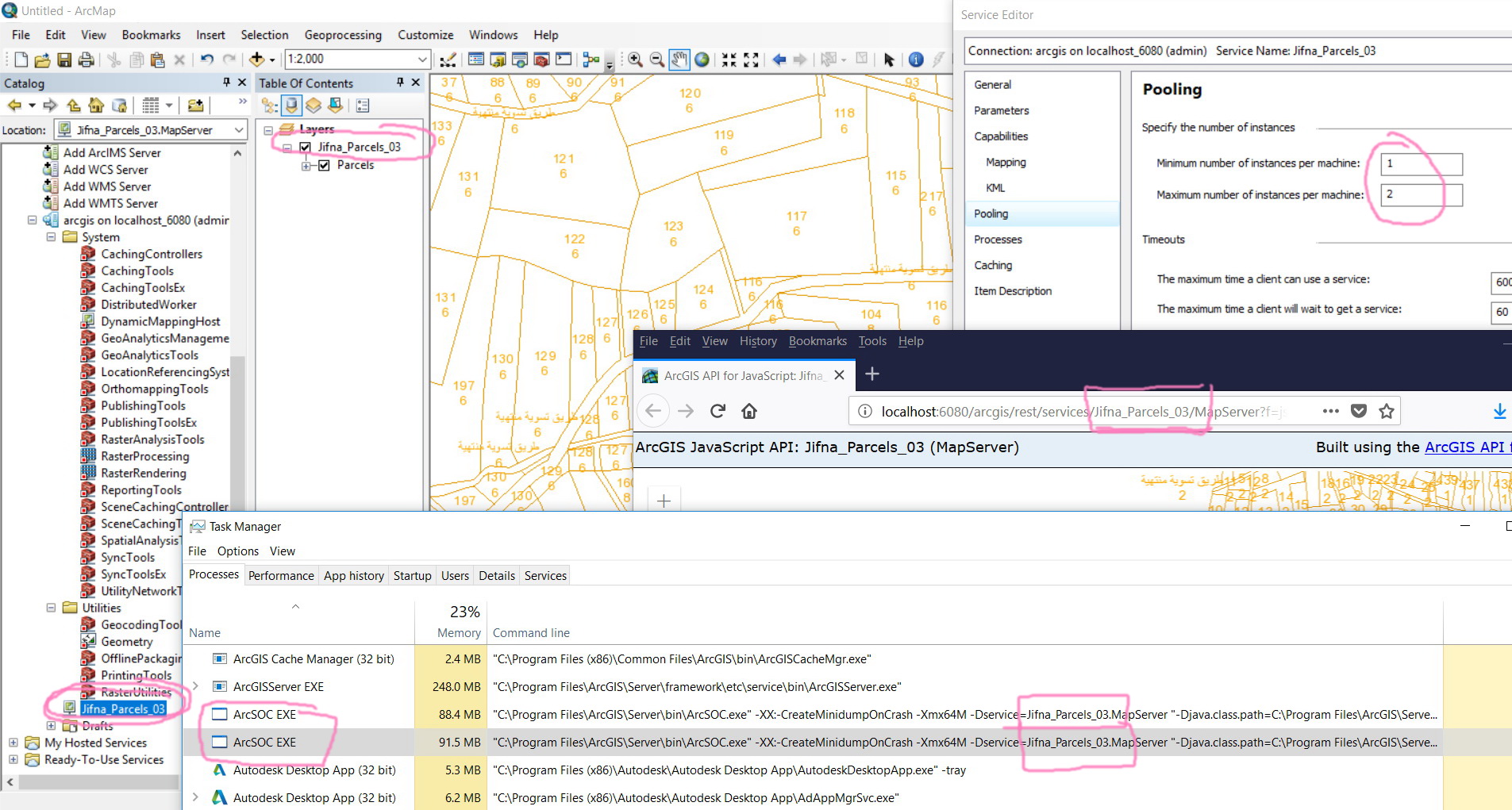
For example, in the screenshot below, I couldn’t figure out how to count the number of users of the indicated service.
Are there simple tools that can performed this task?
Thank you
Best
Jamal
Jamal Numan
Geomolg Geoportal for Spatial Information
Ramallah, West Bank, Palestine
- Mark as New
- Bookmark
- Subscribe
- Mute
- Subscribe to RSS Feed
- Permalink
Hey Jamal,
I'm not sure about active connections, apart from viewing the connections to the SDE.
However ArcGIS server Statistics maybe useful in this case.
It may not give you the number of users but it can give you a very good idea of the usage of your map service.
Hope that helps,
Al
- Mark as New
- Bookmark
- Subscribe
- Mute
- Subscribe to RSS Feed
- Permalink
Thank you for the help Aled Jon
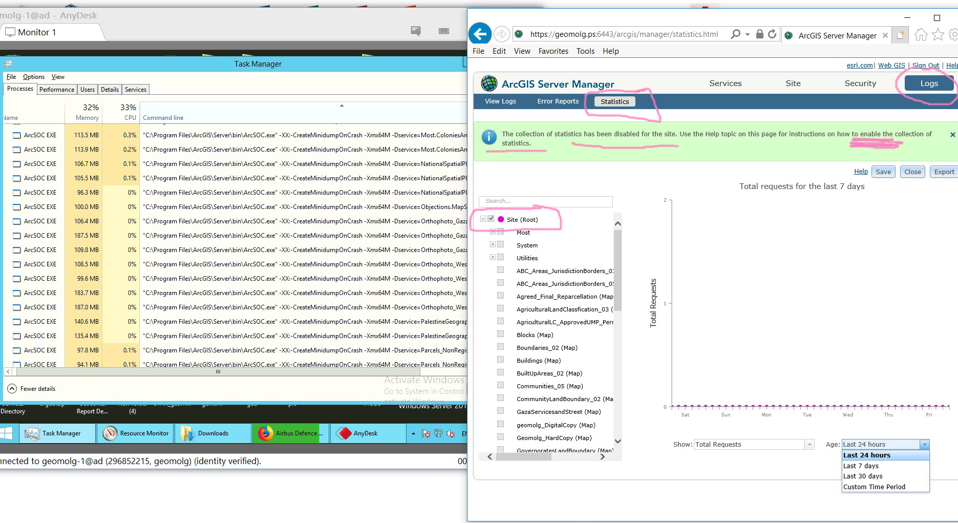
It appears that this tool is very good one to understand the traffic on a particular service. However, the ArcGIS Server says that the statistics needs to be enabled. How this can be performed?
Jamal Numan
Geomolg Geoportal for Spatial Information
Ramallah, West Bank, Palestine
- Mark as New
- Bookmark
- Subscribe
- Mute
- Subscribe to RSS Feed
- Permalink
Yep it's a great tool.
To enable statistics on your server, open the admin rest directory and head to "usagereports".
Here you will see settings and you can enable it from here (this may require a restart of the services).
Here's the url: http://*gis.gisserver.web*/argis/admin/usagereports/settings
- Mark as New
- Bookmark
- Subscribe
- Mute
- Subscribe to RSS Feed
- Permalink
Just to add to this -
Automating statistics can be done with a python script to envoke report templates. These can be customised in the code and called as needed, this is quite tedious though as each service needs to be referenced. Example: Export service statistics to a file—ArcGIS Server Administration (Linux) | ArcGIS Enterpris...
Alternatively, the data that dictates the statistics can be found in .DAT(-U/-I) files can be found in arcgis server directories -> arcgissystem -> statistics.
These can be queried using numpy.
- Mark as New
- Bookmark
- Subscribe
- Mute
- Subscribe to RSS Feed
- Permalink
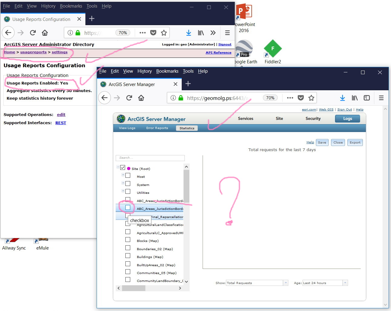
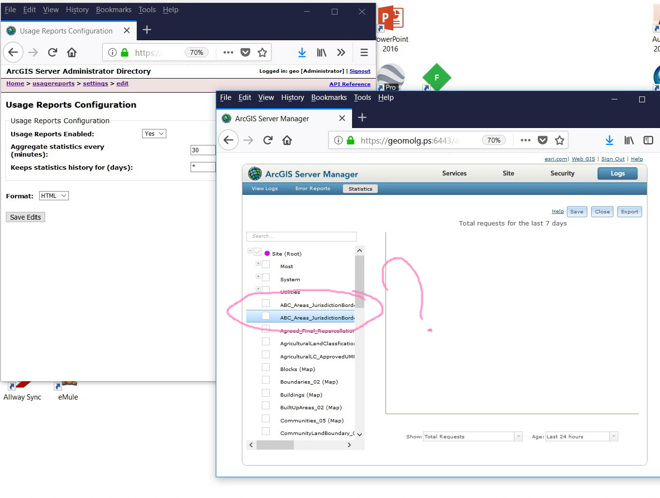
Many thanks for the prompt help. It is enabled now.
I’m not sure why ArcGIS Server fails to accept ticking the checkbox. Is this a known issue?
Jamal Numan
Geomolg Geoportal for Spatial Information
Ramallah, West Bank, Palestine
- Mark as New
- Bookmark
- Subscribe
- Mute
- Subscribe to RSS Feed
- Permalink
No issue here Jamal.
The server hasn't registered any statistics and will begin collecting at your set interval from this point onwards.
Test this by using a few map services over 30 mins (the default interval) and check back.
If this still isn't working.
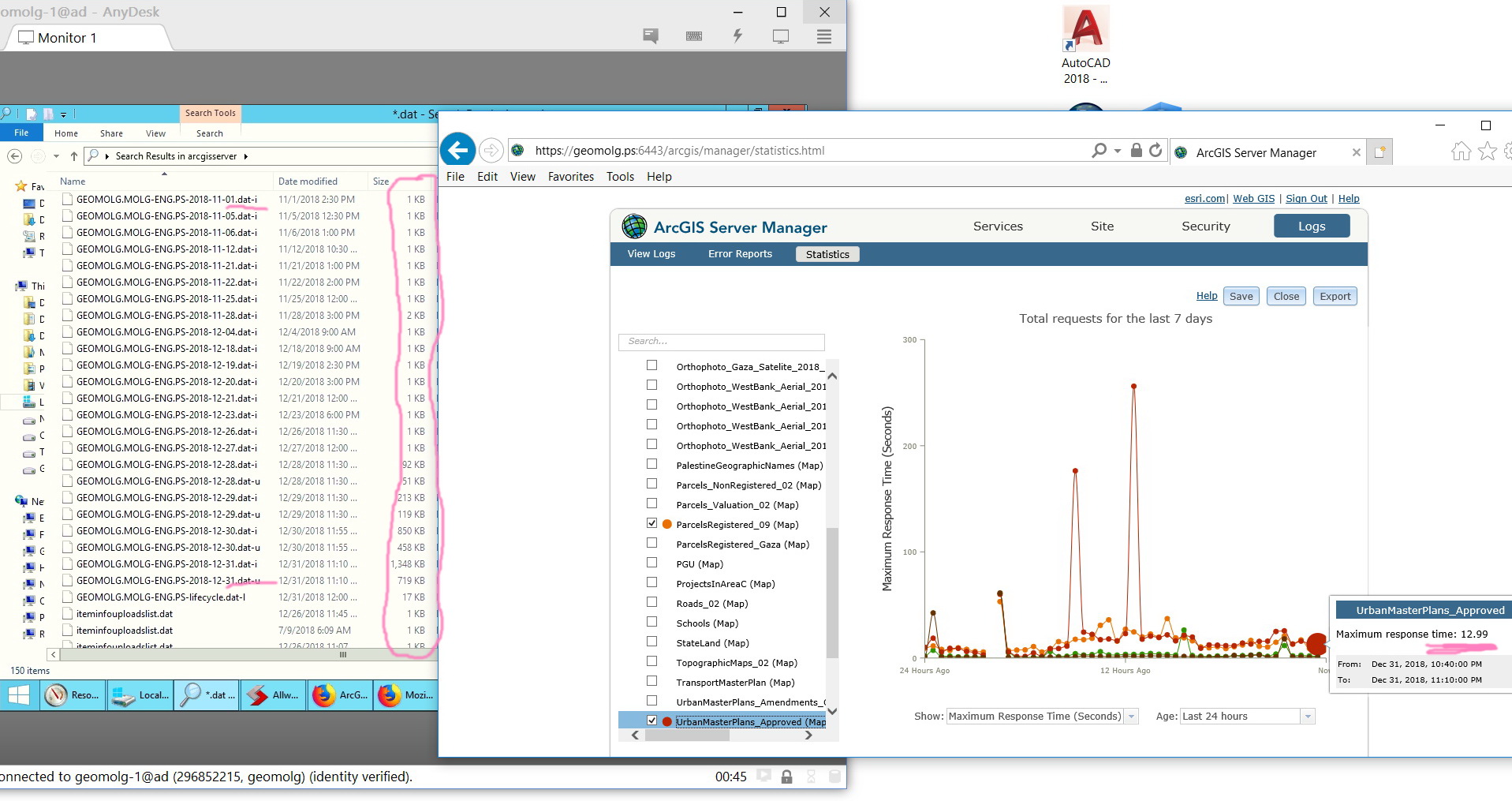
Check the .DAT files to see if they increase in size, if they are, there is a issue.
- Mark as New
- Bookmark
- Subscribe
- Mute
- Subscribe to RSS Feed
- Permalink
Hi Jamal,
Use Internet Explorer to enable a new report stat for each services.
More detail from this bug:
BUG-000104435: In ArcGIS GIS Server, the New Report radio buttons a..
Hope this help you,
Fred
- Mark as New
- Bookmark
- Subscribe
- Mute
- Subscribe to RSS Feed
- Permalink
Thank you Aled and Frédéric for the help
- The size of the .dat-I and .dat-u are quite small. Are these files are temporary and automatically deleted?
- Does this mean the failure in selection is browser issue?
Jamal Numan
Geomolg Geoportal for Spatial Information
Ramallah, West Bank, Palestine