- Home
- :
- All Communities
- :
- Products
- :
- ArcGIS Reality
- :
- ArcGIS Drone2Map
- :
- ArcGIS Drone2Map Questions
- :
- Circlegrammetry and ArcGIS Drone2Map
- Subscribe to RSS Feed
- Mark Topic as New
- Mark Topic as Read
- Float this Topic for Current User
- Bookmark
- Subscribe
- Mute
- Printer Friendly Page
Circlegrammetry and ArcGIS Drone2Map
- Mark as New
- Bookmark
- Subscribe
- Mute
- Subscribe to RSS Feed
- Permalink
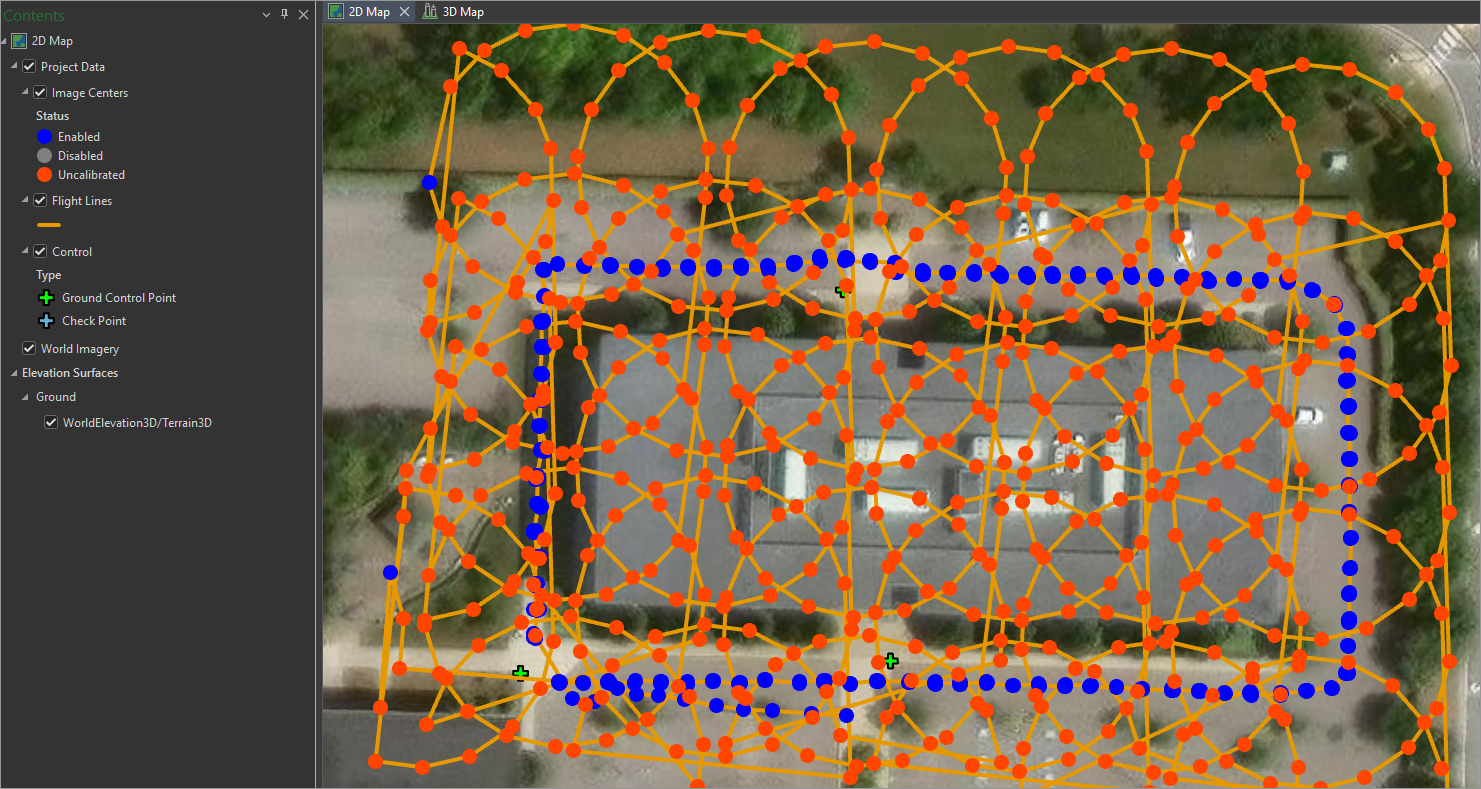
Has anyone used "circlegrammetry" for their drone flight missions and processed the results in ArcGIS Drone2Map? As you can see from my screenshot, Drone2Map can't really calibrate those images (the red dots in the circles flight patterns above the building).
Someone else flew this mission, I was just asked to process the imagery. I'm trying to determine if this is a flight pattern to continue using or to stick to the traditional crosshatch & other 3D patterns.
- Mark as New
- Bookmark
- Subscribe
- Mute
- Subscribe to RSS Feed
- Permalink
It looks like an interesting concept, but I don't know if we've seen any data with this flight pattern previously. Are you able to share your images with us, to allow us to test? Please also share the Drone2Map processing report.
Which drone was used? I would expect that Drone2Map *could* process this, but it may require a drone that includes metadata about the image orientation angles. Without that orientation data, the software will assume the images are all aimed at nadir, and attempt to find matching points in images that are adjacent in (x,y) but aimed in opposite directions.
I'll ask our development team if a new configuration could make this work better.
Thanks
Cody B.
- Mark as New
- Bookmark
- Subscribe
- Mute
- Subscribe to RSS Feed
- Permalink
Thanks for reaching out @CodyBenkelman ! I just sent you an email.