- Home
- :
- All Communities
- :
- Products
- :
- ArcGIS Collector
- :
- ArcGIS Collector Questions
- :
- Re: Yet more offline areas failing to download on ...
- Subscribe to RSS Feed
- Mark Topic as New
- Mark Topic as Read
- Float this Topic for Current User
- Bookmark
- Subscribe
- Mute
- Printer Friendly Page
Yet more offline areas failing to download on Collector
- Mark as New
- Bookmark
- Subscribe
- Mute
- Subscribe to RSS Feed
- Permalink
I have been reading through all previous posts that I could find, on any issues related to problems with downloading areas for offline use on Collector (not Collector Classic).
In the few cases I have experienced recently, there are no copies of layers in the same webmap, or domain names that coincide with field names in any of the present layers (as discussed here and here). All layers are shared at organization and/or group level, with syncing enabled and offline mode enabled too for the webmap.
When trying to download an offline area (Area 1), it simply stops soon after starting and shows a blank page with a message "No maps to display" or similar. When re-trying, it will attempt to download 'Area 2' but the result is the same.
I have tried to find the log through Collector developer options, but the only thing I can see is 'Placeholder' which does nothing when selected.
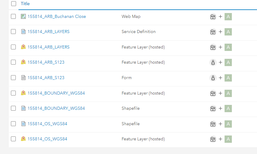
The webmap is created from 3x Feature Layer (Hosted). One was created in ArcMap and based on a File Geodatabase and the other two are shapefiles that have been 'dragged' in.
This works fine on Collector Classic (and it has worked ok with Field Maps too), but the 'new' Collector (v 20.2.2) has very frequent issues with offline area download, even though the type of WebMap we create always follows the same structure.
Despite all layers being shared at organisation and/or group level, I have found that the error is more likely to happen when the user who downloads it is not the same as the user who created the webmap, even though both have equal permissions on AGOL.
Sorry for creating a new post - again after reading through other posts I found no solution to my case and I hope I can find some support here. I'm happy to provide any more information that might be useful to understand the problem.
Solved! Go to Solution.
- Mark as New
- Bookmark
- Subscribe
- Mute
- Subscribe to RSS Feed
- Permalink
Kevin,
I know this is already a little stale, but in regard to Field Maps, it has not been stable enough on the tablet for me to invest in configuring in the new application. Currently I'm deploying Collector Maps, built with the Classic Viewer combined with Survey 123 instruments writing to the same database. Field maps does not yet have the full combination of S123 and Collector features I'm looking for, and the instability on the tablet cinches that decision. I will keep testing, and using the Standard map Viewer in some browser-based maps and applications, but the classic viewer-->Collector-->S123 combination is the most stable and flexible at the moment.
I did share my map with your colleague Jackie (JacquelineH_support).
Can you tell me how to access download logs for troubleshooting without a developer's license?
Thanks!
- Mark as New
- Bookmark
- Subscribe
- Mute
- Subscribe to RSS Feed
- Permalink
Thank you for that information @DavidRichey
Few things:
- What specific functionality does your workflow require that Field Maps doesn't include that Collector+S123 does? Is it related to smart forms?
- Wrt to stability issues on the tablet in Field Maps, what issues are these and have they been reported to Esri in the past to look into?
- Lastly, wrt to logs, are you referring to the logs directly with Collector related to download issues? Are you using iOS or Android?
Thanks
-Kevin
- Mark as New
- Bookmark
- Subscribe
- Mute
- Subscribe to RSS Feed
- Permalink
Yes, it is related to smart forms. From the April 2021 Field Maps update "
- More smart form capabilities (Switch input type, calculating attribute values, attribute rules, contingent values and more)
I have not taken the time to report the issues. There are also enough development pathways that testing becomes hard to find the time for when getting apps in the field is the priority. I am kind of waiting for the Standard map viewer and Field Maps to settle just a bit. Field Maps crashes regularly in my initial testing with Standard map viewer maps I'd put some time into configuring in field Maps with grouping, conditional visibility, etc. It crashed regularly in the field, so I decided to give the path more time to develop.
Yes, I am wanting to access the logs directly with Collector related to download issues so I can see if a particular layer or configuration is causing issue. I'd also like to be able to report the elements with the largest storage requirements so i can convey this to the field staff (how many pictures do you want?). Jackie wrote of a Trouble shooting section under the profile dialogue, but I did not see that.
- Mark as New
- Bookmark
- Subscribe
- Mute
- Subscribe to RSS Feed
- Permalink
@KevinBurke on the same or similar list would be showing related records as a default inclusion on a popup. Available in Map Viewer Classic, but not the Standard map viewer. While not a field requirement, it is a requirement for administrative maps and applications based on the same databases. Thanks !
- Mark as New
- Bookmark
- Subscribe
- Mute
- Subscribe to RSS Feed
- Permalink
@DavidRichey Hi,
I was reading your comment and it made me curious. When you say combine Survey123 'instruments' and Collector to write to the same database, what do you mean exactly? When I set up a webmap I customize the pop-ups with a hyperlink to a new Survey123 form, but it is stored separately and unlinked from the geometry on Collector.
If there is a more 'integrated' way to combine Collector and Survey123 I would be very interested in hearing more!
Also, when you say 'Collector maps built with the Classic Viewer' are you referring to Collector Classic or is there something I'm missing?
Thank you!
- Mark as New
- Bookmark
- Subscribe
- Mute
- Subscribe to RSS Feed
- Permalink
The way to integrate 123 and Collector is relationship classes. You send the Key in the launch url over to 123. Then have the 2 related. You do this by combining the two layers into one service, publish, then point 123 to the new layer.
I do this with 9 diff forms all connected to the main point. See my full directions here. https://community.esri.com/t5/arcgis-survey123-questions/mapping-with-survey123-within-a-polygon-or-... Works slick. Esp with adding in Arcade and such.
The only major bummer here is you must sync in order to see the 123 data over in collector. Hope that helps.
- Mark as New
- Bookmark
- Subscribe
- Mute
- Subscribe to RSS Feed
- Permalink
@DougBrowning 's response is on target and he has well documented descriptions. ESRI has some help on this, but it is not a consolidated description. I use a method of building the database in Survey123, uploading that, exporting the FGDB, customizing the cartography and some other aspects and either deleting and reposting or overwriting the original service (the latter method then displays the map cartography in the Survey123 data dashboard, but seems like it might have some liabilities for still being integrated with the S123 environment). I then deploy the entire database in a map, with elements like "monitoring surveys" as Survey123 repeats on a feature, transferring the global id to the child feature in a URL link in the feature popup (there are issues with this a bit that I have not overcome--at the moment, the user must enter the parentglobalid, which I provide in a popup for copy and paste). This way, once sync'd, all the data is available in the S123 Data view and in the map--including in field offline downloads.
I am not talking about "Collector Classic" but rather the "Classic Map Viewer" for building maps, as opposed to the current "Standard Map Viewer" that is now in use by default for map creation with greater functionality.
Hope this helps. There are a lot of pieces to put together to make it work, but then it can be very effective (when the downloads work! ;-0).
- Mark as New
- Bookmark
- Subscribe
- Mute
- Subscribe to RSS Feed
- Permalink
@DavidRichey You can solve the globalid issues by creating your own second relationship class and passing that id. I do not use globalids for all the reasons mentioned here https://community.esri.com/t5/arcgis-collector-questions/related-tables-for-offline-data-collection/...
Another way is to not have the new records as repeats. Have the main point as one layer then the form as another and use the relationship class to hold it together. That is all a repeat us anyway.
Hope that helps
- Mark as New
- Bookmark
- Subscribe
- Mute
- Subscribe to RSS Feed
- Permalink
@KevinBurke thanks for your reply. The answers to your questions:
- We are working on Android (mainly Samsung devices -tablets and phones- and some Huawei tablet)
- We have not tested Field Maps before. From looking at it briefly, it seemed almost identical to Collector in the way that we would use it. However I only came across it when trying to find solutions to our issues with Collector. Also, is there any example you could think of an example of what would make a webmap fail on Collector but not on Field Maps? Again, happy to use Field Maps if it works, but I don't think I could accept it as a solution especially if there are differences in the functioning of the app that I need to learn and then pass on to other users.
- This has happened repeatedly with different unrelated maps. They all tend to be similar in the sense that we have a Feature Layer that is editable and one or two Feature Layers that are not, but just there to act as background (like a site boundary shp and a shapefile made of topographical or other CAD drawing features) in addition to the basemap.
- Could you please give me some detail of how I would share this with you for further review?
PS. Coming back to my original post, would you know why I'm not able to see any other developer options in Collector (when tapping on the user initials quickly three times) other than 'Placeholder'?
Thank you
- Mark as New
- Bookmark
- Subscribe
- Mute
- Subscribe to RSS Feed
- Permalink
@KevinBurke adding to my previous reply, here's some feedback I had today regarding the use of Field Maps and behaviour found that would not occur with Collector on identically set-up webmaps:
<<When using the Field Maps the [created features] would disappear and then reappear for no reason. A layer (not editable, for background) was taken off to make the locations clearer, but then [Field Maps] would randomly put locations on the plan with equally random names, nothing to do with [the surveyed features]. I closed the app and reopened it and it would put all layers back on and previous locations would have disappeared and only to reappear when we start to plot features again. It would give a white/greyish screen as if it was struggling to process the task in hand but still work. Throughout the day it would make features created on Field Maps disappear>>
I appreciate this might not be the post for a review of Field Maps, but since the topic came up here I thought I'd mention it.
Thanks