- Home
- :
- All Communities
- :
- Products
- :
- ArcGIS CityEngine
- :
- ArcGIS CityEngine Questions
- :
- Using Python to add a list of reports to object at...
- Subscribe to RSS Feed
- Mark Topic as New
- Mark Topic as Read
- Float this Topic for Current User
- Bookmark
- Subscribe
- Mute
- Printer Friendly Page
Using Python to add a list of reports to object attributes
- Mark as New
- Bookmark
- Subscribe
- Mute
- Subscribe to RSS Feed
- Permalink
Wait a minute, I think I'm about to crack it
Hi this is a follow up on my:
NOTE: this is a simple example I have a lot of buildings with architectural freedom.
I need to get shapes to be indexed depending on the distance to the ground or to each other.
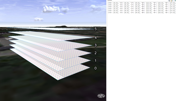
The models are not created in CE but is CAD export to shp. It's one shape, but it contains floors:
I'm able to do a component split and get the facades and floors isolated, but a building can have multiple floor parts in the same level, and in this simple example it get's confused on what's actually are the order of the comp.split.
So I need to be able to pick out a specific index, and therefor I need it to be indexed as below (likek we are use to)
I've created a rint(scope.elevation-elevation) after a component split, and created a loop so I get it in the right sort order. Like elevation = 3,6,9,12 etc. but since it's an component split I can't compare them to each other, so CE don't know that in this case the elevation on 12 is equal index 3.
and if i have a building with a floor height on 4 meters the elevation 12 would be index 2.
If I could only get those elevation into a sorted list, and remove dublicated values, then I could use the list capabilities + the elevation information to pick the right floor.
Right now my thought is to create a rule:
Next(floorHeight,BlHeight,meterMeasure,ZeroIndex) -->

//print(listAdd(str(floorHeight),str(floorHeight)))
case	floorHeight	==	0	:	report("A",floorHeight)
case	floorHeight	==	1	:	report("B",floorHeight)
case	floorHeight	==	2	:	report("C",floorHeight)
case	floorHeight	==	3	:	report("D",floorHeight)
case	floorHeight	==	4	:	report("E",floorHeight)
case	floorHeight	==	5	:	report("F",floorHeight)
case	floorHeight	==	6	:	report("G",floorHeight)
case	floorHeight	==	7	:	report("H",floorHeight)
case	floorHeight	==	8	:	report("I",floorHeight)
case	floorHeight	==	9	:	report("J",floorHeight)
case	floorHeight	==	10	:	report("K",floorHeight)
case	floorHeight	==	11	:	report("L",floorHeight)
case	floorHeight	==	12	:	report("M",floorHeight)
case	floorHeight	==	13	:	report("N",floorHeight)
case	floorHeight	==	14	:	report("O",floorHeight)
case	floorHeight	==	15	:	report("P",floorHeight)
case	floorHeight	==	16	:	report("Q",floorHeight)
case	floorHeight	==	17	:	report("R",floorHeight)
case	floorHeight	==	18	:	report("S",floorHeight)
case	floorHeight	==	19	:	report("T",floorHeight)
case	floorHeight	==	20	:	report("U",floorHeight)
case	floorHeight	==	21	:	report("V",floorHeight)
case	floorHeight	==	22	:	report("X",floorHeight)
case	floorHeight	==	23	:	report("Y",floorHeight)
case	floorHeight	==	24	:	report("Z",floorHeight)

else : NIL
If a floor is 3 meters, I'll get a report called D, with the height.
In the first part of the tutorial 12 that will create a list like:
{'D': [3.0], 'G': [6.0], 'J': [9.0], 'M': [12.0], 'P': [15.0], 'R': [17.0]}
So if I can get that converted into a list like:
3;6;9;12;15;17 and add it to the object attribute of all my models so I can link it back to the attributes, then I'm sure I can get it to work.
I've been looking through tutorial 12 & @CherylLau guide: https://community.esri.com/t5/arcgis-cityengine-questions/using-python-to-create-an-object-attribute...
But I can't get it to work. If this can be done without Python, it's preferable, but I don't think so.
Thanks, Kenneth.
- Mark as New
- Bookmark
- Subscribe
- Mute
- Subscribe to RSS Feed
- Permalink
Hi Kenneth,
Conceptually, I think your approach could work. I think, if I understand your strategy, you are:
- Getting horizontal comp.index
- Setting scope.elevation of the comp.index shape to a new parameter = floor elevation
- Setting the ground floor's scope.elevation to a new shape parameter = ground elevation
- Getting the difference between the floor height and ground per shape, and setting that to a parameter = floor elevation - ground elevation = floor height
- Sorting the floors based on elevation difference (#4) and labeling them to a letter. = conditional statement = If floor height = #, then letter "A"
Is that correct?
Keep in mind, your shapes with created and stored parameters are an array of sorts, just not in a tabularized form. Depending on your strategy, and if you can 'label' your floors a letter using a height from elevation (your floor index), you might have already created the floor index parameter that you need, and a array table creation and table lookup is redundant. If you have the floor index created and parameterized to a shape, maybe you just need to operate another conditional statement to send each floor on there way to new functions.
Also, I just want to comment that you don't necessarily need python for the ideas you explained so far. In latest CGA versions (2019+) you can create and store a "list" array in an attribute. You can then create array lookup functions to find first row/column and report second row/column attribute (or similar). See the CSV tutorial for example of how to do that. And you can then use the set function to create a floor index parameter (your letter identifications) if your shape did not already have the array or index stored as a parameter.

