- Home
- :
- All Communities
- :
- Products
- :
- ArcGIS CityEngine
- :
- ArcGIS CityEngine Questions
- :
- Re: Creating Streets from existing 3d polyline dat...
- Subscribe to RSS Feed
- Mark Topic as New
- Mark Topic as Read
- Float this Topic for Current User
- Bookmark
- Subscribe
- Mute
- Printer Friendly Page
Creating Streets from existing 3d polyline data
- Mark as New
- Bookmark
- Subscribe
- Mute
- Subscribe to RSS Feed
- Permalink
- Report Inappropriate Content
When importing 3d polylines into City Engine from ArcGIS 10.4, how do you retain the 3d geometry of the polyline so that when a shape creation rule (such as simple streets) is applied, the road follows its original design curves (vertical and horizontal) - as defined in the original GIS layer. When I import a 3d polyline, the vertical curves/alignment reset to the ground plane (y=0). I am trying to import 3d centrelines of road from ArcGIS in order to generate roads from the original design (as opposed to aligning with a terrain surface). Align to terrain is set to off in the create new street settings. Any suggestions?
Difficult to show clearly but the attached images show the 3d alignment screenshot from ArcScene and the flattened version screenshot from CE from the same relative position (not the CE JPG has no elevation).
.JPG)
.JPG)
- Mark as New
- Bookmark
- Subscribe
- Mute
- Subscribe to RSS Feed
- Permalink
- Report Inappropriate Content
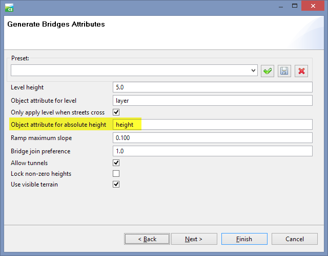
Try this : when Importing the polylines to CityEngine Scene, make sure the Run Generate Bridges Tool is checked.
- Mark as New
- Bookmark
- Subscribe
- Mute
- Subscribe to RSS Feed
- Permalink
- Report Inappropriate Content
Hi Jawadh
Thanks for the response. That did not work, but gave me a few ideas to try. Import 3d polyline seems to work if Generate Bridges is “off” and if imported from a geodatabase (rather than a shape file). If Generate Bridges is “on”, I get some very strange results.
Dave
- Mark as New
- Bookmark
- Subscribe
- Mute
- Subscribe to RSS Feed
- Permalink
- Report Inappropriate Content
Hi Dave
The "Generate Bridges" option sets the height depended on the attribute 'height' (if present).
This is mainly thought to be used with 2D data that has some segments (like bridges) with height information.
Maybe this is the cause of your strange results?
- Mark as New
- Bookmark
- Subscribe
- Mute
- Subscribe to RSS Feed
- Permalink
- Report Inappropriate Content
Thanks Thomas
That is useful to know. I have a workaround for my immediate problem but am still trying to understand the cause of the issue.
Regards
Dave