- Home
- :
- All Communities
- :
- Products
- :
- ArcGIS CityEngine
- :
- ArcGIS CityEngine Questions
- :
- Re: Aligning Problem
- Subscribe to RSS Feed
- Mark Topic as New
- Mark Topic as Read
- Float this Topic for Current User
- Bookmark
- Subscribe
- Mute
- Printer Friendly Page
Aligning Problem
- Mark as New
- Bookmark
- Subscribe
- Mute
- Subscribe to RSS Feed
- Permalink
Hello there,
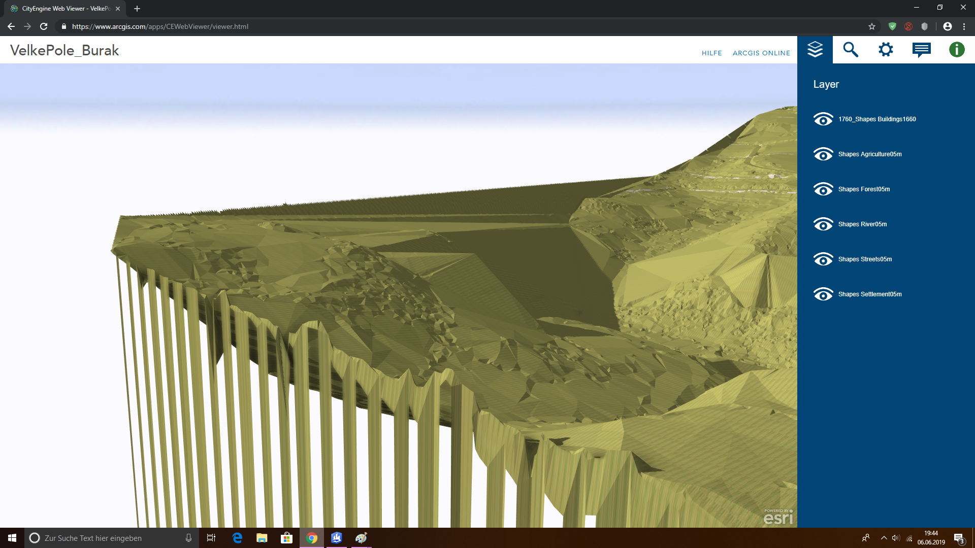
I have a problem. As soon as I click "Align shapes to Terrain", my shapefile rectifies and falls down the edge.
In the first picture(Border_Issue1) you can see that all shapefiles have the right size, in the second picture(Border_Issue) you can see the mentioned problem.
Does anyone have the same problem and can help me? Thomas Fuchs Chris Wilkins Elliot Hartley David Wasserman Geoff Taylor L R Cheryl Lau Matthias Buehler Michelle Mathias
Thanks in advance 
- Mark as New
- Bookmark
- Subscribe
- Mute
- Subscribe to RSS Feed
- Permalink
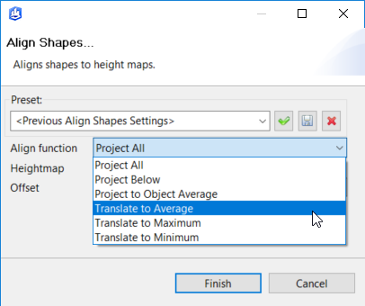
Hi Burak,
Try one of the Translate options. Project will cause the effect you see if any of a shape's vertices extend past the edge of the terrain.
Chris
- Mark as New
- Bookmark
- Subscribe
- Mute
- Subscribe to RSS Feed
- Permalink
Hi Chris,
thank you for your quick answer. However, the problem persists.
In the beginning everything worked fine, see the picture below(it's my backup-file). But after I created a .3ws file for the Cityengine Web Viewer, the problem occurs strangely.
Burak
- Mark as New
- Bookmark
- Subscribe
- Mute
- Subscribe to RSS Feed
- Permalink
Hello Burak Aydin
Can you pleas provide a screenshot of the CityEngine Web Viewer scene?
Is it really the shape files that are wrong?
Or does the terrain itself look strange?
Thanks for your help!
Thomas F
- Mark as New
- Bookmark
- Subscribe
- Mute
- Subscribe to RSS Feed
- Permalink
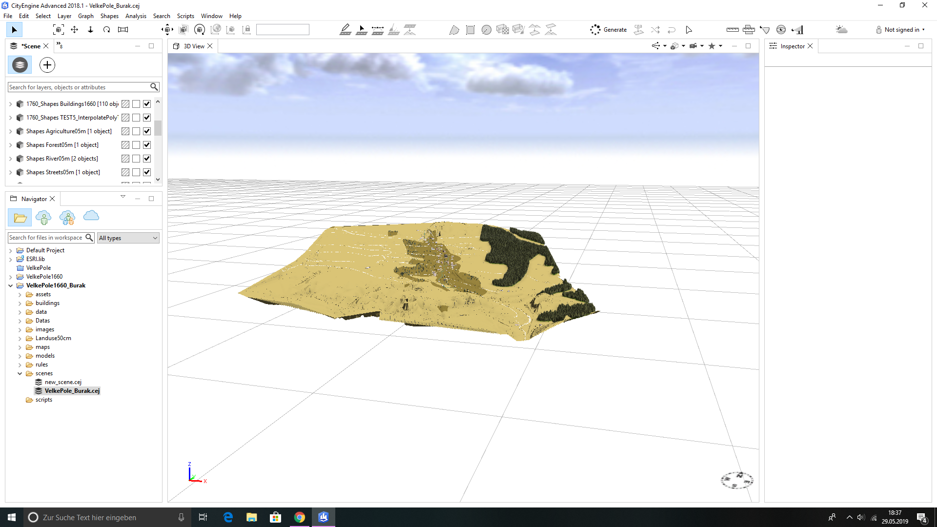
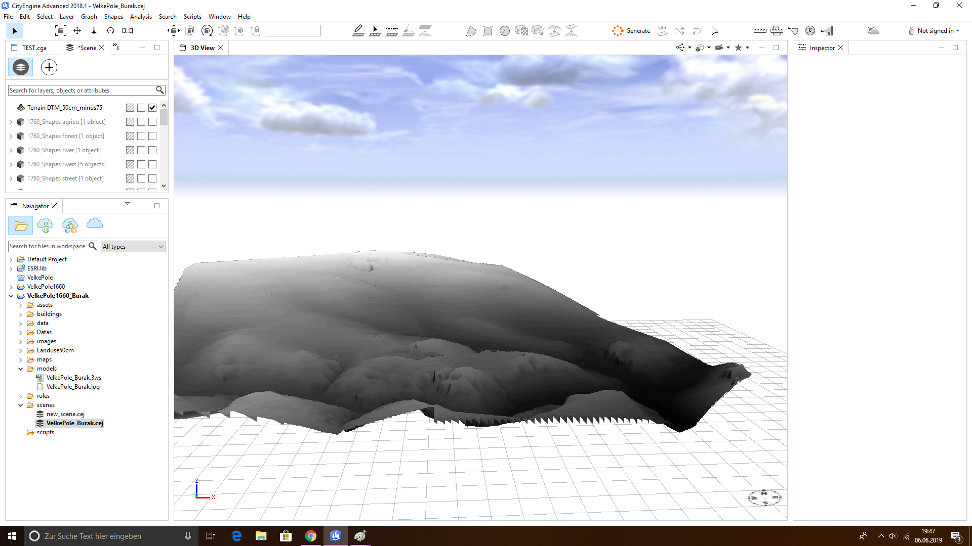
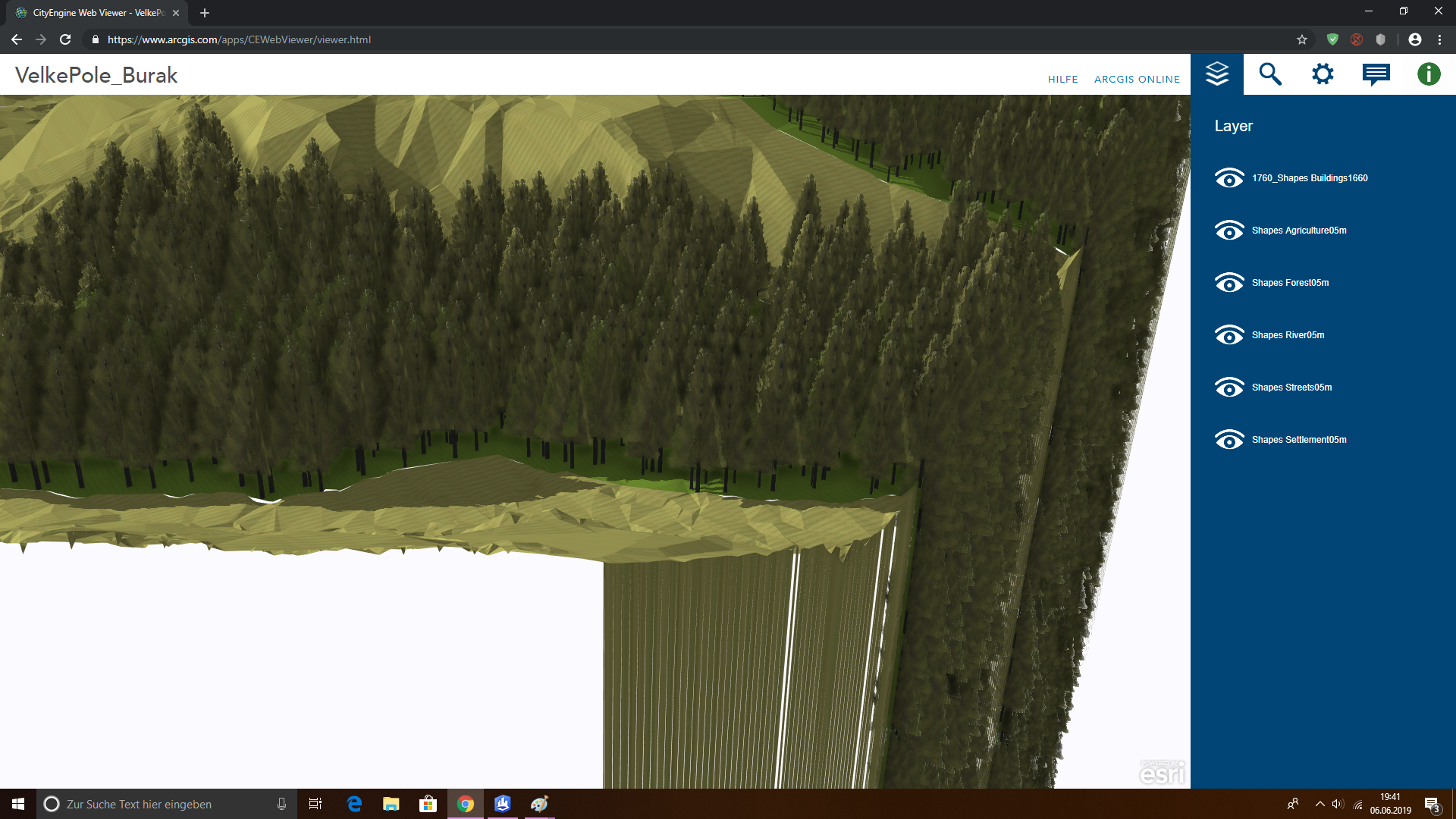
Hi Thomas,
in the appendix you can find the screenshots. You can see the Cityengine scene and the terrain (DGM1&2) as a whole and close up.
I don't know if it can be because of the terrain. The strange thing is that everything worked fine in the beginning, but now this aligning problem arises when i want to add new shapefiles.
Burak
- Mark as New
- Bookmark
- Subscribe
- Mute
- Subscribe to RSS Feed
- Permalink
Hi there,
I found my mistake. The shapefiles were polygons and after I converted them into multipatches everything works fine again.
I don't know if this is the general solution now, but in my case it works fine.
Thanks for your replies and help
Burak