- Home
- :
- All Communities
- :
- Developers
- :
- JavaScript Maps SDK
- :
- JavaScript Maps SDK Questions
- :
- Opinions on which format to save polygon data as.....
- Subscribe to RSS Feed
- Mark Topic as New
- Mark Topic as Read
- Float this Topic for Current User
- Bookmark
- Subscribe
- Mute
- Printer Friendly Page
Opinions on which format to save polygon data as...
- Mark as New
- Bookmark
- Subscribe
- Mute
- Subscribe to RSS Feed
- Permalink
Hi everyone,
Hope everyone is well, I am currently building some mapping software where my customer can draw polygon data in respect to property boundaries so usually just single rectangles or slightly more complex at times. This will be used in Australia but the intent in the future would be international.
From my research, I have noticed that the data I get from the polygon is some sort of x,y which is then interpreted using spatial reference data. From what I understand Longitude & Latitude can be used globally and effectively I wouldn't need a spatial reference?
This leads me to my question I want to save the data in a universal way that is simplest to use, I have noticed geoJSON seems to be the most unified way to store data but doesn't seem to be the most ideal way to process data with ESRI?
I'm looking for opinions on how to save my polygon data, at the moment from my research I have decided to save in GeoJSON format using the Lat & Lng data instead of x, y data and a spatial ref. In your guy's opinion does this seem like a good direction to go.
Furthermore, the DB I am using is MongoDB & they do seem to have some decent support for GeoJSON data which it looks like will make it easy to query etc.
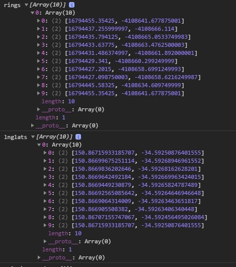
I have attached a picture of the data I get, then I loop it using .getPoint() to get the actual Lat, Lng, then, in turn, I will save to the database.
Any information/experience/guidance on this is appreciated.
this would obviously be saved in GeoJson format like so: