- Home
- :
- All Communities
- :
- Products
- :
- 3D
- :
- 3D Questions
- :
- get more realistic landscape for 3D ArcGIS WebScen...
- Subscribe to RSS Feed
- Mark Topic as New
- Mark Topic as Read
- Float this Topic for Current User
- Bookmark
- Subscribe
- Mute
- Printer Friendly Page
get more realistic landscape for 3D ArcGIS WebScene
- Mark as New
- Bookmark
- Subscribe
- Mute
- Subscribe to RSS Feed
- Permalink
Hi,
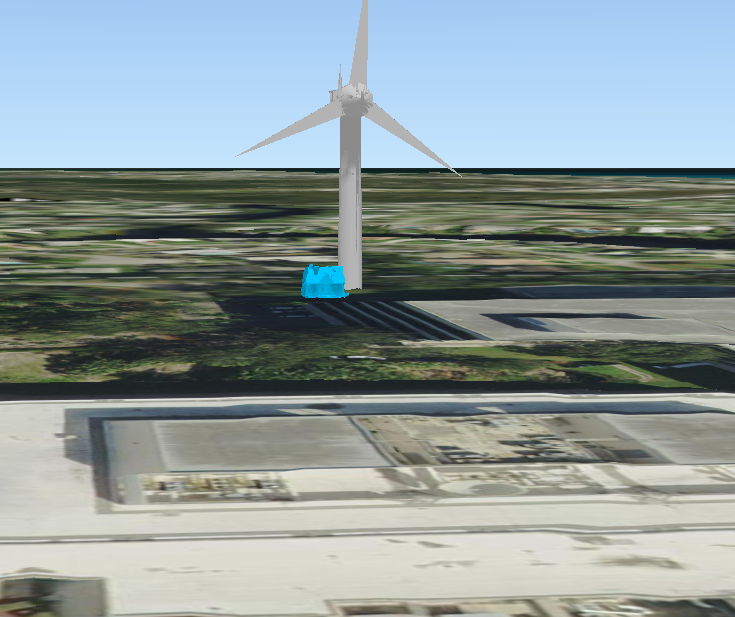
In my webscene, I am using the default Esri elevation layer:
WorldElevation3D/Terrain3D (ImageServer)
Although the terrain does show variation in the land surface, trees and Buildings remain flat, as shown in the picture
I'd like to have at least the trees/bushes be more realistic without having to manually create multiple 3D features (which would be very impractical for showing scenes word-wide) in a Globe Scene to represent realistic terrain.
Also, I am using Portal for ArcGIS WebScenes, and I don't see a way to exaggerate the ground layer.
Is there imagery, or world-wide 3D data available to accomplish what I want?
Sorry for all the @Mentions below, but I figured I'd reach out to some the greatest 3D professionals in the world that I've heard of:
- Mark as New
- Bookmark
- Subscribe
- Mute
- Subscribe to RSS Feed
- Permalink
Andres Castillo For the terrain, I would consider draping the raster over an elevation dataset (Defining data as a draped layer in ArcScene—Help | ArcGIS Desktop , Define height characteristics for layers—ArcGIS Pro | Documentation). And for the 3d objects, I would consider ArcGIS Pro's preset layers (Preset layers—ArcGIS Pro | Documentation) or for the architecture, I would try using Esri's CityEngine software, which utilizes rule packages to automatically generate buildings are a macroscale (CGA modeling overview—Help | Documentation). Another option for other objects like vehicles or miscellaneous structures could be importing them from other 3D software like SketchUp (3D Warehouse ) or Autodesk (https://gallery.autodesk.com/ ). Fortunately, different 3D formats are cross-platform compatible, but my experience is mostly limited to importing using Collada and Multipatch files into ArcGIS Pro.