- Home
- :
- All Communities
- :
- User Groups
- :
- Conservation GIS
- :
- Documents
- :
- John Schaeffer, USA
- Subscribe to RSS Feed
- Mark as New
- Mark as Read
- Bookmark
- Subscribe
- Printer Friendly Page
John Schaeffer, USA
John Schaeffer, USA
John Schaeffer, Juniper GIS, Oregon
xTTTBoard 2003-2019 xConferenceWorkshop 2003-2019 xScholarTraining x2019TTTBoard x2018TTTBoard x2017TTTBoard x2016TTTBoard x2015TTTBoard x2014TTTBoard x2013TTTBoard x2012TTTBoard x2011TTTBoard x2010TTTBoard x2009Training x2008Training x2007Training xCommitteeInternational 1997-2019
2019 Scgis Map Gallery Interview
https://www.scgis.org/council/pages/john_schaeffer
I have been working with GIS and ESRI software since 1993, specializing in training and GIS services for smaller agencies that prefer a more personal approach. I also volunteer training and assistance to conservation groups, especially SCGIS (Society for Conservation GIS) and am interested in more work with groups, anywhere in the world. I have developed extensive course work for using ArcGIS for conservation, natural resouce, and environmental issues.
I have also been the lead instructor for the SCGIS Scholars program since 2009 and have been working with scholars in Uganda, Russia, South Africa, and Mexico to train them as instructors and to provide classes for conservation groups in those areas.
https://www.linkedin.com/in/johnschaeffergisp
John Schaeffer, GISP, CTT+ GIS Analyst and ArcGIS Instructor at Juniper GIS; helping people succeed with GIS
https://www.facebook.com/Juniper-GIS-Services-Inc-243167935331/
Northwest GIS Bio: https://nwgis.org/2014/conference-workshops
In 1994 (John) started one of the first 2-year GIS programs in the United States at Central Oregon Community College. John has taught extensively in the US, and also in Kenya, Uganda, Tanzania, South Africa, Fiji, Russia and Mexico to a wide variety of state, local and federal agencies and many conservation groups, including the Jane Goodall Institute and the Society for Conservation GIS. John has also been the lead instructor for the Society for Conservation GIS Scholars program for the past several years.
https://www.esri.com/esri-news/arcnews/summer14articles/train-the-trainer
BEST OVERVIEW ARTICLE “Building GIS Capacity Across the Globe”
By John Schaeffer, GISP, and Karen Beardsley, PhD, GISP
Excerpt: … “The first TTT candidate was Cecilia Cronemberger, a 2009 Scholar from Brazil. During the more than two-week Scholars training program, she assisted in the class as a helper and presented lectures, and during breaks, she and Schaeffer discussed how the class and course material work, typical problems students might have and how to solve them, and classroom management. Upon completing the program, she was granted her Juniper GIS Instructor certificate, along with the official Juniper GIS uniform, her own Hawaiian shirt. Since her graduation in July 2011, she has taught eight classes to approximately 100 students in Brazil, greatly helping expand GIS training.”
To expand the TTT program, in 2013 a new approach was taken, which was to send Schaeffer to the SCGIS Scholars in their home regions to provide the TTT training. This program, for two to four trainees, consists of a three-day advanced GIS class for the trainees and GIS users from local conservation groups, a five-day ArcGIS for Environmental Analysis (AE) class in which the trainees served as helpers and gave some presentations, and three to four days during which Schaeffer and the trainees work together on teaching skills and issues. After reaching out to the SCGIS International Chapters, Schaeffer and the SCGIS International Committee chose SCGIS Russia from among several offers, for this first effort.
(Years: all ttmaster ttleader tttrainer )
CHRONOLOGY INDEX (see also TTT Training Program History)
Sources: Email and Juniper GIS Newsletters: http://www.junipergis.com/latest-news/press-releases/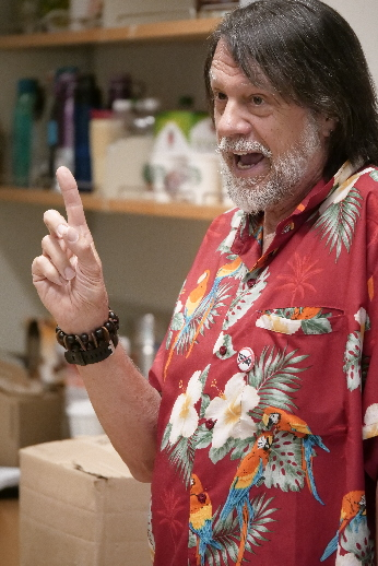
1970-1972 Oakland University, BA Slavic Studies
1975-1976 Graduate Work in Russian Feminism, University of Oregon
1976-1988 Worked as a Carpenter
1988 –1999 Associate Professor, GIS, Central Oregon Community College, started the GIS degree program with Art Benefiel
1996 – Worked with Mike Phoenix & Michael Goodchild to develop a GIS curriculum for technical schools.
1996-1997 Was one of two primary instructors for a six-week NSF funded to train community college instructors in GIS
1999 Juniper GIS Is founded as a private GIS Consulting and Training firm .
2000-2001 – Primary instructor for another NSF funded effort to train high school to university GIS instructors
2007 Kenya 2-day Conservation GIS course & technical presentations at the SCGIS Kenya Conference
2008- FIRST SCGIS SCHOLAR TRAINING: 3 days of advanced training at the University of California James Reserve
2009-2016 – Lead instructor for SCGIS Scholars annual in-depth Desktop GIS training & Conservation GIS Project management
2009 Mexico Conservation GIS Courses for Global Visions International
2009 – Lead instructor for second year for SCGIS Scholars
2010 Jan: John Schaeffer is nominated to the board as a liason for the International Scholars Program.
2010 Feb 7 John Schaeffer & Juniper GIS write the Train-the-Trainer (TTT) Program Proposal
2010 Mar: John is elected to the board of directors for the Society of Conservation GIS
2010 Jun 1, John’s TTT Program formally presented to the board and is approved but not funded.
2010 Jun Lead instructor for third year for SCGIS Scholars
2011 Jul – First TTT scholar Ceciilia Cronemberger de Faria of Brazil, a 2009 scholar, became the first TTT teacher-trainee.
2011 Jul 2011 Scgis scholar Training at UC Davis
2011 Sep7 Ethiopia - One-week ArcGIS for Environmental Analysis (EA) course for
2011 Sep12 Nairobi Kenya - Advanced class at the Regional Center for Mapping of Resources for Development Nairobi
2011 Sep20 Uganda - One-week ArcGIS for Environmental Analysis (EA) course for Jane Goodall Institute Budongo Forest Reserve
2012 Jun-15 Kigoma Tanzania GIS training for Jane Goodall Institute two one-week classes for JGI organized through Lilian Pintea
2012 Jun-July SCGIS Scholar & TTT Training, Davis, CA. June 27 to July 26, 2012
2012 Jul Second TTT Trainer: Carlos a 2011 scholar from Argentina, becomes the second TTT Trainer.
2012 Oct Brazil Scgis’ first TTT Trainer Cecilia Cronemberger teaches her first class: a Juniper GIS class in Teresopolis, Brazil,
2012 Oct 8-12, Ezemvelo KZN Wildlife, Pietersmaritizburg, South Africa, October 8 – 12, 2012, organized by 2012 Scholar Debbie Jewitt
2012 Oct 15-19 Mpumalanga Tourism and Parks Agency, Buffelskloop Nature Reserve, South Africa, organized by 2011 Scholar Mervyn Lotter
2012 Oct 29 – Nov 3 South Africa Wildlife College, Klaserie, South Africa Organized by Mervyn Lotter and Juniper GIS
2012 Nov 3 2011 Scholar Mervyn Lotter becomes the third SCGIS TTT Trainer
2013 For Our Friends in Hawaii (From Juniper early 2013 Newsletter)
2013 Arcnews Article about the new Train-the-Trainer program:
2013 Jun-Jul UC Davis TTT & SCGIS Scholar Training
2013 Mar 3 John first mentions the idea of a TTT Summit in an email
2014 Apr 4 Formal funding request for the new TTT Program goes to Esri
2014 Jun-Jul John Schaeffer is Lead instructor for UC Davis TTT & SCGIS Scholar Training
2014 July: John Receives Special Achievement Award from ESRI
2014 Newsletter2: LAST JUNIPER NEWSLETTER.
2014 South Africa Classes & Training Trainers
2014 May, Suva, Fiji basic & advanced conservation gis courses (From Juniper Newsletter)
2014 John's trip to Russia (From Juniper 2014 Newsletter #1)
2015 Jun-Jul John Schaeffer is Lead instructor for UC Davis TTT & SCGIS Scholar Training
2016 Jun-Jul John Schaeffer is Lead instructor for UC Blue Oaks Research Reserve TTT & SCGIS Scholar Training
2016 Jul TTT training in Cameroon.
2016 Oct TTT training in Uruguay & Argentina
2016 Jun-Jul John Schaeffer is Lead instructor for UC Davis TTT & SCGIS Scholar Training
2017 Oct TTT training in Bali
2017 Jun-Jul UC Davis TTT & SCGIS Scholar Training
2018 Jun-Jul UC Davis TTT & SCGIS Scholar Training
2018 Nov TTT training in Chile
DETAILED HISTORY:
1970-1972 Oakland University, BA Slavic Studies 

December 1972: “I did graduate work in History and started research on a thesis on Russian Feminism but dropped out to work as a carpenter, which was much more profitable and more likely to have continuing employment.” Graduated from Oakland University, in Rochester Michigan, with a “Special Concentration in Slavic Studies” degree which combined Russian and East European History and Literature and Russian Language. After graduation in December, I traveled to California for my first time in a yellow, 72 Cadillac convertible I had to deliver in LA. Spent 3 months in California, and significant events were breaking into the courtyard of Santa Barbara County Courthouse (Pictured above) on New Years Eve, mistakenly thinking it was the Santa Barbara Mission (champagne was involved), apprenticing myself to a carpenter in North Hollywood for a month to learn some construction skills, and living at the Women’s History Research Institute in Berkeley for a month. I was working on a thesis on “19th Century Russian Feminism.”

March 1973 to September 1974: Living back in Rochester, Michigan doing carpentry work and delivering trees for a large nursery.
September 1974 to September 1975: Living in Boston working as a roofer and for a marine construction firm where we cleaned up the harbor, installed navigation lights in the harbor, and salvaged small ships, including our own tugboat (we had pretty bad equipment – made the job very interesting).
September 1975: Moved to Eugene to start a Master’s program in Russian History. Dropped out after a little over a year and worked construction and remodeling. I think most of my Profs at UO appreciated my building skills more than my academics.
1976-1988 Worked as a Carpenter (Ed. note, I was a carpenter in the seventies too and I can verify that John’s photo at right is a true and accurate depiction of what seventies carpenters looked like)
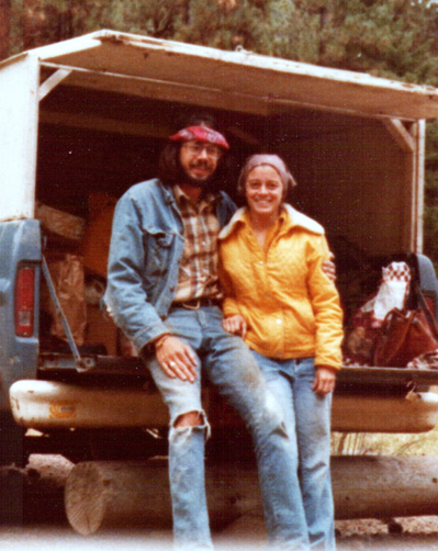
August 1977: Met Patti Bailey (PHOTO LEFT) who was getting her Masters in Library Science; still doing construction work for others and as my own business.
October 1978 to December 1980(?): Moved to Safford, Arizona where Patti got a job in the County Library system, which included one day a week on the San Carlos Apache Reservation. I was a CETA (I think that was a Nixon program) worker for the Public Works Department of Pima, Arizona, doing construction including building bridges, digging graves, etc;. The other workers at the city were on day release from the local minimum security prison. And I also did some work on my own, including building a Geodesic Dome house, and buying and remodeling our first house.
I also took some drafting courses at a community college as I was starting to get into design as part of my construction work. This is also where I taught my first workshops, on Energy Efficient Construction, at the community college and at a minimum security prison. I also was getting into Passive Solar Building Design and this is where I built my first passive solar pole building home for a local family. I was down there about 20 years later and it was still working well. When I built houses for families, I involved the entire family. Except for some special trades, I was the only paid person and the family provided the majority of labor, with me teaching them as we went. I guess this was my first “train-the builder” opportunity.
December 1980 to September 1983: Moved to Crescent City, CA where Patti was the director of the county library. Mostly did construction work there as my own business, and taught a class at the community college on “How to design and build your own house” and also taught a workshop for the library on carpentry for women, showing them some skills as we built a building to hold firewood for the library. Also built homes I designed for a couple different families there.
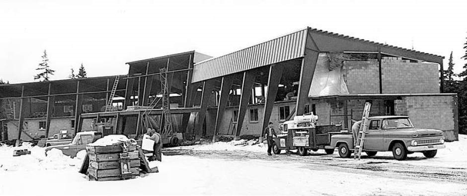
September 1983: Patti and I moved to Bend and I worked at the Mt. Bachelor ski resort doing Lodge Maintenance – fixing things and remodeling all the resorts buildings. While there I talked them into sending me to Central Oregon Community College to improve my drafting and design skills, which included taking classes in AutoCAD. (Photo: Mt Bachelor Lodge in the seventies)
This was actually the start of my GIS career, in 1986 or 87. The person teaching the AutoCAD classes quit at the end of winter term and the college hired me to start teaching part-time, even though I had only taken 2 CAD classes. But I did have a bachelor’s degree and proven experience in drafting and a junior college certificate from California to teach “English and Building Trades.” Within a year or two I was hired full time and I created and got accreditation for a 2-year drafting degree. I was also using AutoCAD to teach mapping for roads for the USFS and felt there had to be a better way. I had heard a little about GIS and then found out that the Forestry instructor was also looking at GIS. So we got together in early 1992 and learned ArcCAD and started using that for a beginning class in GIS. I also used ArcView 1 to display and work with maps I had created in AutoCAD. By 1994 we had received accreditation for a 2-year Associate of Applied Science degree in GIS, one of very first in the US.
(Photo LEFT: Central Oregon Community College in 1981. Photo courtesy of Central Oregon Community College (COCC)

1996 – Worked with Mike Phoenix, who was the University director for ESRI at the time, Karen Kemp, who later started the grad program at Redlands, indirectly with Michael Goodchild and a few others at NCGIA at UCSB to develop curriculum for technical schools
1996-1997 Was one of two primary instructors for a six-week NSF funded effort spread over two summers to train community college instructors in GIS at Indiana State University. One of the students there was Ann Johnson, who later worked at ESRI as the Community College liaison.
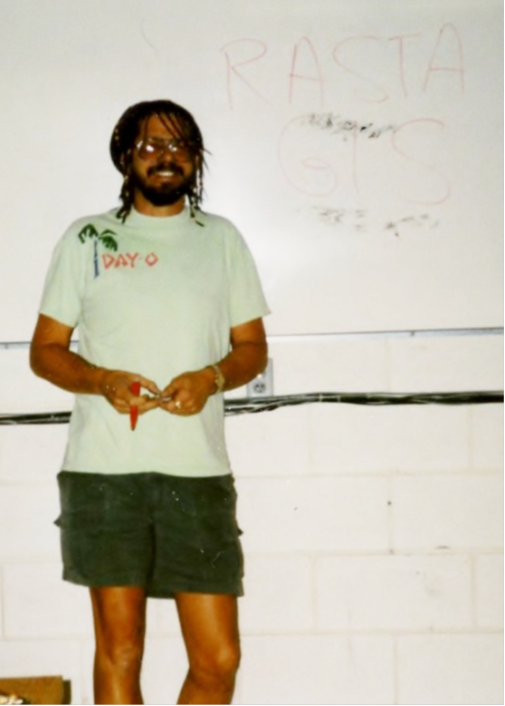
Photo ABOVE RIGHT: “Rasta” John: “Here's one where I was teaching “Rasta” GIS in about 1995/96 (It was the first day of teaching Raster in the intro class at COCC and also Halloween, so had a hainrdresser put my hair in beads.). I still do a version of that for the scholars where I talk about the use of this special type of GIS for studying certain herbs, with 3 levels of resolution - stem, leaf, bud; just like there are 3 levels of ArcGIS.
 September 1999: I got fed up with the college bureaucracy and quit to start my own GIS business, along with Patti who quit the library. Our first business was with one of my former students, but that did not work out well. In 2000, Patti and I split from that firm and started Juniper GIS. I think you know the rest from here.
(Photo: LEFT: Patty and John in Bend, ORE, living in a tent cabin (Background))
Photo RIGHT , the Juniper GIS Offices in Bend, OR in Winter)
2000-2001 – Was primary instructor for another NSF funded effort to train instructors, this time at all levels from high school to university. We did a two week session in Bend one summer, and then the next summer did some follow-up at the ESRI 2001 Education conference.
2007 Kenya 2-day Advanced Conservation GIS course & technical presentations at the SCGIS Kenya Conference. Organized by organized by Board Member & Kenya Chapter Leader Lucy Waruingi, with Patti and Leslie helping. Also did 3-4 technical presentations at the SCGIS Kenya Conference. -30 students in class, over 100 attendees at presentations. TNC provide $2,000 for this trip and Patti and I covered the rest.
2008- FIRST SCGIS SCHOLAR TRAINING: 3 days of advanced training at the University of California James Reserve
(Photos: John teaching the 2008 Scholars at the James. Photo courtesy of Anna Komarova. )
2009-2016 – Lead instructor for SCGIS Scholars annual in-depth Desktop GIS training & Conservation GIS Project management. Made use of my conservation GIS training material that also incorporates scholars’ project work and presentation skills. I ran this more as “GIS Camp” where we keep the schedule a little more flexible so we can mix in consulting and project help with the classes rather than just traditional lecture\lab format.
(Photo Below LEFT: An avid rider, John often does his Scholar Airport Pickups via Bicycle)
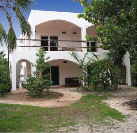
 2009 Mexico Conservation GIS Courses for Global Visions International. One-week ArcGIS for Environmental Analysis (EA) course for 10 students with local conservation people, with Patti helping. Also worked with two other groups there, Amigos de Sian Ka’an and Centro Ecologico Akumal to organize training. (Photo Juniper GIS Southern Office in Mahahual, Quintana Roo, Mexico
2009 – Lead instructor for second year for SCGIS Scholars
(Photo: 2009 SCGIS Scholar Class at the James Reserve with John)

(Photo Below: John and Patti on their way to the airport to pick up more incoming SCGIS Scholars in 2009)

2010 Jan: in the 2010 Board Elections, John Schaeffer puts his hat into the ring and is nominated and elected to the board that March as a liason for the International Scholars Program.
2010 Feb 7 John Schaeffer & Juniper GIS write the Train-the-Trainer (TTT) Program Proposal
“Goal: Provide a cost-effective method of GIS training for people working in developing countries in environmental conservation applications. This would be applicable to SCGIS and other conservation groups around the world. The goal of this program is to help future trainers develop skills and course materials for teaching core GIS classes. This is not intended to compete with the current SCGIS scholars program, but to supplement and extend the program. Developing more locally qualified trainers will provide continued support to GIS practitioners in conservation organizations in remote locations.
Training Program: Provide in-depth GIS training to ensure potential trainers have a comprehensive set of core GIS skills. This will be a two-week course for 10-12 potential trainers that cover beginning to advanced GIS skills. Ideally, potential trainers will have good GIS skills, and this course will allow them to re-enforce their GIS skills and provide a solid base for teaching a core course. This two-week training module will be based on the GIS training taught at the James Reserve in 2009 – 2010 by John Schaeffer of Juniper GIS. Students will learn more ways to be effective with ArcGIS, both from the instructors and the other students, which will benefit them as teachers.
Upon completion of the full class, class participants will receive a certificate indicating they are authorized by Juniper GIS to teach a core GIS class. Students will have the skills to be able to teach this effectively to others back in their own countries or for other groups.
Becoming a Juniper GIS Authorized Instructor: With the SCGIS scholars and Karen, after they complete the training, we sign a contract acknowledging them as Juniper Authorized Instructors and we make all Juniper materials available for them to use, including any updates, so that they are ready to teach a class the day they finish their teacher-training. For Cecilia, Carlos and Karen it was a rigorous process where they had to take the two-week class first so they knew the material very well, and then I worked with them on the lecture material, and why I organized it on a certain way, how they might change it for other classes or different skill levels, how to write exercises, managing classes, presentation skills, even little things like how I organize PowerPoints or create screen grabs. At the end, they will all be competent instructors capable of teaching a solid one-week in-depth Conservation GIS course, translating and developing their own material as they go.”
2010 Mar: John Schaeffer is Elected to the board of directors for the Society of Conservation GIS to liase with the Scholars porgram and continue to serve as lead instructor for the SCGIS Scholars. 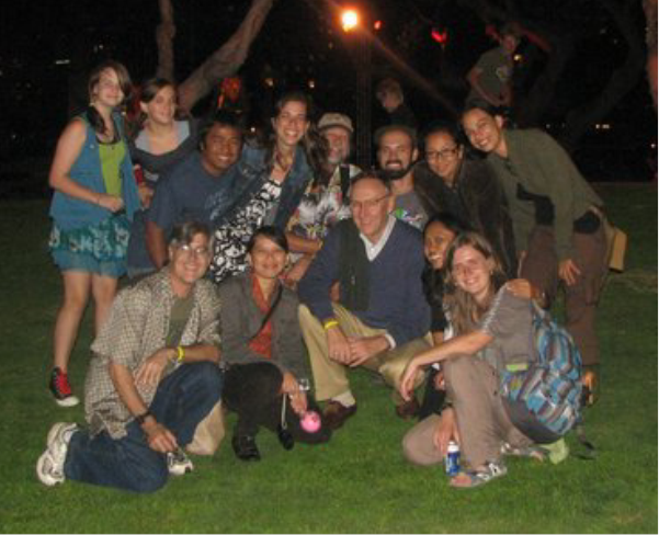
2010 Jun Lead instructor for third year for SCGIS Scholars.
(From the Juniper GIS Newsletter #1 of Jan 2011) “In the past few years, we have become involved the Society for Conservation GIS (SCGIS), which supports GIS work in conservation groups all over the world. One of its missions is to bring scholars from conservation groups around the world to the U.S. to strengthen their GIS knowledge and skills, and to allow them to connect with the larger GIS community by attending the SCGIS Conference and the ESRI User Conference.
Here is a picture of some of the scholars with Jack Dangermond at the 2010 ESRI Conference.
(Photo RIGHT: Scgis 2010 Scholars with Jack Dangermond, John Schaeffer and Charles Convis)
(Photo Below: John teaches 2010 Scholar and now-frequent SCGIS Conference Presenter Gabriel Daldegan)
2011 Jul – First TTT scholar Ceciilia Cronemberger de Faria of Brazil, a 2009 scholar, became the first TTT teacher-trainee.
(Photo Below: Cecilia (center) signs her TTT Trainer Certification papers, with help from Sasha (L) and John (R)

2011 Jul 2011 Scgis scholar Training at UC Davis
(Photo Newly-Certified Trainer Cecilia assists with the 2011 Scholar Training)

2011 Juniper GIS Training Mission Reports:
From the 2011 Juniper GIS Newsletter #4 “2011 Exploring GIS Resources & Education in Africa” http://www.junipergis.com/newsletters/newsletter_1-2012.html
With the generous support of InsideNGO, we are exploring GIS needs and opportunities in Africa. The vision of InsideNGO is to be an international NGO community where operational excellence and professional expertise come together to help change the world. They provide services to support NGO's internationally, and they want to add GIS training as one of the core services they offer to clients. We taught two GIS classes in Washington, DC for some of their clients, and they want to expand and eventually offer classes internationally.
On this trip, we will explore all of our GIS connections in Ethiopia, Kenya and Uganda, meeting with people, teaching classes and making presentations. We will be working with the Jane Goodall Institute to teach a week-long class at the Budongo Forest Reserve in Uganda. While in Uganda we will meet with some former students and do a mountain gorilla trek.
Then we will return to Nairobi to work with Lucy Waruingi who works for the African Conservation Centre and is an SCGIS board member. As a founder and active member of SCGIS Kenya, she has arranged for John to make a presentation to the User Group, and to teach an Advanced GIS class for SCGIS Kenya members at the Regional Center for Mapping of Resources for Development (RCMRD) in Nairobi.
John will be in Addis Ababa, Ethiopia September 7-10, and then in Nairobi, Kenya the week of September 12-17, and then onto Uganda, returning to Nairobi October 1. If you have any contacts in that area that might need GIS training or help, contact John. Email: [email protected]
2011 Sep 7-10 Ethiopia - One-week ArcGIS for Environmental Analysis (EA) course. Taught a ModelBuilder course for Eyob Teshome, an ESRI authorized instructor there in Addis Ababa. InsideNGO is an international organization that provides support services for NGO's around the world. They provided resources for us to explore GIS needs in Ethiopia, Kenya and Uganda. In Ethiopia, John was surprised when his taxi driver even knew what GIS was. The taxi driver, Brook, was impressed to learn John was a GIS "master" and immediately introduced John to Eyob Teshome, an ESRI authorized instructor there in Addis Ababa, who had John teach a ModelBuilder session for Eyob's class. The next day John got a chance to see some of the beautiful countryside with Aweke, a guide from Safari Ethiopia tours. Photos: LEFT: Bleeding heart baboon RIGHT Ancient bridge built by the Portuguese >>>
2011 Sep12 Nairobi Kenya - Advanced class at the Regional Center for Mapping of Resources for Development Nairobi
 Taught a 3-day Advanced class organized by Lucy Waruingi at ESRI East Africa offices, with Patti helping. - 18 students. We covered all our own costs for this. ESRI East Africa offered its computer lab as the location for this two-day class. Lucy Waruingi is a founder of SCGIS Kenya and an active member of SCGIS International, and the students represented the SCGIS Kenya membership and its various conservation organizations. A representative was there from Kenya OpenData to discuss the various types of GIS datasets available in Kenya and the efforts to develop and share information. PHOTOS: LEFT: The Class. RIGHT: Bernard & Lucy on the left; John on the right (Bernard, works for Save the Elephants and was an SCGIS scholar a few years ago. He continues to take John's classes whenever he can
(Photos Below, the Nairobi Kenya Class Group )
2011 Sep20 Uganda - One-week ArcGIS for Environmental Analysis (EA) course for Jane Goodall Institute Budongo Forest Reserve (Photo Below)

2011 Late Sep Uganda - One-week ArcGIS for Environmental Analysis (EA) course for Jane Goodall Institute at the Nyabyeya Forestry College near Masindi. I  had another agency cover my airfare to Africa and JGI covered airfare for me to Uganda from Kenya and provided housing and meals for Patti and I. Patti helped on this class, as well as Phillip Khimuro, a 2011 scholar. It was good to have a scholar helping as this strengthened our connection and helped provide more visibility for SCGIS. -15 students.
John and Patti flew from Nairobi, Kenya to Kampala, Uganda, where we were met by the representatives from the Jane Goodall Institute. Simon and Augustine took great care of us for the week and provided lodging for us at the Sonsa Field Station for chimpanzee research. The Jane Goodall Institute brought together people with a common interest to learn GIS for
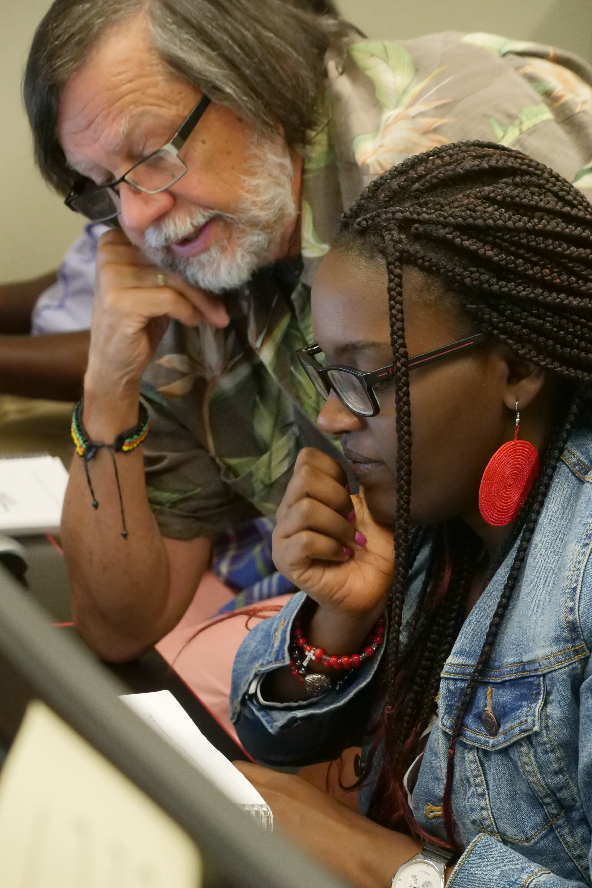
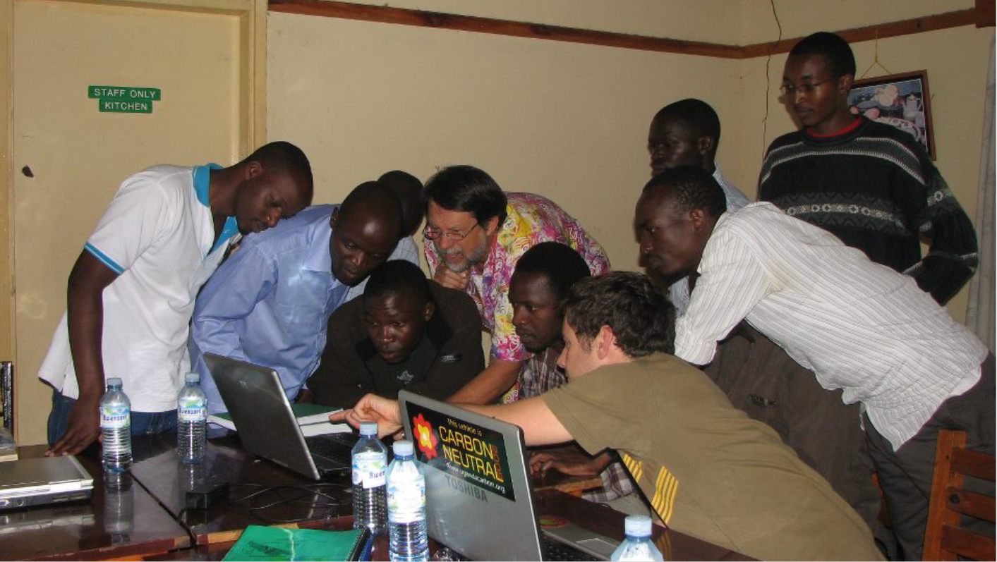
the week. All students were selected because they worked for organizations that impacted chimpanzee habitat in western Uganda. The project goal for these organizations is to create a continuous corridor of habitat that allows the chimpanzees more range in these areas. PHOTOS RIGHT: John, our host, Simon, & Patti. PHOTO BELOW: the Uganda class discovers something interesting on the screen.
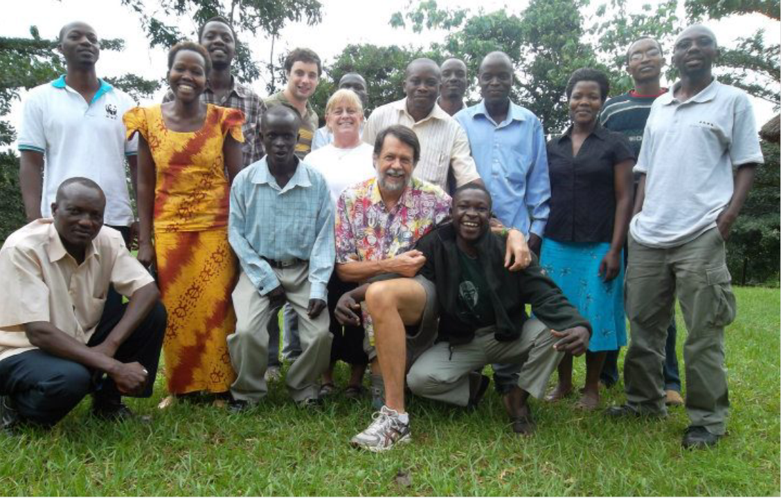
2012 Jun4-15 Kigoma Tanzania GIS training for Jane Goodall Institute in Kigoma, Tanzania. Two one-week classes for JGI organized through Lilian Pintea,  Director of Conservation Science for JGI Africa. This was a great opportunity to teach people how to use GIS to collaborate with all the diverse organizations having an impact on chimpanzee habitat in the area. This was not really an SCGIS linked activity, but I made the connection with Lilian through SCGIS and while there, I was able to promote SCGIS. (PHOTO Class in Kigoma, Tanzania Mother chimp and baby
There were a total of 30 students over the two weeks. Patti Bailey assisted on this course and her help was critical considering the number of students, the language issues, and their computer literacy level. Having her as an assistant allowed me to keep the course moving at a reasonable pace and allowed me a little extra time to help the more advanced students and answer specific project questions.
Another benefit of these classes was that the majority of the students were from JGI partner organizations like the Ministry of Natural Resources and Tourism (5), Local and Regional Governments (11), Tanzanian Department of Forestry (2), The University of Zanzibar (1), and other conservation groups (4).Having all of these students from the various organizations definitely helped further cooperation among these groups, showing them how GIS could be used in problem-solving.
ESRI provided 30 books and 30 90-day license codes for ArcGIS 10, plus 10 evaluation DVDs sent to me as backup. I was able to share the extra DVDs with other people and groups doing conservation work in Tanzania.
JGI provided round trip airfare from Bend to Kigoma, plus all lodging and meals while in Kigoma. They also printed the manuals in-house. This makes the cost of training one student for one week about $225. The JGI funding was from grants for REDD and other projects. Juniper GIS provided 10 days of instruction with one instructor and one assistant, plus about a 40 hours of time revising manuals and coordinating the trip and training.
2012 Jun-July SCGIS Scholar & TTT Training, Davis, CA. June 27 to July 26, 2012
I was the lead instructor for this training, using a more detailed version of the ArcGIS for Environmental Analysis course, along with material from the Juniper Geodatabases and Linear Referencing and Spatial Analyst courses. This year we had 15 scholars.
Karen Beardsley and Leslie Backus provided assistance in the class, with Leslie teaching the GPS module. Besides helping in the class room, Karen provided most of the logistical support and planned most of the outside activities, as well as arranging for home-stays. Since most of us are familiar with this activity, and ESRI’s significant support, I don’t see any need for more detail.
The Juniper GIS in-kind contribution was 12 teaching days, plus 40 hours of course preparation
Training for SCGIS Scholars: SCGIS sponsored 15 scholars this year. The core training took place at UC Davis, with scholars from South Africa, Brazil, Argentina, Uruguay, Nepal, Zambia, Russia, Malawi, and more. Carlos De Angelo, a 2011 scholar from Argentina, returned this year to help teach new scholars and to become a Juniper GIS Authorized Instructor
(Photos: 1. Leslie Backus, John and Carlos DeAngelo plan and prepare the 2012 training. 2 Leslie Backus and Carlos DeAngelo team up to help a scholar)


2012 Jul Second TTT Trainer: Carlos a 2011 scholar from Argentina, becomes the second TTT Trainer.
This was the second year where we brought back a scholar to work specifically to become a Juniper GIS/SCGIS trainer. The candidate this year was Carlos De Angleo, a 2011 scholar from Argentina. Carlos is a very good instructor and was also a large help in class, especially with the Spanish-speaking and Brazilian scholars. At the SCGIS conference Juniper GIS gave Carlos a certificate as an Authorized Juniper GIS Instructor, with authority to teach any of our courses, as well as the normal Juniper GIS teaching shirt. I provided Carlos with all of my 10.0 teaching material at the end of the training, and recently sent him all the 10.1 upgrades. Carlos has already taught one course for 14 people based on the ArcGIS for Environmental Analysis course and has another course planned for next June. I don’t know how to value my material, but one rule of thumb that I, and other instructors use, is that it takes 5 days to produce 1 useable day of classroom material. I provided Carlos with about 15 days worth of material and teacher training. Carlos has already taught one course for 14 people based on the ArcGIS for Environmental Analysis course and has another course planned for next June.” Carlos was also proactive in translating the ArcGIS Course materials into Spanish.
(Photo: Carlos DeAngelo receives his official TTT Certified Trainer Paperwork with help from John Schaeffer (L) and Sasha Yumakaev ®

2012 Oct Brazil Scgis’ first TTT Trainer Cecilia Cronemberger teaches her first class as a TTT in Teresopolis, Brazil, “The same week John was teaching a Juniper GIS class in Nairobi, Kenya (UTM Zone 37 South), Ceciilia Cronemberger de Faria was teaching a Juniper GIS class in Teresopolis, Brazil, (UTM Zone 23 South), and a month later John was teaching in Hawaii, (UTM Zone 4 North). “ Cecilia, a former SCGIS Scholar, became a Juniper GIS Authorized instructor in July, 2011, working with John for two weeks teaching the SCGIS scholars in Davis, California.
For her first class, Cecilia translated the Juniper GIS course into Portuguese and created exercises with local data. Cecilia looks forward to teaching more classes in Brazil.”
2012 Juniper GIS Newsletter4 Juniper GIS/SCGIS 2012 Training Report
“I am writing this to document my activities so that Sasha and Charles can show how the software, books and other support provided by ESRI has helped conservation work globally, and also to fulfill the requirement mentioned by Eric Sandoval for a activity report for SCGIS Board Members. For each activity, I’ll try to quantify the results in terms of beneficiaries, costs, and value as an in-kind donation for my time.
Summary: In 2012, I taught GIS to 83 students in 1-week classes, 15 for a two-week class and 12 for a 1-day workshop, not including the SCGIS conference workshop, in some sort of “volunteer” capacity related to SCGIS. It’s been a lot of fun and I hope to keep doing this. I greatly appreciate ESRI, represented by Sasha, for all the support.
The course taught in most of these classes was ArcGIS for Environmental Analysis, which is an intensive, 5-day course designed to teach core GIS skills using conservation oriented data and scenarios, with an introduction to Spatial Analyst for Habitat Analysis so that students can see how to perform analysis using both vector and raster techniques. Because each group of students has different skill levels, I adjust the pacing and level of detail as needed. For each class, I also include some local data in an introductory exercise, and then work with student data on the final day if time permits.
2012 Oct 8-12, Ezemvelo KZN Wildlife Training, Pietersmaritizburg, South Africa, October 8 – 12, 2012. “Organized by 2012 Scholar Debbie Jewitt
This class was organized by Debbie Jewitt, a 2012 Scholar, for her organization – Ezemvelo KZN Wildlife. This quasi-government agency is responsible for conservation and biodiversity planning in the province of KwaZulu Natal. There were 15 students in the class, all from her organization. Debbie was the class assistant, and she also provided lodging and meals at her house out of her pocket, plus all the logistics, including of getting me to/from airports. ESRI provided 10 books and 17 ninety-day evaluation copies of ArcGIS 10.1.”
2012 Oct 15-19 Mpumalanga Tourism and Parks Agency, “Buffelskloop Nature Reserve, South Africa, organized by 2011 Scholar Mervyn Lotter
This class was organized by Mervyn Lotter, a 2011 scholar, for his organization - Mpumalanga Tourism and Parks Agency, which has the same responsibilities as Debbie’s organization, but for the province of Mpumalanga. There were 21 students in this class, all from Mervyn’s organization, with all working directly in conservation. Mervyn was the class assistant, plus he took care of all the logistics of organizing the class, and getting me to/from airports and to the class location. (Photo Class at Buffelskloof Reserve. ESRI provided 10 books and 24 90-day evaluation copies of ArcGIS. (photo: John lets students take a break for a game drive, (but they must come in early the next day to catch up on the work.)
2012 Oct Brazil The same week John was teaching a Juniper GIS class in Nairobi, Kenya, Ceciilia Cronemberger de Faria was teaching a Juniper GIS class in Teresopolis, Brazil, and a month later John was teaching in Hawaii,
2012 Oct 29 – Nov 3 South Africa Wildlife College, Klaserie, South Africa Organized by Mervyn Lotter and Juniper GIS
This was an entrepreneurial class organized by me, Mervyn, and Patti Bailey. Mervyn suggested that there was a need for GIS training for university students and that they would be willing to pay a modest fee. But as we started planning this, the schedule didn’t work for most university students, so we decided to open the class up to any takers. Mervyn arranged to rent a lab at the South Africa Wildlife College for 6 days, and also arranged for them to provide lodging and meals.
We offered the 5 and a half day class for $575 including lodging in shared rooms and all meals, with an added fee of $30 for a single room. Out of the fees collected, Juniper GIS paid for all meals and lodging for the students, facility use fees, bank transfer fees, and covered the meals and lodging for Patti, Mervyn and I, and for Mervyn’s mileage.
There were 17 people in the class, including 11 from South Africa, 3 from Ghana (2 from the Centre for Remote Sensing and Geographic Services at the University of Ghana), and 1 each from Tanzania, Swaziland, and Sierra Leone. Including the students from Ghana, there were 7 university students; 3 from private organizations, one minister in training, and the rest from non-profit conservation groups. Most of the non-South African students actually paid more in airfare than in class fees.
Mervyn and Patti both assisted in the class, and in the logistics and registration. It was quite a job to keep track of registrations and money collected in two different currencies on two different continents and dealing with so many different agencies. Many agencies needed documentation from Juniper GIS or from the South Africa Wildlife College to obtain permission for paying for the class and or to get visas for South Africa.
The response was more than we thought and next time, we will probably charge more per person, mostly to compensate for all the time spent on logistics, including organizing transport to the class for some of the students. Based on our experience, we will probably try this again; and I also think that this might be a model for SCGIS chapters to organize and help pay for training. ESRI provided 10 books and 19 90-day evaluation copies of ArcGIS.
2012 Nov 3 2011 Scholar Mervyn Lotter becomes the third SCGIS TTT Trainer.
Because Mervyn was willing to assist and work with me for two weeks on the South Africa Wildlife College class, I offered to work with Mervyn on training skills and course presentation skills. Because Patti was also assisting in this class, Mervyn and I could take some time during class to discuss training strategies, course development and evaluating student needs. We continued these discussions most evenings. At the end of the second class, we gave Mervyn a certificate recognizing him as a Juniper-authorized instructor for the ArcGIS for Environmental Analysis class.
2013 For Our Friends in Hawaii (From Juniper early 2013 Newsletter)
The Conservation leader Kimokeo Kapahulehua will speak at the Society for Conservation GIS Conference about harmonious existence with nature and ancient solutions to modern problems. Kapahulehua is a "kupuna," or elder, in the Hawaiian community of Maui. Driven by a mission to improve life for humans and nature, he is a tireless advocate for the preservation of Hawaii's waters, lands, and ancient culture. Watch the exciting trailer for Kapahulehua's video Family of the WA'A. Attend the conference, meet Kapahulehua, and be inspired.
We recently returned from teaching two weeks of classes in Hawaii. As you can see from the photo, we are not too picky about the training space. Kaloko-Honokohau National Historical Park hosted one of the classes in this warehouse-like setting. It was a great training because of the enthusiasm of the people in the class, and their willingness to work at learning new GIS tools and techniques.
While we were in Hawaii, we discovered a great book, Mapping the Lands & Waters of Hawai'i, by Riley M. Moffat & Gary L. Fitzpatrick; published by Editions Limited, ©2004. This book focuses on mapping from 1870 - 1898, when the Kingdom of Hawai'i established the Hawaiian Government Survey. According to its Introduction, it "celebrates the real beginning of the mapping of Hawai'i by and for the Hawaiians." John said about this book, "Being used to things like the PLSS and 'Metes and Bounds' this book provided a good insight into how the government of Hawai'i developed a land mapping system unique to Hawai'i and its culture." Of course, another benefit of this trip was John found the opportunity to purchase at least seven new shirts!
2013 Arcnews Article about the new Train-the-Trainer program:
“To expand the TTT program, in 2013 a new approach was taken, which was to send Schaeffer to the SCGIS Scholars in their home regions to provide the TTT training. This program, for two to four trainees, consists of a three-day advanced GIS class for the trainees and GIS users from local conservation groups, a five-day ArcGIS for Environmental Analysis (AE) class in which the trainees served as helpers and gave some presentations, and three to four days during which Schaeffer and the trainees work together on teaching skills and issues. After reaching out to the SCGIS International Chapters, Schaeffer and the SCGIS International Committee chose SCGIS Russia from among several offers, for this first effort. (https://www.esri.com/esri-news/arcnews/summer14articles/train-the-trainer ) “
2013 Mar 3 John proposes a way to mass-certify many TTT trainers at once "Hi everyone,I am working with the SCGIS grant person to apply for a grant to expand the Train-the-Trainer program. Hopefully most of you know of this program, as we have been bringing back a past scholar the last two years to work with me and become a Juniper GIS Authorized trainer. The purpose of the grant is to create a 3-week program, in some part of the developing world (anyplace other than the US, Canada, or Western Europe), where I will work with 8-10 former scholars, who have taken the 2-week SCGIS training from me, to become new trainers.” We failed to find any funding for the proposed workshop
2013 Jun-Jul UC Davis TTT & SCGIS Scholar Training
 This year SCGIS sponsored training for 21 international scholars, and John was the lead instructor. The core training took place at UC Davis in California with excursions to ESRI UC in San Diego and the SCGIS Conference in Asilomar. All scholars made presentations about their projects at both conferences. Countries represented were Argentina, Armenia, Brazil, Bulgaria, Cameroon, China, Colombia, Democratic Republic of Congo, Indonesia, Japan, Madagascar, Mexico, Nepal, Philippines, Russia, Slovenia, South Africa, Uruguay, Zambia.
2013 Jul John first mentions the idea of a TTT Summit brining back prior TTT trainers in an email
“Returning Instructors: You mentioned something about bringing back one of the previous trainees to help in the scholar training and as a refresher for their own skills. I think this would be good as this person would be a great resource for helping with projects and in class, and also it would be good for them to do some refresher work. And, it would be a good way to keep up the scholar connections. “
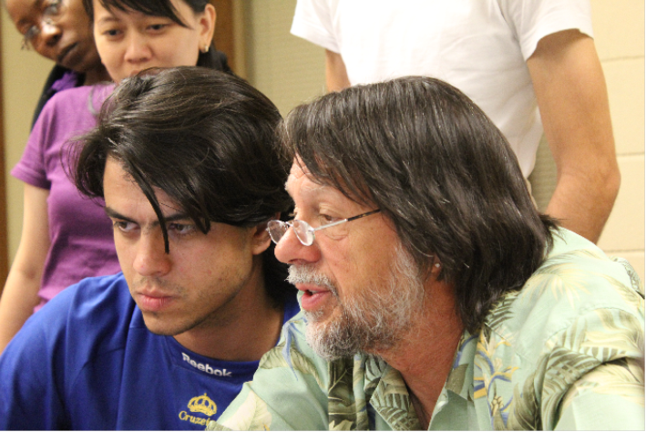
2013 John's trip to Russia (From Juniper 2014 Newsletter #1)
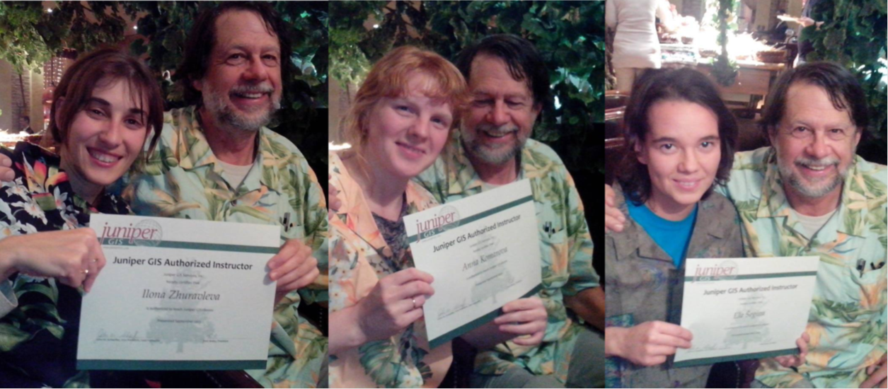
John taught two classes in Russia last September, for Greenpeace Russia and other conservation groups, as part of SCGIS Russia’s first ever “Regional Conference on Conservation GIS” During these classes, he trained three new Juniper GIS Instructors, including Ilona Zhuravleva & Anna Komarova, from Russia and Ela Segina* from Slovenia. He also made presentations at the SCGIS Russia Conference in Moscow, where he gave away two of his Hawaiian shirts.
After the classes, John visited St. Petersburg and some smaller towns around Moscow. Since he has a degree in Slavic Studies, this was a great chance to see some of the places he studied as an undergraduate. While in Russia, John was able to stay with SCGIS scholars and their friends, who were all great hosts, and made his trip especially memorable. (*Our apologies to Ela. The program we use for the newsletter would not let me use the special characters in her name.)
(Photo Left: John's presentation announced in Cyrillic)
(Photo Below L-R Ilona Zhuravleva, Anna Komarova and Ela Segina receive their TTT Training Certificates)
2014 Apr 4 Formal funding request for the new TTT Program goes to Esri
Below is the formal request for creating the new SCGIS global train-the-trainer program that I mentioned as one of my top 3 must-do's for SCGIS for 2014. Although based on a long history of John Shaffer's support to SCGIS and some great success stories with prior trainers, we are treating this as a startup effort to fund over a 2-year development cycle, hence my mention of opportunities for 2014 thru 2015. Given the growing distributor interest, we have great hopes for their involvement to help make this self-sustaining. As usual, I am deeply indebted and grateful for your ongoing support to SCGIS. I hope you'll agree that this new program presents a valuable opportunity for Esri to play another leveraged role in growing international conservation GIS capacity with our tools. regards, Charles Convis, esri conservation program
2014 TTT FUNDING PROPOSAL
Request for $20k core funding to establish new Esri-SCGIS-Juniper GIS global training program for 2014 thru 2015
Train the trainer (TTT) is a partnership between SCGIS and John Shaffer of Juniper GIS that began in 2009, as an extension to the core UC Davis/SCGIS scholarship experience. In TTT a single outstanding scholar from prior years, who has demonstrated ongoing SCGIS leadership & GIS skill, is funded to return to UC Davis. There they become a certified trainer for the full catalog of Juniper conservation ArcGIS classes, and help teach the new group of scholars with John Shaffer. Esri and UC Davis already support this program from existing resources. What this proposal is requesting is support for globalizing the TTT program so we can certify more than 1 new trainer per year. (John has done similar train-the-trainer work for the US National Science Foundation and several workshops for the Jane Goodall Institute in Kigoma and Uganda)
Past trainer certifications and subsequent successes:
-2011 Cecilia Cronenberger, SCGIS Brazil, Trained and Certified at the UC Davis Program. has since taught conservation GIS in 8 classes to over 100 students.
-2012 Carlos DeAngelo, SCGIS Argentina, Trained and Certified at the UC Davis Program. has since taught 2 classes to 29 students, several more classes planned for 2014.
-2013 Global In-country program begins (unfunded) in Russia: Ela Segina, Ilona Zhuralvleva and Anna Kamarova are all given initial trainer training by John at an SCGIS workshop cosponsored by SCGIS and Greenpeace Russia, but resources were insufficient to get all 3 to full certification in all ten conservation GIS classes taught by Juniper).
Business model: The train-the-trainer program piggybacks atop SCGIS training workshop events organized by international SCGIS chapters. They obtain their own funding and sponsorship from local NGO organizations, SCGIS itself, Juniper GIS, and lately, Esri Distributors. Train the Trainer is an added cost requiring more intensive interaction and one-on-one time with the candidate trainers that SCGIS cannot cover from local resources. We feel TTT presents an appropriate opportunity for Esri Redlands to become part of this exciting new program as a core sponsor, to help it graduate from an ad-hoc workshop opportunity to a more formal, strategically managed capacity building program for SCGIS which can more effectively take advantage of growing Distributor interest in SCGIS and conservation GIS training.
If funded, Charles Convis, Sasha Yumakaev, Karen Beardsley (UC Davis) and John Shaffer will act together to plan and manage this program on behalf of Esri and SCGIS, reviewing opportunities, organizing Distributor support, allocating funds carefully and strategically, and compiling short reports and additional articles back to Esri (one is already in the works for the current issue)
We are requesting a flat $20k endowment to begin this program, to be allocated among the following current opportunities and help create new opportunities over the rest of 2104 thru 2015.
Current Opportunities and estimated costs
Fiji: 2 week conservation GIS workshop sponsored by Global Visions International in May 2014. If a TTT component is funded, in cooperation with SCGIS New Zealand and the new SCGIS Hawaii, then a trainer could be certified there to help start a new SCGIS Fiji for about $5k
Colombia: The Esri Distributor has already offered to cover all local expenses and logistics for a conservation GIS training workshop if we can find a way to fund John’s airfare. This will be a mix of commercial/govt students selected by the distributor who will be charged nominal course fees of $250 per week. We have 3 strong SCGIS trainer candidates selected who could be included and certified for $9,200
South Africa: 3 week workshop in November organized and sponsored by SCGIS, South African National Biodiversity Institute and others. 2 trainer candidates identified who could be included and certified for $6400. (This class corresponds in timing and location to what Rina Kurnia could support, so that we can add the same successful 3-day cloud training segment we offer in UC Davis to this group in South Africa. I'm working with Dean Angelides to try to get her approved to support this event)
Indonesia: 3 week workshop in early 2015 organized by SCGIS. 3 trainer candidates are identified and costs for their travel and certification will be $8,950.
2014 May, Suva, Fiji basic & advanced conservation gis courses (From Juniper Newsletter)
 In May 2014, Juniper GIS partnered with Global Visions International (GVI)to offer ArcGIS training in Suva, the capital of Fiji. The class was well-attended with people from the U.S., Nauru, and Tonga, as well as, local Fijian government and NGO people doing conservation work. The Wildlife Conservation Society office in Fiji provided the core group of people to get this training started. This seems to be a great place to gather South
  Pacific people for GIS training, and we hope to offer more classes there in the future.
One student commented, "I would like to take this time to express my deepest appreciation for conducting such a worthwhile, relevant and very very useful and applied two weeks training last month. For me personally,
the training was one of the best training so far. I and all the others were privileged to be the first from the Pacific Region to participate in this training." -- Kasaqa Tora, National Trust of Fiji
(Photo Below: The Conservation GIS Training Course Class in Suva (Photo Above RIGHT: Patti & John in Suva. )

2014 Jun-Jul John leads the 2014 UC Davis TTT & SCGIS Scholar Training
(Photos: 2014 Scholars on the Trans-Bay Golden Gate Bicycle tour organized by John Schaeffer each year. Photos courtesy of Sasha Yumakaev))

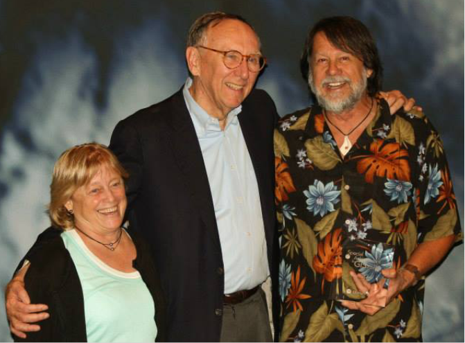
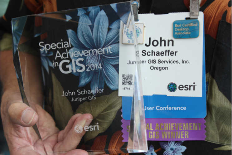
2014 July: John Receives Special Achievement Award from ESRI
From Esri Press Release: “John Schaeffer received a Special Achievement in GIS (SAG) Award at the Esri International User Conference in San Diego, California held July 16, 2014. This award acknowledges vision, leadership, hard work, and innovative use of Esri's geographic information system (GIS) technology. John teaches GIS internationally, using Esri ArcGIS technology to help GIS users develop skills to solve problems and analyze issues in their home countries. He works closely with the Society for Conservation GIS (SCGIS) to train international scholars and has recently developed a program to "Train the Trainer," developing GIS training capacity in countries around the world. His students are studying, analyzing and developing data to help with issues of wildlife, natural resources, population growth, climate change, agriculture and telecommunications. In recent years, John Schaeffer has taught classes in Mexico, Kenya, Uganda, Tanzania, Ethiopia, South Africa, Fiji, and Russia. Each year, the "Train the Trainer" program selects former students to become qualified instructors to develop GIS training capacity for conservation and international aid work throughout the world. Read more about the "Train the Trainer Program", on page 8, of the Summer issue of ArcNews. Juniper GIS currently has authorized instructors working in Russia, Slovenia, Scotland, Honduras, Ecuador, Argentina, Brazil, Bangladesh, Bhutan, and South Africa.”
"The SAG Awards identify the organizations and people that are using the power of geography to improve our world and drive change," says Esri president Jack Dangermond. "At Esri, we are always deeply inspired by the passion and innovation of our users. They deserve recognition for both solving their communities' greatest challenges and for their invaluable contributions to the continued evolution of geographic science."
From the Juniper Newsletter: “Juniper GIS and John have been getting some good recognition lately. John Schaeffer, the Lead Instructor for Juniper GIS, received a Special Achievement in GIS (SAG) Award at the Esri UC in San Diego, California held July 16, 2014. This award acknowledges vision, leadership, hard work, and innovative use of Esri's geographic information system (GIS) technology. During the awards ceremony, John was one of only two people out of 170+ awardees singled out by Jack Dangermond for his work.
This award was in recognition for all the ArcGIS teaching John does internationally, and for Patti for letting him spend all that time away from home. In recent years, John has taught classes in Mexico, Tanzania, Uganda, Kenya, South Africa, Fiji, and Russia. On our website, we call this “Destination Training” but there is a larger purpose than just having classes in interesting places. Our students are studying, analyzing and developing data to help with issues of wildlife, natural resources, population growth, climate change, agriculture and telecommunications, and anytime one our US clients takes part in these classes, they are helping to support this type of training and these students. And the joy I get out of teaching keeps me going to do these classes.

John works closely with the Society for Conservation GIS (SCGIS) to train international scholars and has recently developed a program to “Train the Trainer” to develop GIS training capacity in countries around the world. Each year, the “Train the Trainer” program selects former SCGIS Scholars to become qualified instructors to develop GIS training capacity for conservation and international aid work throughout the world. Juniper GIS currently has authorized instructors working in Russia, Slovenia, Scotland, Argentina, Brazil, and Bangladesh.”
For more on the SAG award and John’s work see: http://events.esri.com/conference/sagList/…
For more information about the 2014 Special Achievement in GIS Award winners, including project information and photos, please visit esri.com/sag.
2014 Newsletter2: LAST JUNIPER NEWSLETTER.
GIS Instructors Teaching on 3 continents: Africa, Asia & South America (From Juniper Newsletter)
On October 20th of this year, Juniper GIS instructors were teaching classes simultaneously in South Africa, Argentina, & Bhutan. On that day, Karen Beardsley from Davis, California, who became a Juniper Authorized Instructor in 2013, and M Abdullah Abu Diyan(Diyan), from Bangladesh, who became a Juniper Authorized Instructor in 2014, were teaching in Bhutan. A few hours later, as the sun rose in South Africa, John was starting a class near Kruger National Park, working with Mervyn Lotter, who became a Juniper Authorized Instructor in 2014. And about eight hours after that, as the sun rose in Argentina, Carlos De Angelo, who became a Juniper GIS Authorized Instructor in 2012, was starting a class in Patagonia. Juniper GIS has truly become an international player in Conservation GIS training!
2014 OCT: The class in Bhutan was taught at the Royal Thimphu College (RTC), situated in a serene forested area nestled in the mountains about 20 minutes from Thimphu, the capital of Bhutan. The classes Karen and Diyan taught were also in conjunction with the National GIS Exposition, the launching of the Bhutan Geospatial Portal by Her Majesty the Gyaltsuen, the lovely 24-year old Queen of Bhutan. Karen and Diyan also helped RTC install and initiate their Esri university site license. Some of Karen's expenses were covered by an award from the Esri Education Ambassador program and Diyan's expenses were covered by SCGIS. Also see this Arcnews Article on Karen's 2014 Course in Bhutan:
(Photos: LEFT Karen Beaardsley (seated front row center-right in pink shirt) next to SCGIS TTT Trainer Diyan (on her right) and Esri Trainer and longtime SCGIS Scholar Program Online GIS Trainer Canserina Kurnia (Karen's Left) with the participants of their Cloud GIS Training course at Royal Thimphu College, Bhutan) RIGHT: Scgis Trainer Diyan (L) and Karen Beaardsley (R) at the beginning of their Conservation GIS Training Course.


Carlos's class, Herramientas de SIG para Ecologia y Conservacion to use the Spanish name, was taught at La Pampa, Northern Patagonia, as a postgraduate course. Carlos's course used Juniper GIS material for the core part, supplemented with Carlos's own material.It was hosted by the National University of La Pampa and the Center for the Study and Conservation of Birds of Prey. It included a short visit to a provincial reserve where it is possible to see the vast Patagonian steppe and its most incredible sunsets.

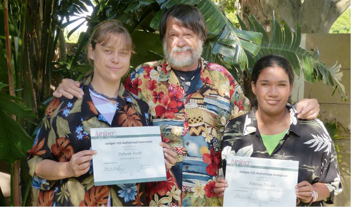
2014 South Africa Classes & Training Trainers The class in South Africa, ArcGIS for Environmental Analysis, was taught at the Southern African Wildlife College, just outside of Kruger National Park, and was taught to people from several conservation groups in the region. This is the second class Juniper has taught there. It's always nice to see giraffe and impala as you walk around the campus. After teaching the class at the Southern African Wiidlife College, John and Patti visited Kruger National Park and then Victoria Falls in Zambia. On the way back from Zambia, we ran into Griffin Kaize Shanungu, a 2014 SCGIS Scholar from Zambia in the Johannesburg Airport. It is great to run into and work with SCGIS Scholars from all over the world, it shows the reach of SCGIS. Then we went to Cape Town, where John taught two weeks of classes at the Kirstenbosch National Botanical Garden, which lies at the base of Table Mountain. Besides people from South Africa, there was a student from Nigeria and a student from Tanzania who had taken a Juniper GIS class in Kenya in 2007. As part of the two weeks of classes, John worked with two former SCGIS Scholars, Debbie Jewitt and Fahiema Daniels to become Juniper GIS Authorized Instructors through our Train-the-Trainer program.
(Photo Below: Debbie Jewitt (L) and Faheima Daniels (R) receive their formal TTT Trainer Certificates
(Photo Below: the 2014 Conservation GIS Training Class of the Southern African Wildlife College
2016 Feb TTT training in Colombia.
Dates: TTT Training - ArcGIS for Environmental Analysis January 25-29 and Advanced Topics for ArcGIS, February 1-5 at the Universidad de los Andes in Bogota. This was sponsored by the university as a continuing education class, where they advertised the class for a fee in order to pay for the course. The university paid me a $2,500 fee and covered lodging and meals. There were 41 students total for both classes.
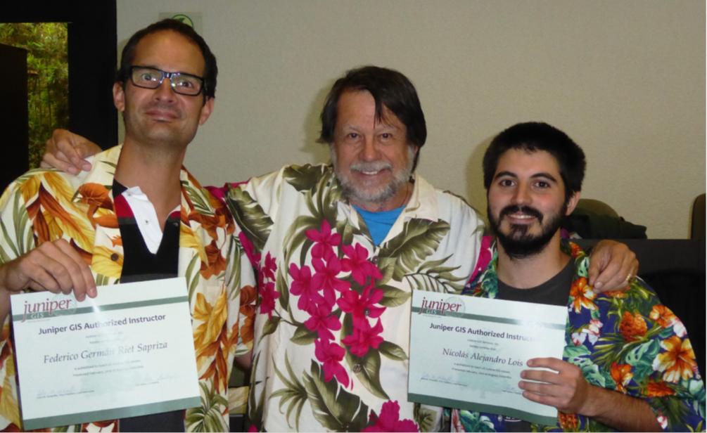
TTT Trainees: The two trainees were Federico Germán Riet Sapriza, a 2012 Scholar from Uruguay who was the primary local organizer and was teaching biology at the university at that time; and Nicolás Lois, also a 2012 Scholar, from Argentina.
Notes on Photos: Photo1 – Students and us at the end of the last class. Photo 1 Federico, John, and Nico in Juniper shirts and with their certificates. Photos courtesy John Schaeffer)
2016 Jun-Jul John Schaeffer is Lead instructor for UC Blue Oaks Ranch Reserve TTT & SCGIS Scholar Training
Current Events and News Media, http://www.blueoakranchreserve.org/in-the-news.html
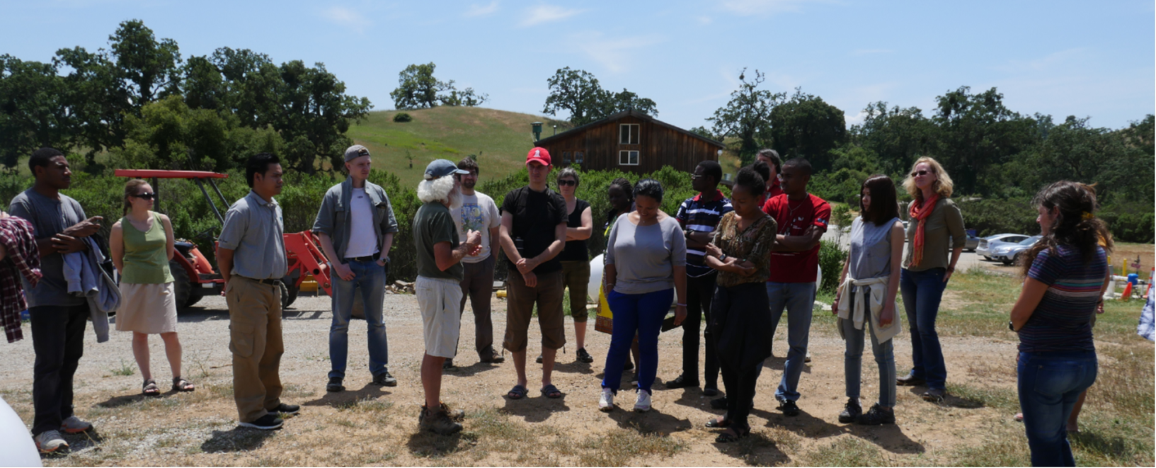
May 29, 2016 Article: The World of GIS has arrived to Blue Oak Ranch Reserve
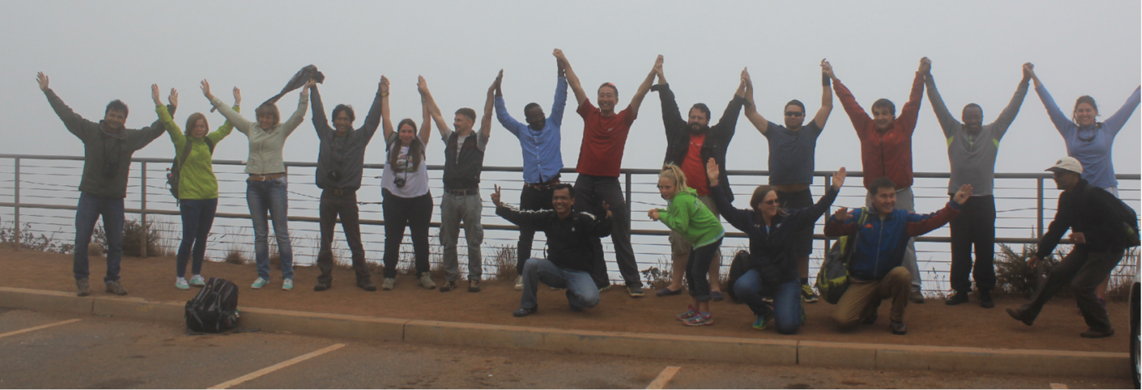
16 International scholars and 5 instructors have gathered at BORR on May 25 for a month of hands on training in the use of Geographic Information Systems for conservation. These courses are provided jointly by Society for Conservation GIS, Juniper GIS, ESRI, UC Davis Information Center for the Environment, and UC Berkeley Blue Oak Ranch Reserve
(photo 1: The 2016 was hosted by Dr. Michael Hamilton, (center) appointed director of the newest and largest of the University of California Research Reserve, the Blue Oak Ranch Reserve (BORR)
https://ucnrs.org/mapping-for-conservation/ 2016 June 28 “Mapping for conservation” Article By Kathleen Wong
Global reach: This June, conservation professionals from around the world have come to the NRS’s Blue Oak Ranch Reserve east of San Jose to sharpen their GIS skills. Armed with their own data and mapping projects, the sixteen scholars hail from fifteen different countries ranging from Cameroon to Uruguay, Belarus to Congo, Cambodia to Venezuela.
(photo 2: An aspect of the Scholars program dating back to its origins is the provision of recent-but-used laptops to every scholar, many of whom were previously struggling along with ten-year old computers or worse)
The 2016 Conservation GIS scholars gather before the Blue Oak Ranch barn with Charles Convis, cofounder of workshop sponsor Society of Conservation GIS. The scholars include Andina Anastasia Krey (top row, far left), Ricardo Sandi Sagot (top, third from left), Iurii Strus (top, far right), Maholy Ravaloharimanitra (bottom, second from left) and Cintia Giesele Tellaeche (bottom, third from left). Image credit: Mike Hamilton

2016 Jul TTT training in Cameroon.
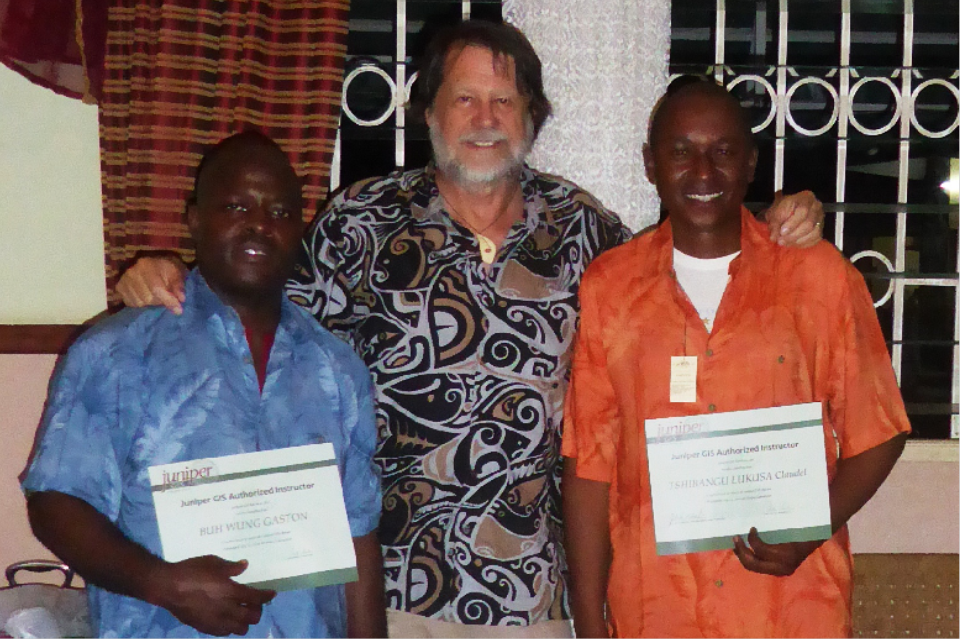
Dates: TTT Training - ArcGIS for Environmental Analysis July 11-15 and Advanced Topics for ArcGIS, July 18-22 in Limbe, Cameroon. The class was initiated by Buh and there was EFN funding for the WWF participants. There were 25 students total for both classes from about 10 different conservation groups.
TTT Trainees: The two trainees were Gaston Buh Wung, a 2009 and 2013 Scholar from Cameroon who was the primary local organizer; and Claudel Tshibangu Lukusa, also a 2013 Scholar, from DRC.
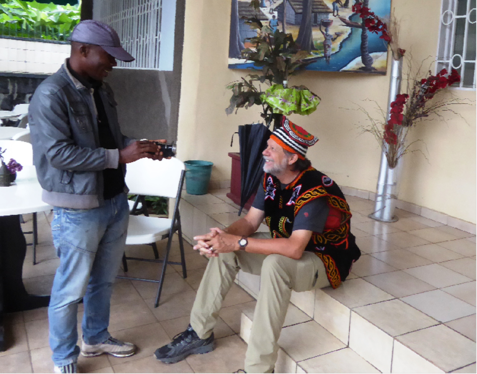
(Photos: 1. Buh Gaston and Claudel Lukasa happy to be certified as TTT Trainers. 2. A local TV reporter came to the last day of class and interviewed John and Buh about the class and conservation GIS. “I was wearing a traditional garment Zouh made for me.” Photos courtesy of John Schaeffer
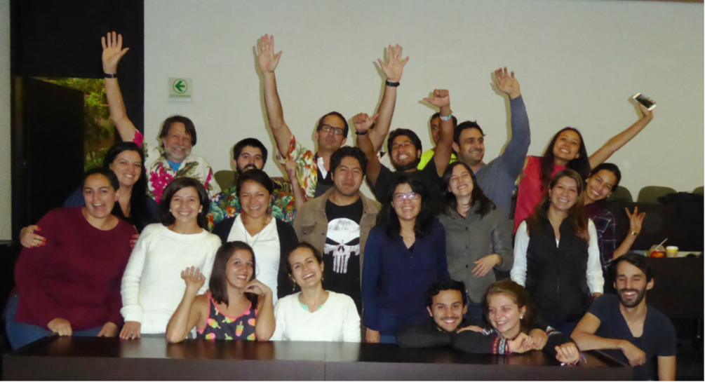
2016 Oct TTT training in Uruguay & Argentina
Dates: TTT Training - ArcGIS for Environmental Analysis October 3-7 and Advanced Topics for ArcGIS, October 10-14 at the University of the Republic – East Region University Center in Rocha, Uruguay. There were 23 students in this class from several conservation, university, and government groups. This was a Fulbright project, with Mariana Ríos Balletto, a 2013 Scholar from Uruguay, being the primary organizer.
Non-TTT training in Uruguay - a 3-day advanced workshop in Montevideo at the National System of Protected Areas - National Directorate of Environment office. This was mostly for their staff, and Cata, one of the trainees, helped me in this class. There were 15 students in this class and a total of 38 for both classes.
Non-TTT training in Argentina - a 3-day advanced workshop in Bariloche, Argentina. Since Patti and I were going to Argentina, visiting with some former scholars, I offered to do a class for Alejandro Vila and WCS-Chile. WCS-Chile paid me $750 for the 3 days, out of which we paid for our hotel and meals. There were 10 students in this class and a total of 48 for all three classes I taught in South America.
TTT Trainees: The two trainees were Caterina Dimitriadis Pampin, a 2016 Scholar from Uruguay; and Diana Marisol Paredes Olmedo, a 2015 Scholar, from Ecuador.
Funding: Almost all my costs were covered by Fulbright; the TTT costs were $3,967 and came from the funding that Jack provided.
Photo1: TTT Candidates Diana Olmedo (L) and Caterina Pampin (R) as newly-certified TTT Trainers Photos courtesy of John Schaeffer
Photo2: Cata helps teach the Advanced class in Montevideo covering Cartographic Modelling


2017 Jun-Jul UC Davis TTT & SCGIS Scholar Training
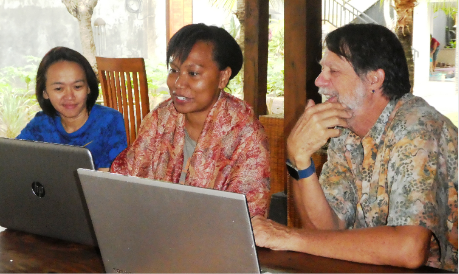
2017 Oct TTT training in Bali
Dates: TTT Training - ArcGIS for Environmental Analysis October 9-13 and Advanced Topics for ArcGIS, October 16-20; held at the Indonesia Australia Language Foundation, located in Denpasar, Bali. There were 14 students who took both classes. 8 students were from WCS, including one from Uganda, and the rest from several conservation, university, and government groups, including US AID. Rina came down from Singapore to do 2 days of Web GIS training, with her expenses out of her own pocket and from course revenue.
TTT Trainees: The two trainees were Andina Anastasia Krey (Tasya), a 2016 Scholar from Indonesia; and Lucy Peter Liew, a 2017 Scholar, from Malaysia. Tasya was the prime organizer for this class and handled all the local arrangements.
Funding: This was a completely self-funded class.
Photo 1: the Bali Conservation GIS TeachingTeam2017_Tasya, Lucy John, Rina – The instructors.Photos courtesy of John Schaeffer
Photo 1: Tasya, Lucy John preparing for teaching the class

2018 Jun-Jul UC Davis TTT & SCGIS Scholar Training
(Photo1 : 2018 TTT Trainer Aaria Waitere helps out at UC Davis Scholar Class
Photo 2 TTT Trainers Mervyn, Aaria and John prepare for the class

2018 Nov TTT training in Chile
Dates: TTT Training - ArcGIS for Environmental Analysis November 5-9 and Advanced Topics for ArcGIS, November 12-16; held at the Böll Foundation in Santiago, Chile. There were 15 students in the first class and 13 in the second class. Most of the students were from WCS, but one was a doctoral student I had met in Davis.
TTT Trainees: The two trainees were Alejandro Rubén Vila, a 2014 Scholar from Argentina; and Johanna Prüssmann, a 2017 Scholar from Colombia. Alejandro was the primary organizer and while he lives in Argentina, he has been working with WCS-Chile for several years as their chief science officer.
Additional Presentations: I was invited by the Centro de Observación de la Tierra, Hemera, de la Universidad Mayor, through a connection made by Janet Nackoney, to do a presentation on Coordinate Systems. Before I went into the presentation, I presented about 10 slides on SCGIS and the TTT program. I will attach the invitation.
Photo 1: the Chile Conservation GIS TeachingTeam2017_Ale, Johanna and John – The instructors. Photos courtesy of John Schaeffer
Photo 2 EndOfClass – Students and instructors with certificates


-
 Anonymous User