- Home
- :
- All Communities
- :
- User Groups
- :
- Conservation GIS
- :
- Documents
- :
- CONS GIS HISTORY: National Cons GIS Russia Confere...
- Subscribe to RSS Feed
- Mark as New
- Mark as Read
- Bookmark
- Subscribe
- Printer Friendly Page
CONS GIS HISTORY: National Cons GIS Russia Conference 2013
CONS GIS HISTORY: National Cons GIS Russia Conference 2013
National Conservation GIS Conference, Russia, 2013
Organized by a collaborative partnership including SCGIS Russia, ESRI-CIS Russia, Greenpeace & Transparent World, with extensive pre-conference workshops by Juniper GIS/TTT Trainer John Schaeffer xHistory xTTT

Excerpts from the Official Conference Webpage on the 2013 Conference
http://gis-lab.info/qa/scgisconf-2013.html
Conference of the community of environmental GIS in Russia, Sep 28-29, 2013
Theme: The use of non-profit and scientific organizations of GIS-tools in environmental protection
Announcement: “ Friends! In Autumn 2013, the first practical conference with the international participation of the community of environmental GIS in Russia "Using GIS and Earth Remote Sensing Data for Nature Conservation" , dedicated to the use of various GIS technologies for nature conservation, will be held. The main goal of the conference is the creation of an active GIS community in Russia and the CIS countries.
Conference participants
Representatives of non-profit public organizations and educational institutions involved in environmental projects, employees of protected areas and anyone interested in using GIS tools in nature conservation are invited to participate. We are also waiting for the members of SCGIS and those who have ever applied for participation in the fellowship program of the Community Environmental Conservation GIS.
Conference tasks
To enable non-profit organizations, scientific institutions and practitioners involved in practical nature conservation to discuss application issues and share experience in using GIS technologies in their work, gain technical skills and theoretical knowledge on using GIS tools in environmental projects, discuss current state and ways to further GIS community development for nature conservation in Russia and CIS countries.
“At the conference, a lot of time is devoted to technical master classes from Juniper GIS (in English and Russian), ESRI CIS, RDC ScanEx, NextGIS. Master classes are a unique opportunity to get acquainted with the possibilities of web services and software that are most often used in environmental projects. Master classes teachers are leading experts of Juniper GIS, ESRI CIS, ITC ScanEx, NextGIS.
Excerpts from John Schaeffer’s Mission Report in support of this conference and TTT trainers
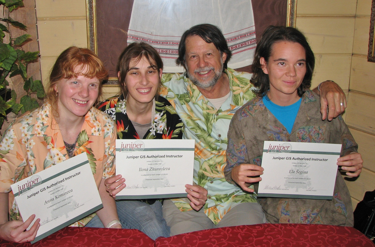
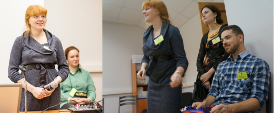
“Three new SCGIS Train-the-Trainer Teachers were certified at this event, Anna Komarova, Ilona Zhureleva, and Ela Segina (L-R pictured below with John. Photo courtesy John Schaeffer)
Excerpt from John Schaeffer’s Report:
Dates: September 11 through September 20 for training; then the SCGIS Russia Conference September 28-29.
TTT Trainees: Ela Šegina a 2013 SCGIS Scholar from Slovenia who has been working primarily in Croatia; Ilona Zhuravleva, a 2011 Scholar from Russia; and Anna Kamarova, a 2012 Scholar also from Russia. Ilona and Anna are both from Greenpeace Russia and were the main organizers of the training.
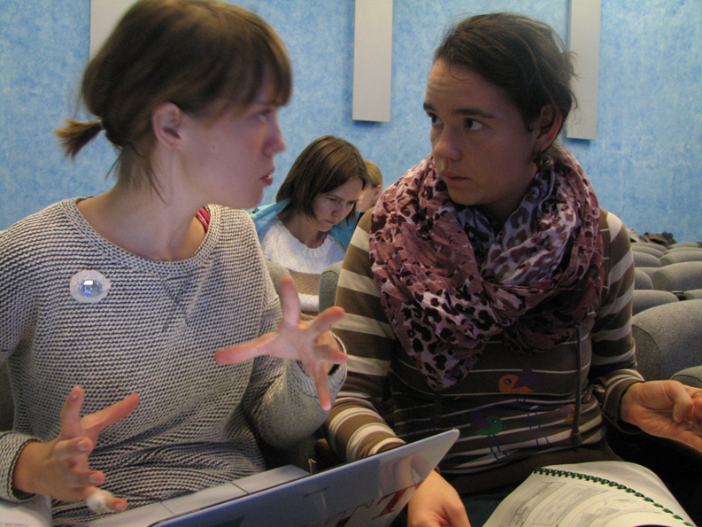
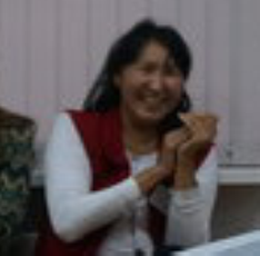
(Photo: Ela helping Evgeniya Elkina, an SCGIS 2015 Scholar, courtesy John Schaeffer)
Classes and Presentations: I taught a 3 day Advanced ArcGIS: Productivity, Geoprocessing, and Analysis class September 11-13 for 7 students, including another 2013 SCGIS Scholar, Alexandra Loshkareva from Transparent World. The purpose of this class for the trainees was to review the course material, and prepare for teaching the next week.
On Saturday, September 14, for what was the Moscow equivalent of Earth Day, Ilona arranged to have us do a presentation on “What is GIS” plus some information on what Greenpeace was doing and on my international training and the Scholars program. This was held at the Russian Youth Library, who also hosted our class the following week.
September 16-20 I and the Trainees taught the 5-day ArcGIS for Environmental Analysis class, which I consider my “Core GIS” class for 16 students, for a total of 23 new students trained on this trip.
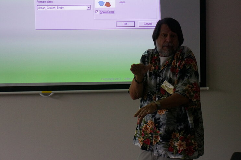
(Photos, John Schaeffer Teaching. courtesy Ilona Zhureleva)

Conference: Our last activity on this trip was the SCGIS Russia Conference September 28-29, organized by Anna and Ilona and supported and hosted by ESRI CIS, the ESRI international dealer for Russia. The manager of this company, Olga Serebryannaya, was very supportive of this conference. Ela had to return to Slovenia before the conference, but Ilona, Anna, and I all did presentations during the conference, and at the Plenary session, and along with Sasha Yumakaev, we all made short presentations on SCGIS, the scholars program and on the TTT program.
Funding: The SCGIS Board gave Juniper GIS $2,500 and the Scholars in Russia provided home-stays for me and Ela, the Trainee from Sloviena. After paying for airfare, visa, meals, metro, etc, and helping my host with food money, I spent about $1,000 out of pocket.
Juniper Contribution: 8 days of training @ $2,000; 5 days of prep @ $750; 5 days of working with Trainees @$750 a day, out-of-pocket @ $1000 for a total of $24,500.
This was the first TTT outside of Davis and since then I have changed the format of these courses to include 2 full weeks of training, with me meeting with the Trainees 2 days in advance to start their training. Then they do about 3 lectures during the first week, which is the ArcGIS for Environmental Analysis class. The during the weekend, the trainees prep for doing 1 or 2 lectures during the second week’s class, which is called Advanced Topics for ArcGIS. This includes 2 days of Geodatabase and Linear Referencing, 1 day of ModelBuilder, and 2 days of Spatial Analyst.
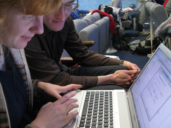
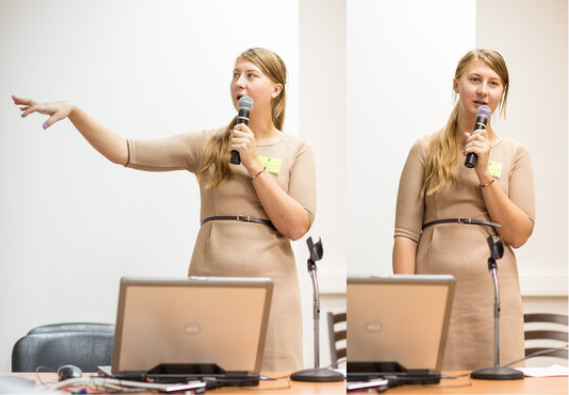
(Photos: Anna helping workshop students)
 .
.
MORE Excerpts from the Official SCGIS Russia Chapter Webpage on the 2013 Conference
CONFERENCE AGENDA
Opening of the conference, Ilona Zhuraleva
Plenary Session
Alexander Yumakaev (SCGIS advisory council member, ESRI Conservation program) "What is SCGIS?"
John Shaeffer (Principal & Senior GIS Analyst for Juniper GIS) "Juniper GIS education program for conservation worldwide"
Olga Gershenzon (ScanEx RDC Vice-President) "The Importance of Remote Sensing Data in Nature Conservation Projects"
Alexey Yaroshenko (Head of the Forest Department of Greenpeace Russia) "GIS Technologies for Monitoring Forestry Activities"
Dmitry Aksenov (Director of the Transparent World Non-Profit Partnership) "Spatial technologies and civil societ
Maxim Dubinin (CEO of "NextGIS") "Is life possible on Mars GIS in the protected areas"
Conference organizers
Сообщество природоохранных ГИС (Society for Conservation GIS, SCGIS) An international organization that brings together GIS professionals working in the field of nature conservation and education. One of the main tasks of the organization is building a GIS community, as well as training and supporting individuals and organizations using GIS and scientific approaches to the protection of natural and cultural objects.
ESRI CIS The main task of Esri CIS (ESRI CIS) is the distribution of Esri geo-information technologies. The company provides sales and technical support for software products, user training and consulting services, conducts seminars and conferences, provides support to universities and research centers in the CIS countries. The company assists environmental organizations in obtaining ESRI software, as well as in holding conferences and seminars.
Greenpeace Russia An independent international organization whose goal is to preserve nature and peace on the planet through changing people's attitudes towards the natural wealth of the Earth. The work of Greenpeace is guided by the principle of independence, including information. Therefore, GIS technologies and remote sensing data in the organization’s projects have been used regularly since the late 90s, especially often in the area of forest conservation and pollution monitoring.
Juniper GIS A company that provides ArcGIS training services worldwide. John Schaeffer is a GISP-certified GIS Professional (GIS Professional) GIS specialist with more than 24 years of experience in theoretical and practical courses, a member of the GIS Conservation Society (SCGIS) and a regular teacher of SCGIS training courses since 2009.
ScanEx RDC ScanEx Engineering and Technology Center (ScanEx RDC) is a Russian company providing a full range of services: from reception to thematic image processing of the Earth from space. Center specialists offer the most advanced solutions in the field of operational satellite monitoring, in particular, the company has created a system of geoportals, which are an effective tool for managing territories based on updated information about the Earth from space.
NextGIS NextGIS LLC is a commercial company that builds its business around open source software, open data and geoinformatics methodologies. The NextGIS team is represented by the best specialists in open GIS. It was the company's specialists who began to develop open GIS in Russia and continue to actively promote them in our country and in the world as a whole.
Non-profit Partnership "Transparent World" Implements projects in the field of using images of the Earth from space in scientific and applied research, education, design, tourism and local history. The partnership's activities are aimed at expanding and simplifying access to space information on the state of the Earth and at promoting its use for management decisions. The mission of NP “Transparent World” is information support of environmental organizations through gis technology, satellite imagery and the Internet.
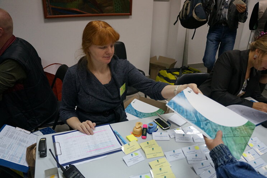
(Photo: LEFT: Scgis Russia Chapter Leader and 2009 International Scholar Anna Komarova helps with Conference Organizing)
(Photo: RIGHT Scgis Ukraine Chapter Leader and 2011 International Scholar Roman Sizo helps with Conference Registration)

2013 Conference PAPERS BY SCGIS RUSSIA CHAPTER MEMBERS:
http://gis-lab.info/qa/scgisconf-2013.html
Conference of the community of environmental GIS in Russia, 2013
Session: "Experience in the use of geographic information technologies in the work of environmental organizations."

Using GIS technology in Greenpeace projects. Ilona Zhuravleva. . . [email protected] Greenpeace Russia, Moscow Russia
(Scgis 2009 Scholar, https://community.esri.com/docs/DOC-13209-ttttrainer-ilona-zhuravleva Photo courtesy I. Zhureleva)
Greenpeace is an independent international organization whose goal is to preserve nature and peace on the planet through changing people's attitude to the natural wealth of the Earth. The work of Greenpeace is guided by the principle of independence, including information. Therefore, GIS technologies and remote sensing data in the organization’s projects have been used regularly since the late 90s, especially often in the area of forest conservation and pollution monitoring. GIS departments exist only in three national offices of Greenpeace, including in Russia, and the total staff of GIS specialists for the entire international organization is no more than 10-15 people. The report presents the main areas of GIS work of the Russian office of Greenpeace - international projects (monitoring of intact forests of the world,

GIS is an everyday tool for practical nature conservation. Egorova A.V. [email protected] MBOO Sibecocenter, Novosibirsk, Russia ,
( Scgis 2003 Scholar, photos courtesy I. Zhureleva & C. Convis)
Our organization, the public environmental organization Sibecocenter, has been using its GIS tool for its work for 10 years. Since then - each project uses GIS in its work, and research and educational, and the protection of rare species, and the cleaning of landfills. I want to tell about the experience of using in different projects at the conference.

Space images and GIS for civil society. Loshkareva A.R. [email protected] Transparent World NP, Moscow, Russia
(Scgis 2013 Scholar http://www.conservationgis.org/scgis/2013/ScgIntl2013E.html#Alexandra, photos courtesy I. Zhureleva)
The use of satellite imagery and GIS technologies has opened up truly unique opportunities for civil society to monitor and control various objects and phenomena. Information about any activity conducted on the earth's surface is becoming increasingly difficult to hide. The data archives of space imagery, the possibility of its operational implementation, the possibility of comparing actual and official spatial information can make the system of management and management of various types of economic activity completely transparent. In addition, such technologies are becoming more and more accessible not only to specialists, but also to ordinary citizens. The creation of an open portal for monitoring various problems of the Space Patrol should be an important step towards this development.

Geoinformational modeling of potential habitats of biological species (using the example of identifying nesting gray crane stations in the Lipetsk region). Sarychev D. [email protected] State Reserve "Galichya Gora", Voronezh, Russia
(Scgis 2015 Scholar: http://www.conservationgis.org/scgis/2015/ScgIntl2015A.html#Dimitri Photos courtesy of D. Sarychev and C. Convis)
A method for identifying potential habitats of a biological species by means of geo-information-statistical modeling is proposed. Model Maker (ERDAS Imagine) was used as the model building environment. The technique was tested on the example of identifying nesting stations of the gray crane Grus grus in the Lipetsk region, where the species is listed in the Red Book. According to 29 known for the region of the nesting site of the gray crane, using data of remote sensing and thematic vector layers, statistically the characteristics of nesting stations were established. The model, “trained” on their basis, revealed within the study area 59 plots with a total area of 30.9 square meters. km, potentially suitable for nesting 39-70 pairs of the gray crane. A sample survey of these sites, conducted in the 2013 field season,
Creating a map of the main types of vertebrate habitats for the Northern Urals. Kvashnina A.E. [email protected] Federal State Budgetary Institution "Denezhkin Stone State Reserve"
(Scgis 2005 Scholar Anna Kvashnina,photo)
The purpose of the study - a geographical assessment of natural biodiversity and the response of natural communities to the transformation of the ecosystems of the Urals - involves the task of assessing the dependence of spatial diversity and species distribution on the structure of landscapes. The region selected for work is in the range of 56.00 - 65.000 north latitude and 57.00 - 63.000 east longitude, occupying more than half of the territory of the Ural Range. The North Urals province is one of the highest (up to 1617 m above sea level), with average heights of 600-800 m. Within this province, vertical zonality is expressed and most landscapes characteristic of the Urals as a whole are represented (with the exception of the steppe belt). The middle Urals is reduced, the average heights there do not exceed 500-600 m. This area is largely developed, mainly mining forest industry, 20% - agricultural landscapes. Untouched forests are represented by small areas of several hundred hectares. To create a map, we used three groups (types) of cartographic materials. 12 major habitat types identified.


GIS for restoration of wetlands on the example of polder Zarza. Sizo R.V. [email protected] Center for Regional Studies, Odessa, Ukraine
(Scgis 2011 Scholar Photo: Left: Roman helps with SCGIS Russia Conference, photo coursety I. Zureleve. RIGHT: Roman at SCGIS 2011 Scholar Program training with scholar Phillip Millter)
The Danube Delta is a unique and largest natural wetland in Europe. In the 60s of the last century, floodplains were artificially separated from the Danube and are currently managed by a system of dams of canals and locks. This caused a significant number of environmental problems: soil degradation, reduction of biodiversity, the appearance of invasive species, the disappearance of spawning grounds, deterioration of water quality and many others. Polder Zarza is one of the artificially managed territories in the Ukrainian part of the Danube Delta. Its hydrological regime depends on the artificially regulated water regime of Lake Kartal. The main type of restoration of floodplain lands in the Ukrainian part of the Danube Delta is the reconstruction of the hydrological regime close to the nature. Our task was to predict the state of the polder ecosystem under various restoration scenarios. Based on the geodetic survey data, a digital polder relief model was created. Based on the model, 4 bathymetric maps of flooding were created at different water levels in the Danube River: 2.8, 3.5, 3.7 and 4 meters BS. The bathymetric maps and polder restoration scenarios served as the basis for creating prognostic vegetation maps and polder zoning. The simulation results are used to coordinate hydrotechnical restoration work in the relevant instances, work with the local population and search for sources of further project financing. Based on the model, 4 bathymetric maps of flooding were created at different water levels in the Danube River: 2.8, 3.5, 3.7 and 4 meters BS. The bathymetric maps and polder restoration scenarios served as the basis for creating prognostic vegetation maps and polder zoning. The simulation results are used to coordinate hydrotechnical restoration work in the relevant instances, work with the local population and search for sources of further project financing. Based on the model, 4 bathymetric maps of flooding were created at different water levels in the Danube River: 2.8, 3.5, 3.7 and 4 meters BS. The bathymetric maps and polder restoration scenarios served as the basis for creating prognostic vegetation maps and polder zoning. The simulation results are used to coordinate hydrotechnical restoration work in the relevant instances, work with the local population and search for sources of further project financing.
The system of remote monitoring of wildfires in Greenpeace Russia. Komarova A.F. [email protected] Greenpeace Russia, Moscow Russia
(Scgis 2012 Scholar https://community.esri.com/docs/DOC-13214-ttttrainer-anna-komarova
The main goal of the Greenpeace Russia remote fire monitoring system is to provide relevant and as complete information as possible for extinguishing fires and for dialogue with authorities at various levels. Basic data: FIRMS (daily data on thermal anomalies with a resolution of 1 km) - to monitor the fire situation, Landsat satellite imagery is the main source of information about fire areas and active fires in remote regions. Also, Greenpeace's own products are used as data sources: a layer of drained peatlands, data on fires of previous years, separate data on damage to forest stands by pests, desiccation and windfalls, etc. Visual interpretation of images of two to four time periods simultaneously is used as the main method of interpretation for assessing the areas covered by fires. The Greenpeace Russia data archive on fires is not complete, but includes data on fires in various regions for 2010-2013. and is available for use on request.
 The use of GIS technologies to assess the impacts caused by the activities of the CCP on the natural ecosystems of the South-East of Transbaikalia Kirilyuk O.K. [email protected] Daursky State Reserve, Trans-Baikal Territory, Lower Casucha, Russia, Faleychik L.M. [email protected] IPREK SB RAS, Chita, Russia, Daursky State Reserve, Zabaykalsky Krai, Lower Casuchey, Russia (Faleychik was 2003 Scgis International Scholar)
The South-East of the Trans-Baikal Territory (YVZ), a territory bounded by the Argun, Shilka, Onon rivers and the border of Russia with China, possesses outstanding environmental and geological qualities. Since the end of the 17th century, mining and processing of mineral resources have been carried out here, now the mining cluster is actively developing in the territory. A comprehensive assessment of the impact of the GPC objects on the environmental protection systems of the YuVZ was carried out. Obtained as a result of field work, the analysis of Earth remote sensing data and literature data are summarized in the GIS project. With the use of geographic information products ArcGIS 10, ArcView 3.3 and GlobalMapper, an integrated assessment of the impact of GC objects on natural ecosystems was carried out. It is shown that in the coming years, more than 60% of the territory of the South-East Port will be affected
Juniper GIS Presenter - John Schaeffer; in English, having a laptop is not necessary: Working with Geodatabase Topology (Working with a geodatabase topology). There are some ways to learn how to create your data. Using a Geodatabase for less than ideal conditions. Panther Refuge and Wenatchee National Forest.
Conference participants (SCGIS Scholars highlighted)
Alexander Kaplin, Rosprirodnadzor Management in the Ulyanovsk Region, Ulyanovsk
Alexander Savitsky, Institute of Hydrobiology of the National Academy of Sciences of Ukraine, Kiev
Alexey Tysov, Tver State University, Ecological Center, Tver
Andreeva Elena Borisovna, Stolby State Reserve, Krasnoyarsk
Anna Kvashnina, State Nature Reserve "Denezhkin Kamen", Severouralsk
Artaev Oleg Nikolaevich, Mordovia State Nature Reserve named after P.G. Smidovich, Mordovia
Belyaeva Nadezhda Georgievna, CEPL RAS, Moscow
Berlin Nikolai Gennadievich, Saratov State Agrarian University, Saratov
Biatov Anton Petrovich, National Park "Slobozhansky", Kharkov
Denis Afanasyev, Moscow State University Lomonosova, Moscow
Denisova Olga Orestovna, Khakass State University, Abakan
Dmitry Koltsov, NP Transparent World, Moscow
Dyakonova Tatyana Andreevna, VolSU, Volgograd
Dzherentyaeva Aisa Arkadyevna, Lomonosov Moscow State University, Moscow
Egorova Alexandra Viktorovna, MBOO Sibecocenter, Novosibirsk
Evgeniya Elkina, Transparent World
Genin Vsevolod Anatolyevich, BSU, Minsk
Gennady Chernyshev, Institute of Informatics and Regional Management Problems, KBNTS RAS, Nalchik
Glotov Alexey Alexandrovich, Sovzond, Moscow
Gruzinov Veniamin, Stanislavovich, MIIGAiK, Moscow
Heinonen Vladislav Eduardovich, NEPCon, Arkhangelsk
Isaev Vitaly, Faculty of Geography, Moscow State University, Moscow
Julia Rafikova, Scientific Research Laboratory of Renewable Energy Sources of Moscow State University, Moscow
Kalashnikova Yulia Andreevna, Moscow State University, Moscow
Kalinin Alexander Anatolyevich, Moscow
Kapralova Daria Olegovna, RUDN, Moscow
Khokhryakov Vladimir Rafaelevich, Smolenskoye Pozerye National Park, Smolensk Region
Kutuzov Mikhail Nikolaevich, Darvinsky State Natural Biosphere Reserve, Cherepovets
Lebyazhinskaya Irina, Privolzhskaya forest-steppe, Penza
Lyudmila Kuznetsova, Russian North National Park, Vologda
Lyudmila O. Ivanova, Committee on Natural Resources of the Leningrad Region, St. Petersburg
Malakhova, Ekaterina Gennadyevna, Federal State Budgetary Institution "Roslesoprotection", Pushkino
Margarita Pukhova, WWF-Russia, Murmansk
Maxim Shashkov, Institute of Physicochemical and Biological Problems of Soil Science, RAS, Pushchino
Myshlyakov Sergey, Sovzond Company, Moscow
Nagornyuk Konstantin, ESRI CIS, Moscow
Natalia Ivanova, Institute for Mathematical Problems of Biology, Pushchino
Natalia Kalutskova, Faculty of Geography, Moscow State University, Moscow
Natalia Shulga, Secondary School Secondary School № 82 named. F.I. Dubovitskogo, Chernogolovka
Natalya Alekseenko, Lomonosov Moscow State University, Moscow
Natalya Rogova, NP Transparent World, Moscow
Nikita Lavrentiev, R & D Center ScanEx, Moscow
Nikon Platonov, IPEE RAS, Moscow
Nina Stepanova, Main Botanical Garden N.V. Tsitsin RAS, Moscow
Noskova Maria Georgievna, Department Applied Ecology, St. Petersburg State University, St. Petersburg
Nosova Maria, Main Botanical Garden of the Russian Academy of Sciences, Moscow
Oleg Ryzhkov, Central Chernozem State Natural Biosphere Reserve them. prof. V.V. Alekhina, Kursk region, pos. Reserved
Olga Kirilyuk, Federal State Budgetary Institution "Daursky State Reserve"; IPREK SB RAS, Chita
Olga Petrova, Kola Wildlife Conservation Center, Apatity
Osinniy Sergey, Western Ukrainian Ornithological Society, Lviv
Pecheritsa Alyona, EcoCenter "Reserves", Moscow
Petr Petrovich Egorov, Department of Protected Natural Areas and T GBU RS (Y) "DBR and PAs under the Ministry of Natural Resources of RS (Y)", Yakutsk
Pooh Andrew, Amur WWF, Vladivostok
Pozhvanov Grigory, St. Petersburg State University, St. Petersburg
Pushay Elena Stanislavovna, Ecological Center of the Tver State University, Tver
Redkozubov Alexey, Moscow
Rogaleva Nina Nikolaevna, Daursky Reserve, Transbaikal Territory
Roman Sizo, Center for Regional Studies, Odessa
Romanenko Vladislav Sergeevich, RUP "BelNITszem", Minsk
Ryumin Alexander G., St. Petersburg State University, St. Petersburg
Sarychev Dmitry, reserve "Galichya Gora", Voronezh GU, Voronezh
Selivyorstov Oleg Y., GIS-Lab, Kharkov
Shubina, Lyubov Andreevna, IGD UB RAS, Ekaterinburg
Simakin Leonid, Pechoro-Ilychsky State Biosphere Reserve, Komi Republic, pos. Yaksha
Tatyana Chernenkova, Center for Problems of Ecology and Forest Productivity, Russian Academy of Sciences, Moscow
Telnova Natalia, Moscow State University named after MV Lomonosov, Faculty of Geography, Moscow
Terekhov Anton, Department of Cartography and Geoinformatics, St. Petersburg State University, St. Petersburg
Tsydypova Marina Vladimirovna, Ulan-Ude / Irkutsk
Tsyganova Natalia, Moscow
Vinokurova Svetlana Vladimirovna, Azov-Black Sea Ornithological Station, Melitopol
Vladimir Naumov, Swedish University of Agricultural Sciences, Skinnskatteberg
Zagidullina Asiya, SPbNIILH, St. Petersburg
-
 Anonymous User