- Home
- :
- All Communities
- :
- User Groups
- :
- Conservation GIS
- :
- Documents
- :
- Mohammad Abdullah "Diyan", Bangladesh
- Subscribe to RSS Feed
- Mark as New
- Mark as Read
- Bookmark
- Subscribe
- Printer Friendly Page
Mohammad Abdullah "Diyan", Bangladesh
Mohammad Abdullah "Diyan", Bangladesh


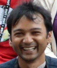
M Abdullah "Diyan" Abu Diyan, Bangladesh/Australia
xTTT2014-2019 x2019TTT x2018TTT x2014TTT x2012Scholar xBangladesh xAsia xClimate Change xMarine xMammal xMangrove xForest xWhale
Linkedin Profile Researchgate Profile
Current Status: (from Linkedin Profile) July 2014 – Present ArcGIS Trainer, Juniper GIS Services, Inc, Adelaide, Australia
2019 Status: Diyan was a participant in the first-ever SCGIS TTT 2019 Summit Meeting.
 "SCGIS Scholarship’s Butterfly Effect: Conserving the Magical Mangroves " SESSION: Human & Wildlife Relationships
2019 ABSTRACT "SCGIS Scholarship’s Butterfly Effect: Conserving the Magical Mangroves "
Presenter: M Abdullah Abu Diyan, Bangladesh Cetacean Diversity Project, Bangladesh/Australia
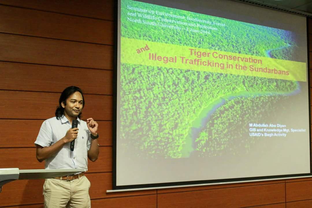
"This is a personal account of how my participation in the SCGIS scholarship program provided the means to implement GIS technologies for helping to conserve the magical mangroves of Bangladesh. The Sundarbans Mangrove Forest is the largest mangrove in the world shared by Bangladesh and India. Sundarbans is the last remaining habitat of the endangered Bengal tigers in Bangladesh and supports the largest known population of endangered freshwater dolphins – Ganges river dolphin and Irrawaddy dolphin. Climate change, poaching, habitat degradation, management issues, over-exploitation of resources, and human-wildlife conflict are some of the issues that make wildlife conservation challenging in the Sundarbans. Given the limitations, use of citizen science and GIS has been instrumental in establishing new sanctuaries inside the forest and providing vital support for completing multiple research activities aimed to gain in-depth understanding of this dynamic landscape and the population of wildlife. GIS was used starting from designing sampling methods to analyzing data, visualizing results in innovative ways to providing support for policy change dialogues, human-wildlife conflict to showcasing wildlife information to the local population for strengthening conservation efforts at local levels and generating love and awareness for wildlife conservation. The presentation attempts to demonstrate the importance for individuals from developing countries to have access to advanced technology and resources, and how this can become a game changer for wildlife conservation in challenging landscapes."
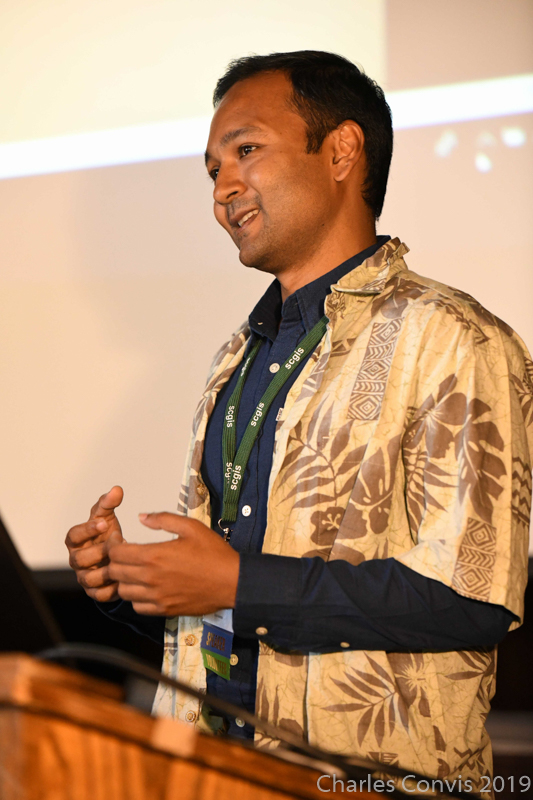
2018 Profile: Provides training on ESRI's ArcGIS Desktop products including ArcMAP, ArcCatalog, Geodatabase, and Modelbuilder to effectively analysis variety of geographic data sets and efficiently mange spatial data. Spatial data collection using handheld GPS or online portals, import collected data into ArcGIS ecosystem using quality checks and transformation also frequently featured on training modules. Juniper GIS training modules are based on real data and case studies with a focus on conservation issues - found to be extremely useful, easy to understand and follow by the 128 trainees I have taught so far in various countries. (Photo: Diyan Teaching Conservation GIS at a TTT Trainer in the requisite Juniper GIS uniform)
August 2016 – Present: Gis & Remote Sensing Analyst at Freelance / Contract Analytics
I provide GIS related services including spatial analysis, spatial data collection and management, remote sensing applications, digital cartography. I am experienced in research and innovative solutions and insights using spatial data visualizations. Experienced working for multicultural and multi-disciplinary organizations, conservation startups, and researchers. Major achievements includes:
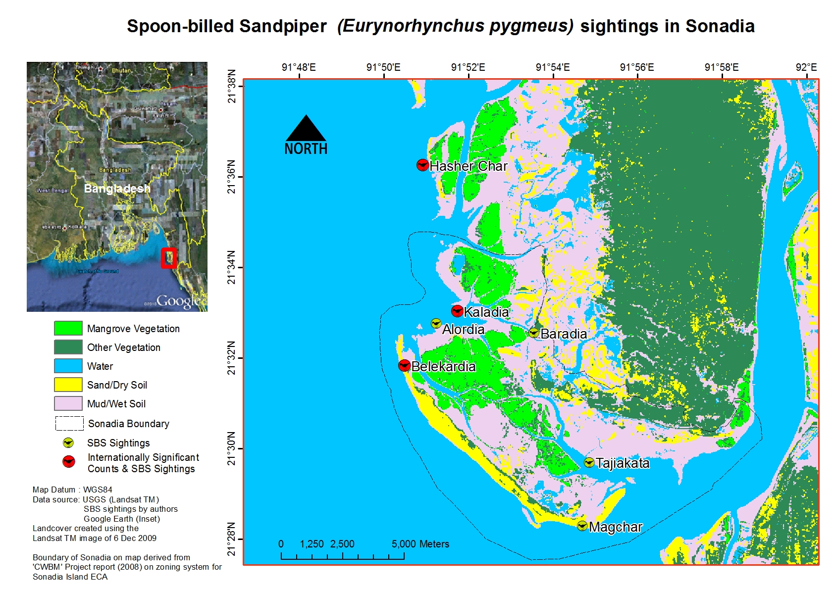
- Discovering new wintering habitat for critically endangered Spoon-billed Sandpiper
- Accurate historical flood mapping in absence of official flood maps for an international trans-boundary project
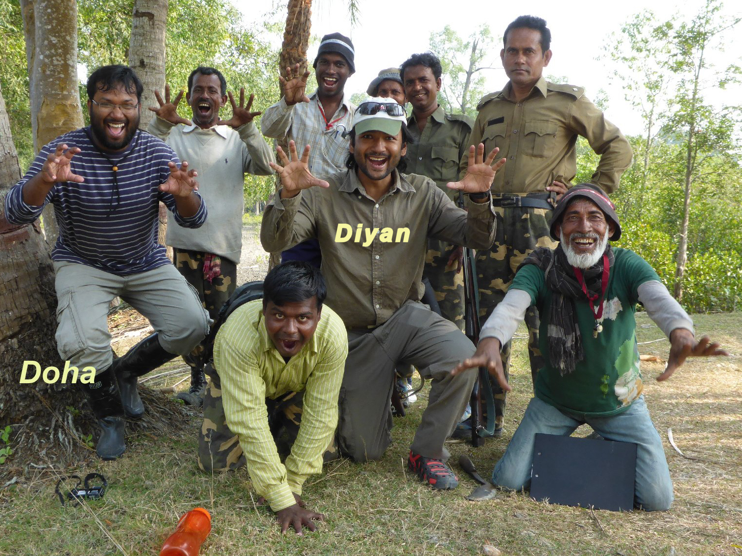
(Photo Below: Diyan with his colleague and 2017 SCGIS Scholar Doha as part of the "Wildteam" wildlife conservation project in Bangladesh)
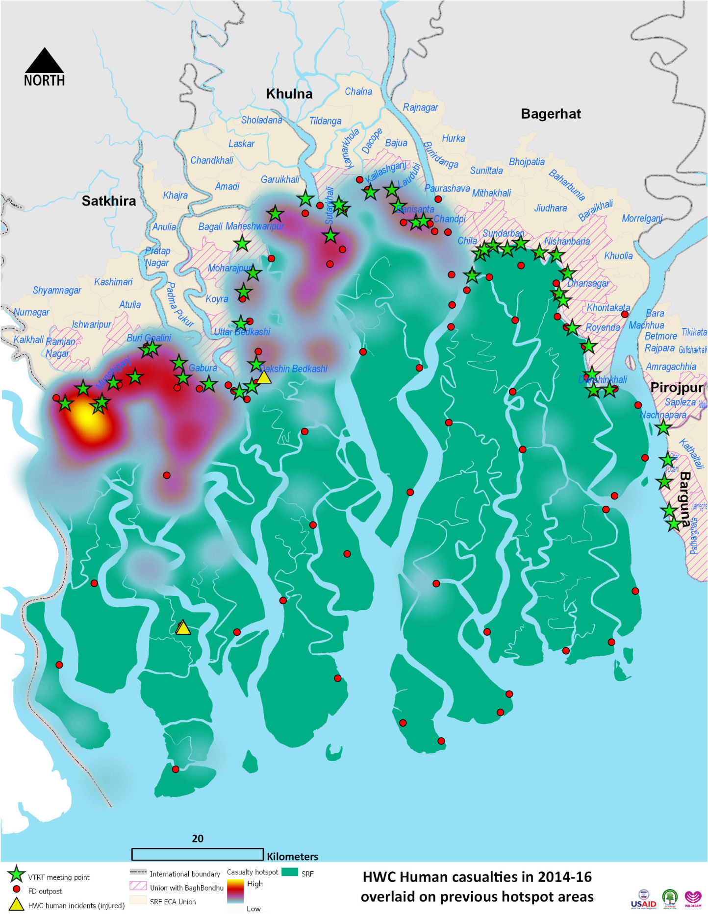
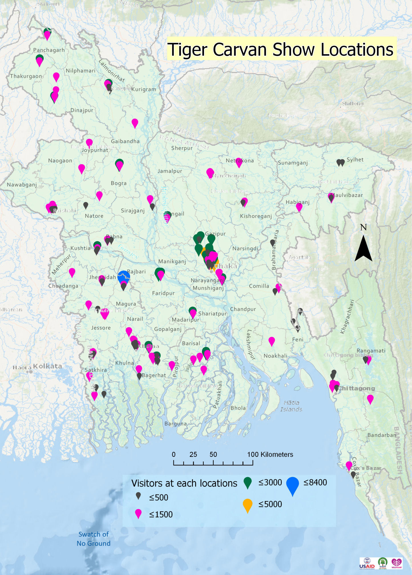
(WILDTEAM Mapping work: Human Tiger Casualties in 2014-2016. "Wildteam ran a month long awareness raising program. A bus designed to look like a Tiger supported installations and road shows, documentaries and photos, to show to the public all around the country. Map below shows the locations it went and the photos and video links. Even the prime minister attended one of the shows!")
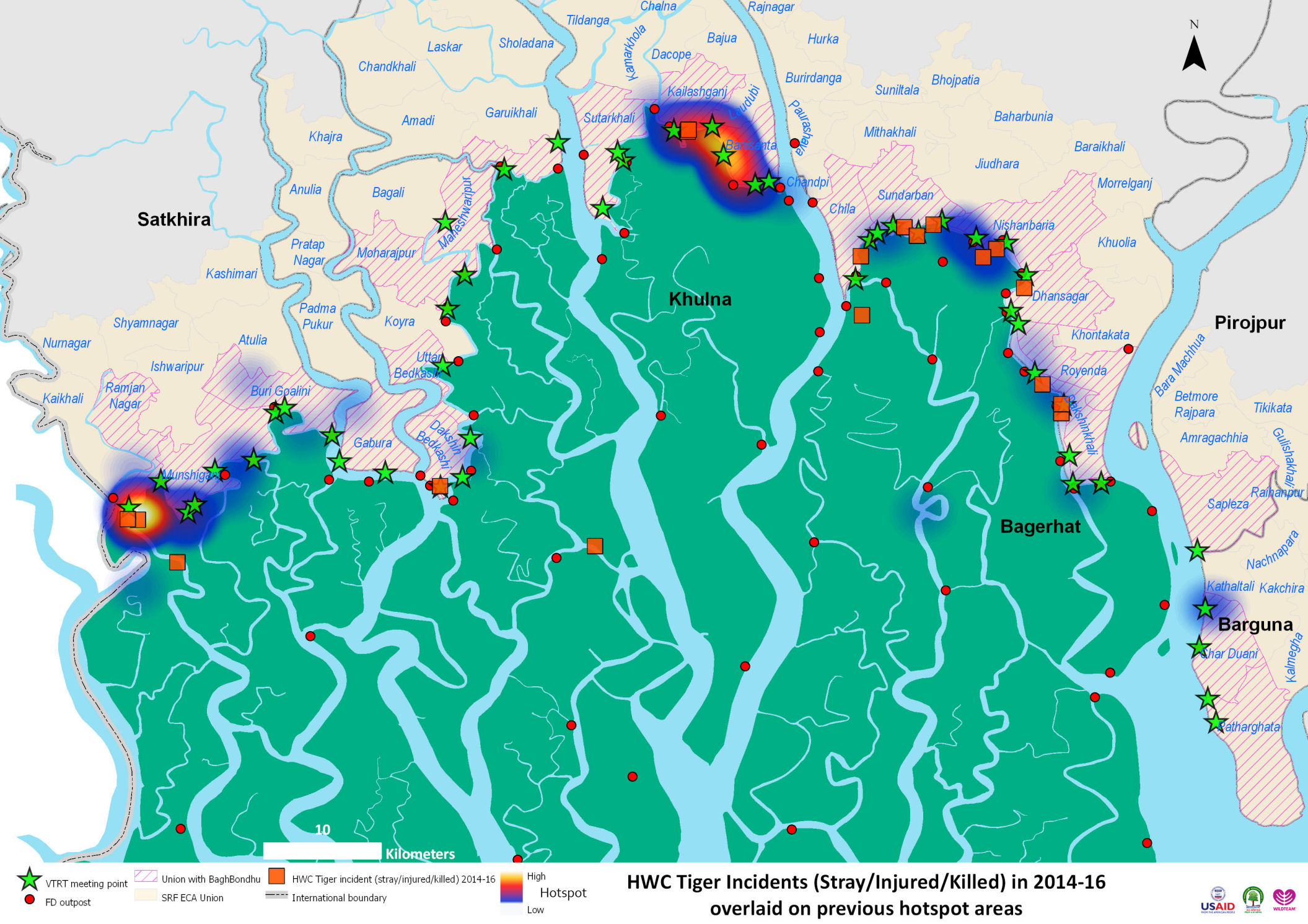
(WILDTEAM Mapping work: Tiger Incidents 2014-2016)
(WILDTEAM Mapping work: Map of Wildteam and Community effort by work hours devoted to wildlife conservation activities in each of the local communities.)

Diyan is also a member of "Pangea Proxima", a global network of " international consultants with a mission to alleviate global poverty through social research and construction of  educational, health and social program facilities. As it says in his profile "M Abdullah Abu Diyan is a Conservation GIS and Remote Sensing Analyst, who received his MSc in Geo-Spatial Technologies from a consortium of three universities of Portugal, Spain and Germany; and BSc in Environmental Science from Bangladesh. Diyan has spent last five years volunteering, working, training, studying, and living in Australia, Europe and USA. He is now working independently in Bangladesh as a Conservation GIS and Remote Sensing Analyst. He has worked as Research Assistant at the Institute of Geoinformatics of University of Muenster in Germany, as forestry field worker for Department of Sustainability and Environment in Victoria, Australia; Volunteered as a GIS analyst for Birds Australia; and various conservation projects in Bangladesh including a dolphin conservation project funded by WCS. He is motivated to combine his Geo-Spatial and Environmental Science expertise to contribute to Pangea Proxima’s sustainable projects.". Diyan's colleagues in this network include former SCGIS Scholar Sabrina Costa and Scgis member and speaker Trevor Stine
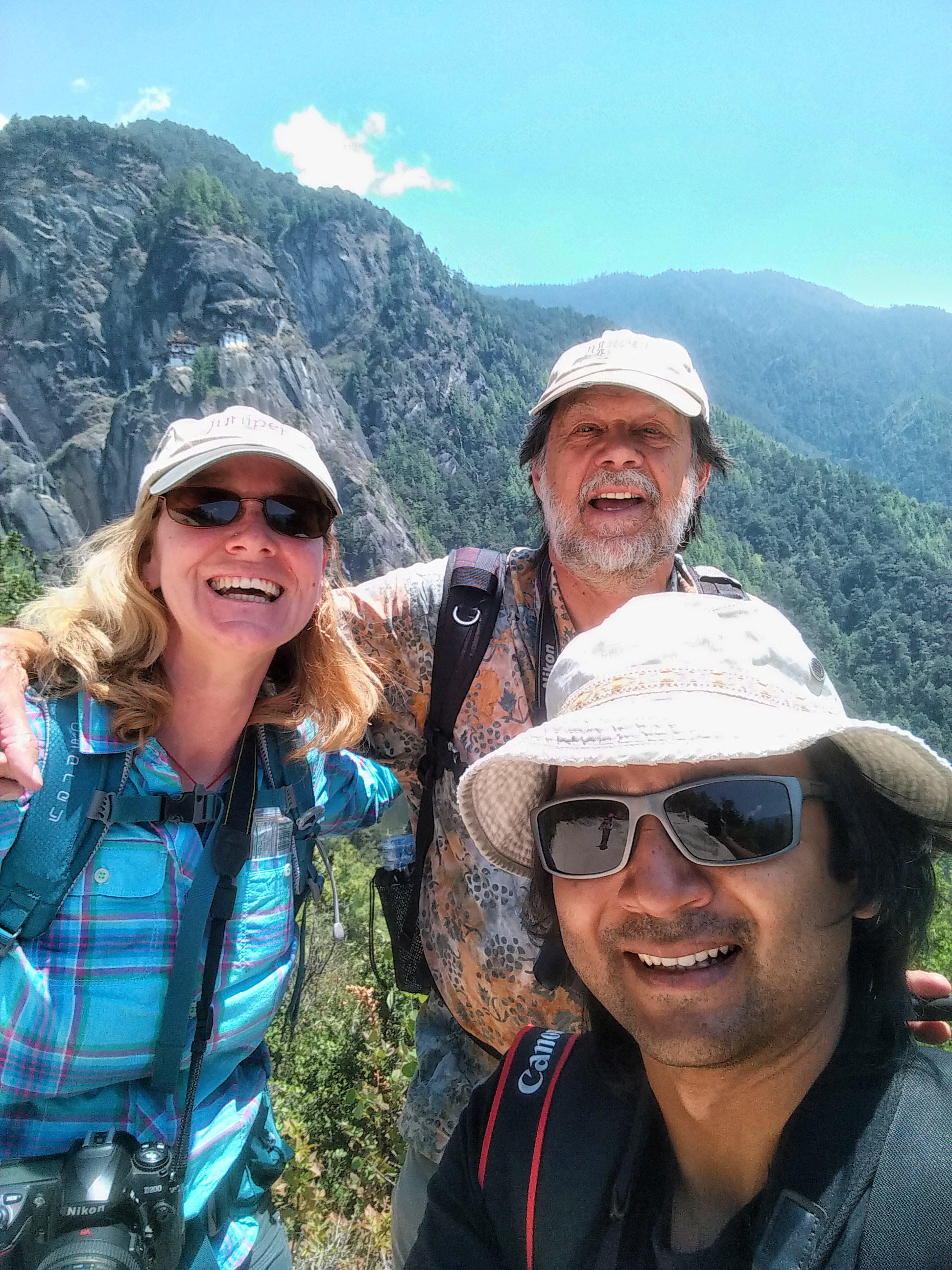
(Photo: Diyan and fellow TTT Colleagues Leslie Backus and John Schaeffer on the Paro Taksang Trail, Bhutan. Diyan collecting field data in the Sundarbans Mangrove Region)
(Map: Diyan's coastal mapping findings showing coastal change in the Sundarbans)

2014 TTT Certification: Diyan was awarded his TTT Certification in 2014
2014 TTT Profile, taken from Diyan's TTT Application: "My experience as a SCGIS scholar in 2012 was one of the most memorable of my life. I am really excited to apply for the TTT, and if given the opportunity, it will be a great pleasure learn from you, and help the scholar to have similar great experience as I had.
Previous teaching experiences: I have taught Introduction to Environmental Science at North South University, Bangladesh as a lecturer during fall 2013. I am affiliated with the university as a part-time faculty member. I plan to carry on teaching there, when my schedule permits.
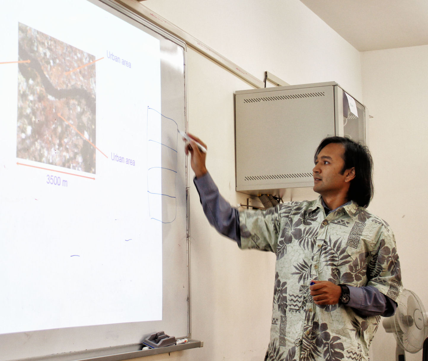
I have also instructed lab sessions as a tutor at Institute of Geo-informatics (ifgi) of University of Muenster, Germany, for two courses: Introduction to GI Science and Reference Systems. I was the lead facilitator for a weeklong GIS introduction training session in Dhaka for the finance sector. (Photo Below, Diyan assisting at the 2014 SCGIS Scholar Training Program. photo by Sasha Yumakaev)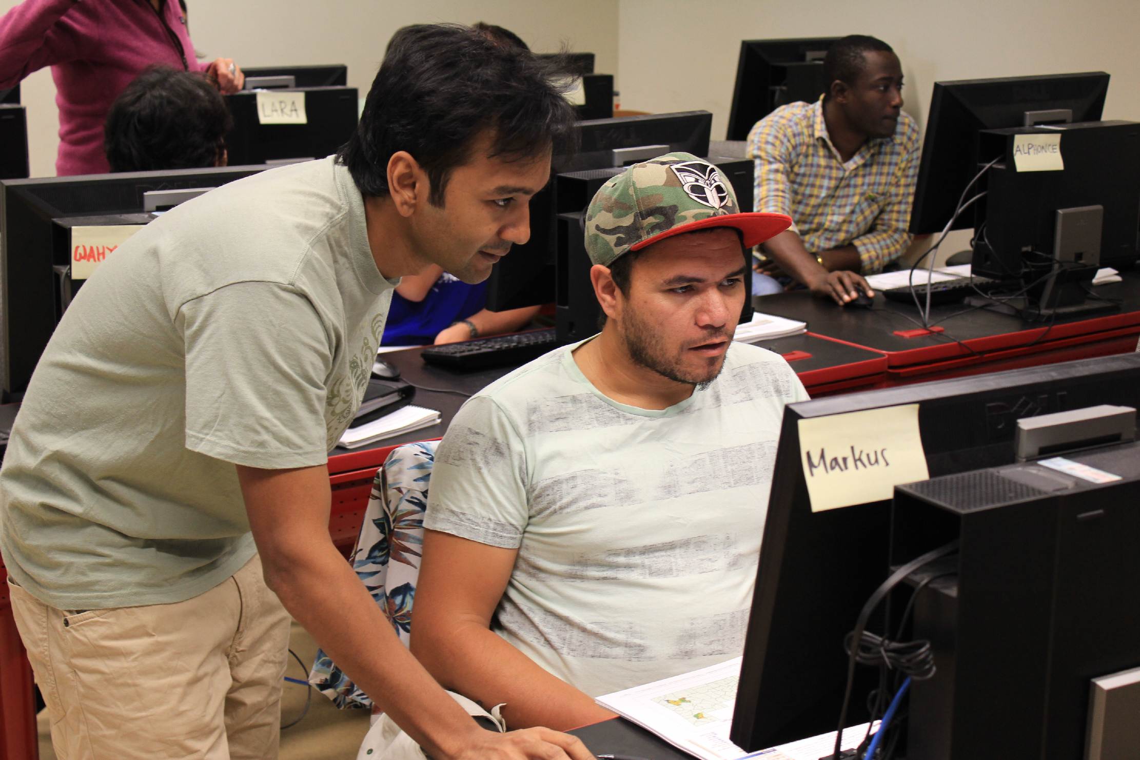
In Bangladesh, very little has been done to us GIS analytically for conservation issues, and there is a lack of good facilitators. The use of GIS among industry and commercial sector in Bangladesh is on the rise; however, not much of that growth is facilitated by academia. Use of GIS in conservation in this country is also very little. The TTT program therefore is a great opportunity for me to start something new in my country. I can learn from the training, and most importantly, use the teaching materials as ideal resource to start training the people involved in nature conservation. Such initiative will help to expand capacity of the conservation scientists and help spreading the use of GIS in this community. My previous work of GIS analysis to find dolphin hotspots areas, is now recognized by the Govt. of Bangladesh, and declared as protected areas. Apart from that project, there is a lack of using spatial data extensively in the conservation field in Bangladesh. Trained individual can go back to their work with a better perspective of how to use spatial data extensively in the future, which in terns will help the community to move forward a wider use of GIS as an analytical tool. I would like to facilitate the expansion of conservation GIS community in my country, and in future would like to get involved in international collaboration in this region. I hope to make Bangladesh a regional hub for conservation GIS activity, and hold international training workshops in Dhaka.
2012 SCGIS Scholar: Diyan attended the 2012 SCGIS Scholars Program, as the first scholar ever from Bangladesh. He was followed in 2017 by his colleague at Wildteam Bangladesh, Mohammad "Doha" Shamsuddoha, and in 2018 by his colleague Animesh Ghose, from Creative Conservation Alliance, Bangladesh
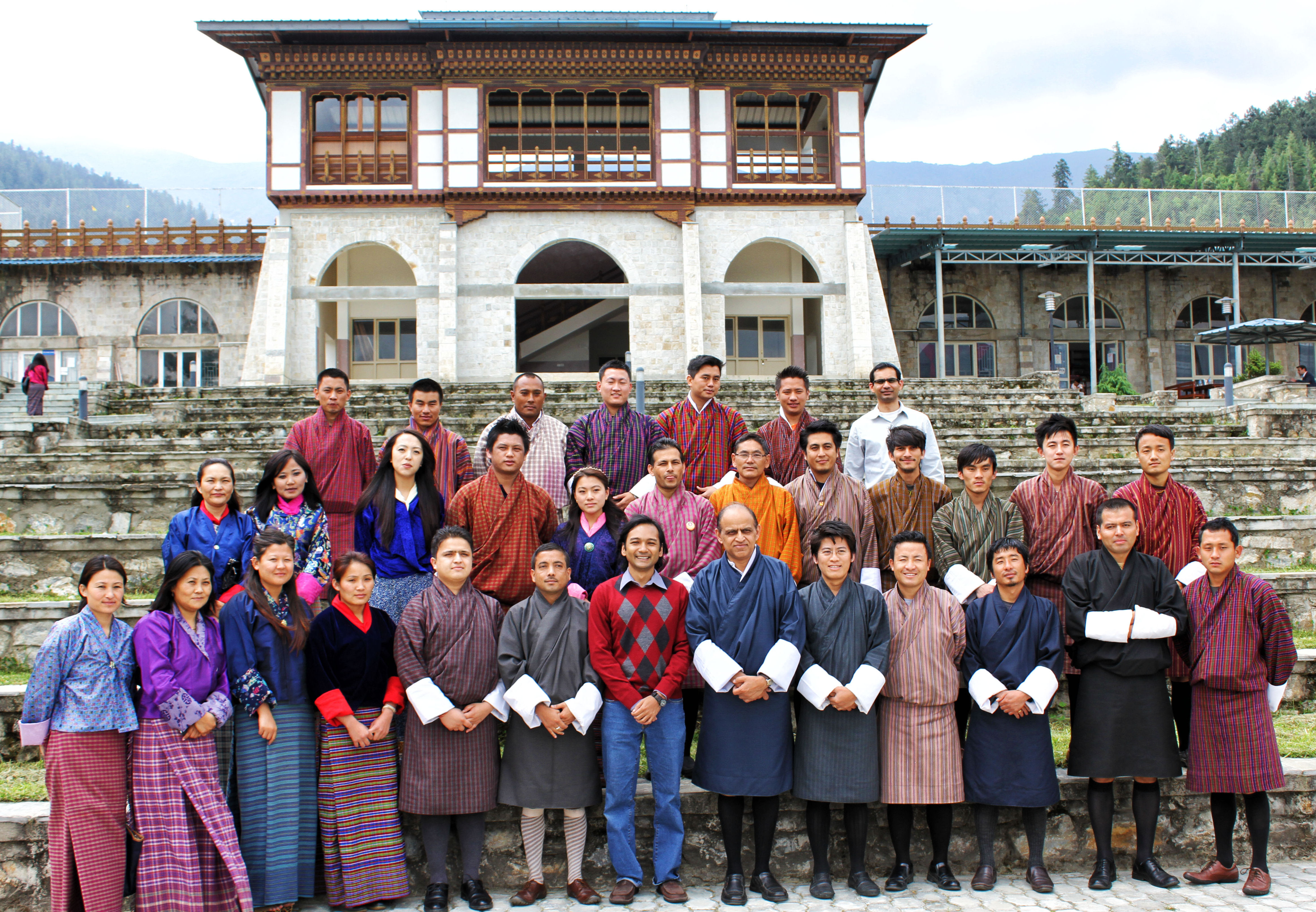
(Photo Below: Diyan, center, following his "Gis for Biodiversity" training workshop at the Royal Thimpu College, Bhutan, organize thanks to support from a World Wildlife Fund Conservation Workshop grant)
2012 SCGIS Scholar Profile:
Organization name: Bangladesh Cetacean Diversity Project (BCDP)
“ Bangladesh Cetacean Diversity Project (BCDP) is working with the local community, NGOs, and the University to better conserve the country’s cetacean species. The project initiated a sustainable data collection network involving ship Captains of the local tourism vessels, who have been collecting Geo-referenced dolphin sighting data for the last 10 years, creating what is possibly the largest dataset of fresh water cetaceans in the world. When I worked as a coordinator at BCDP for a year, the first three years of the data collected by the captains was analyzed using GIS techniques to identify cetacean ‘Hotspots’; and this study served as the scientific basis for the Bangladesh Govt. to declare three new protected areas for the cetacean. Since BCDP is a working at several aspects of cetacean conservation, and being a small NGO with very limited fund makes it difficult to employ full time GIS experts and acquire necessary GIS software and hardware. As a result, since I left the project for higher studies not much additional GIS work has been done. More than seven years data is still to be analyzed and are in need of a better organization and storing. The project uses old donated laptops, and we find that the open source GIS software are still not that user friendly for the non-experts. I am currently helping the project to organize data and clean up GI data for further GIS analysis; but the project needs proper GIS software and hardware to continue the work, so that the condition of cetacean and the protected areas can be easily monitored using the data collected. Therefore, I am applying to SCGIS, and hoping to receive a grant to attend the training provided by SCGIS; and also to learn from the experienced members of this tight-knit network. I plan to create an efficient work flow for the project so that the data collected can be easily visualized and analyzed by the non-experts to monitor the condition of the cetaceans and also monitor the status of protected areas. (Photo: Diyan on field trip to Muir Woods State Park, California. Photo by SCGIS & TTT classmate, Nicolas Lois)
Please describe the history of your personal work in conservation and GIS: I started working with GIS will working for a tour operating company were we set up a dolphin sighting network to collect voluntary GI data. We trained the captains of the tourist vessel to spot, identify, and then record the data of the dolphin with position information collected from GPS. I later while working for BCDP, used three years of data (2002-2005) to analyze and identify the six 5 km long river segments that are dolphin ‘hotspot’. I also volunteered for Birds Australia for six months to analyze some of their data to come up with 330 random areas that can be used for random surveys. I am also helping the young researchers and conservationists in Bangladesh with basic mapping.
Please describe how your work involves cooperation with any local and/or international groups: I am currently volunteering for BCDP to organize their GI data, and plan to analyze GI data to update the ‘Hotspot’ data. I am also helping another project designed for Spoon-billed Sandpiper conservation where I work with young researchers from the local universities. I also provide small scale GIS help for the members of the Bangladesh Bird Club and the Wildlife Trust of Bangladesh. The work of BCDP is done under supervision of the International NGO Wildlife conservation Society (WCS). We are currently in touch with the SCGIS Nepal chapter for future collaboration.
Please describe what is the most unique and the most challenging about the conservation/GIS work that you do: The unique part of our work involves actively using VGI data for conservation purpose that are collected by Captains of the tourist vessels. This ensures a sustainable collection of data with minimum resources spent and with supervision. These data collector had no previous GIS know-how, and did not even used GPS before they stared cetacean data collection. Part of this database played a major role in establishing three new protected areas for the cetaceans. The challenge we face is to analysis this volume of data in a time and in efficient manner. When we started analyzing this data set, we did not have accurate maps/shape file of the rivers, and there most of the GIS work is manual. We are in need of creating a efficient work flow for visualizing and analyzing the dataset.
2012 SCGIS PAPER:
Mohammad Abdullah Abu Diyan, Bangladesh Cetacean Diversity Project, Bangladesh
TITLE: “Identification and channel characteristics of cetacean hotspots in waterways of the eastern Sundarbans mangrove forest, Bangladesh
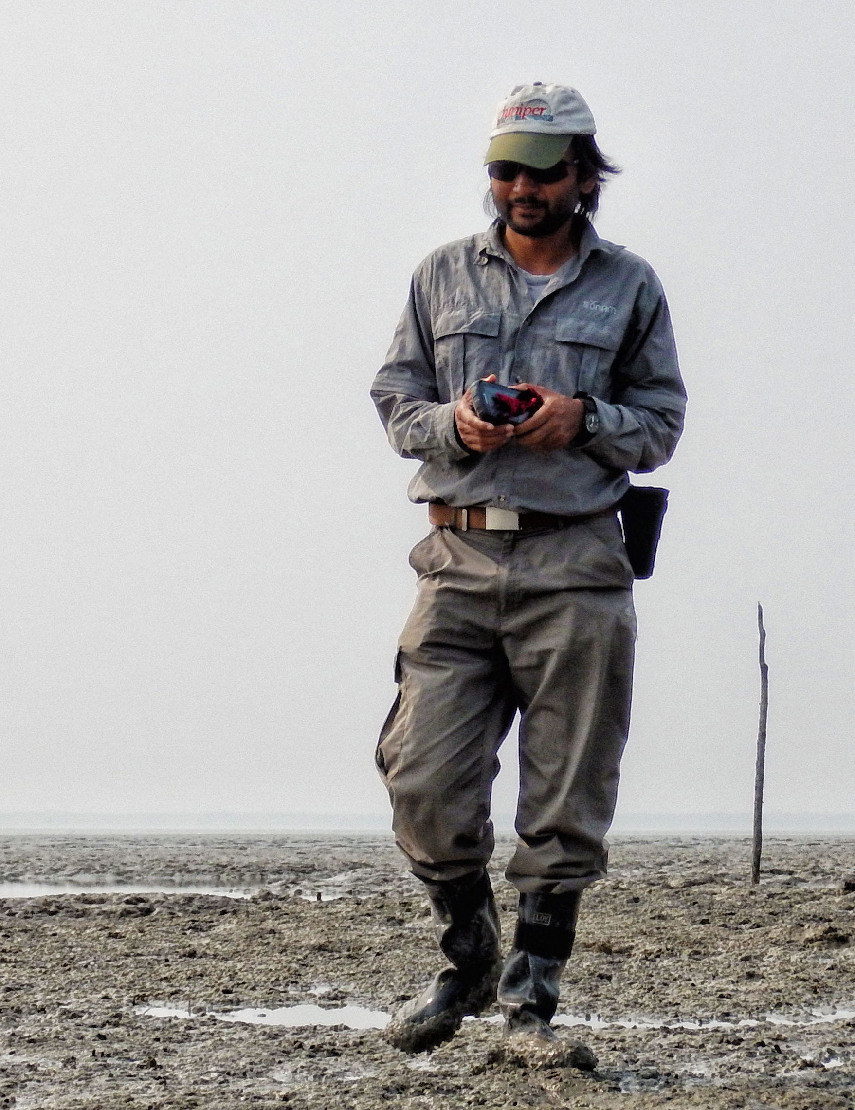
ABSTRACT: Sightings data of two freshwater-dependent cetaceans, the Ganges River dolphin Platanista gangetica gangetica and Irrawaddy dolphin Orcaella brevirostris, were recorded by captains of three nature tourism vessels operating in waterways of the eastern Sundarbans mangrove forest, Bangladesh. These data were used to investigate channel-type preferences and identify cetacean hotspots according to a scoring system based on group, individual and calf encounter rates, the co-occurrence of both species, and encounter rates in neighbouring segments recorded during monsoon, post-monsoon and dry seasons. Six 5-km segments were identified for priority conservation attention from a total of 38 that were surveyed on at least three occasions during each season. Understanding the preferred habitat and identifying hotspots of freshwater-dependent cetaceans in the Sundarbans is the first step of a planning process for the potential establishment of a network of protected waterways for these threatened species. (Photo: Taking a water sample at the Swatch of No Ground as part of the cetacean conservation work with WCS)
-
 Anonymous User