- Home
- :
- All Communities
- :
- Events
- :
- FedGIS Conference
- :
- FedGIS Conference Blog
- :
- FedGIS 2017 Plenary Live Blog
- Subscribe to RSS Feed
- Mark as New
- Mark as Read
- Bookmark
- Subscribe
- Printer Friendly Page
Editor's note: We're live blogging the Monday morning plenary on this post. For more discussions and updates this week visit the FedGIS Conference space here in the GeoNet Community.
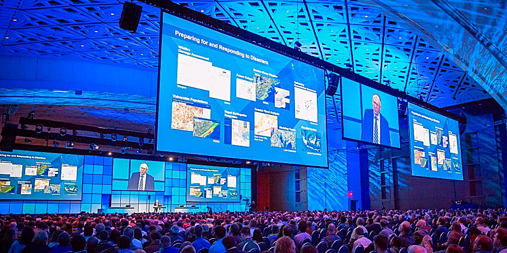
9:00amEST
FedGIS 2017 is underway! The plenary kicks off as Jack welcomes attendees and continues an Esri conference tradition inviting us to turn around and say "hello" to each other. I had the pleasure of talking with Rolando from the Department of Defense. He's excited to learn more about clean data and GIS.
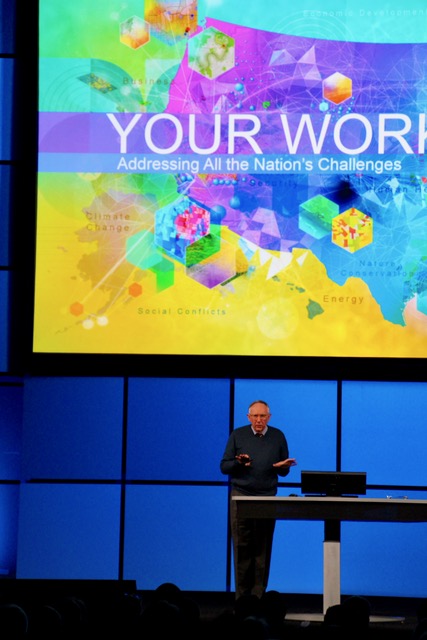
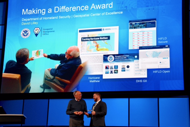
Jack jumps in and recognizes the Winners of the Global Content Challenge, and then David Lilley of the Department of Homeland Security is awarded the "Making a Difference award. David thanks Jack and says this recognition and important work is because of "the power of partnerships built with Esri.
Jack shares his vision of the future of GIS and it's impact on the world: "If we're going to have a positive future. It's going to take us working together to make it work."
Jack shares the Science of Where. "What is it? It's the "Geography and Technology of GIS coming together."
"Humans have never been more capable, now is the time to apply the Science of Where. We need to scale it out. realize what is possible and collaborate among all levels of our organizations."
9:30am
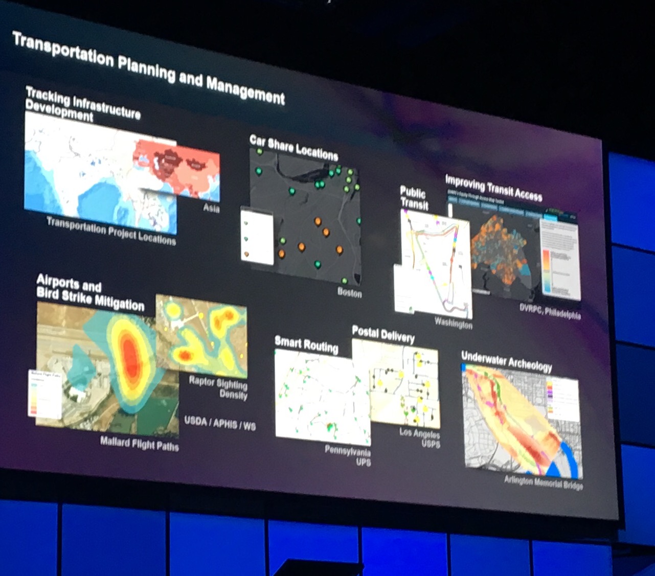
Jack highlights the impact and power of GIS in government agency and projects.
9:45am
Jack dives into sharing how Big Data, Imagery and Real-time are key elements to Esri platform and they are impacting GIS and together they changing how we understand our world.
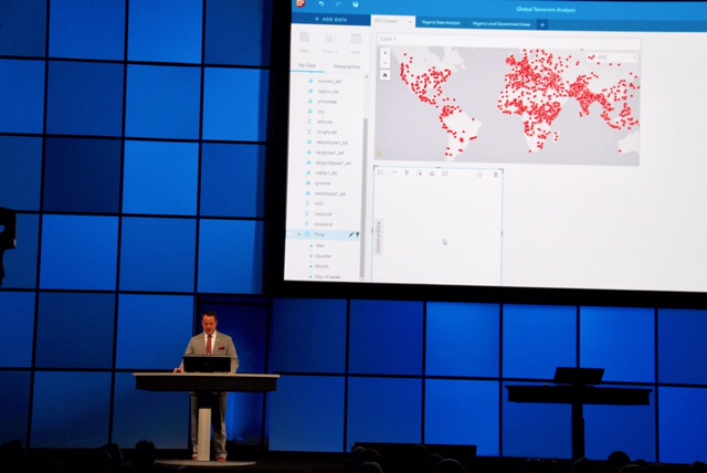
Jack shares that "Smart means real-time. This is so exciting!" He then welcomes David Attaway who demonstrates the power of Insights showing it as a powerful platform and tool to fight global terrorism and its sociogeographic impact.
10:00am
Tim Clark shares how ArcGIS Pro is improving workflows through wildfires. He takes us through a real-time use case and shows us how to use the 3D imagery and space time cube. "You can maximize your data and apply it to the meaning of your symbology. ArcGIS Pro is a connected environment and this integration can make your workflows easier."
10:30am
A portal to portal cross-agency use case shows how the Fusion Center in Virginia is collaborating with partners to better understand and address issues caused by heroine overdoses in their local counties.
Jack shares the new stats on ArcGIS online:
- 3.8 Million users
- 1 Billion day map views
- 7.9 million items
- 18.8 million open data downloads
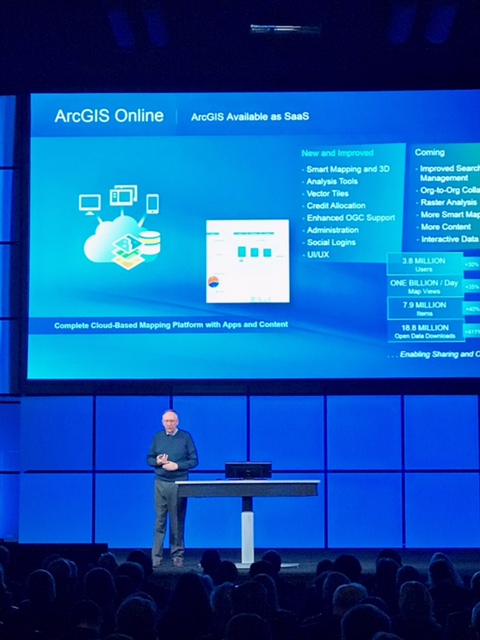
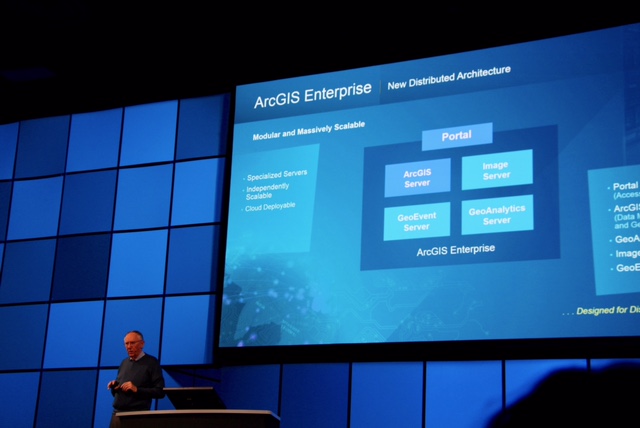
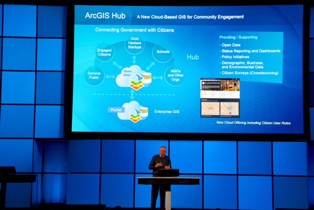
Jack takes us through the ArcGIS Enterprise and its new distributed architecture, and then gives us a tour of the ArcGIS Hub that's a new cloud-based GIS for community engagement.
10:45amEST
Heading into the break Jack thanks the audience. "Geography has never been so important. It's enabling the Science of Where and creating a platform for creating a better future. You've made it come alive. You're building the maps that run our country. It's a great privilege to serve and work with you."
We're taking a short break on the plenary and will be back shortly. What did you think so far? Share your thoughts and feedback in the comments!
11:08am
And we're back! A video about the "Science of Where" welcomes us back.
Then Tyson Quink takes us through what's new in ArcGIS online:
- Vector basemaps
- Joined features tool
- Publishing WSFS servers in web maps
- New and improved Smart mapping and 3D
- Analysis tools, vector tiles and more.
- Publish to 3D mapping and Droan2map
11:30am
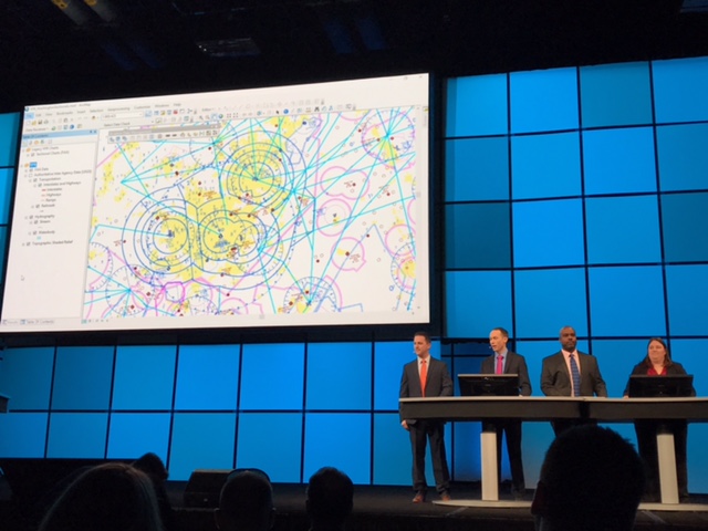
Federal Aviation Administration team takes us through how they use ArcGIS to make sure planes stay out off restricted airspace when landing in Washington DC and flying for passengers remains safe and uneventful so you can send that happily send that "just landed" text to your family."
Did you know...?
- 690,000 drones are in operation since they first become legal to fly in recent years.
- Drones can freely fly below 400 feet but the FAA still has to figure out how we balance legal drone flight paths with maintaining safe airspace that is always dynamic and changing. (yes, they use ArcGIS to do it)
11:50am
The Chesapeake Conservatory team shows how they are using ArcGIS Pro to better understand and solve watershed issues. "In the past this type of data processing might take a week, with ArcGIS Pro we are able process 3.8 billion pixels of NAIP imagery in high resolution in 5 minutes."
12:02pm
The Ardent MC team shares how they used the Operations Dashboard to bring teams together to make decisions, synchronize data and promote operational awareness.
They also shared 3 tips to create Operational Awareness with GIS:
1. Paperwork before process. Do this first before begin your projects.
2. Get to know the gatekeepers. Build relationships and educate those who are the influential and on the front lines.
3. Agile Management approach. Agile isn't just for product development use it to manage your teams and change how you work.
12:15pmEST
We have apps! Chris from the Esri team takes us through how you can take GIS into the field via the helpful workforce friendly and mobile Field Apps.
The Loudoun county team takes us through their new GeoHub and share how they're using it to improve the lives of the local families and businesses.
And that's a wrap! We hope you enjoyed the plenary presentations. What did you think of the talks and demos? Share your thoughts and comments below.
Thanks for following along during this live blog. As the conference continues, be sure to join the discussions and daily update conversations in the FedGIS Conference space.
You must be a registered user to add a comment. If you've already registered, sign in. Otherwise, register and sign in.
-
FedGIS 2017
4 -
FedGIS 2018
5 -
FedGIS 2019
1 -
FedGIS 2020
3 -
FedGIS 2021
4 -
FedGIS 2023
4 -
FedGIS 2024
3