- Home
- :
- All Communities
- :
- Products
- :
- ArcGIS Spatial Analyst
- :
- ArcGIS Spatial Analyst Questions
- :
- Raster Interpolation Pixel based Pop-Up configurat...
- Subscribe to RSS Feed
- Mark Topic as New
- Mark Topic as Read
- Float this Topic for Current User
- Bookmark
- Subscribe
- Mute
- Printer Friendly Page
Raster Interpolation Pixel based Pop-Up configuration in ArcGIS Online
- Mark as New
- Bookmark
- Subscribe
- Mute
- Subscribe to RSS Feed
- Permalink
I am attempting to make a raster IDW based heat layer from a point feature layer based on weight.
The point feature layer that I have looks like this.

This feature layer has a field named "Total Score" based on which I perform IDW interpolation and generate a raster heat layer which looks like this. The resampling technique that I used here to display raster is Bilinear Interpolation.
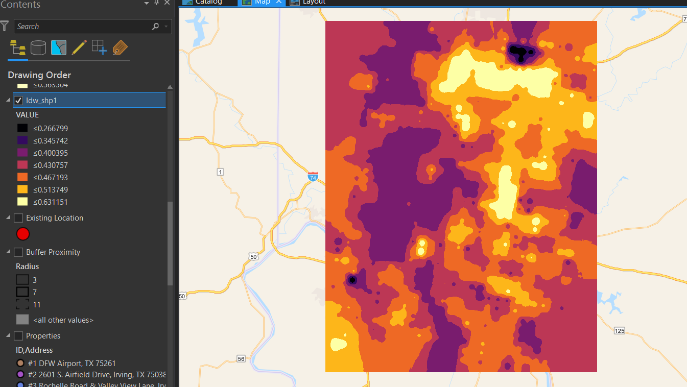
Now I published this layer to my AGOL account as a Hosted Tile Layer.
I would like to configure a popup for this layer which shows the attributes of the point feature layer which we have used earlier for which I have followed the procedure of "Enable Popups" and selected the point feature layer.
Now I can see that the popups only for some raster pixels where the earlier points were located like this
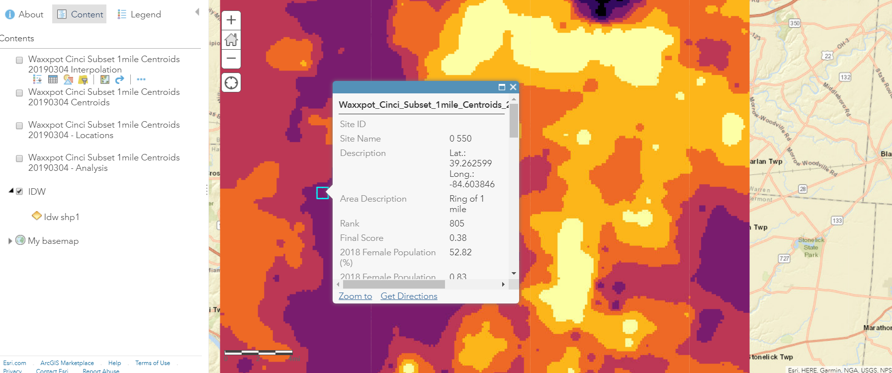
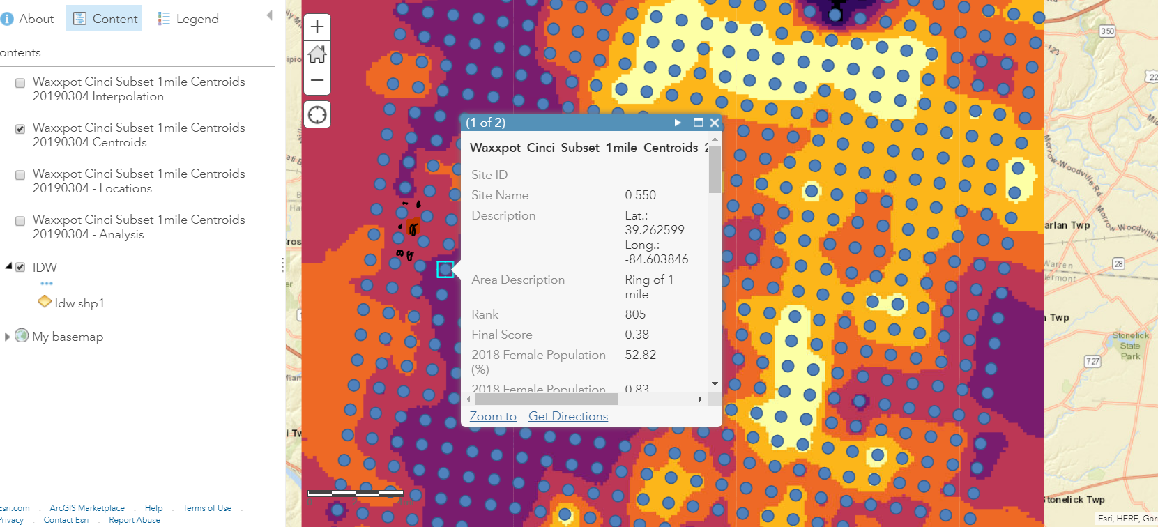
But if I click anywhere in between the grid points (marked in black above), no attributes show up since it isn't configured as popups. It simply shows "No Information Available"
So my question here "If I am only using the heat layer, what can I do in order to make a pop-up appear which will take the nearest point popup to display if we click anywhere inside the grid or square (not exactly on the points, but when I click anywhere in a pixel or square it should look for nearest point for which popups are already configured in the pixel/ square and display it)
- Mark as New
- Bookmark
- Subscribe
- Mute
- Subscribe to RSS Feed
- Permalink
Tiled layers are map services, they can't be queried like feature services.
Perhaps the best way to get what you want would be to slice your raster into ranges, convert to polygons with the Raster To Polygon tool, and share the polygons as a feature service. You could get fancy with this by still posting your tiled map to get the nice symbology, but post the polygons with symbology to make them near or totally invisible.
- Mark as New
- Bookmark
- Subscribe
- Mute
- Subscribe to RSS Feed
- Permalink
Thank you Curtis.
But I see we can assign the raster, the popups from our Point Layer.
I have also tried to generate a Fishnet in ArcGIS Pro along with the point layer which are centroids of that fishnet
Now I have used a spatial join so as to bring the attributes of each point to its corresponding cell/square.
Now when I publish this resultant fishnet into AGOL and assign their attributes to raster, it worked and showed up.
But I am not sure if this approach is correct or not.