Turn on suggestions
Auto-suggest helps you quickly narrow down your search results by suggesting possible matches as you type.
Cancel
- Home
- :
- All Communities
- :
- Developers
- :
- Python
- :
- Python Questions
- :
- NetCDF Longitude values shift
Options
- Subscribe to RSS Feed
- Mark Topic as New
- Mark Topic as Read
- Float this Topic for Current User
- Bookmark
- Subscribe
- Mute
- Printer Friendly Page
07-02-2018
06:31 AM
- Mark as New
- Bookmark
- Subscribe
- Mute
- Subscribe to RSS Feed
- Permalink
Hi,
I've been several days with this not quite getting what I need. Any help would be much appreciated.
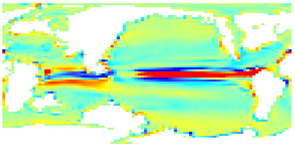
I'm trying to use python to shift the longitude values of a netcdf file. The original file longitude goes from -1.875 to +360
I need the file to show properly when importing it in Arcmap (Make NetCDF Raster Layer) so the raster and its values are -180 180 (as well as -90 90). The values are vertical velocity depth.
I'm trying a short script that someone showed online with a similar issue. Apparently it worked for him. In my case I just manage to shift the frame but not the values (see picture).
Any suggestions? Many thanks
import arcpy
import numpy as np
import netCDF4
from netCDF4 import Dataset
from arcpy import env
arcpy.env.overwriteOutput=True
from arcpy.sa import*
arcpy.CheckOutExtension("Spatial")
Bathy = Dataset(r"H:\NETcdf_TEST\tdhteo.pfclapr.nc",'r+', format="NETCDF4")
lon = Bathy.variables[u'longitude'][:]
lat = Bathy.variables[u'latitude'][:]
depth = Bathy.variables[u'W_mm_dpth'][:]
depth_new = np.roll(depth, 360, axis = 1)
lon_new = lon[:]-178.125
Bathy.variables[u'longitude'][:] = lon_new
Bathy.variables[u'W_mm_dpth'][:] = depth_new
Bathy.close()
Solved! Go to Solution.
1 Solution
Accepted Solutions
1 Reply
07-03-2018
03:20 AM
- Mark as New
- Bookmark
- Subscribe
- Mute
- Subscribe to RSS Feed
- Permalink
This does the job. Thanks
depth_new = np.roll(depth, 720, axis = 3)