- Home
- :
- All Communities
- :
- Products
- :
- ArcGIS Network Analyst
- :
- ArcGIS Network Analyst Questions
- :
- Split an area based on points number
- Subscribe to RSS Feed
- Mark Topic as New
- Mark Topic as Read
- Float this Topic for Current User
- Bookmark
- Subscribe
- Mute
- Printer Friendly Page
Split an area based on points number
- Mark as New
- Bookmark
- Subscribe
- Mute
- Subscribe to RSS Feed
- Permalink
I m trying to figure out a way to split an area in two (or more) parts, based on the number of points (in my case coordinates). The difficult part is that the two areas boundary must be a road (not predefined) and not just a straight line.

Is there a way to do this using ArcGis 10.4.1?
- Mark as New
- Bookmark
- Subscribe
- Mute
- Subscribe to RSS Feed
- Permalink
This sounds familiar. Why is it posted in the Network Analyst Place? It sounds like a similar question with a minimum spanning tree suggestion. What are the rules you are using for the required aggregation? It seems that you don't want to do any pre-processing at all, since my first suggestion would be to separate your data into its groupings before you begin whatever analysis you are doing.
Perhaps some further details would help
- Mark as New
- Bookmark
- Subscribe
- Mute
- Subscribe to RSS Feed
- Permalink
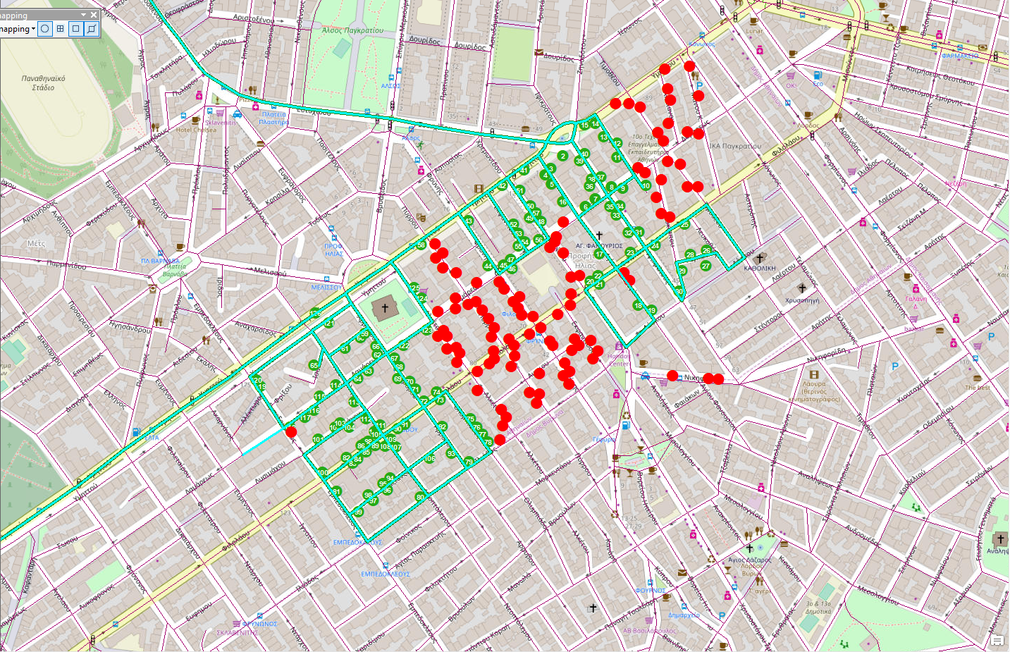
It is for a major postal service, there are routes assigned to certain clusters but some days when there are too many deliveries in a certain cluster, we have to create subroutes. We create the subroutes by running a vrp solution and then split in half the created route. But this solution creates some overlapping issues, as shown in the following picture.

So we are trying to find out a better solution to do that.
- Mark as New
- Bookmark
- Subscribe
- Mute
- Subscribe to RSS Feed
- Permalink
> We create the subroutes by running a vrp solution and then split in half the created route.
Why not add more constraints on the VRP to create smaller routes that adhere to the work that needs to be accomplished rather than splitting in half?
Jay Sandhu
- Mark as New
- Bookmark
- Subscribe
- Mute
- Subscribe to RSS Feed
- Permalink
Thank you for your reply, there is a routine that we use. It works as follows; if it detects that the area has more than 400 deliveries the VRP solver uses roads centroids, representing the multiple orders along each road network segment. Then it splits the route in half and produces 2 subroutes. We have tried adding more constraints on the VRP to create smaller routes but it doesnt seem to effectively split the subroutes(i.e picture below)
- Mark as New
- Bookmark
- Subscribe
- Mute
- Subscribe to RSS Feed
- Permalink
Jay,
Im new to this Geonet thread, but I have been having a problem running a VRP solver and it stalling out at 33%.. I saw that a few years back you were messaging with someone about this who could not seem to run anything over 300 points. I am having the same problem and have not been able to find a fix. That user deactivated their acct too unfortunately. Did you have any advice on this?? Thanks so much!!
- Mark as New
- Bookmark
- Subscribe
- Mute
- Subscribe to RSS Feed
- Permalink
Jennifer,
Can you describe your issue with some more details? What version of the software are you using? What network dataset? Any special settings for costs/restrictions/barriers/etc. How many orders/points are in the VRP layer? How many routes? If you monitor the system resources, are you running out of memory for that process? i.e., using up 2 GB of RAM. Thanks,
Jay Sandhu