- Home
- :
- All Communities
- :
- Developers
- :
- Developers - General
- :
- Developers Questions
- :
- I have made changes in shape file by adding few da...
- Subscribe to RSS Feed
- Mark Topic as New
- Mark Topic as Read
- Float this Topic for Current User
- Bookmark
- Subscribe
- Mute
- Printer Friendly Page
I have made changes in shape file by adding few data points in shape files but I am not able to see those data points ?
- Mark as New
- Bookmark
- Subscribe
- Mute
- Subscribe to RSS Feed
- Permalink
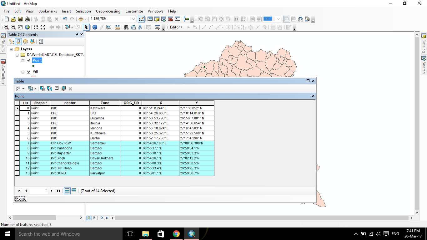
I have edited the attribute table of a shape file by adding new points( selected portion) as these are also data points which should be present in this shape file, When i finished in adding these points then after saving my edits I am not able to get these data points. How can I get these data points ?
- Mark as New
- Bookmark
- Subscribe
- Mute
- Subscribe to RSS Feed
- Permalink
How did you convert the text representation of the XY back to a number that you can use as the geometry XY?
- Mark as New
- Bookmark
- Subscribe
- Mute
- Subscribe to RSS Feed
- Permalink
If you click on the layer and select "Zoom to extent", what do you see?
- Mark as New
- Bookmark
- Subscribe
- Mute
- Subscribe to RSS Feed
- Permalink
How did you make the points? By clicking points in the dataframe then adding the attributes, or did you go from attributes to an event layer. The fields that you have showing the coordinates wouldn't yield useful coordinates in any event since geographic coordinates have to be entered in decimal degrees. If you made the points using standard editing, were you editing in the coordinates of the shapefile or the dataframe?