- Home
- :
- All Communities
- :
- User Groups
- :
- Coordinate Reference Systems
- :
- Questions
- :
- How to find the unknown coordinates reference syst...
- Subscribe to RSS Feed
- Mark Topic as New
- Mark Topic as Read
- Float this Topic for Current User
- Bookmark
- Subscribe
- Mute
- Printer Friendly Page
How to find the unknown coordinates reference system for my map data
- Mark as New
- Bookmark
- Subscribe
- Mute
- Subscribe to RSS Feed
- Permalink
I have several shapesfiles which perfectly overlay but the coordinates reference system is unknown. I need to overly these with other data in a differetn coordinate system. The coordinate extent is quite unique. I tried initially to overlay with several projected and geographic coordinates systems associated with the area out of which two showed very close displacement (about 60m). Next i tried different datum with one of the 'promising' coordinates reference systems (a geographic coordinates system) and also change the units but same results. Attached is a clip of two of the coordinate extents. I am yet to try the second 'promising' CRS but decided to put it out just in case i am missing something
- Mark as New
- Bookmark
- Subscribe
- Mute
- Subscribe to RSS Feed
- Permalink
Hi Kofi,
Have you tried using the Georepository website to find common coordinate systems for your area?
This may help in finding what you need.
- Mark as New
- Bookmark
- Subscribe
- Mute
- Subscribe to RSS Feed
- Permalink
Ya i have, maybe there is something i am missing, cannt just figure it out.
- Mark as New
- Bookmark
- Subscribe
- Mute
- Subscribe to RSS Feed
- Permalink
I have several shapesfiles which perfectly overlay
What are the overlaying perfectly to? If a basemap or a raster, does that have a coordinate system identified? If so, you could look at the properties of that layer, save the coordinate system as a "favorite" then in ArcCatalog, update the properties using this favorite coordinate system. This is not projecting but just assigning a system....and should only be used only in the situation I mentioned. (note: you could also see if the data frame has a coordinate system assigned, this may project data with coordinate systems assigned, but will not project those items with unknown.)
This may be more confusing that helpful.
Otherwise, I would refer you to what Adrian suggested.
- Mark as New
- Bookmark
- Subscribe
- Mute
- Subscribe to RSS Feed
- Permalink
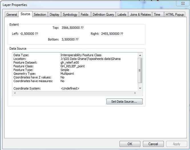
Rebecca, all of them overlay but have unknown coordinates, (eg shpfile_1 top 3576.5; left -0.5; bottom -0.5; right 2455.5: shpfile_2 top 3566.5; left -0.5; bottom 3.5; right 2455.5). for the second 'favorite' too i have tried several geographic coordinates, and changed units to Km, one of them yielded a major shift but not enough to overlay.
- Mark as New
- Bookmark
- Subscribe
- Mute
- Subscribe to RSS Feed
- Permalink
Could this data have come from a converted raster? The -0.5 value is classic for a raster that hasn't been georeferenced. What coordinate systems are within 60 meters?
- Mark as New
- Bookmark
- Subscribe
- Mute
- Subscribe to RSS Feed
- Permalink
Ghana Meter Grid and WGS_1984, these two the first projected and the other geographic lies within 50m. I cannot tell how they were developed, but some are rainfall iso, soil maps, vegetation maps etc
- Mark as New
- Bookmark
- Subscribe
- Mute
- Subscribe to RSS Feed
- Permalink
Melita, if it was developed from a raster that was not georeferenced, then how come all of them overlay?
- Mark as New
- Bookmark
- Subscribe
- Mute
- Subscribe to RSS Feed
- Permalink
They may overlay each other because they cover the same area, but are in "raw" meter-based values. The numbers don't make sense for either Ghana grid (Accra or Leigon GCS/datums) that's in ArcGIS. Both should have all positive easting values. If they are in meters, should the data extent be 2.5 km by 3.5 km? What location / approximate area should these datasets represent?
Melita
- Mark as New
- Bookmark
- Subscribe
- Mute
- Subscribe to RSS Feed
- Permalink
Attached is the doc from ASPRS / Clifford Mugnier details Ghana's geodetic control and history.
I see that your data appears to be old coverage export files. Perhaps you should import them into a fgdb first, before trying to get the underlying GCS / datum correct.
The doc (& the ArcGIS documentation) says that the classical datum in Ghana is Leigon (WKID 1159) and there is a geocentric transformation available in the system.
If you have the data already matching to within 60m, then you obviously have the correct projection system already. Just need to apply this transformation and see if the alignment improves.
Also in the doc, CM details a 7 param Bursa Wolfe transformation which he says greatly improves the accuracy. This is not in the ArcGIS system (at 10.3.1), so you would have to try this by creating a custom transformation.