- Home
- :
- All Communities
- :
- Products
- :
- ArcGIS CityEngine
- :
- ArcGIS CityEngine Questions
- :
- Color/texture for grid in scene
- Subscribe to RSS Feed
- Mark Topic as New
- Mark Topic as Read
- Float this Topic for Current User
- Bookmark
- Subscribe
- Mute
- Printer Friendly Page
- Mark as New
- Bookmark
- Subscribe
- Mute
- Subscribe to RSS Feed
- Permalink
- Report Inappropriate Content
This seems simple, but I cannot figure out how to change the grid color/texture as in the Desert City example web scene (http://www.arcgis.com/apps/CEWebViewer/viewer.html?3dWebScene=d80ef4549f9a4ce4a4a4ab6a9a847035 ). What steps do I need to take to apply a texture to the grid in my scene (assuming this is what was done in the Desert City example...)?
Thanks in advance,
Tess
Solved! Go to Solution.
Accepted Solutions
- Mark as New
- Bookmark
- Subscribe
- Mute
- Subscribe to RSS Feed
- Permalink
- Report Inappropriate Content
Ok I see what you mean. I thought you were referring to the terrain of the scene, but you mean the bottom portion of the panorama where a grid would normally be in the software. correct?
I think you can create your own panorama pictures to use. Just click the panorama button ..
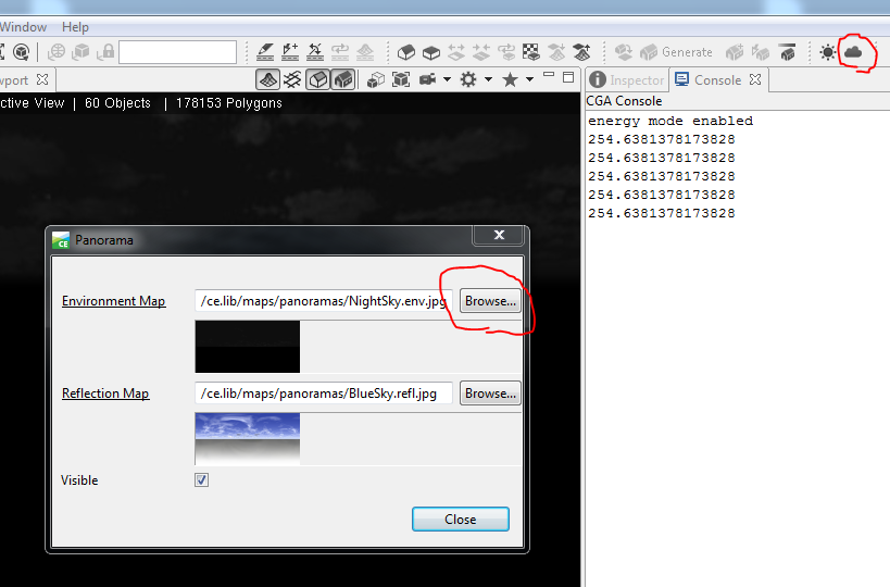
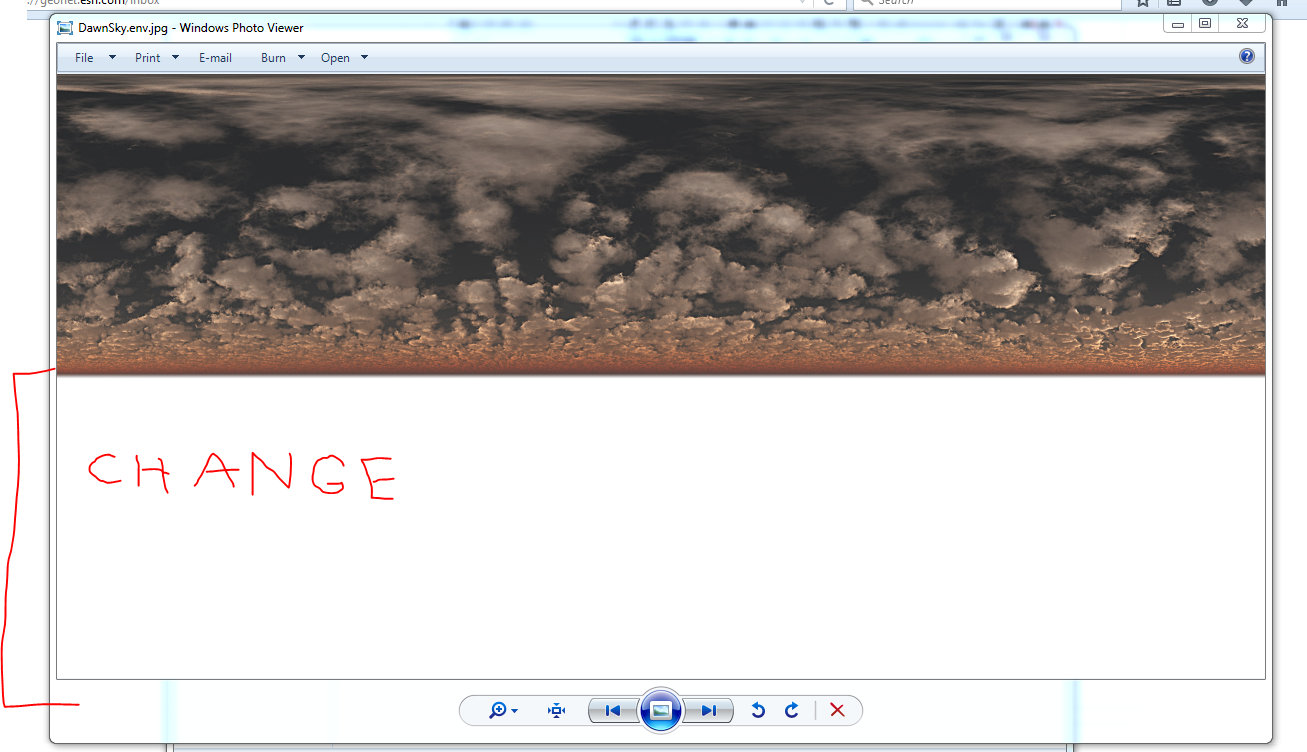
..and then Browse your workspace for whatever picture you want to use for an Environment Map . The bottom portion of the picture would be what appears to be the texture of the "Grid" area. (see pic below)
So you could change the bottom half in photoshop or powerpoint and then use that NEW image as your Env. Map.
- Mark as New
- Bookmark
- Subscribe
- Mute
- Subscribe to RSS Feed
- Permalink
- Report Inappropriate Content
I am not 100% sure, but I think that is just imagery on a DEM ("Terrain") that was exported with the other 3D elements.
- Mark as New
- Bookmark
- Subscribe
- Mute
- Subscribe to RSS Feed
- Permalink
- Report Inappropriate Content
Hmm it doesn't look like the extent is limited as I would suspect from a imagery/DEM 'terrain' layer...otherwise I would assume is was a terrain layer. The extent of the texture appears continuous (much like the sky). To me, it seems like maybe a texture has been applied to the base grid or something. Just not sure how this can be done. Thanks for the input.
- Mark as New
- Bookmark
- Subscribe
- Mute
- Subscribe to RSS Feed
- Permalink
- Report Inappropriate Content
Ok I see what you mean. I thought you were referring to the terrain of the scene, but you mean the bottom portion of the panorama where a grid would normally be in the software. correct?
I think you can create your own panorama pictures to use. Just click the panorama button ..
..and then Browse your workspace for whatever picture you want to use for an Environment Map . The bottom portion of the picture would be what appears to be the texture of the "Grid" area. (see pic below)
So you could change the bottom half in photoshop or powerpoint and then use that NEW image as your Env. Map.
- Mark as New
- Bookmark
- Subscribe
- Mute
- Subscribe to RSS Feed
- Permalink
- Report Inappropriate Content
Oh okay. That makes sense. I will give it a go. Thank you very much for your help!
Tess