- Home
- :
- All Communities
- :
- User Groups
- :
- Web AppBuilder Custom Widgets
- :
- Documents
- :
- Google Street View Widget 2.1 - 08/29/16
- Subscribe to RSS Feed
- Mark as New
- Mark as Read
- Bookmark
- Subscribe
- Printer Friendly Page
Google Street View Widget 2.1 - 08/29/16
Google Street View Widget 2.1 - 08/29/16
All after much back and forth with different people and what now seems to be legitimate email traffic with the Google Maps API Team. It is now apparent that this widget does NOT conform to the Google Maps API Terms of Service. Due to this fact, this widget download will be removed and the live preview site will be un-accessible. It is my recommendation that all users of this widget immediately remove the widget from their WAB site and discontinue use of this widget. The only way it seems currently to be compliant with the TOS is to not have a (non-Google) map visible at all in the app which is of no use at all to us esri users. I find it hard to understand how the Worlds leader in GIS technology and Google can not come to terms on the use of StreetView panoramas with esri basemaps, but it is what it is. So after years of this widget being used by hundreds of users around the world we must say good-bye.
Here is another widget for the Web App Builder.
Web AppBuilder for ArcGIS | Help - Google Street View widget
List of the latest enhancements and changes:
- Updated for WAB 2.1
List of older enhancements and changes:
- Widget no longer open the street view html window automatically on open.
- Prevent popup check from firing multiple times.
- Removed sensor portion of the StreetView code as Google has depreciated it.
- Minor configuration UI changes.
- Widget code updated to work with all the new themes and their style colors.
- Fixed issue with maps whose spatial reference was not 4326 or 102100
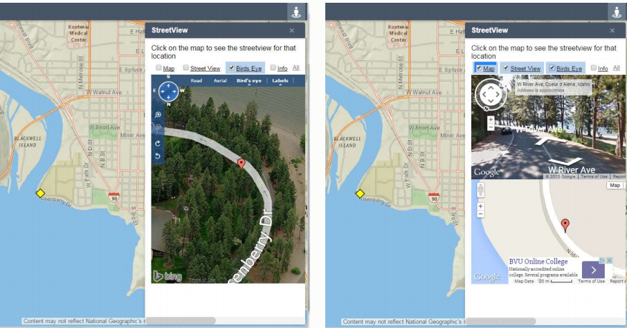
Features:
- This widget conforms to the Google Terms of Use (TOS) agreement
- Widget allows configuration of Google Street View Panorama Options
- Widget provides drag and drop support
- Widget provides graphical feedback on the map when changes are made to the Street View Panorama window
- This widget displays the Google Street View Panorama in a popup browser window as to not violate the Google TOS agreement
Here's what I think Rob Halko is trying to get at... if you are simply using url parameters to link out to Google Maps or Street View in a new window - just a plain old hyperlink where the windows are not communicating with each other in any way - then you aren't actually using anything in the API to achieve this, and therefore would not be subject to the TOS. True or false, I don't know enough about it to answer the question, but it is an interesting question.
It is not possible to get access to streetview panorama without the use of the GoogleMaps API and even if it were the TOS covers this as a violation. A url still goes to a html page that has JS code that use the Google Maps API, thus still governed by the APIs TOS.
I couldn't agree more. It's been a nice run Robert that's for sure. Perhaps if/when ESRI and Google work this out . . .
Hi Robert,
I have been searching for an alternative to the Google Street View and discovered that HERE has a Street Level API.
I know that HERE is actively capturing street view around the world.
Would you consider reviving the Street View widget using HERE instead?
Hi Jon,
HERE already has a custom widget (Reality Lens) for this and quite powerful too as you can add feature to capture street info but I don't think they have captured that much. Also its a premium widget.
Baba
Hi Baba,
Yes, I'm aware of Reality Lens. In fact, I have spoken to representatives from HERE on that product. It is really impressive, with ability to measure and extract x,y and z coordinates.
However, I think it might be an overkill for some users who just want a street view image as a reference data in their GIS.
Jon Kwong and all, that's why I thing Bing StreetLevel is the way to go. Terms of use seem more friendly and it's probably the only other provider that can or will come close to matching Google's unparalleled coverage. I also agree that most users will not need or want measurement, simply a point of reference. The other advantage to Google Streetview is (or would have been) VR. I just got a VR headset and was blown away at how fast VR and AR have advanced. It will rapidly intersect with GIS and GPS and Esri and Google should jump on this and begin researching ways to integrate VR. (CityEngine/ArcEarth/Cardboard all together?) I hope Google will collaborate with Esri. Cardboard will corner the market. Oculus is better because of positional tracking, but I imagine that's next for Cardboard. Hopefully VR will standardize, then enter the GIS world and eventually a WAB widget will be created.
while not a WAB widget, building directly on top of the Google Maps API was the only way we could figure out how to integrate Streetview in a browser based app. it's still Beta right now but it does allow you to integrate your ArcGIS Online (Organization) account with Google Maps, Oblique Maps and Streetview. at some point in the future, it may be possible to inject the Google Maps API into WAB via a widget and use that for basemap display, thus allowing legal Streetview access.
here's an online demo (requires you login via AGOL):


Streetview with the lines overlay is amazing! Our field crews would love that!
Streetview lines - yes, if your feature data is near streets (like most utility data), it is a really nice visualization. we still need to add the realtime chat/map markup to Streetview (it already works for map view) but its great to send your map view to others in your Org and then be able to interact in real time
also fwiw, you should be able to try your own Web Maps with the demo link above, just open the side drawer and click on My Content (which is is linked to your AGOL account). For now, only FeatureLayers will show up on Streetview but in the near future, MapServer layers will appear there as well when the main map only contains an image of the MapServer content
finally, the demo is only beta so if you find any issues, feel free to pass them on. There are several known issue when loading certain types of maps
cheers
brian
Sorry to hear it is non-compliant. I am still very impressed with this development. Hopeful for future updates...
Yes, Brian dynamic layer (mapServer) and/or tiled layers (Vector Tiles) is mission-critical. With a big layer like a utilities layer, FeatureServer layers are very, very slow. They are Editing capable, though, which is their main purpose. So if I were to use your product, I'd probably have both versions of utitilities layers in display, one for editing and one steady-state version (read only) for more rapid viewing. But yes this looks amazing!
agreed - MapServer Search, Identify and Streetview overlay is in the works. that said, you can view MapServer layers right now in the regular map view (even over oblique view).
FEMA Maps demo - A2E Online
Frank Roberts or yarn5961 have you corresponded with Google/MSFT about Innovate! products? It looks like a public repo no longer holds the StreetView widget but a demo app hosted on it.innovate.com still shows this functionality. Have you had luck negotiating the TOS?
live app: ArcGIS Web Application
promo material: http://www.innovateteam.com/wp-content/uploads/Next-Frontier-in-Mobile-Mapping.pdf
Brian or Robert, can anyone help me get in contact with a Google representative? I have very specific questions to clarify regarding this topic. With all respect to everyone's (conflicting!) interpretations and assumptions, I cannot trust anything other than straight from the horse's mouth. I tried posting the following as a Stack Overflow question:
When it comes to dynamically displaying Street View using a lat/lon obtained from a map click in an ESRI or any non-Google web application, I need clarification on the Terms of Service. Will Google allow either of the following scenarios?
- Opening a new window containing only the street view by using this URL structure:http://maps.google.com/maps?q=&layer=c&cbll=32.7211048,-97.1346032
No API is used for development. If this is prohibited, would you also prohibit me from dynamically creating a link with the lat/lon parameters so the user just needs to click on it? If both of these are prohibited, how is it any different than "prohibiting" me from typing this link directly into my address bar? I just don't understand where the line is drawn.
- Opening a new window containing both a Google Map and a Street View container, a la this:http://www.geocodezip.com/v3_Streetview_lookAtC.html?location=40.720032,-73.988354&fov=90&heading=23...
If needed, I could automatically zoom to the location, and then perhaps use the center spot in the Google Map as a determinant for loading the Street View.
Based on Google's restrictions, I don't see a specific reference to using direct URLs (rather than the Maps Javascript API + key) in a new window. And while it does specify a Google Map must be the source of the Street View location, there's nothing stating how the Google Map is used - manually or programmatically - to ultimately obtain the location.
Robert,
If the widget takes the screen point (x,y) and passes it to a call to Google Maps in a new tab to open the map at the desired location, would that be breaking the agreement?
Instead of directly opening Street View, you would at least be able to easily switch to Street View at your desired location.
Not as nice as a popup window with the location already in Street View, but better than not having the ability at all.
Thank you for your insight and knowledge on the subject.
Andy, this is a great idea. However, I would just field calculate links in my data to achieve this outcome. Thanks for the idea! I hope more people comment on your suggestion, because I think it is a solid solution, minus functionality lost.
Does anyone have an update on this? We were using this widget in an internal webapp (its extremely popular) and have since removed it. Does ESRI and Google have any type of agreement or anything that would allow use in a partners app (ie an esri app).
Be careful with this. According to Section 9.1.1 of the Google Maps ToC, internal-only applications that use the Google Maps API are not allowed, except for testing and development, or unless you have an Enterprise Agreement with Google.
This is true if we're talking about using the Google Maps JavaScript API. However, my proposed (unimplemented) method above uses the publicly accessible URL structure -- free of any license-based Google Map APIs.
http://maps.google.com/maps?q=&layer=c&cbll=32.7211048,-97.1346032
At the top of the ToS page it says: "This page contains the Google Maps APIs Terms of Service", so I take this to be for API's specifically. I cannot find anything elsewhere on Google's ToS pages indicating developers are not allowed to provide users a link (whether internal or external application) or go one step further and automatically open a new window.
It might help to create a new thread aimed at understanding Google Maps and Street View limitations, separating it from specific widgets or the Web App Builder. Unless you are a lawyer or work at Google, though, we likely won't make progress amongst ourselves...
This addon seems to do what you're describing. Super useful, and they put the link to ToS on the window.
http://www.siggis.be/en/products/siggis-street-amp-bird-view
Recently, I started getting this error while using the streetview widget:
Upon coming to this page for help, I saw Robert's disclaimer in red 
Has the streetview widget stopped working for all of folks out there? And if so, can anyone suggest me an alternate to this? This was by far the most popular widget and the discontinuation of it is incomprehensible to many of the users like me.
Thanks,
Were you able to find any alternative to this?
Thanks,
Shital,
Try researching into Microsoft's Bing or ESRI's Mapillary or HERE's Reality Lens.
Baba
Mapillary is a great option, and there are multiple ways to integrate it. Currently the Mapillary viewer is available in GeoCortex, in the Mapillary for ArcGIS Online app (ArcGIS Marketplace), Esri JS API (use MapillaryJS to implement), and WebApp Builder (post here). A new version of the WebApp Builder widget is being pondered, please do let us know if you have any special feature requests!
Chris
Solutions Engineer, Mapillary
If someone has an old version and wouldn't mind sharing with me please can you contact me
Has anything changed with this? Because I'm seeing this widget used on several public facing webapps. Are they just some of the lucky few that managed to have an older version and are still able to run it?
David,
People have been warned about the violation. If anyone is still using it it is at their own risk.
Ok thanks Robert. I was surprised to find it on 4 or 5 pretty reputable city govt. web apps.
Luckily we can still display ESRI mapservices or layers on google map and use street view. The Reality is that for certain audience, especially the public, Google map is just more desirable even though it could not provide more rich functionalists as ESRI map.
If anyone in charge of city governments needs a solution for Google
StreetView alternative, feel free to contact me at [email protected]
and we can get you set up, using Esri ecosystem.
I took the old widget (above, which does not work anymore..) and changed it a bit to assemble a link with the relevant coordinates once you click a point on the map and then a google street view is opened on a seperate tab in the browser. I believe this is completely legal?
Also, I noticed it's still possible to show a popup in the widget window as long as you use a personal token during the usage but I didn't invested more time on doing this this at this point. Maybe in the future -
Street View containers | Google Maps JavaScript API | Google Developers
I thought i'll upload the widget with my changes but I'm still not completely certain that's legit.. so I thought I'll consult here with you first..?
Regards,
Shay.
Hm. Let us know if you find out from them that it is okay. I once had a widget that simply opened new tab by passing lat long coords into the url. I was about to code the same thing for Bing Street Level. But right as I was about to, Microsoft changed their TOS to mirror Google. My understanding was you can't pass location to their map from 'another map' platform. I know, it's a facepalm thing. Google is passing up on eyeballs on Google Maps. I talked to Ad Analytics people, no dice. I also recently created a widget to pass in to Google Earth. I wish I could share it. It's internal because ToS. I hope Mapillary spreads!
Any map that is not Google can not be used as the starting point to open a Google streetview panorama. The only way to conform to the TOS is to have the link open a Google MAP and then allow the user to open a street view from there or swap the esri map with the Google Basemap before opening the streetview (which is also a tricky area).
Mapillary has updated the Web AppBuilder Developer Edition widget, which is available for free use here: GitHub - mapillary/Mapillary-WebAppWidget
We also offer a premium version that allows for editing by clicking on the photo to add points to the map, please contact [email protected] for more information!
I have read almost all the comments but still have a doubt. If in my application I am not using any of the ESRI webmaps but a google basemap instead, would that allow usage to the widget?
Giacomo,
Well technically it is impossible for you to be using Googles Basemap in esri with out violating the TOS (you can not directly access Googles tiles with out using the Google Maps API).
Thank you Robert,
So does that means that the Google basemaps you find on ArcGIS online are in breach of Google's TOS? like this one for example http://www.arcgis.com/home/item.html?id=a6276bbdc8c44b4b942168e3265965b1
Yes that is a clear violation of Googles TOS, as it is directly accessing Google tiles without the use of the Google Maps API.
Understood, that puts a nail in the coffin then. Thanks again!
Is the free to use version licensed for internal use in a utility or does that fall under an enterprise type license.
I find it hard to understand how the Worlds leader in GIS technology and Google can not come to terms on the use of StreetView panoramas with esri basemaps
I couldn't agree more with you.
StreetView marked a before and after in how people interacted with maps. Ask GIS or non-GIS users what mapping tools they use in a daily basis and most will name StreetView. So obviously the choice between two similar products with and without StreetView will be easy.
It is a good marketing campaign from ESRI to keep most of the users off their products.
Wake up.
Albert, it is mostly Google's decision from what I understand, not Esri. Esri from what I have seen works well with partners (i.e. Microsoft with Bing, etc) Esri's GeoNet is a vibrant, useful, and helpful community. You can interact with all the lead developers and product designers here that you meet at conferences. Google's forums do not have this. I truly think Google actually would make more money if they collaborated with Esri. Google makes money from ads. The more users and eyeballs are driven into Google Maps, the better for them. Esri sells tools to make maps, Google sells ads on top of maps, it's almost a natural partnership; if one day Google will allow partnering. But hey, now that Bing has StreetLevel, it would be interesting to see more integration with Bing, maybe that would bring Google to the table as well.
It's been awhile, but some news on the street-level imagery front:
Mapillary now has plugins for ArcGIS Pro and Web AppBuilder, available on
the ArcGIS Marketplace. These include imagery uploaded from a variety of
government, business, nonprofit, and individual community users. Examples:
City of Detroit, Arizona Department of Transportation, City of Amsterdam,
Lithuanian road authority, Brazilian road authority, and more. You can
check out Mapillary.com/app to see where coverage exists, and also be aware
that Mapillary is geared toward letting you as a GIS user be able to
capture, upload, and view your own images rather than rely on a global
company like Google to capture at their convenience. Give it a look and see
if this solves any issues for you. Feel free to email us at
[email protected] with questions.
- « Previous
- Next »