- Home
- :
- All Communities
- :
- Industries
- :
- Water Utilities
- :
- Water Utilities Questions
- :
- Re: Has anyone used stream order spatial analyst t...
- Subscribe to RSS Feed
- Mark Topic as New
- Mark Topic as Read
- Float this Topic for Current User
- Bookmark
- Subscribe
- Mute
- Printer Friendly Page
Has anyone used stream order spatial analyst tool for sewer network?
- Mark as New
- Bookmark
- Subscribe
- Mute
- Subscribe to RSS Feed
- Permalink
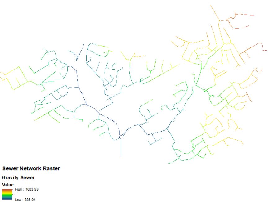
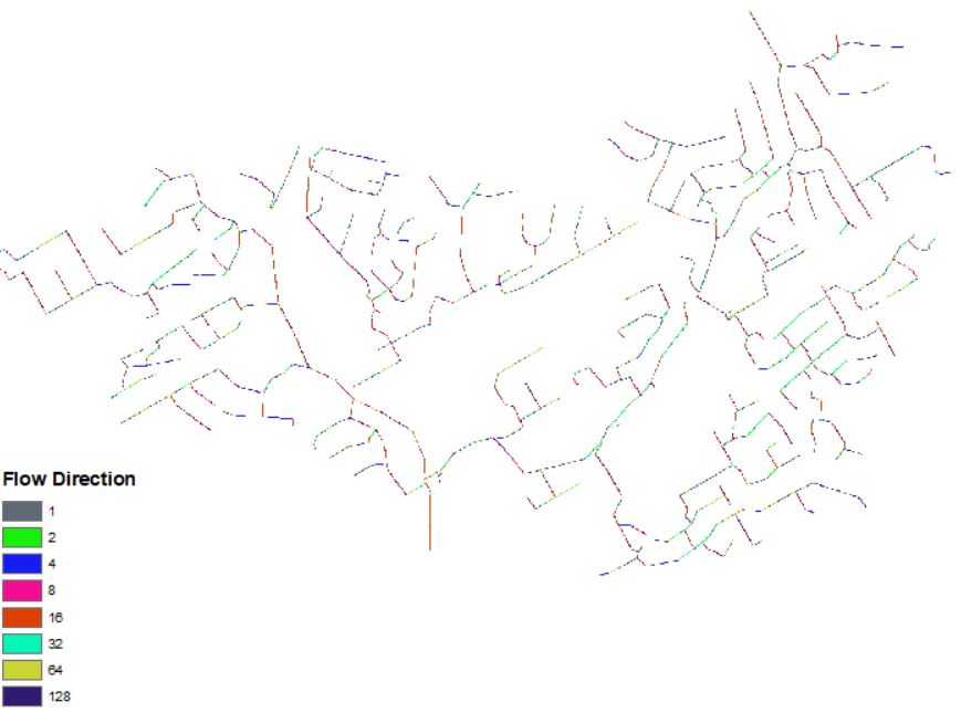
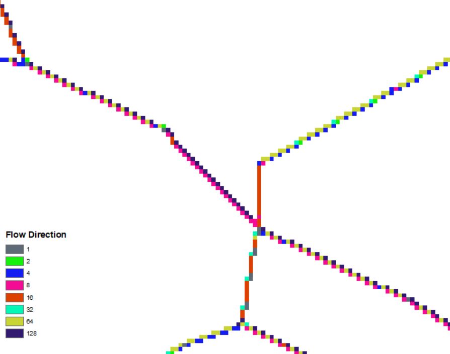
I am working on a sewer analysis project for school/work and I am trying to order the sewer network using the stream order networking tool but I am getting very confusing results. I can create a raster grid for the sewer network; however, I cannot create an accurate flow direction raster. The values for flow direction do not make sense to me. I have some screenshots below that show the results.
If anyone has any experience with these tools and can provide some feedback it would be greatly appreciated.
- Mark as New
- Bookmark
- Subscribe
- Mute
- Subscribe to RSS Feed
- Permalink
Not sure exactly what your project is, but the hydrology tools like Stream Order and Flow Direction are used to analyze surface flow across a continuous surface, like a DEM. So those tools are typically used for surface water, not for pipes.
The first bullet point under Usage sounds like the results you are experiencing if you turned your pipes into a raster - Stream Order—Help | ArcGIS Desktop
Most organizations represent their sewer system using vector data (typically a network) and use that vector data to perform analysis.
- Mark as New
- Bookmark
- Subscribe
- Mute
- Subscribe to RSS Feed
- Permalink
Howard,
Thank you for your reply. I currently have a vector sewer network, but I am trying to identify the pipes in the system as first, second, third-order pipes. I have data from our hydraulic sewer model, which shows flow data, but I want to be able also to see which pipe segments have "upstream branches" and how many branches are upstream.
I haven't been able to find a vector stream ordering tool so I was trying to see if I could convert the vectors into rasters and use the tools, but no luck.
Thanks,
Eric
- Mark as New
- Bookmark
- Subscribe
- Mute
- Subscribe to RSS Feed
- Permalink
You might be able to use the Summary Flow Accumulation tool on the Water Utility Network Reporting toolbar to get at the answer. Requires your data to be in a geometric network. You could use it sum the number of upstream manholes for each pipe and use that a proxy or if you have customer connections you could assign a weight to each connection and accumulate that for each upstream pipe. Water Utility Network Reporting toolbar - Water Utility Network Editing and Analysis | ArcGIS Soluti...